This article was automatically translated from the original Turkish version.
+2 More
Elevation(s) | 1500-1700 m | ||||||||
|---|---|---|---|---|---|---|---|---|---|
Type(s) | Summer pasture | ||||||||
Tourism Status | By decision of the Council of Ministers in 1991 | ||||||||
Tourism Type | Ecotourism | ||||||||
Distance to Provincial Center | 40-45 km | ||||||||
Address | Kulakkaya Village Dereli / Giresun / Türkiye Yavuzkemal Township | ||||||||
Tourism Activities | Nature walking Winter tourism activities Wildlife observation Botanical tourism Photo safari Bicycling and jeep safari Horseback riding | ||||||||
Transportation Routes | Erimez location route Çaldağ and İnişdibi route Dereli District and Yavuzkemal Township | ||||||||
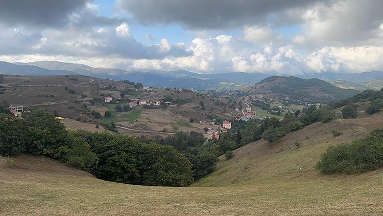
Kulakkaya Yaylası, Giresun province’s Dereli district boundaries, near Kulakkaya Village, is a highland settlement. This area, classified under highland tourism, has elevations ranging between 1500 and 1700 meters.
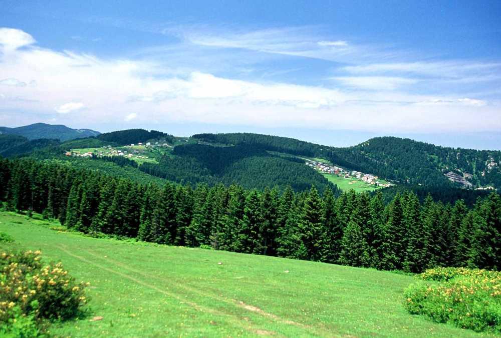
Kulakkaya Yaylası (Kültür Portalı)
Kulakkaya Yaylası is approximately 40 to 45 kilometers from the city center of Giresun. Access to the highland is provided via Dereli district and Yavuzkemal Village. Additionally, access is possible through the Çaldağ and İnişdibi route via Batlama Valley, the Erimez Mevkii route via Kayadibi Village, and the Dereli center route.
Along the route, natural formations such as Despot Kayası and Suyu, Erimez Mevkii, and Gelin Kayası can be observed.
Kulakkaya Yaylası was officially declared a tourism center by a decision of the Council of Ministers published in the Official Gazette on 20 September 1991.【1】 It is known that the highland lies among ancient settlement areas of the Eastern Black Sea Region, along the Silk Road routes, and gradually transformed into a summer settlement. During the Republican era, changes in settlement patterns occurred as transhumance activities expanded.
Elevations exceeding 2000 meters are found around the highland. These include Çaldağ (2030 m), Göktaş Tepe (1781 m), Ayıgöl Tepe (1758 m), Çavlak Tepe (1732 m), and Belen Tepe (1713 m).
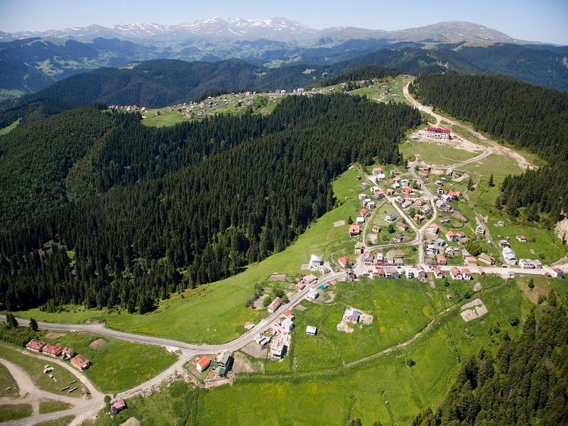
Kulakkaya Yaylası (Giresun Valiliği)
Kulakkaya Yaylası is situated on a high plateau landscape shaped by Aksu Creek and its tributaries, on the northern slopes of the Giresun Mountains. The terrain consists of rugged, deeply dissected valleys.
The climate of Kulakkaya Yaylası and its surroundings combines the Black Sea climate with altitude-dependent features. Summers are cool and humid, while winters are cold and snowy. Due to elevation, temperatures are lower than those in coastal areas. Winter temperatures fall below zero, while summer conditions remain cool.
The forest ecosystem is prominent around Kulakkaya Yaylası. The forest cover consists of Oriental spruce, Turkish pine, oriental beech, and hornbeam. Understory species include forest rose and blackthorn.
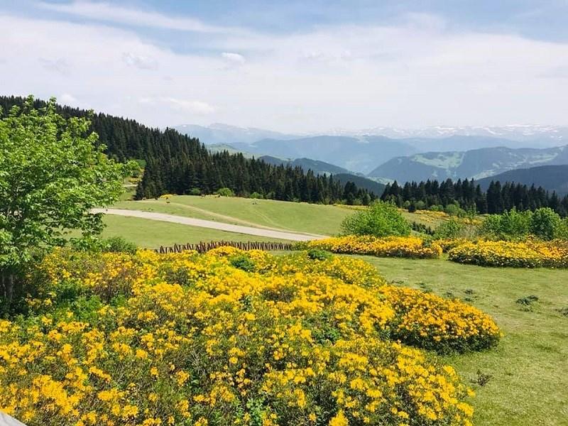
Kulakkaya Bitkileri (Giresun Valiliği)
The highland also hosts a variety of plant species including ivy, Anatolian shepherd’s-purse, great mullein, goat’s horn, sainfoin, knapweed, mountain bellflower, rock fingergrass, primrose, lady’s mantle, three-petal species, elderberry, wild strawberry, blackberry, dog rose, forest hyacinth, violet species, centaury, nettle, bracken fern, and numerous herbaceous plants.
The area around Kulakkaya Yaylası supports a diverse fauna of mammals and birds. Mammals include wild boar, roe deer, jackal, fox, squirrel, hare, rock hyrax, tree squirrel, genet, wolf, bear, and Eurasian otter.
Bird species include hawk, goshawk, kestrel, eagle owl, tawny owl, golden eagle, rock pigeon, wheatear, woodpecker species, sparrows, wagtails, nightingales, blackbirds, hoopoes, chaffinches, rock thrushes, crow, fish eagle species, and quail.
The area around Kulakkaya Yaylası includes tributaries of the Aksu and Batlama rivers. Kulakkaya Creek and Kodal Creek are part of this system. Additionally, springs such as Despot Suyu, Kara Pınar, and Çam Pınarı contribute to the hydrographic network. Seasonal streams also form part of the hydrographic structure.
Kulakkaya Yaylası is considered a highland tourism destination. Activities such as nature walking, horseback nature trekking, cycling and jeep safaris, photo safaris, botanical tourism, and wildlife observation are possible. It is regarded as an area suitable for the development of various tourism types.
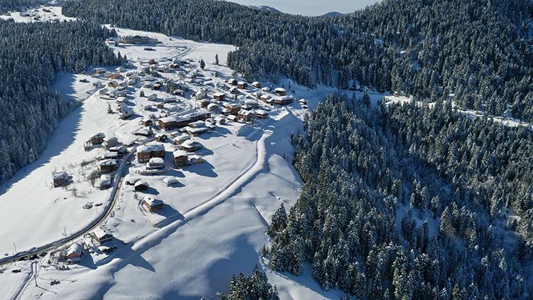
Kulakkaya Yaylası'nda Kış Mevsimi (Anadolu Ajansı)
Kulakkaya Yaylası is also used for winter tourism. In 2015, the Kulakkaya Snow Festival and Off-Road Games were organized. Events included sledding, skiing, snowboarding, and snowman-building competitions. Local dishes such as beet soup, corn bread, and highland potatoes were served during the festival. Horon dance performances were also part of the events.
Due to its rich plant diversity, Kulakkaya Yaylası has potential for botanical tourism. Proposed measures include creating marked trails and labeling plant species for educational purposes.
The area is considered suitable for climatotherapy due to its elevation, forest cover, and climate characteristics. The impact of the forest cover on air quality and microclimate is evaluated within this context.
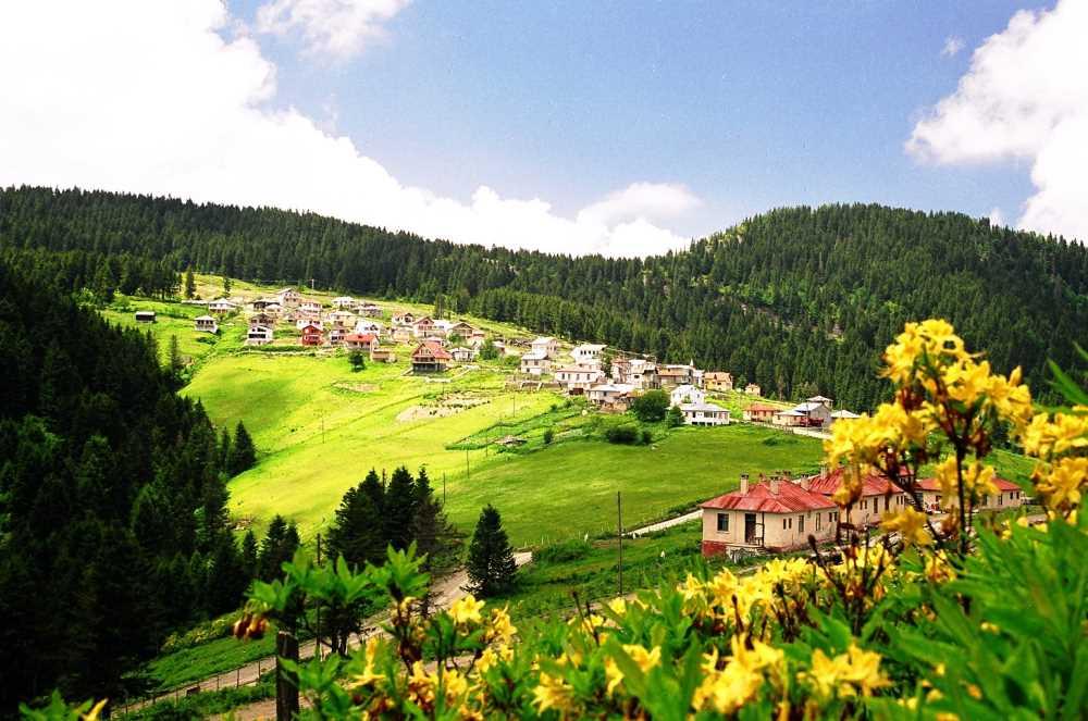
Kulakkaya Yaylası (Kültür Portalı)
Kulakkaya Yaylası serves as a seasonal settlement during summer months. The highland season typically occurs between late spring and early autumn. During winter, settlement activity declines significantly, and residents return to coastal areas.
The settlement structure consists of both clustered and dispersed areas. Traditional wooden dwellings coexist with reinforced concrete buildings.
Historically, economic activities around Kulakkaya Yaylası have been based on transhumance and animal husbandry. Today, tourism and recreational activities have become integral to the local economy. Accommodation facilities and day-use areas have been developed accordingly.
The Alçakbel forest picnic area offers day-use opportunities for rest and recreation. Various retail services are available in the nearby Yavuzkemal Village. The Ormaniçi Education Facility and forest picnic area located at Kulakkaya–Alçakbel Mevkii serve day visitors.
Benim Ormanım. "Kulakkaya Ekoturizm Alanı." Accessed May 12, 2026. https://benimormanim.ogm.gov.tr/ekoturizm-rotalari/kulakkaya-ekoturizm-alani-901
Sezer, İbrahim. "Doğu Karadeniz’de Gelişme Potansiyeli Yüksek Bir Yayla Turizm Merkezi: Kulakkaya Yaylası." *Doğu Coğrafya Dergisi* 20, no. 34 (2015): 89–114. Accessed May 12, 2026. https://dergipark.org.tr/en/pub/ataunidcd/issue/2462/31421
T.C. Giresun Valiliği. "Yaylalarımız Kulakkaya Yaylası." Accessed May 12, 2026. https://www.giresun.gov.tr/yaylalarimiz
T.C. Official Gazette. "Bakanlar Kurulu Kararları." Accessed May 12, 2026. https://www.resmigazete.gov.tr/arsiv/20997.pdf
Türkiye Kültür Portalı. "Kulakkaya Yaylası – Giresun." Accessed May 12, 2026. https://www.kulturportali.gov.tr/turkiye/giresun/gezilecekyer/kulakkaya-yaylasi
Yetgin, Gültekin. “Karla Kaplanan Kulakkaya Yaylası Eşsiz Manzarasıyla Havadan Görüntülendi.” *Anadolu Ajansı*, January 22, 2026. Accessed May 12, 2026. https://www.aa.com.tr/tr/yasam/karla-kaplanan-kulakkaya-yaylasi-essiz-manzarasiyla-havadan-goruntulendi/3807350
Çıtlak, Atakan. “Kulakkaya Yaylası'nın Turizm Potansiyelinin Artırılması Hedefleniyor.” Anadolu Ajansı, August 27, 2025. Accessed May 12, 2026. https://aa.com.tr/tr/yasam/kulakkaya-yaylasinin-turizm-potansiyelinin-artirilmasi-hedefleniyor/3670276
[1]
T.C. Resmî Gazete. “Bakanlar Kurulu Kararları.” 20 Eylül 1991. Erişim 12 Mayıs 2026. https://www.resmigazete.gov.tr/arsiv/20997.pdf
Elevation(s) | 1500-1700 m | ||||||||
|---|---|---|---|---|---|---|---|---|---|
Type(s) | Summer pasture | ||||||||
Tourism Status | By decision of the Council of Ministers in 1991 | ||||||||
Tourism Type | Ecotourism | ||||||||
Distance to Provincial Center | 40-45 km | ||||||||
Address | Kulakkaya Village Dereli / Giresun / Türkiye Yavuzkemal Township | ||||||||
Tourism Activities | Nature walking Winter tourism activities Wildlife observation Botanical tourism Photo safari Bicycling and jeep safari Horseback riding | ||||||||
Transportation Routes | Erimez location route Çaldağ and İnişdibi route Dereli District and Yavuzkemal Township | ||||||||
Access
Historical Development
Physical Geography
Climate Characteristics
Vegetation
Wildlife
Hydrography
Tourism Features
Winter Tourism
Botanical and Nature Tourism
Health Tourism Potential
Human and Settlement Characteristics
Economic Activities