


This article was automatically translated from the original Turkish version.
+1 More
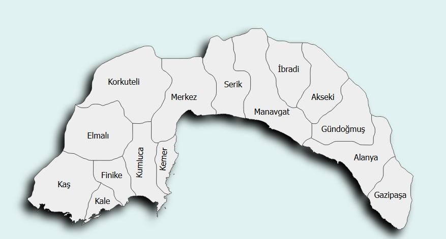
Konyaaltı (District)
Foundation | 1998 | ||||||||
|---|---|---|---|---|---|---|---|---|---|
Area | 483 km² | ||||||||
Notable Places | Konyaaltı Plajı Termessos Boğaçayı | ||||||||
Climate | Mediterranean climate | ||||||||
Main Economy | Service sector Tourism | ||||||||
Population (2024) | 196.079 | ||||||||
Konyaaltı is a district located on the western boundary of Antalya province, on the southern coast of Türkiye. This district, adjacent to the urban center of Antalya, encompasses both urban and rural settlements. Konyaaltı gained district status in 2008 following the Metropolitan Municipality Law, when it separated from Muratpaşa. Today, it is one of Antalya’s most developed districts in terms of tourism and residential growth. It is bordered by Muratpaşa to the east, Kemer district to the west, Döşemealtı to the north, and the Mediterranean Sea to the south. The district is known for Konyaaltı Beach, the Beydağları mountain range, and its natural areas.

Konyaaltı Beach (Source: Kültür Portalı)
Historically, Konyaaltı lies within the western part of the ancient region of Pamphylia. Evidence of settlement in the area dates back to the Lycian and Roman periods. Particularly around Liman Mahallesi, remains from the Roman era have been discovered. During the Ottoman period, the territory of present-day Konyaaltı was described as the western villages of Antalya center, which formed part of the Teke Sancağı. The district’s boundaries gradually took shape throughout the 20th century as Antalya expanded westward, and it was officially established as a district in 2008.
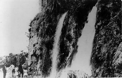
Old Antalya-Falezler (Source: Antalya Provincial Directorate of Culture and Tourism)
Konyaaltı district is situated on the Mediterranean coast, to the west of the Antalya Gulf. Its natural boundaries are defined by the Antalya-Kemer road to the west and the foothills of the Beydağları to the north. Along the southern coastline, Konyaaltı Beach extends for approximately 7 kilometers. In addition to the Beydağları, which are an extension of the Taurus Mountains, the district includes rivers such as Boğaçayı and Sarısu. The district experiences a Mediterranean climate, with hot and dry summers and mild, rainy winters. The annual average temperature ranges from 18 to 20°C, and the average annual rainfall is around 1000 mm. In higher-elevation settlements, summers are noticeably cooler.
According to 2024 ADNKS data, the total population of Konyaaltı district is 215,480. Approximately 49 percent of the population are men and 51 percent are women. Since its establishment as a district in 2008, Konyaaltı’s population has shown steady growth. Konyaaltı is a district that receives migration from all parts of Türkiye. It is particularly favored by university students, retirees, and workers in the tourism sector. Additionally, the district hosts a settled population of foreign nationals. This situation has led to the emergence of a multilingual and culturally diverse social structure.

Antalya Population-2024 (Source: Nufusu)
The economy of Konyaaltı district is predominantly based on services and tourism. While large-scale agricultural activities are limited, greenhouse farming and citrus production occur in rural areas. Industrial zones within the district host small and medium-sized enterprises. Hotels, cafes, restaurants, and entertainment venues along the Konyaaltı coastline are key sources of tourism revenue. Residential and commercial investments in the district are also significant; particularly along the coastline, luxury housing projects and the real estate market are highly active. This dynamic has largely shaped the district’s economic profile.
Konyaaltı is one of the most popular destinations for both domestic and international tourists, thanks to its beaches and coastal amenities. Konyaaltı Beach is a Blue Flag beach open to the public free of charge. Along the shoreline, walking paths, cycling lanes, and social facilities are available. The district also features entertainment and cultural venues such as the Antalya Aquarium, Aktur Park, and the Antalya Kültür Center. The Tünektepe Cable Car and Sarısu Recreation Area, located within Beydağları Coastal Milli Park, are notable attractions for nature tourism.
The cuisine of Konyaaltı reflects the broader culinary traditions of the Antalya region. Dishes such as stuffed squash blossoms, hibeş, tomato cives, and citrus marmalade are widely known and enjoyed in the district. Due to the influence of multicultural settlement and tourism, international cuisine options have also become increasingly common. This trend supports gastronomic tourism.
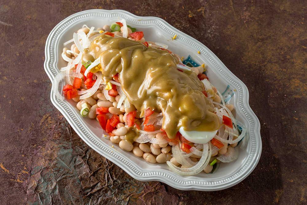
Antalya-Specific Dish Tahinli Piyaz (Source: Arda'nın Mutfağı)
Konyaaltı Belediyesi. "İlçemiz Hakkında." Accessed April 17, 2025.https://www.konyaalti.bel.tr.
Konyaaltı Kaymakamlığı. "Tarihçe ve Genel Bilgiler." Accessed April 17, 2025.https://www.konyaalti.gov.tr.
Ministry of Culture and Tourism. "Culture Portal: Konyaaltı." Accessed April 17, 2025.https://www.kulturportali.gov.tr.
Türkiye Diyanet Vakfı İslam Ansiklopedisi. "Antalya." Accessed April 17, 2025.https://islamansiklopedisi.org.tr/antalya.
Türkiye İstatistik Kurumu (TÜİK). "Adrese Dayalı Nüfus Kayıt Sistemi (ADNKS) Sonuçları, 2024." Accessed April 17, 2025.https://data.tuik.gov.tr.
Konyaaltı (District)
Foundation | 1998 | ||||||||
|---|---|---|---|---|---|---|---|---|---|
Area | 483 km² | ||||||||
Notable Places | Konyaaltı Plajı Termessos Boğaçayı | ||||||||
Climate | Mediterranean climate | ||||||||
Main Economy | Service sector Tourism | ||||||||
Population (2024) | 196.079 | ||||||||
No Discussion Added Yet
Start discussion for "Konyaaltı (District)" article
History
Geography and Climate
Population and Demographics
Economy
Tourism, Culture and Cuisine