


This article was automatically translated from the original Turkish version.
+1 More
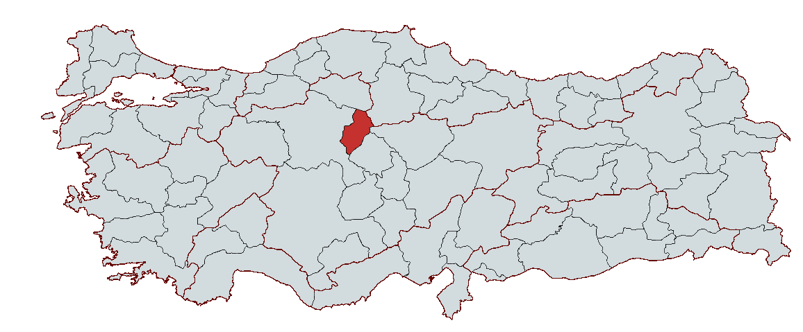
Kırıkkale
Country | Türkiye | ||||||||
|---|---|---|---|---|---|---|---|---|---|
Region | Central Anatolia Region | ||||||||
Population | 283.053 (2023) | ||||||||
Area | 4.575 km² | ||||||||
Climate | Continental Climate | ||||||||
Important Structure | Peribacaları Haydar Sultan Türbesi Sulu Mağara | ||||||||
Area Code(s) | 318 | ||||||||
License Plate Code | 71 | ||||||||
Governor | Mehmet Makas | ||||||||
Mayor | Ahmet Önal | ||||||||
Kırıkkale is a province located in the Central Anatolia Region of Türkiye. Geographically, it is situated east of Ankara and within the Kızılırmak River basin. The province is an important center in terms of industry and culture. Kırıkkale is particularly notable for its defense industry and is known for its machinery, chemical industry, and arms production. The city began to develop with the operation of the İmalatı Harbiye Factory established in the early years of the Republic in 1925 and attained provincial status in 1989. Today, Kırıkkale draws attention for its advanced industrial and educational infrastructure.
The name Kırıkkale is derived from the combination of Kırıkköy, located 3 km north of the city, and Kaletepe in the city center. While this name became widely accepted among the local population, during the Ottoman period it was recorded in archives as “Kırıkkal’a.” The name Kırıkkale dates back approximately 400 years. It is known that during the 16th and 17th centuries, various Turkic tribes and communities from the east were settled in Anatolia, particularly in the Central Anatolia region. The area to which Kırıkkale belongs holds historical significance as part of these settlements.
The history of Kırıkkale and its surroundings is not limited to the Ottoman and Republican periods. Archaeological excavations and surface surveys in the region have uncovered findings dating back to prehistoric times, demonstrating that Kırıkkale has been a settlement area since ancient times. Research conducted by Japanese scientific teams has revealed that the region was also inhabited during the Chalcolithic period.
The province of Kırıkkale has been influenced by various ancient civilizations. Excavations in the region have revealed significant findings from the Neolithic and Chalcolithic Ages. Pottery fragments collected from the mounds in Kırıkkale confirm the region’s association with the Chalcolithic period. This era marks an important cultural evolution with the beginning of metal use.
The Hittite Empire period following the Early Bronze and Chalcolithic Ages is also of considerable importance. Excavations in the district of Keskin have revealed that the region was inhabited during this time. The Hittites established extensive dominance over Central Anatolia and left their mark on the Kırıkkale region. The Phrygians arrived in Anatolia around 1200 BCE and took control of existing settlement units. Some mounds in Kırıkkale exhibit Phrygian influences from this period.
Traces of the Roman and Byzantine periods have survived to the present day. Settlements around the Kızılırmak River were densely populated during this era. After the Roman Empire conquered Anatolia, the region to which Kırıkkale belongs became part of Roman territory. Settlement remains from the Byzantine period hold significant importance in the historical development of the city.
Following the Battle of Manzikert in 1071, the gates of Anatolia opened to the Turks, and the Kırıkkale region became part of the Turk-Islamic world. From the 11th century onward, Kırıkkale served as a settlement area for Oghuz and Turkmen tribes and gained prominence for its cultural and religious homogeneity. During this period, traces of Turk-Islamic culture can be found in nearly every village in the region.
The modern urbanization of Kırıkkale gained momentum in the early years of the Republic. The İmalatı Harbiye Factory, established in 1925, spearheaded the city’s economic development. It gained municipal status in 1929 and became a province in 1989. The industrial push in the early years of the Republic transformed Kırıkkale into a major defense industry center. The rapid population growth beginning in the 1950s shaped the city’s social and cultural structure. The city, which attained provincial status in 1989, is today an important settlement with advanced industrial infrastructure, educational institutions, and cultural heritage.
Kırıkkale is located in the Middle Kızılırmak section of Türkiye’s Central Anatolia Region and possesses a wide geographical diversity. The province’s territory lies on the sloping areas descending from the Çamlıca, Karakaya, and Kırıkkale hills toward the plain. These elevated areas indicate that the province has an average elevation of approximately 700 meters above sea level. Although much of the terrain is rugged, Kırıkkale province has extensive arable land suitable for agriculture, particularly in low-lying settlement areas.
The Koçu Mountain, forming the highest mass in the region, extends in a northeast-southwest direction, with Yığlıtepe (1278 m) as its peak. To the southeast, the Denek Mountain range follows the Çoruhözü Valley with a sharp elevation, and its highest points—Gavur Tepesi (1742 m) and Bozkaya Tepesi (1577 m)—complete the region’s geographical diversity. Additionally, the Küre Mountain rises to a height of up to 1450 meters, further reinforcing the region’s mountainous character.
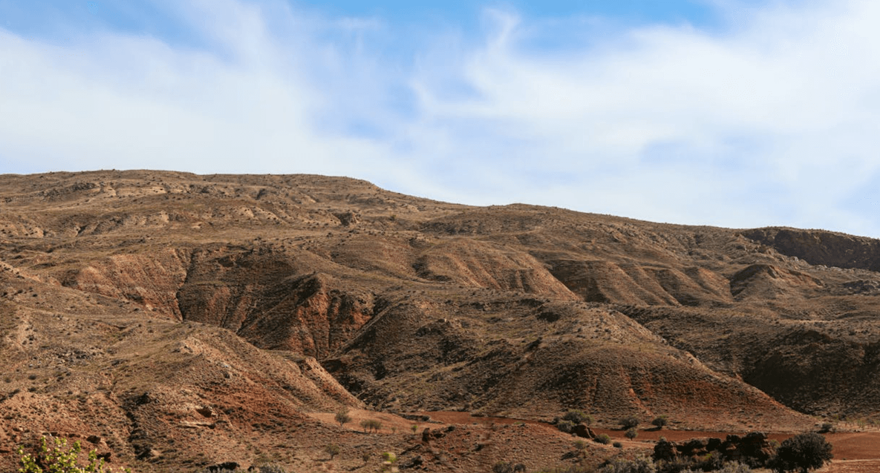
Kırıkkale (Source: Pexels/caffeine)
Plains within the boundaries of Kırıkkale province are limited. Nevertheless, the most important plain in the province is the Kırıkkale Plain. It stretches from the Çamlıca and Karakaya hills in the north to the western side of Denek Mountain in the south. The plain widens from east to west toward the Kızılırmak River and reaches its widest point near the section where the Çoruhözü Creek flows into the Kızılırmak. This plain is highly suitable for agricultural activities and also hosts the main settlement areas surrounding the city. The factories of the MKE Corporation are also located on this plain. However, the flat areas along rivers outside the plain are not considered geologically significant because the elevation difference between riverbeds and surrounding hills is pronounced.
The summer pastures of Kırıkkale are surrounded by high mountains and typically lie at elevations between 1200 and 1600 meters. Among the best-known are Hodar, Bedesten, Kamışlı, and Sarıkaya on Küre Mountain; Koçu pasture on Koçu Mountain; and Gümüşpınar, Pehlivanlı, Suludere, Yeşilkaya, and Azgın pastures attached to Denek Mountain. These areas are used as summer pastures by local communities engaged in agriculture and animal husbandry during the summer months.
The vegetation cover of Kırıkkale is predominantly steppe, with some forested areas found in higher elevations. In the north, dwarf oaks and partially juniper trees grow on Koçubaba, while in the south they are found on Denek Mountain. The plant species native to Kırıkkale are mostly drought-resistant and adapted to arid conditions. Common plant species include yavşan herb, sesame, daisy, carnation, mint, thyme, blackberry, and rosehip. A large proportion of these plants are suitable for agriculture and contribute to the local economy.
In terms of fauna, the limited extent of mountainous and forested areas in Kırıkkale restricts the diversity of wildlife. However, domestic animals such as sheep, goats, and cattle are widely raised. Among wild animals, the partridge and wild duck are prominent.
The geological structure of Kırıkkale has been shaped by volcanic activity. The province lies within the Kırşehir Massif, where various rock types such as granite, hornblende granite, syenite, and monzonite are found. These rocks are observable in areas concentrated between Kırıkkale and Keskin. In terms of seismic activity, Kırıkkale lies within different earthquake zones in Türkiye. The majority of the region is in the second-degree earthquake zone, while the districts of Yahşıhan, Bahşılı, and Çelebi in the southeast fall within the third-degree earthquake zone.
The water resources of Kırıkkale are fed by the Kızılırmak River, the most important river in the region. The Kızılırmak enters the province from the southeast and flows northward, with the Kapulukaya Dam located on this river. Additionally, the Çoruhözü Creek and Delice Creek are important water sources. The Kızılırmak plays a major role in irrigation and drinking water supply, while other rivers also support agricultural lands.
The climate in Kırıkkale generally exhibits continental characteristics. Due to its location in the transitional zone between high mountains and plains, temperature variations are pronounced. Winters are cold and snowy, while summers are hot and dry. The annual average temperature is 12.5 °C; in July, temperatures rise to an average of 24.5 °C, while in January they drop to 0.6 °C. Annual precipitation is approximately 366.2 kg/m². Kırıkkale is classified as a semi-arid region, with the majority of rainfall falling as snow during winter.
The economic structure of Kırıkkale is characterized by a strong integration of industry and agriculture. Following the proclamation of the Republic, the province underwent rapid industrialization driven primarily by the defense industry and large industrial enterprises. Today, the provincial economy is largely based on industrial production and agricultural activities.
Kırıkkale stands out as a major production center in the industrial sector. Key pillars of the provincial economy include various factories affiliated with the Machinery and Chemical Industries Corporation, with defense industry leading the way. The MKEK and TÜPRAŞ Kırıkkale Refinery form the core elements of the province’s industrial infrastructure. Other industrial establishments include steel factories, electrical machinery plants, and brick and tile production facilities. The majority of industrial enterprises in the province are concentrated in defense, metal, and petrochemical sectors. Organized Industrial Zones (OSB) and small industrial sites further strengthen Kırıkkale’s industrial capacity. Additionally, the Kırıkkale Arms Industry Specialized OSB, established in the province, enhances the region’s potential in defense industry and provides significant employment opportunities.
The rural areas of Kırıkkale are largely based on agriculture. Major agricultural products include wheat, barley, sugar beet, sunflower, and lentils. Vegetable and fruit production also holds considerable importance, with specialized agricultural activities such as viticulture contributing to the economy. Alongside agriculture, livestock farming is practiced using traditional methods. Cattle, sheep, Ankara goats, and mohair goats are the primary livestock raised. Agricultural production and livestock farming constitute fundamental elements of Kırıkkale’s rural economy.
There are 2013 registered firms in Kırıkkale province under chambers of commerce and industry. The majority of these firms are limited companies, concentrated in sectors such as agriculture, livestock, food production, and metal processing. In the province’s domestic trade structure, enterprises serving the food, construction, metal processing, and automotive sectors are particularly prominent. Additionally, small industrial sites and organized industrial zones in Kırıkkale make significant contributions to trade and industrial activities in the province.
The main export sectors of Kırıkkale include chemical products, food and beverages, and metal goods. As of 2019, Kırıkkale’s export volume amounted to 60.6 million US dollars. Major export destinations include Turkmenistan, Iraq, the Turkish Republic of Northern Cyprus, Ukraine, and Pakistan. Imports are primarily concentrated in sectors such as live animals, cereals, and organic chemicals. In 2019, Kırıkkale’s import volume was recorded at 97.6 million US dollars.
The industry and agriculture sectors are the most significant determinants of Kırıkkale’s economic structure. The majority of agricultural land in the province is used for field cultivation, and agriculture serves both as a livelihood source for the local population and as a direct contributor to the provincial economy. Industry, particularly due to the presence of large state-owned industrial facilities in Kırıkkale, is a vital economic activity. Large industrial enterprises such as MKEK and TÜPRAŞ not only generate employment but also facilitate the development of related industries.
The infrastructure of Kırıkkale province has developed in line with its growing population and industrializing structure. The province occupies a strategic position in terms of both road and rail transportation networks, playing a significant role in its economic and social development.
Kırıkkale is favorably positioned in terms of road and rail transport. Road connectivity in the city is primarily centered on the Ankara-Kırıkkale and Kırıkkale-Samsun highways. Access between Kırıkkale and neighboring provinces has been accelerated by these motorways, resulting in heavy traffic flow. In addition to road networks connecting the district centers, the railway system is also a crucial infrastructure component. Within the city, vehicles operating along the Kırıkkale-Samsun road and railway routes manage urban traffic.
The most important innovation in Kırıkkale’s urban transportation is the Kaleray tramway project. This initiative aims to modernize public transportation and reduce traffic congestion. The 12.5-kilometer tramway line in the city center connects major transportation hubs and passes through key residential areas. The implementation of this line aims to increase the city’s passenger transport capacity. The project seeks to significantly improve urban mobility by offering advantages such as speed, safety, and low cost.
The development of Kırıkkale’s transportation infrastructure has grown in parallel with the city’s increasing population and industrialization. However, this growth has also led to increased traffic congestion and environmental issues. The road network in Kırıkkale is critical for connecting major industrial zones, the university, hospitals, and other key settlements. Therefore, sustainable management of the transportation infrastructure is essential. Rail system projects and the addition of new transport lines are vital to alleviate traffic pressure and reduce environmental impacts.
The existing infrastructure in Kırıkkale must be upgraded to match the growing population and increasing industrial output. Infrastructure investments are of great importance, particularly in strengthening urban transportation systems and improving traffic management. Current infrastructure shortcomings are most evident in the city center, where traffic congestion and bottlenecks at transport nodes are prominent. Therefore, enhancing the transportation infrastructure and implementing modern systems represent a critical step toward achieving the province’s future growth objectives.
Mehmet Makas is currently serving as the Governor of Kırıkkale. He was appointed as Governor of Kırıkkale by Presidential Decree No. 2023/376 dated 09.08.2023 and assumed office on 17.08.2023. The governors who have served in the city from the past to the present are as follows:
Battal Doğan, and Adem Kablan. "Kırıkkale Şehir İçi Ulaşımda Alternatif Sistem Değerlendirmesi." Düzce Üniversitesi Bilim ve Teknoloji Dergisi 4 (2016): 431-437.
Kırıkkale Büyükşehir Municipality. "Görev Yapmış Valilerimiz." Accessed February 11, 2025.http://www.kirikkale.gov.tr/gorev-yapmis-valilerimiz
Kırıkkale Ticaret ve Sanayi Odası. *2019 Kırıkkale Ekonomik Durum.* Accessed February 11, 2025.https://www.kirikkaletso.org.tr/ktso/dosyalar/2019%20KIRIKKALE%20EKONOM%C4%B0K%20DURUM.pdf.
Kırıkkale Valiliği. "Jeolojik Yapı ve İklim." Accessed February 11, 2025.http://www.kirikkale.gov.tr/jeolojik-yapi-iklim.
Kırıkkale Valiliği. "Sanayi, Tarım ve Hayvancılık." Accessed February 11, 2025.http://www.kirikkale.gov.tr/sanayi-tarim-hayvancilik#:~:text=%C4%B0limizin%20ekonomisi%20daha%20çok%20sanayi,%2C%20arpa%2C%20%C5%9Fekerpancar%C4%B1%20ve%20ay%C3%A7i%C3%A7e%C4%9Fidir.
Kırıkkale Valiliği. "Tarihçe." Accessed February 11, 2025.http://www.kirikkale.gov.tr/tarihce#:~:text=Cumhuriyet%20D%C3%B6neminde%20K%C4%B1r%C4%B1kkale%20%3A%20Bilindi%C4%9Fi%20gibi,hanelik%20k%C3%BC%C3%A7%C3%BCk%20bir%20k%C3%B6y%20idi.
Kırıkkale İl Kültür ve Turizm Müdürlüğü. "Genel Bilgiler." Accessed February 11, 2025.https://www.kulturportali.gov.tr/turkiye/kirikkale/genelbilgiler.
Kırıkkale İl Kültür ve Turizm Müdürlüğü. "Gezilecek Yerler." Accessed February 11, 2025.https://www.kulturportali.gov.tr/turkiye/kirikkale/gezilecekyer
Kırıkkale.com. "Kırıkkale Ekonomik Yapı." Accessed February 11, 2025.https://www.kirikkale.com.tr/kirikkale/ekonomik-yapi.
Sosyal Medya ve Bilimsel Yayınlar. "Kırıkkale'nin Tarihçesi ve Coğrafi Yapısı." Accessed February 11, 2025.https://www.alestamedya.com/blog/kirikkale-nin-tarihcesi-ve-cografi-yapisi-1.

Kırıkkale
Country | Türkiye | ||||||||
|---|---|---|---|---|---|---|---|---|---|
Region | Central Anatolia Region | ||||||||
Population | 283.053 (2023) | ||||||||
Area | 4.575 km² | ||||||||
Climate | Continental Climate | ||||||||
Important Structure | Peribacaları Haydar Sultan Türbesi Sulu Mağara | ||||||||
Area Code(s) | 318 | ||||||||
License Plate Code | 71 | ||||||||
Governor | Mehmet Makas | ||||||||
Mayor | Ahmet Önal | ||||||||
No Discussion Added Yet
Start discussion for "Kırıkkale (Province)" article
History
Before the Turks
Ancient Age
Hittite and Phrygian Period
Roman and Byzantine Period
Turk-Islamic Period
Republican Period
Geographical Structure
Plains and Plateaus
Summer Pastures
Flora and Fauna
Geological Structure
Water Resources and Coastal Features
Climate
Economic Structure
Industry
Agriculture and Livestock
Domestic Trade
Foreign Trade
Contribution of Industry and Agriculture to the Economy
Infrastructure
Transportation Infrastructure
Rail System Project (Kaleray)
Development and Challenges of Transportation Infrastructure
Infrastructure Investments and Needs
Historical Structures
Administration
Governor