


This article was automatically translated from the original Turkish version.
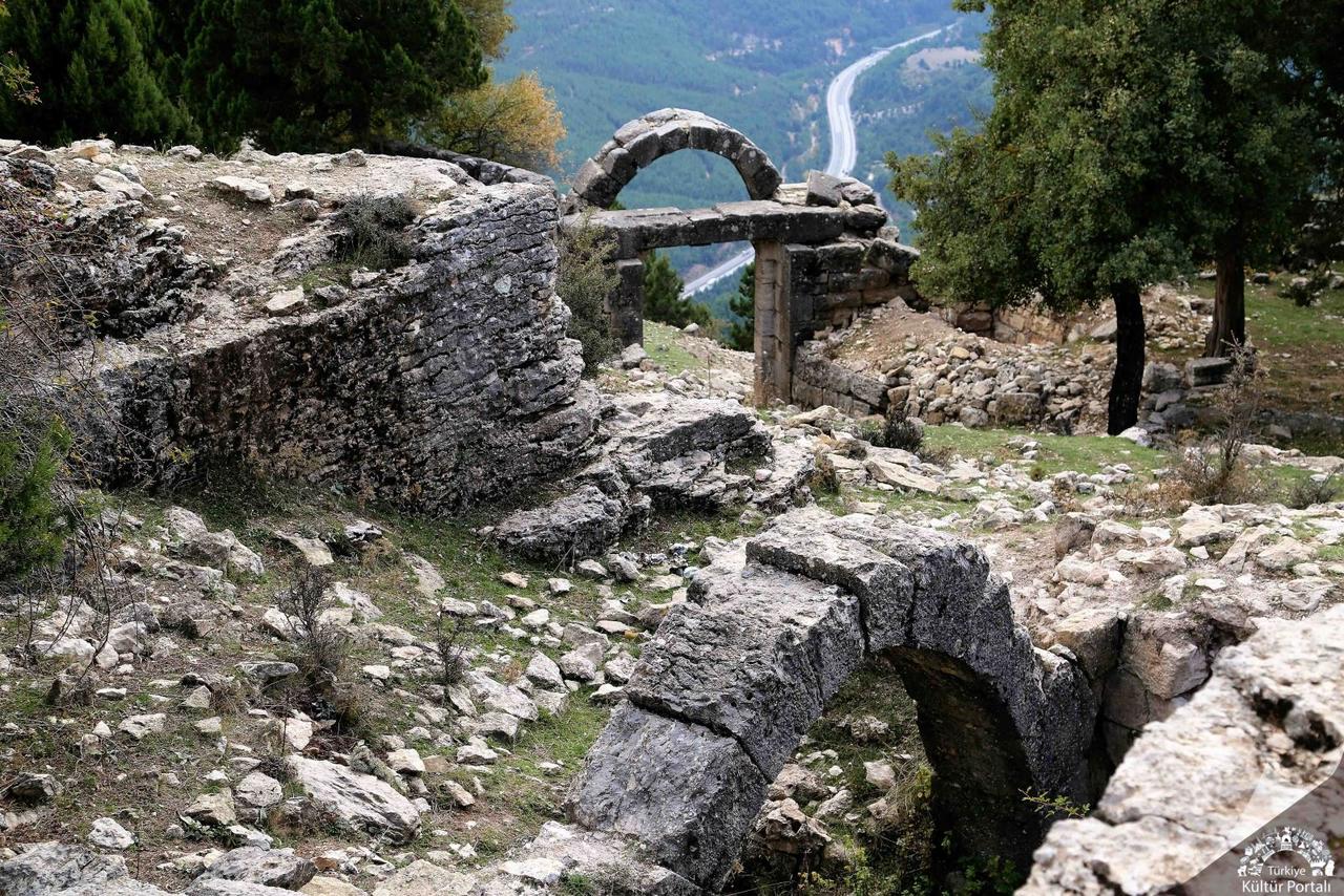
Gülek Castle
Location | Gülek Village (60-65 km north of Tarsus) Tarsus Mersin | ||||||||
|---|---|---|---|---|---|---|---|---|---|
Region | Türkiye Mediterranean Region | ||||||||
Elevation | 1600 metres from the sea | ||||||||
Type | Castle | ||||||||
Historical Period | Middle Ages and later | ||||||||
Cultural Influences | Arab, Byzantine, Armenian, Cilician, Mamluk, Ottoman | ||||||||
Strategic Importance | Control of Gülek Pass (Cilician Gates) and the Via Tauri route | ||||||||
Entrance | Monumental gate in the south | ||||||||
Defense | Southern and western walls, round/square towers | ||||||||
Cistern | At the easternmost end | ||||||||
Material | Bosajlı cut stone blocks | ||||||||
Findings | Yellow and green glazed/unglazed ceramic fragments | ||||||||
Other Name | Kuklak Guglag Gogulat Cogolaquum Kawlak Asakaliba | ||||||||
Gülek Kalesi is a historical fortress located approximately 60–65 km north of the district of Tarsus, within Mersin Province in Türkiye’s Mediterranean Region, near the village of Gülek. It was constructed on a strategic point atop the Taurus Mountains, at an elevation of 1600 meters above sea level, commanding the Gülek Pass (Cilician Gates). The fortress was built to control the Gülek Pass, one of the most important routes connecting Inner Anatolia with the Mediterranean Region. The foundations of the fortress extend back to the Middle Ages, and its architectural plan, stonework, and surface finds indicate occupation during multiple historical periods. Historical sources refer to the structure by various names such as Kuklak, Guglag, Gogulat, Cogolaquum, Kawlak, and it bears traces of dominance by Arab, Byzantine, Armenian, Cilician, Mamluk, and Ottoman cultures.
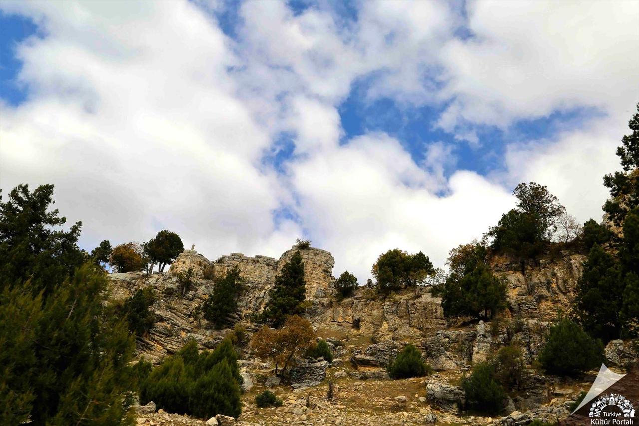
Gülek Kalesi (Kültür Portalı)
Gülek Kalesi is situated on a dominant hilltop 2 km southwest of the Gülek Pass. Its northern and northeastern sides are bordered by natural cliffs, eliminating the need for additional fortifications in those directions. Access to the fortress is via a monumental gate on the south side, and the curtain walls on the south and west are clearly visible. These walls are reinforced with circular and square towers of varying sizes. At the easternmost end of the fortress lies a cistern, and the walls feature ashlar blocks characteristic of the Cilician Armenian Kingdom period. Aside from the structure on the right side of the entrance gate, very few interior spaces remain standing. Surface finds include glazed and unglazed ceramic fragments in yellow and green colors.
The slopes of the rocky hill on which the fortress stands are covered with cedar trees, while the base consists of mixed limestone rocks that rise in layered formations toward the summit. Alishan (1899) recorded the discovery of fossilized marine invertebrates of the genus Echinites and various coral species in the area. Additionally, traces of an ancient altar carving carved into the rock face on the western cliff and two illegible inscriptions have been identified.
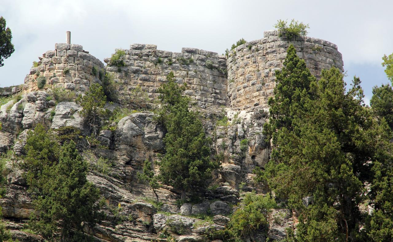
Gülek Kalesi (kulturenvanteri)
The strategic importance of Gülek Kalesi stems from its role as a military complex guarding the Tarsus main road (Via Tauri) and the Cilician Gates. During the Middle Ages, travelers passing through the Gülek Pass were required to pay a toll to the fortress commander, underscoring its economic and military value. Historical records indicate that the fortress was either constructed or substantially renovated during the period of the Cilician Armenian Kingdom. In the 1198–1199 coronation list, the name Smbat appears as Lord of Gülek, and the fortress was then known as Asakaliba. Its continuous occupation over centuries is evident from its architectural structure and archaeological finds.
In 1432–1433, Bertrandon de la Broquière visited the region and referred to the fortress as Cublech, describing it as “the highest castle he had seen up to that point.” Evliya Çelebi, in the 17th century, described the fortress as “rising to the heavens” and noted its location in the Ramazanoğlu Yaylası area within the Kusun kazas. It is known that in 1838–1839, İbrahim Paşa, who led a rebellion against Ottoman rule, briefly occupied the fortress. During this period, a lead mine was recorded on the northwestern side of the fortress, and the masonry on the southern and western walls was noted to resemble that of the fortifications in Pozantı from the late 1830s.
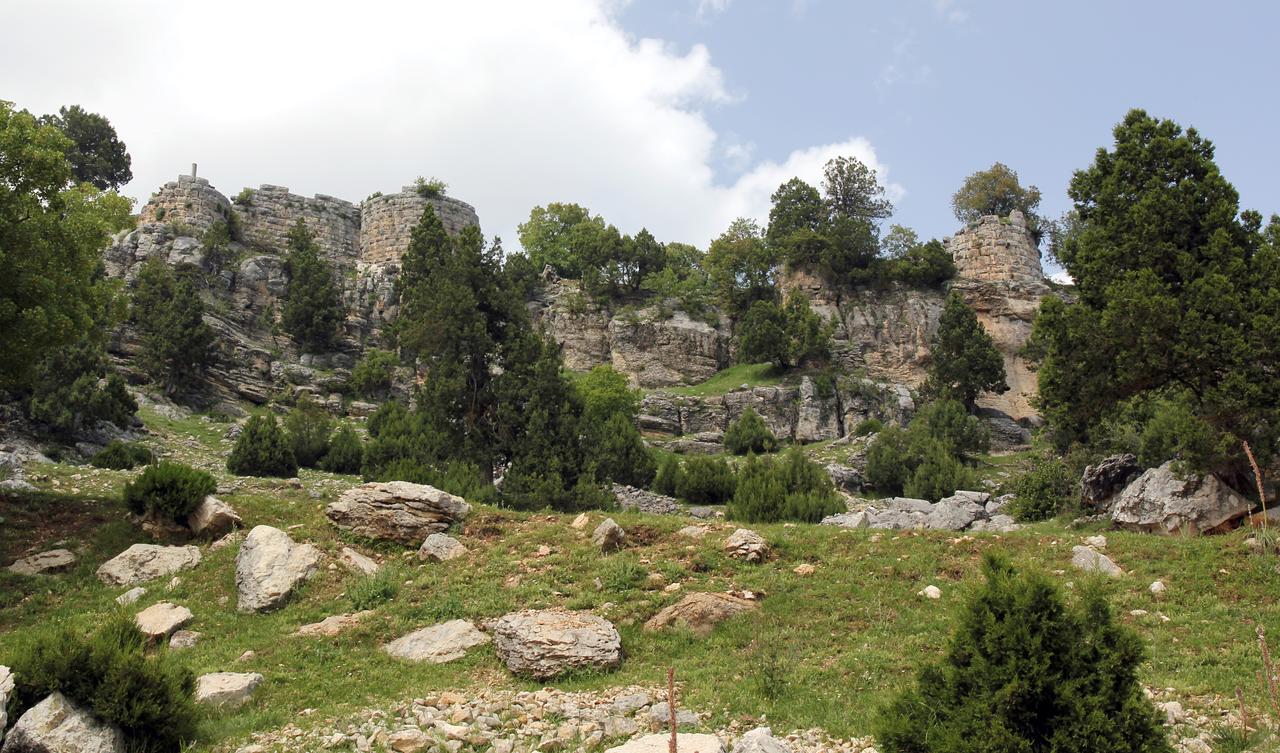
Gülek Kalesi (kulturenvanteri)
Today, Gülek Kalesi is accessible and has attracted a large number of visitors in recent years, largely due to photographs taken on the edge of the cliff being widely shared on social media. Two new structures now stand on the site, but most of the original spaces have not survived. Gülek Kalesi, one of the most significant remnants reflecting Mersin’s historical and natural heritage, continues to draw the interest of history enthusiasts and nature lovers alike.
Anadolu Ajansı. "Gülek Kalesi son dönemde çok sayıda ziyaretçiyi ağırlıyor," Accessed April 5, 2025.https://www.aa.com.tr/tr/vg/video-galeri/gulek-kalesi-son-donemde-cok-sayida-ziyaretciyi-agirliyor.
Culture Inventory. "Gülek Kalesi." Accessed April 5, 2025.https://kulturenvanteri.com/yer/gulek-kalesi/#17.1/37.269528/34.790769
Culture Portal. "GÜLEK KALESİ | Kültür Portalı." Accessed April 5, 2025.https://kulturportali.gov.tr/turkiye/mersin/gezilecekyer/gulek-kalesi
Türkiye Turizm Ansiklopedisi. "Gülek Kalesi." Accessed April 5, 2025.https://turkiyeturizmansiklopedisi.com/gulek-kalesi.
Gülek Castle
Location | Gülek Village (60-65 km north of Tarsus) Tarsus Mersin | ||||||||
|---|---|---|---|---|---|---|---|---|---|
Region | Türkiye Mediterranean Region | ||||||||
Elevation | 1600 metres from the sea | ||||||||
Type | Castle | ||||||||
Historical Period | Middle Ages and later | ||||||||
Cultural Influences | Arab, Byzantine, Armenian, Cilician, Mamluk, Ottoman | ||||||||
Strategic Importance | Control of Gülek Pass (Cilician Gates) and the Via Tauri route | ||||||||
Entrance | Monumental gate in the south | ||||||||
Defense | Southern and western walls, round/square towers | ||||||||
Cistern | At the easternmost end | ||||||||
Material | Bosajlı cut stone blocks | ||||||||
Findings | Yellow and green glazed/unglazed ceramic fragments | ||||||||
Other Name | Kuklak Guglag Gogulat Cogolaquum Kawlak Asakaliba | ||||||||
Location and Structural Features
Historical Significance
Current Condition