This article was automatically translated from the original Turkish version.
+2 More
Vegetation Cover | Alpine meadows and plant communities | ||||||||
|---|---|---|---|---|---|---|---|---|---|
Summer Pasture Area (2025) | 66282.79 hectares | ||||||||
Tourism Activities | Highland festivals birdwatching botanical tourism horseback nature walks paragliding mountaineering activities camping and caravan areas nature sports and walks | ||||||||
Summer Pastures Declared as Tourism Centers | Kümbet Kulakkaya Sis Dağı Bektaş | ||||||||
Main Summer Pastures | Kümbet Gölyanı Çakrak Paşakonağı Karagöl Kulakkaya Sis Dağı Bektaş | ||||||||
Rakım | over 3000 metres in some mountainous areas Average 1600–2250 metres | ||||||||
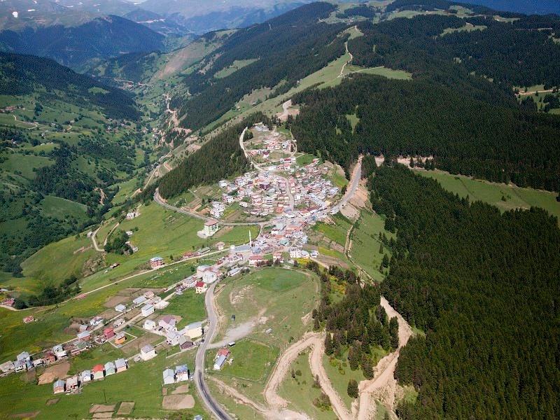
Giresun alpine pastures refer to the alpine grazing areas and oba settlements located primarily in the higher elevations of the Eastern Black Sea Region. Giresun’s forest cover ends at approximately 2,000 meters elevation, and above this altitude, the landscape is dominated by alpine meadows and alpine plant communities that retain their greenery during summer months. The pastures beginning where the forest belt ends have historically been associated with transhumance, animal husbandry, and seasonal settlement activities. The pastures and grazing lands in Giresun generally follow a geographic pattern extending from north to south and from the coast toward inland areas.
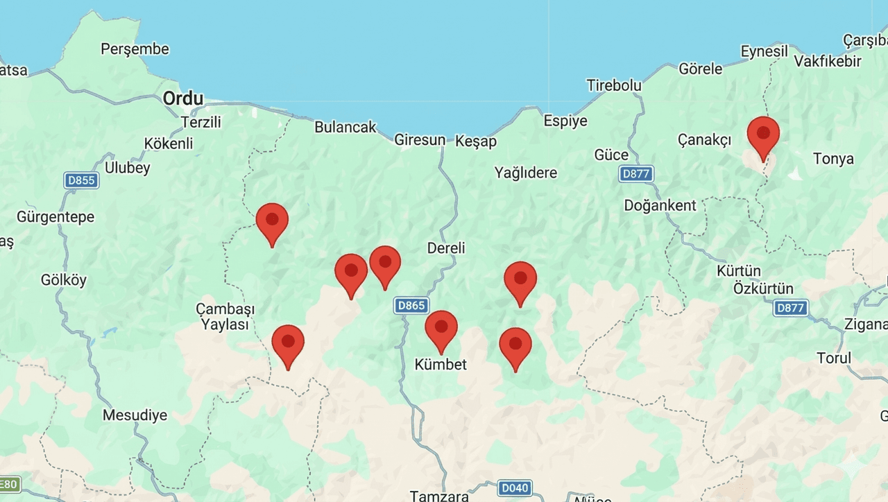
Main Giresun Alpine Pastures (Generated by Artificial Intelligence)
Giresun alpine pastures lie within the topographical structure shaped by Giresun and Karagöl mountains. These pastures are typically found between 1,600 and 2,250 meters elevation. In some areas, elevations exceed 3,000 meters. Karagöl Tepesi in the Karagöl Mountains reaches 3,107 meters, while Kırklar Tepesi stands at 3,040 meters.
Alpine vegetation is widespread across the pastures. The highland areas remain green even during summer months, covered by meadows. Wild animal species such as bear, wolf, eagle, and hare inhabit the Giresun mountains. Forested areas contain tree species including fir, red pine, hornbeam, beech, and alder.
Numerous lakes and oba settlements are located around the Karagöl Mountains. These include Aygır Gölü, Karagöl Gölü, Bağırsak Gölü, Camlı Göl, Sağrak Gölü, and Kazan Gölü. Surrounding these lakes are oba settlements such as Eğrikaya, Kanlıağıl, Avşar, Yukarı Belen, and Aşağı Belen.
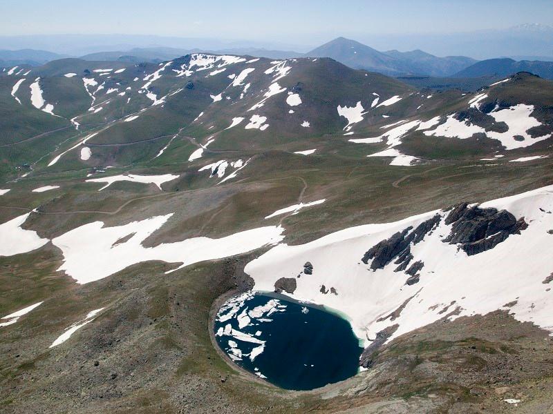
Karagöl (Giresun Governorship)
Transhumance in Giresun has historically been linked to a pastoral way of life. Broadly defined, a yayla is a seasonal destination for animal grazing and sometimes limited agriculture. In regional usage, the term encompasses broader areas including grazing lands, forested zones, and settlement sites. The residential sections of these settlements are known as obas.
Nomadic communities that migrated to the region brought with them transhumance culture and associated cultural elements. In 1515 Ottoman records, 26 pasture settlements within the boundaries of Vilayet-i Çepni in the Giresun region are mentioned by names such as Uluköy, Harıd, Akçal, Gönderi, Köy-yeri, Elmacık, Döşek, and Akdaş. These pastures were used for animal grazing, cultivation, and seasonal climate adaptation.【1】
The coastal communities near the main agricultural zones refer to their villages as “cenik”. Each village or family has its own designated pasture or oba. These pastures are typically communal property owned by the village or its residents. In some cases, usage rights to pastures are rented to other pasture dwellers, a practice known as “kırtıl”.
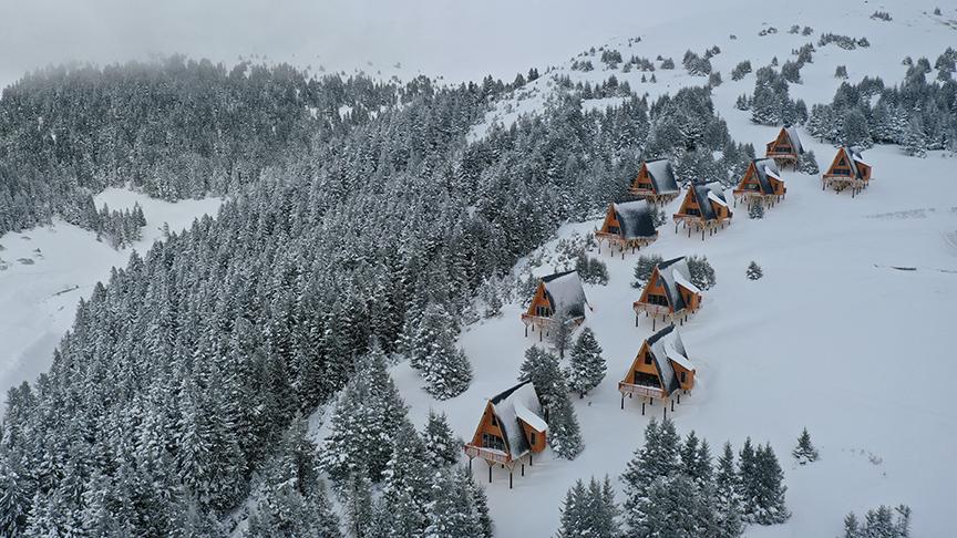
Kümbet Pasture (Anadolu Agency)
Climate conditions and animal husbandry have been decisive in shaping transhumance culture. Seasonal rainfall patterns and rotational use of pastures led to the development of a semi-nomadic lifestyle based on the summer-winter-winter system. Livestock herds were moved to highland pastures during summer months and returned to lower elevations during winter.
According to 2025 data from the Giresun Provincial Directorate of Agriculture and Forestry, the total area of pasture lands in the province is 66,282.79 hectares. The usable green forage yield is recorded as 270, and the grazing capacity is noted at 25,566.22 livestock units.【2】
The legal status of pastures and grazing lands has been defined through various regulations. These stipulate that pastures, water sources, and grasslands are under common ownership and may be used by villages or village communities. These areas cannot be bought or sold.
Kümbet Pasture is located within the boundaries of Dereli district, approximately 60 kilometers from the city center of Giresun. It lies between 1,600 and 1,950 meters elevation. The Kümbet Tourism Center encompasses numerous surrounding obas and pastures including Erenler Yaylası, Can Obası, Çeğerli Yaylası, Tekke Yaylası, Çomakkonağı Obası, Yağmurca Yaylası, Çeğerçukur Obası, Köyyeri Obası, Hamurlu Obası, and Elemeği Obası. It serves as the central hub during the transhumance season.
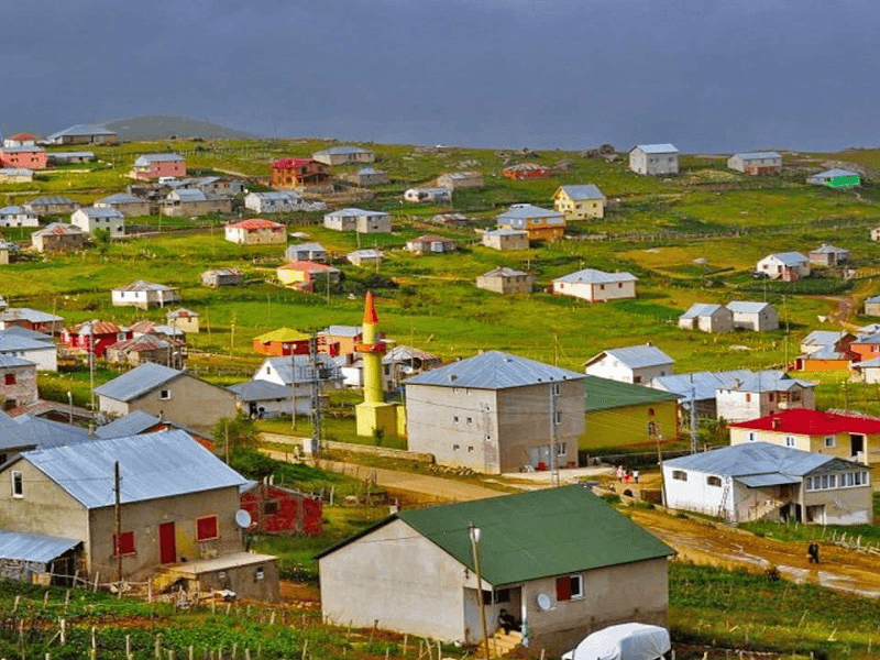
Bektaş Pasture (Giresun Governorship)
Bektaş Pasture is located approximately 56 kilometers from the center of Giresun. Its central area spans 2,000 to 2,250 meters elevation. Together with Kulakkaya Pasture, Melikli Obası, Kurttepe Mevkii, and Alçakbel Forest Picnic Area, it forms the Bektaş Tourism Center. Numerous obas surround the pasture. At Kurttepe, skiing is practiced in winter and grass skiing in summer.
Sis Dağı lies within the boundaries of Görele district and reaches an elevation of 2,182 meters. It is approximately 40 kilometers from the coast. The area is used for nature sports and mountaineering activities. The Sis Dağı Festival is held annually. Sis Dağı has been designated as a Class C National Park for conservation.【3】
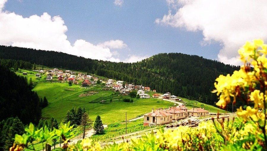
Kulakkaya Pasture (Giresun Governorship)
Kulakkaya Pasture is located at approximately 1,700 meters elevation and is 40 kilometers from the center of Giresun. It is known for its wild roses and vargit flowers. Along the access route are natural sites such as Despot Kayası ve Suyu, Erimez Mevkii, and Gelin Kayası. Alçakbel Forest Picnic Area and Forest Education Facilities are among the day-use areas.
Surrounding the Karagöl Mountains, the second highest peak in Giresun, are numerous oba settlements including Elmalı, Bozattaşı, and İnboynu. The area contains lakes such as Aygır Gölü, Karagöl Gölü, Bağırsak Gölü, Camlı Göl, Sağrak Gölü, and Kazan Gölü. It is used for trekking and nature walks.
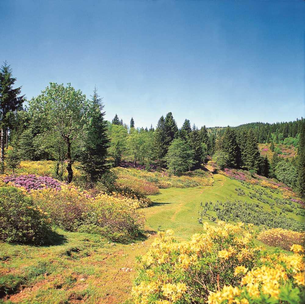
Paşakonağı Pasture (Culture Portal)
Paşakonağı Pasture is located within the boundaries of Bulancak district and the Kovanlık township. It lies approximately 1,450 meters above sea level. The area features azaleas, valleys, and waterfalls. Natural sites nearby include Karasay Waterfall, Geçilmez Valley, Çiğseli Lake, and Kızılot Meadow.
Çakrak Pasture is approximately 80 kilometers from Giresun. The area contains arch bridges, church ruins, and mill remains. The Hacı Abdullah Wall, located in Çıkrıkkapı Obası, was constructed around 1610. This approximately 6.5-kilometer-long wall was built to separate grazing areas from settlement zones.
Gölyanı Obası lies within the boundaries of Sınır Village in Yağlıdere district, 51 kilometers from the district center. A natural lake is located in the area. Traditional wooden structures of the “hartama” type are present, and the settlement is protected under natural site status.
Traditional pasture houses were constructed as simple, multi-functional structures. Initially single-story and single-room buildings, they expanded over time with additional rooms and guest quarters. The layout of pasture houses is determined by their proximity to forested areas, terrain conditions, and the socio-economic structure of the local population.
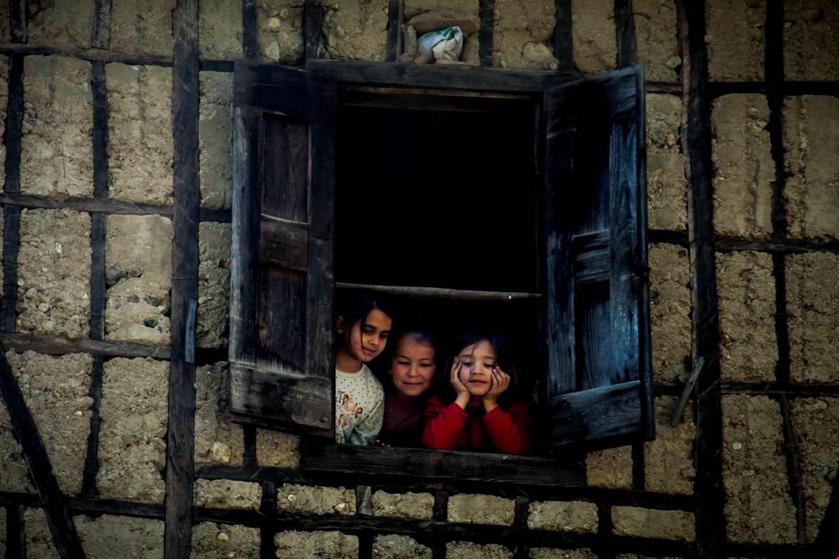
Göz Dolma Wall Construction (Yağlıdere Subgovernorship)
Stone and wood are the primary building materials used in pastures. In particular, Gölyanı Obası features traditional wooden structures known as “hartama”. Historically, pasture architecture is associated with harmonious integration with nature, local production methods, and social solidarity culture.
The backbone of the economy in Giresun pastures is animal husbandry. Both large and small livestock farming are practiced. Milk produced is processed into products such as butter, cheese, and whey.
Traditional small-scale crafts have also developed in the pastures. Women in the region weave wool from sheep into yarn, headscarves, blankets, coarse cloth, and sacks. Additionally, fabrics known as “şal” are woven to make garments called jackets, vests, and zıpka. Other traditional crafts integral to pasture culture include hartamacılık, hızarcılık, küfecilik, külekçilik, sepetçilik, and yayıkçılık.
Pasture tourism refers to tourism activities based on day visits or short-term stays in high-altitude areas. These activities, motivated by immersion in nature, escape from hot weather, and participation in outdoor activities, are classified under ecotourism.
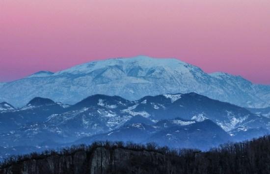
Sis Dağı Pasture (Giresun Governorship)
Eastern Black Sea Region is included in the Turkey Tourism Strategy 2023 as a development corridor for pasture tourism. Giresun Province is identified as one of the key destinations for pasture tourism under this plan. Kümbet, Bektaş, Kulakkaya, and Sis Dağı pastures have been officially designated as tourism centers by a decision of the Council of Ministers.【4】
In recent years, changing tourism trends have increased demand for the Eastern Black Sea pastures. This has led to the transformation of some pastures into tourism centers and spurred tourism investments in the region. Expansion of pasture roads and construction of new routes have resulted in a rise in the number of second-home type structures in pasture areas.
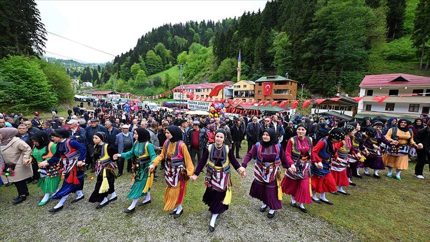
Pasture Festival (Anadolu Agency)
Festivals and events held in Giresun pastures are important elements of the region’s cultural life. Pasture festivals are typically held in July, before the hazelnut harvest. These events revive traditions and customs passed down from generation to generation. Various pasture festivals are held annually in many districts of Giresun.
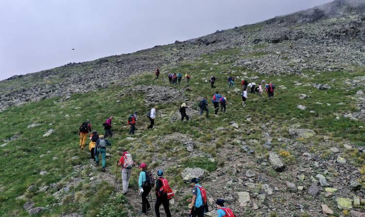
Nature Walk in Karagöl (Anadolu Agency)
Giresun pastures host a variety of nature sports and tourism activities. Camping and caravan tourism is practiced at Kulakkaya Pasture’s Alçakbel area, Kümbet Pasture’s Uzundere region, and Bektaş Pasture.
Trekking is feasible in Karagöl during summer months with guided nature walks. Horseback nature walks take place around Tamdere Pasture, Karaovacık Pasture, Çıkrıkkapı Yaylası-Kümbet route, and Karaduğa Pasture.
Birdwatching activities are conducted along the Çıkrıkkapı, Dereli, and Kümbet pasture routes. For botanical tourism, Şebinkarahisar’s Arslancık-Arslanyurdu Pasture stands out. Paragliding activities are carried out at Koçkayası, Aymaç, and Bektaş pastures.
Anadolu Ajansı. "Karagöl Dağları Doğa Tutkunlarına Eşsiz Güzellikler Sunuyor." Accessed May 11, 2026. https://www.aa.com.tr/tr/yasam/karagol-daglari-doga-tutkunlarina-essiz-guzellikler-sunuyor/3275015
Anadolu Ajansı. “Doğu Karadeniz'de Yayla Şenlikleri Başladı.” Accessed May 11, 2026. https://aa.com.tr/tr/yasam/dogu-karadenizde-yayla-senlikleri-basladi/3217383
Anadolu Ajansı. “Kümbet Yaylası Doğaseverlerin Kış Rotasında Yer Alıyor.” Accessed May 11, 2026. https://www.giresun.gov.tr/yaylalarimiz
Başer, Volkan. "Yaylalardaki Arazi Kullanım Değişiminin Coğrafi Bilgi Sistemi ile Analizi: Giresun Örneği." *Bitlis Eren Üniversitesi Fen Bilimleri Dergisi* 8, no. 1 (2019): 167–175. Accessed May 11, 2026. https://dergipark.org.tr/en/download/article-file/668486
Durdu, Ayşe. “Giresun'da Yayla Kültürü ve Geleneksel Yayla Evleri (Alucra ve Yağlıdere).” Master's thesis, Selçuk Üniversitesi, 2011. Accessed May 11, 2026. https://acikerisim.selcuk.edu.tr/items/ae549514-bff5-4e8a-81b4-ba9228c8109e
Mutlu, Elanur. "Yayla Kültürünün Mekânsal Dönüşümü ve Destinasyon İmajı Üzerindeki Etkileri: Bektaş Yaylası Örneği (Giresun-Türkiye)." The Journal of Academic Social Science Studies 19, no. 107 (2026): 399-412. Accessed May 11, 2026. https://jasstudies.com/?mod=makale_tr_ozet&makale_id=90046
Paslı, Mehmet Mert, and Nazik Çelikkanat Paslı. "Giresun İlinin Ekoturizm Potansiyelinin Değerlendirilmesi." *Gümüşhane Üniversitesi Sosyal Bilimler Dergisi* 10 (2019): 297–306. Accessed May 11, 2026. https://dergipark.org.tr/en/pub/gumus/article/616541
T.C. Giresun Valiliği. "Yaylalarımız." giresun.gov.tr. Accessed May 11, 2026. https://www.giresun.gov.tr/yaylalarimiz
T.C. Giresun Valiliği. “Giresun İli 2024 Yılı Çevre Durum Raporu.” Çevre Şehircilik ve İklim Değişikliği İl Müdürlüğü. Accessed May 11, 2026. https://webdosya.csb.gov.tr/db/giresun/icerikler/2024-yili-g-resun-cevre-durum-raporu-20250808105235.pdf
T.C.Yağlıdere Kaymakamlığı Governorship. "Gölyanı Yaylası." yaglidere.gov.tr. Accessed May 11, 2026. https://www.yaglidere.gov.tr/golyani-yaylasi
Türkiye Kültür Portalı. “Paşakonağı Yaylası – Giresun.” T.C. Kültür ve Turizm Bakanlığı. Accessed May 11, 2026. https://www.kulturportali.gov.tr/turkiye/giresun/gezilecekyer/pasakonagi-yaylasi
[1]
Ayşe Durdu, “Giresun'da Yayla Kültürü ve Geleneksel Yayla Evleri (Alucra ve Yağlıdere),” Yüksek Lisans Tezi, Selçuk Üniversitesi, (2011): 9, Erişim 11 Mayıs 2026, https://acikerisim.selcuk.edu.tr/items/ae549514-bff5-4e8a-81b4-ba9228c8109e
[2]
T.C. Giresun Valiliği, “Giresun İli 2024 Yılı Çevre Durum Raporu,” (2025): 185, Erişim 11 Mayıs 2026, https://webdosya.csb.gov.tr/db/giresun/icerikler/2024-yili-g-resun-cevre-durum-raporu-20250808105235.pdf
[3]
T.C. Giresun Valiliği, “Yaylalarımız Sis Dağı Yaylası,” Erişim 11 Mayıs 2026, https://www.giresun.gov.tr/yaylalarimiz
[4]
Mehmet Mert Paslı ve Nazik Çelikkanat Paslı, "Giresun İlinin Ekoturizm Potansiyelinin Değerlendirilmesi," Gümüşhane Üniversitesi Sosyal Bilimler Dergisi 10 (2019): 300, Erişim 11 Mayıs 2026, https://dergipark.org.tr/en/pub/gumus/article/616541
Vegetation Cover | Alpine meadows and plant communities | ||||||||
|---|---|---|---|---|---|---|---|---|---|
Summer Pasture Area (2025) | 66282.79 hectares | ||||||||
Tourism Activities | Highland festivals birdwatching botanical tourism horseback nature walks paragliding mountaineering activities camping and caravan areas nature sports and walks | ||||||||
Summer Pastures Declared as Tourism Centers | Kümbet Kulakkaya Sis Dağı Bektaş | ||||||||
Main Summer Pastures | Kümbet Gölyanı Çakrak Paşakonağı Karagöl Kulakkaya Sis Dağı Bektaş | ||||||||
Rakım | over 3000 metres in some mountainous areas Average 1600–2250 metres | ||||||||
Geographical Features
Transhumance Culture
Pasture and Grazing Lands
Main Pastures
Kümbet Pasture
Bektaş Pasture
Sis Dağı Pasture
Kulakkaya Pasture
Karagöl Pasture
Paşakonağı Pasture
Çakrak Pasture
Gölyanı Obası
Pasture Settlements and Architecture
Pasture Economy and Production Activities
Pasture Tourism
Pasture Festivals
Nature Sports and Tourism Activities