


This article was automatically translated from the original Turkish version.
Clouds are a natural atmospheric phenomenon resulting from the transformation of water vapor in the atmosphere into liquid water droplets or ice crystals through specific physical and thermodynamic processes. This natural event is one of the fundamental components of the water cycle and is directly related to vertical air movements, temperature changes, and the presence of microscopic particles. Cloud formation is not a single-stage process but arises from the simultaneous or sequential interaction of multiple complementary mechanisms.
The first stage of cloud formation involves the mixing of water vapor into the atmosphere and its subsequent ascent. The primary source of atmospheric water vapor is evaporation from Earth’s water bodies, including oceans, seas, lakes, and rivers. The moisture introduced into the air must rise to initiate cloud formation. This ascent occurs through various physical mechanisms. Solar radiation heats surface layers of air, causing them to expand and become less dense, thereby initiating upward motion; this process is called convective uplift. When winds encounter a mountain range or hill, air masses are forced upward along the topography; this mechanism is termed orographic uplift. At frontal zones where warm and cold air masses meet, the lighter warm air rises over the denser cold air, leading to cloud formation associated with frontal systems. Additionally, in low-pressure areas, converging air currents from different directions force air upward; this is known as convergence-induced uplift.
In the second stage, ascending moist air undergoes cooling and condensation. As air rises in the atmosphere, it expands due to decreasing ambient pressure and cools adiabatically. As the air temperature drops, its capacity to hold water vapor diminishes. When the air mass reaches its dew point, it becomes saturated, and excess water vapor begins to transition from the gaseous phase to the liquid or solid phase. At this stage, water vapor condenses into extremely small water droplets or, under suitable conditions, ice crystals. Condensation is the key physical transformation that renders clouds visible.
For condensation to occur, microscopic particles known as condensation nuclei must be present in the atmosphere. Pure water vapor cannot easily condense spontaneously; thus, these nuclei play a critical role in initiating the condensation process. Soluble particles such as sea salt and sulfate, due to their hygroscopic properties, readily attract water molecules and accelerate droplet formation. Meanwhile, insoluble particles such as dust, pollen, and smoke also function as condensation nuclei. Modern atmospheric research has demonstrated that mineral dust transported from deserts into the atmosphere contributes significantly to cloud droplet formation by adsorbing water vapor onto their surfaces, often producing more droplets than expected. These microscopic particles directly influence the number density and optical properties of clouds.
The physical structure and composition of clouds are closely linked to their altitude and temperature conditions. Clouds forming at low levels typically consist of liquid water droplets, which remain suspended in the air despite gravity due to their extremely small size. At higher altitudes, where temperatures fall below freezing, clouds are composed of fine ice crystals that impart a fibrous or silky appearance. The vertical temperature profile of the atmosphere determines both the internal structure of clouds and the weather phenomena they produce.
Clouds are generally classified into three main levels based on their formation altitude: low-level clouds below approximately 6,500 feet, mid-level clouds between 6,500 and 20,000 feet, and high-level clouds above 20,000 feet. This vertical distribution, combined with morphological characteristics, gives rise to fundamental cloud types such as cumulus (puffy), stratus (layered), and cirrus (thin and high). Each cloud type is shaped by the strength of upward air motion, moisture content, temperature profile, and properties of condensation nuclei.
As a result of these processes, clouds consist of water vapor as well as solid and liquid particles in the atmosphere and can assume various forms depending on atmospheric conditions. Cloud layers are examined in three distinct classes.
Cloud Altitudes by Layer (Table Created by Author)
The extent of cloud cover over the sky is measured in units called oktas, where one okta equals one-eighth of the sky.
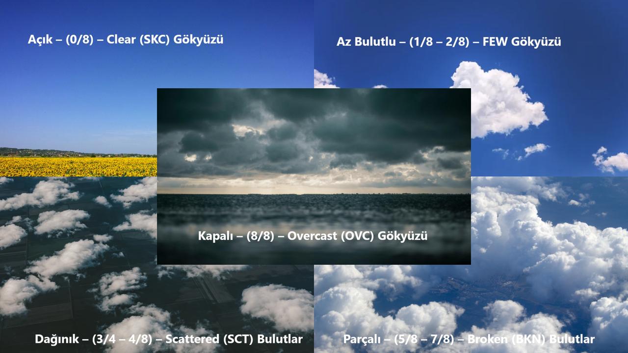
Cloud Types (Created by Author)
Stratus clouds are low-altitude (0 to 2,000 meters), gray, extensive, and flat layered clouds. They cover the sky, producing a cloudy and foggy appearance. Stratus clouds often open the way for misty or overcast conditions by covering the sky with a single covering layer.
Stratus clouds are typically associated with an overcast sky and show little variation throughout the day. They reduce visibility by creating a foggy environment and impart a cold, gloomy atmosphere.
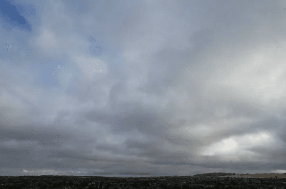
Stratus (ST) Clouds (Depositphotos)
Stratocumulus clouds are low-altitude (typically 600 to 2,000 meters above ground), widespread yet fragmented and lumpy in appearance. They often appear as rounded or rolled formations arranged across the sky and are colored in gray or white tones.
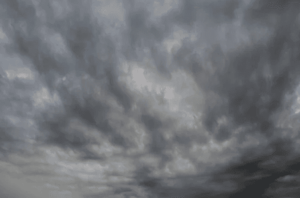
Stratocumulus (SC) Clouds (Depositphotos)
Nimbostratus clouds form extensive, dark gray, thick layers that cover large portions of the sky. They are associated with continuous precipitation and typically signal prolonged, steady rainfall or snow. Nimbostratus clouds form between low and mid-altitudes and largely obscure the sun or moon.
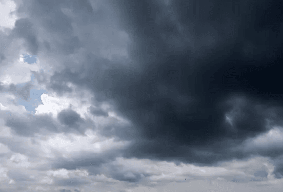
Nimbostratus (Ns) Clouds (Depositphotos)
Altostratus clouds are mid-altitude clouds (typically 2,000 to 7,000 meters) that cover large areas of the sky with gray or blue-gray hues. They commonly cause the sun or moon to appear diffused, though their details remain indistinct.
Altostratus clouds occur at altitudes between stratus (low clouds) and cirrostratus (high clouds). Their presence in weather forecasting often indicates approaching precipitation, particularly when a warm front is approaching.
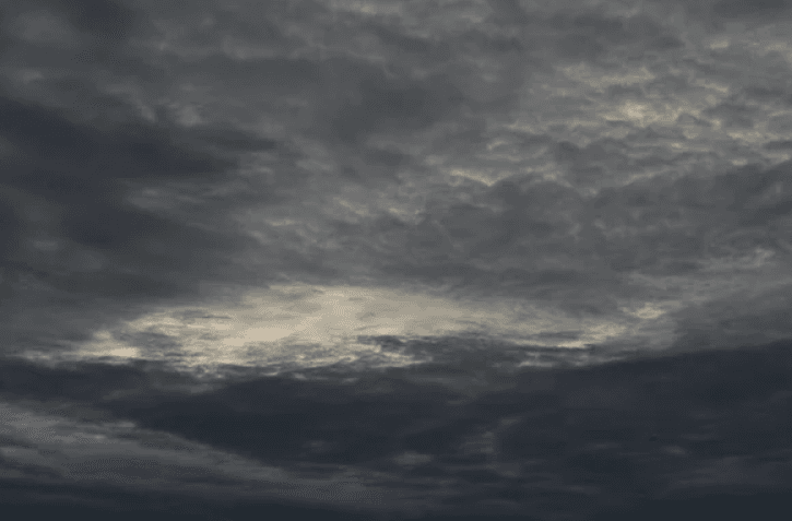
Altostratus (As) Clouds (Depositphoto)
Altocumulus clouds are mid-altitude (typically 2,000 to 6,000 meters), white or gray, fragmented, and clustered clouds. They appear as small patches or patterns resembling a marble texture and often form in closely spaced clusters or regular patterns.
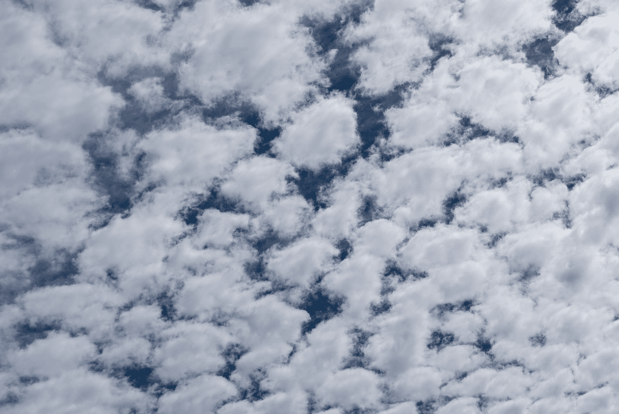
Altocumulus (Ac) Clouds (Pixabay)
Cirrus clouds are thin, wispy, white clouds forming at high altitudes (typically 6,000 meters and above). Composed of ice crystals in very cold upper atmospheric layers, they allow sunlight to pass through, giving them a bright and delicate appearance.
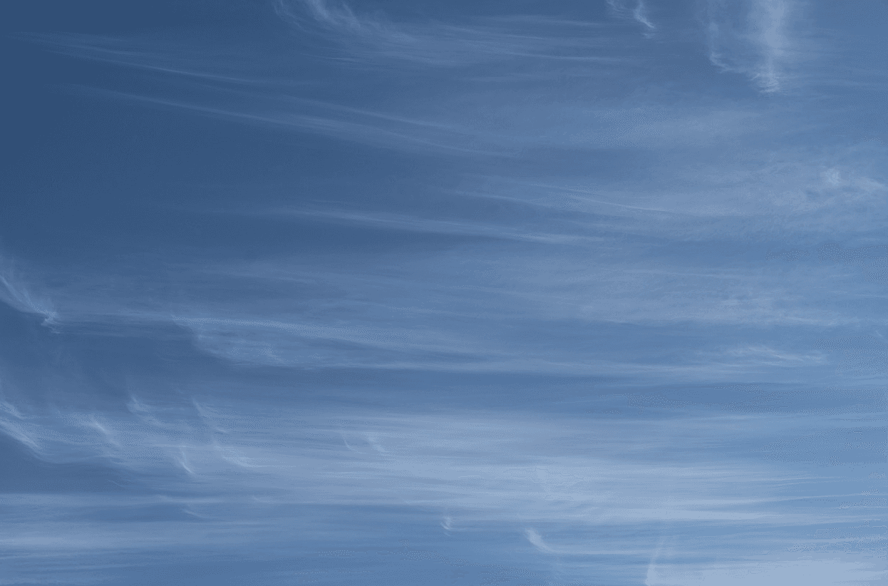
Cirrus (Ci) Clouds (Pixabay)
Cirrostratus clouds are thin, transparent layers forming at high altitudes (typically 6,000 to 13,000 meters). Composed of ice crystals, they often cover the sky like a fine veil. These clouds can produce halos—light rings—around the sun or moon.
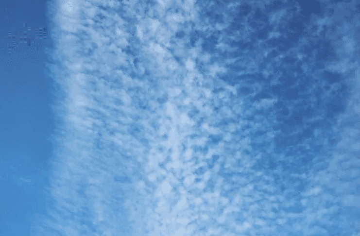
Cirrostratus (Cs) Clouds (Depositphoto)
Cirrocumulus clouds form at high altitudes (typically 5,000 to 13,000 meters) and appear as thin, white clusters or small grains scattered across the sky. Composed of ice crystals, they often spread in a regular pattern resembling small ripples or speckles.
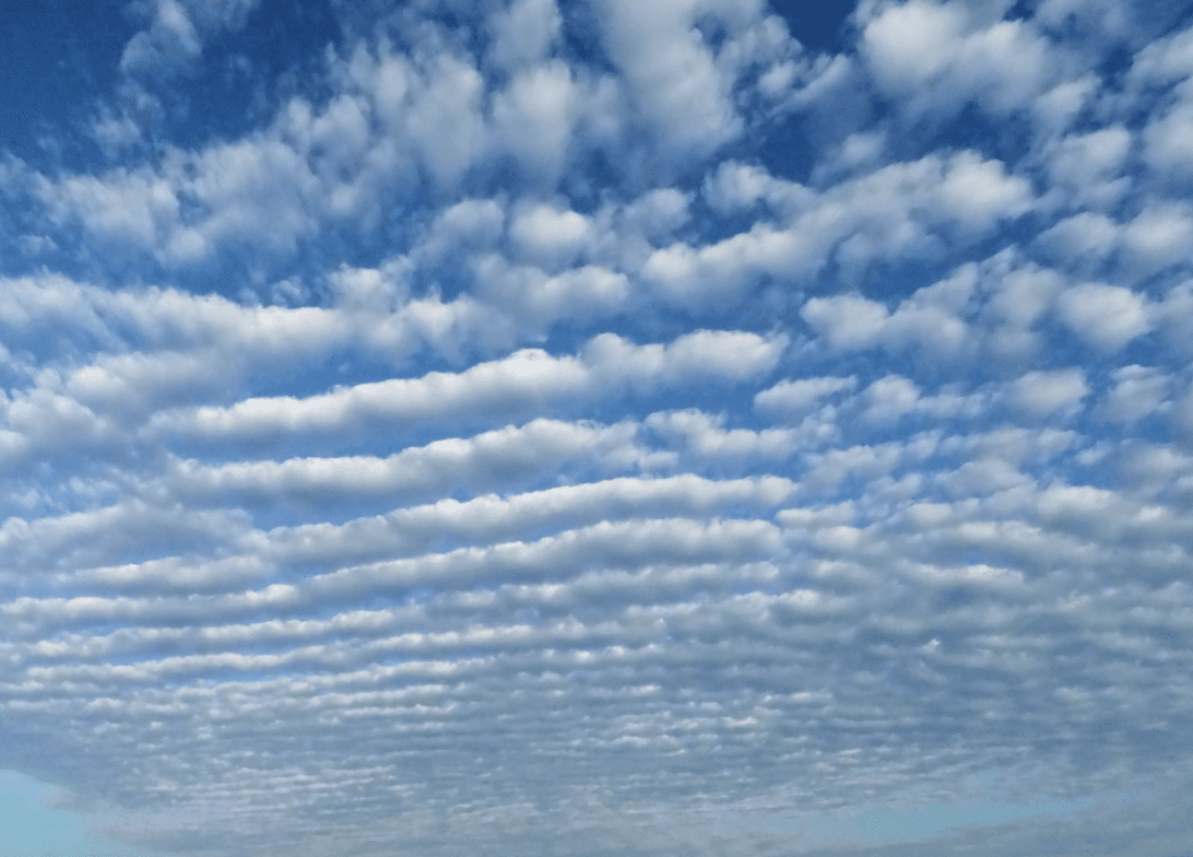
Cirrocumulus (Cc) Clouds (Pixhere)
Cumulus clouds are prominent, puffy, and cotton-like white clouds. Known as fair-weather clouds, they appear as isolated clusters in the sky. Their bases are flat, while their tops are rounded and puffy. Cumulus clouds form at low altitudes (typically 500 to 2,000 meters).
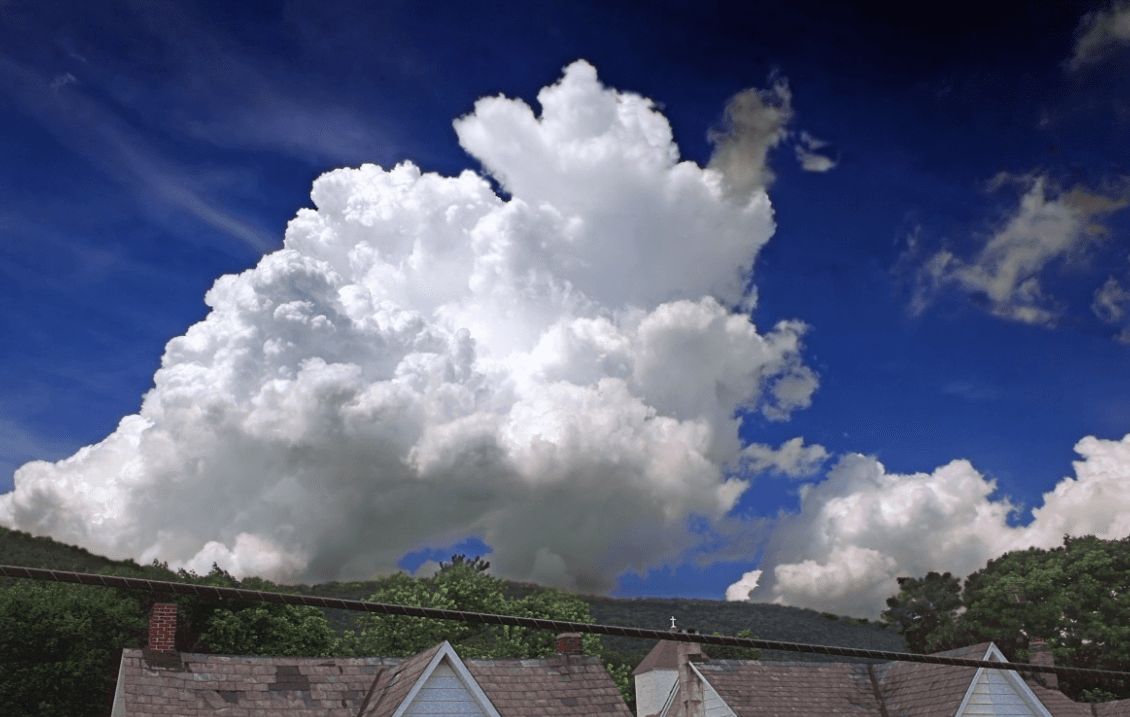
Cumulus (Cu) Clouds (Pixhere)
Cumulonimbus clouds are massive, towering clouds capable of producing severe storms, lightning, thunder, and downpours. These clouds exhibit strong vertical development, rising as high as 10,000 meters in the atmosphere, with their upper portions flattening into an anvil shape. Cumulonimbus clouds are associated with the most hazardous weather conditions.
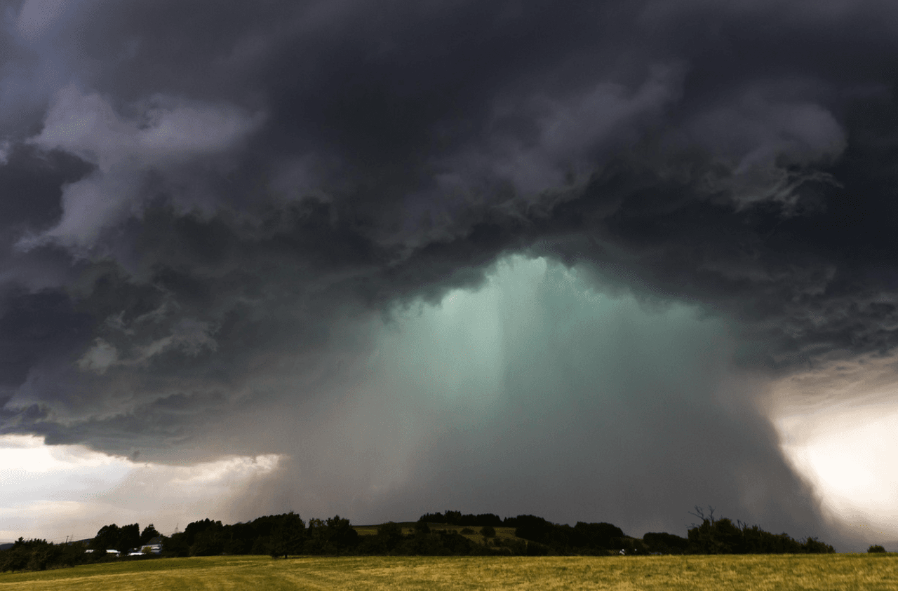
Cumulonimbus (Cb) Cloud (Pixabay)
Cloud Types (Table Created by Author)
Depositphotos Inc. "Az Bulutlu Stok Fotoğrafları." Stock Visual Archive. Accessed January 23, 2026.https://depositphotos.com/tr/photos/az-bulutlu.html
Freepik Company S.L. "An Aerial View of Large Cumulus Clouds in the Air." Stock photo. Accessed January 23, 2026.https://www.freepik.com/free-photo/aerial-view-large-cumulus-clouds-air_10292359.htm#fromView=keyword&page=1&position=26&uuid=bd812b25-0885-462a-8591-74e113c0ff91&query=Scattered+cloud+view
Freepik Company S.L. "Scattered Cloud View Images." Stock image collection. Accessed January 23, 2026.https://www.freepik.com/free-photos-vectors/scattered-cloud-view
Georgia Institute of Technology Research News. "Cloud Formation: Insoluble Dust Particles Can Form Cloud Droplets That Affect Global and Regional Climate." ScienceDaily, Accessed January 15, 2026.https://www.sciencedaily.com/releases/2011/10/111013113814.htm.
Kadıoğlu, Mikdat. Havacılık Meteorolojisine Giriş. İstanbul: Nobel Yayınları, 2021.
Met Office. “Clouds.” *Types of Weather*. Accessed January 15, 2026.https://weather.metoffice.gov.uk/learn-about/weather/types-of-weather/clouds
Meteorology General Directorate. "Bulutlar." *Sıkça Sorulan Sorular*. MGM. Accessed September 23, 2025.https://www.mgm.gov.tr/genel/sss.aspx?s=bulutlar.
Meteorology General Directorate. "Meteorolojiye Giriş." *Meteorolojiye Giriş*. MGM. Accessed September 23, 2025.https://www.mgm.gov.tr/genel/meteorolojiyegir.aspx?s=5
Pexels. "Body of Water." Photograph. Accessed January 23, 2026.https://www.pexels.com/photo/body-of-water-1154510/
Pexels. "Sunflower Garden under Blue Sky." Photograph. Accessed January 23, 2026.https://www.pexels.com/photo/sunflower-garden-under-blue-sky-544554/
Sever, Hanifi, and Ömer Kuplay. İnsansız Hava Araçları: Makinelerin Yükselişi. 3. baskı. Ankara: Adalet Yayınları, 2024.
University of Wisconsin–Madison. “What Is a Cloud? Scientists Still Searching for a Clear-Sky Definition.” ScienceDaily. Accessed January 15, 2026.https://www.sciencedaily.com/releases/2005/12/051207110456.htm.
bilimUP. "Bulutlar Nasıl Oluşur." Accessed September 23, 2025.https://www.bilimup.com/bulutlar-nasil-olusur

Cloud Formation
Cloud Cover Fraction
Cloud Types
Stratus (ST) Clouds
Characteristics
Stratocumulus (SC) Clouds
Characteristics
Nimbostratus (Ns) Clouds
Characteristics
Altostratus (As) Clouds
Characteristics
Altocumulus (Ac) Clouds
Characteristics
Cirrus (Ci) Clouds
Characteristics
Cirrostratus (Cs) Clouds
Characteristics
Cirrocumulus (Cc) Clouds
Characteristics
Cumulus (Cu) Clouds
Characteristics
Cumulonimbus (Cb) Clouds
Characteristics