


This article was automatically translated from the original Turkish version.
+2 More
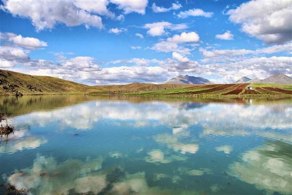
Ceyhan River
Door | River | ||||||||
|---|---|---|---|---|---|---|---|---|---|
Length | 509 km | ||||||||
Basin Area | 21.593 km² | ||||||||
Delta Area | Approximately 214 km² (Ceyhan Delta) | ||||||||
Climate | Continental in the upper basin Mediterranean climate in the lower basin | ||||||||
Soil Types | Alluvial Rendzina Colluvial Red Mediterranean soils | ||||||||
Main Tributaries | Mağara Gözü Körsulu Göksun Aksu Fırnız Tekir Söğütlü Hurman | ||||||||
The Ceyhan River is one of the longest rivers in southern Türkiye, flowing into the Mediterranean Sea. With a total length of approximately 509 kilometres, the river originates at the Pınarbaşı locality in the Elbistan district of Kahramanmaraş and empties into the Gulf of İskenderun, thereby reaching the Mediterranean Sea. Its flow regime varies seasonally, with high discharge periods typically occurring during spring due to snowmelt and rainfall.
The Ceyhan River is recognized as one of the two primary life sources of Çukurova, holding strategic importance for both agriculture and settlement in the regions it traverses. The river flows through provinces such as Kahramanmaraş, Osmaniye and Adana, forming a wide delta before reaching the sea. Its main tributaries include the Söğütlü, Hurman, Göksun, Mağara Gözü, Fırnız, Tekir, Körsulu and Aksu streams.
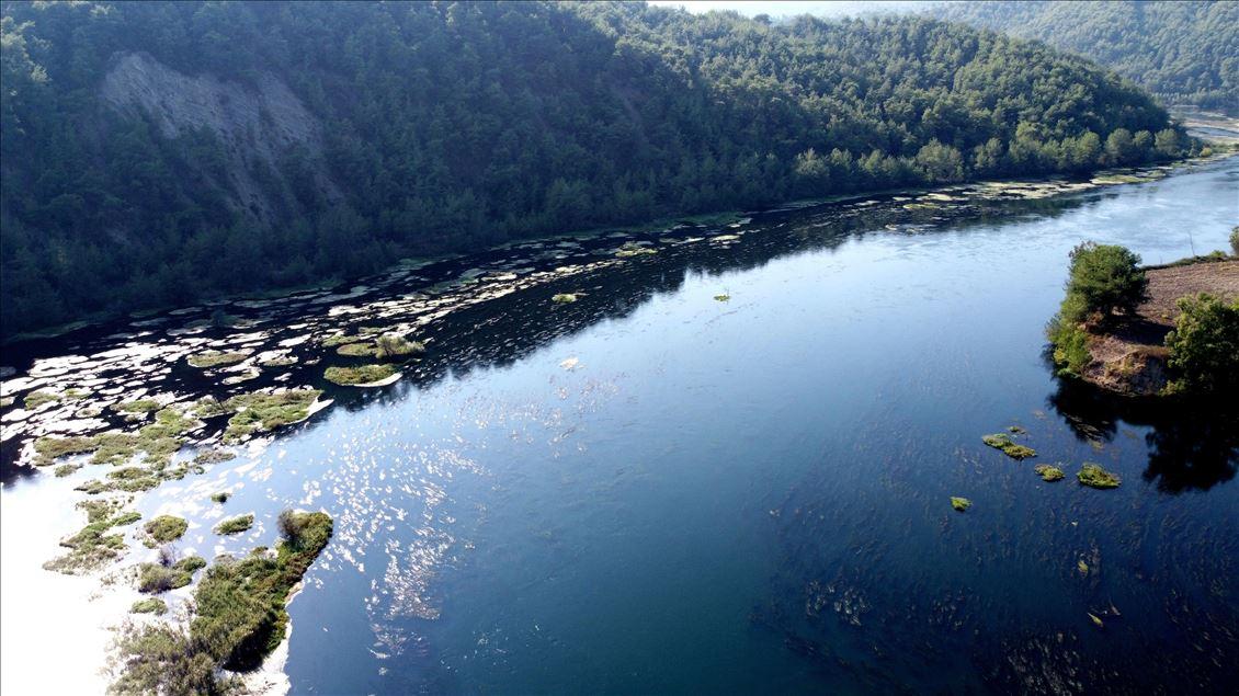
Ceyhan nehri (Anadolu Ajansı)
The Ceyhan River basin lies within the transition zone between the Mediterranean and continental climates. In the lower reaches, particularly around Adana and Osmaniye, the Mediterranean climate dominates, characterized by hot dry summers and mild wet winters. In contrast, the upper reaches, especially in the highland areas of Kahramanmaraş and Sivas provinces, are dominated by continental climatic conditions, with cold and snowy winters.
These distinct climatic zones directly influence the river’s flow regime and recharge patterns; snowmelt and precipitation regimes are decisive factors in the seasonal variation of the Ceyhan River’s discharge. Environmental monitoring studies in the Ceyhan Basin have revealed that the region’s soil structure is heterogeneous. The soils in the basin generally consist of alluvial soils, red Mediterranean soils (terra rossa), colluvial deposits and rendzinas. In the middle and lower reaches of the river, particularly as the Çukurova region is approached, fertile agricultural soils formed by alluvial deposition become widespread. This condition has made the Ceyhan River basin one of Türkiye’s most important agricultural areas.
The soils in the region are rich in both agricultural productivity and plant diversity. A wide variety of crops, including wheat, cotton, maize and others, are cultivated in the areas irrigated by the river. However, in some sub-basins, soil fertility is threatened by erosion, overgrazing and agricultural expansion.
The Ceyhan River serves as the primary water source for agricultural production in the regions it flows through. Especially in the eastern part of Çukurova, in the provinces of Adana, Osmaniye and Kahramanmaraş, the river’s waters are used to irrigate both the alluvial fertile plains along the coast and the sloping lands of the middle basin. The Ceyhan Basin stands out as one of Türkiye’s most productive agricultural regions, where crops such as wheat, maize, cotton, citrus fruits, soybeans, peanuts, sunflowers and vegetables are intensively cultivated.
Numerous dams and regulators on the Ceyhan River form the backbone of the irrigation infrastructure. Major water structures such as Aslantaş, Menzelet, Sır, Berke, Kılavuzlu and Kandil Dams have been constructed for both irrigation and hydropower generation. Through these dams, river water is regulated and directed to agricultural lands, thereby balancing seasonal water shortages.
However, the widespread expansion of irrigation activities has brought about several environmental problems. The intensive use of river water for agricultural irrigation has led to seasonal reductions in water quantity, deterioration of water quality and weakened sediment transport. This situation is one of the main factors accelerating coastal erosion, particularly in the areas of the Ceyhan Delta that interface with the sea.
On the other hand, the expansion of agricultural land within the Ceyhan Delta Important Natural Area has exerted pressure on natural habitats. The opening of new farmland near abandoned sections of the riverbed has led to the contraction of wetland areas.
To promote sustainable agriculture, irrigation management strategies have been developed in the Ceyhan Basin. Under the Basin Protection Action Plan, initiatives such as domestic and industrial wastewater management, diffuse pollution control and drought management have been launched. Additionally, techniques such as monitoring irrigation water quality, reducing pollution loads and reusing treated water are being encouraged to make agricultural activities in the basin more sustainable.
One of the most significant morphological changes to the Ceyhan River occurred following the flood event of 1935. During this event, the river abandoned its existing channel and shifted southward, beginning to discharge into the sea at the southern tip of its delta. This new course triggered major changes in the delta lobe; approximately 57.3% (17.7 km²) of Akyayan Lake was converted to land.
Following avulsion, a new delta lobe rapidly developed at the river’s new mouth during the 1960s and 1970s, with an average progradation rate of 53.9 metres per year toward the sea. In contrast, along the abandoned former river mouth, a coastal retreat of 1,585 metres occurred, corresponding to an average annual retreat rate of 26 metres per year.
The Aslantaş Dam, commissioned in 1984, is the most significant anthropogenic factor affecting the delta’s morphology. This dam has drastically reduced the sediment load delivered to the delta, halting coastal accretion and accelerating erosion. Before 1984, the river transported an average of approximately 19,795 tonnes of sediment per day; after dam construction, this value dropped to 4,879.7 tonnes per day. This reduction halted sand accumulation in the delta and triggered a reverse process: coastal erosion.
Following dam construction, a coastal retreat of 660 metres occurred between 1992 and 2014 at the river’s new mouth, intensifying morphological degradation, particularly along the southern front of the delta. Today, the delta faces serious threats of coastal retreat on its eastern side due to avulsion and on its southern side due to dam impacts.
Numerous dams have been constructed along the river. One of the most prominent is the Aslantaş Dam, which began operation in 1984. This dam significantly reduced the sediment load carried by the Ceyhan River and altered the delta’s morphological structure. Before 1984, the river transported an average of 19,795 tonnes of suspended sediment per day; after the dams became operational, this quantity decreased by approximately 75% to 4,879.7 tonnes per day.
Analyses of surface waters in the Ceyhan Basin have evaluated key water quality parameters such as electrical conductivity (EC), total dissolved solids (TDS), total hardness (TH), calcium (Ca) and magnesium (Mg). Studies have also identified the presence of heavy metal contamination (e.g. Cu, Fe, Zn, Ni, Pb) in certain water sources.
Water temperatures in the dams and reservoirs associated with the river range from 8.1–26.7 °C, pH values from 8.0–8.6, and dissolved oxygen levels from 3.97–12.09 mg/l. Factor analysis of the chemical and physical properties of water in the Ceyhan Basin has classified them into five main dimensions; the most influential variables among these are conductivity, dissolved solids and hardness. Additionally, under the Basin Protection Action Plan initiated in 2010, water quality monitoring systems have been established, with measurements taken at 53 monitoring points. As a result of these studies, 40 uncontaminated reference water sources have been identified in the Ceyhan Basin.
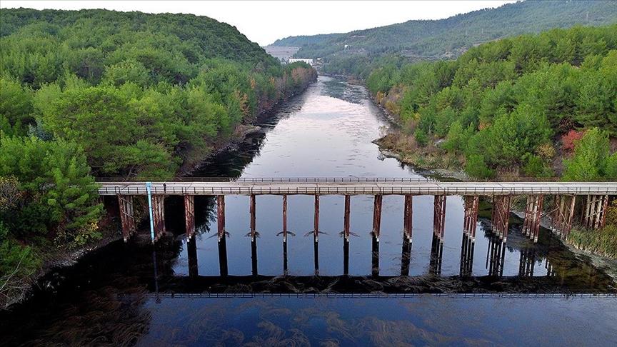
Ceyhan Nehri (Anadolu Ajansı)
The Ceyhan River and especially its delta host one of Türkiye’s most ecologically rich wetland systems. The delta provides habitat for a wide variety of ecosystems including lagoons, reed beds, salt marshes, sand dunes, maquis communities and agricultural lands. This habitat diversity supports numerous species of flora and fauna, including endemic plant species, birds, mammals, fish, reptiles and invertebrates. Floristic studies in the region have identified 17 plant taxa that meet the criteria for an Important Natural Area (INA). Notable among these are endemic Turkish species such as Astragalus subuliferus, Bupleurum zoharii, Centaurea calcitrapa ssp. cilicica, Iris xanthospuria and Tordylium elegans. Aleppo pine (Pinus halepensis) forests, which extend across the sand dunes between Ömer Lake and Yumurtalık Lagoon, are also part of the region’s unique vegetation cover.
Due to its location along major bird migration routes, the Ceyhan Delta is of great importance for both breeding and wintering bird species. Breeding birds include the little ringed plover (Charadrius alexandrinus), black-winged stilt (Glareola pratincola), little tern (Sterna albifrons) and spiny-tailed lizard (Vanellus spinosus). Important wintering waterbirds include the white-headed duck (Oxyura leucocephala), northern shoveler (Anas penelope), common shelduck (Tadorna tadorna) and Caspian tern (Sterna caspia). During migration periods, species such as the flamingo (Phoenicopterus roseus), white stork (Ciconia ciconia) and spoonbill (Platalea leucorodia) also use the area.
The delta is not only vital for birds but also serves as an important habitat for various mammal and reptile species. Mammals such as the Eurasian otter (Lutra lutra) and the Anatolian ground squirrel (Spermophilus xanthophrymnus) live in the delta. Moreover, the Ceyhan Delta is a significant nesting site in the Eastern Mediterranean for two endangered sea turtle species: the loggerhead sea turtle (Caretta caretta) and the green sea turtle (Chelonia mydas). The delta is also rich in fish species, including Alosa fallax nilotica and Aphanius fasciatus, and hosts the rare damselfly species Coenagrion syriacum.
The Ceyhan River and its basin are exposed to various types of pollution and environmental threats due to the intensity of agricultural, industrial and urban activities in the region. Agricultural practices, industrial effluents and wastewater from settlements negatively affect river water quality. Hydrogeochemical analyses conducted between Eskikent and Bebeli have revealed seasonal fluctuations in heavy metal concentrations. Additionally, it has been reported that wastewater from Osmaniye’s urban sewage systems is discharged into the Ceyhan River, threatening wetland ecosystems.
Another major threat is the uncontrolled expansion of agricultural land. New fields are being opened around the abandoned former riverbed, leading to habitat loss and altered sediment input to the delta system. Overgrazing is another widespread threat; herds of livestock entering the area from early morning graze throughout the day, damaging the natural vegetation within the delta.
Climate change, fluctuations in precipitation patterns and declining groundwater levels threaten the future of the Ceyhan River. Increased evaporation during summer months leads to lower water levels, directly impacting agricultural production. Policies promoting sustainable water use, the widespread adoption of drip irrigation systems and the protection of water basins are essential for the region’s future.
Anadolu Ajansı. “Ceyhan Nehri Çevresinde Sonbaharın Renkleri Hakim Oldu.” Accessed May 7, 2025.https://www.aa.com.tr/tr/yasam/ceyhan-nehri-cevresinde-sonbaharin-renkleri-hakim-oldu/2432648
Anadolu Ajansı. “Çukurova'nın 'can suyu' Ceyhan Nehri kartpostallık manzaralar sunuyor.” Accessed May 7, 2025.https://www.aa.com.tr/tr/pg/foto-galeri/cukurovanin-can-suyu-ceyhan-nehri-kartpostallik-manzaralar-sunuyor/0#
Ataol, Murat. “Ceyhan Nehri Eski ve Yeni Ağzında Son 70 Yıldaki Kıyı Çizgisi Değişimi.” *The Journal of International Social Research* 9, no. 42 (2016): 881–885.https://www.sosyalarastirmalar.com/articles/coastline-changes-of-the-old-and-new-mouth-of-ceyhan-river-over-the-last-70-years.pdf
Demirkıran, Ali Rıza, and Şenol Çelik. “Ceyhan Havzasındaki Suların Bazı Özelliklerinin Faktör Analizi ile İncelenmesi.” *Turkish Journal of Agricultural and Natural Sciences* 8, no. 3 (2021): 567–575.https://dergipark.org.tr/tr/pub/turkjans/issue/64226/803704
Doğa Derneği. "Ceyhan Deltası." Doğa Derneği. Accessed May 8, 2025.Accessed adresi
T.C. Göksun Kaymakamlığı. “Ceyhan nehri.” Accessed May 8, 2025.http://www.goksun.gov.tr/ceyhan-nehri
T.C. Ministry of Agriculture and Forestry. "Ceyhan Havzası." Accessed May 8, 2025.Accessed adresi
Şahan, Aysel, Sibel Özütok, and Fatma Çevik. “Ceyhan Nehri (Adana-Türkiye)'nin Farklı Bölgelerinden Yakalanan Afrika Kedi Balığı (Clarias gariepinus Burchell, 1822)’nda Su Kalitesinin Bazı Hematolojik Parametreler Üzerine Etkisi.” Ege Journal of Fisheries and Aquatic Sciences 34, no. 4 (2017): 375–382.http://www.egejfas.org/tr/download/article-file/376783

Ceyhan River
Door | River | ||||||||
|---|---|---|---|---|---|---|---|---|---|
Length | 509 km | ||||||||
Basin Area | 21.593 km² | ||||||||
Delta Area | Approximately 214 km² (Ceyhan Delta) | ||||||||
Climate | Continental in the upper basin Mediterranean climate in the lower basin | ||||||||
Soil Types | Alluvial Rendzina Colluvial Red Mediterranean soils | ||||||||
Main Tributaries | Mağara Gözü Körsulu Göksun Aksu Fırnız Tekir Söğütlü Hurman | ||||||||
Climate and Soil Structure
Agricultural Activities and Irrigation
Morphological Changes and Delta Dynamics
Impact of Dams and Sediment Dynamics
Hydrological Characteristics
Ecosystem and Biodiversity
Pollution and Environmental Threats
Sustainability