


This article was automatically translated from the original Turkish version.
+2 More
Blue Lake
Location | Dereli Giresun Türkiye | ||||||||
|---|---|---|---|---|---|---|---|---|---|
Water Property | Sodal and basic | ||||||||
Source of Supply | Göksu Creek | ||||||||
Administration | Dereli Forest Management Directorate, Ikisu Forest Management Unit, General Directorate of National Parks | ||||||||
Location | Kuzalan Nature Park | ||||||||
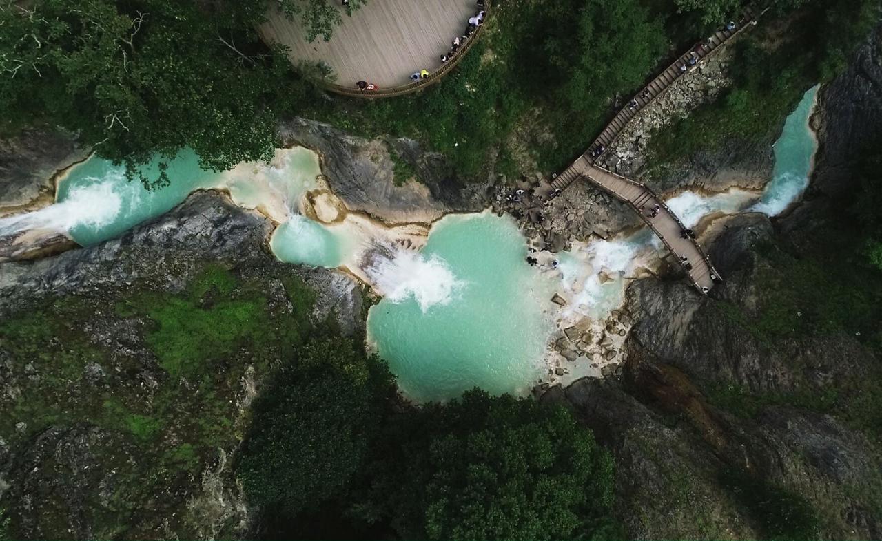
Mavi Göl is located within the boundaries of the Dereli district in Giresun province, in Türkiye’s Black Sea Region. The lake lies within the Kuzalan Nature Park and is approximately 19–20 kilometers from the Dereli district center. It sits at an elevation of 726 meters above sea level and covers an area of 68 hectares.
Mavi Göl is a natural water body formed by the convergence of three small lakes. The water exhibits alkaline properties due to the interaction between the sodic water carried by the Göksu Stream and the surrounding limestone rocks. This chemical composition causes the lake’s water to appear light blue and turquoise during the summer months. Göksu Stream is one of the few rivers in the Black Sea Region with sodic water. The lake is situated in a narrow and steep valley, surrounded by rocky slopes. A wooden footbridge spans between the two slopes.
Mavi Göl is part of Kuzalan Nature Park, which spans 482 hectares. The park also contains waterfalls (approximately 1800 meters in length), travertine formations, Dikoluk Spring, and Marazlı Hill, all of which contribute to the area’s geological and biological diversity.
The lake and its surroundings host an ecosystem shaped by the interaction between limestone formations and sodic water.
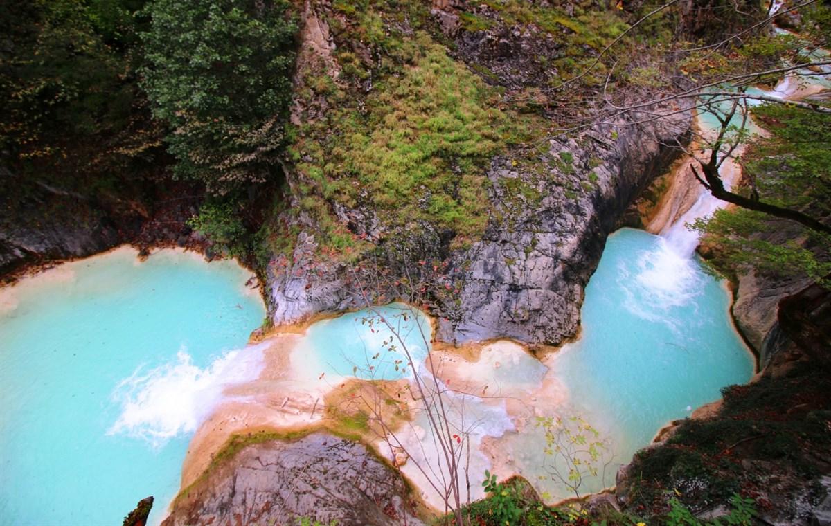
Mavi Göl (T.C. Giresun Valiliği)
Access to Mavi Göl is via a narrow and steep footpath that ascends approximately 100 meters from Kuzalan Waterfall, traversing stone, soil, and rocky terrain. Infrastructure around the lake includes walking trails, viewing terraces, wooden bridges, and a parking area.
Mavi Göl is visited by both domestic and international tourists during the summer months. Some visitors utilize the lake’s sodic water for health and cooling purposes. Visitors also engage in activities such as walking, photography, and nature observation around the lake and its surroundings.
Mavi Göl lies within the boundaries of Kuzalan Nature Park and holds the status of a nature park. All management and usage activities within the area are conducted with the aim of preserving its natural features. The site is managed by relevant units under the General Directorate of Forestry.
Mavi Göl (Youtube/Giresun)
Giresun. "Mavi Göl." YouTube. Accessed May 25, 2025.https://www.youtube.com/watch?v=iJWFRPSCC6c
Karadeniz Kültür Envanteri. "Mavi Göl." Karadeniz Kültür Envanteri Resmi Web Sitesi. Accessed May 25, 2025.https://www.karadeniz.gov.tr/mavi-gol/
Koday, Saliha, Hatice Kaymaz, and Günay Kaya. “Kuzalan Tabiat Parkı’nın Doğa Turizm Potansiyeli (Dereli-Giresun).” *Marmara Coğrafya Dergisi* (2018): 124–143. Accessed May 25, 2025.https://dergipark.org.tr/en/pub/marucog/article/386171
T.C. Giresun Valiliği. "Kuzalan Tabiat Parkı ve Mavi Göl." T.C. Giresun Valiliği Resmi Web Sitesi. Accessed May 25, 2025.http://giresun.gov.tr/kuzalan-tabiat-parki-ve-mavi-gol
T.C. Giresun Valiliği. "Mavi Göl’e Çevre Düzenlemesi ve Tanıtım Atağı." T.C. Giresun Valiliği Resmi Web Sitesi. Accessed May 25, 2025.http://www.giresun.gov.tr/mavi-gole-cevre-duzenlemesi-ve-tanitim-atagi
T.C.Dereli Kaymakamlığı Governorship. "Mavi Göl." T.C. Dereli District Governorship Official Website. Accessed May 25, 2025.http://www.dereli.gov.tr/mavi-gol
Türkiye Kültür Portalı. "Mavi Göl - Giresun." Türkiye Kültür Portalı Resmi Web Sitesi. Accessed May 25, 2025.https://kulturportali.gov.tr/turkiye/giresun/gezilecekyer/mavi-gol

Blue Lake
Location | Dereli Giresun Türkiye | ||||||||
|---|---|---|---|---|---|---|---|---|---|
Water Property | Sodal and basic | ||||||||
Source of Supply | Göksu Creek | ||||||||
Administration | Dereli Forest Management Directorate, Ikisu Forest Management Unit, General Directorate of National Parks | ||||||||
Location | Kuzalan Nature Park | ||||||||
Physical Geography and Hydrographic Characteristics
Geological Structure and Ecosystem
Access and Infrastructure
Usage and Visitor Profile
Conservation Status and Management