


This article was automatically translated from the original Turkish version.
+2 More
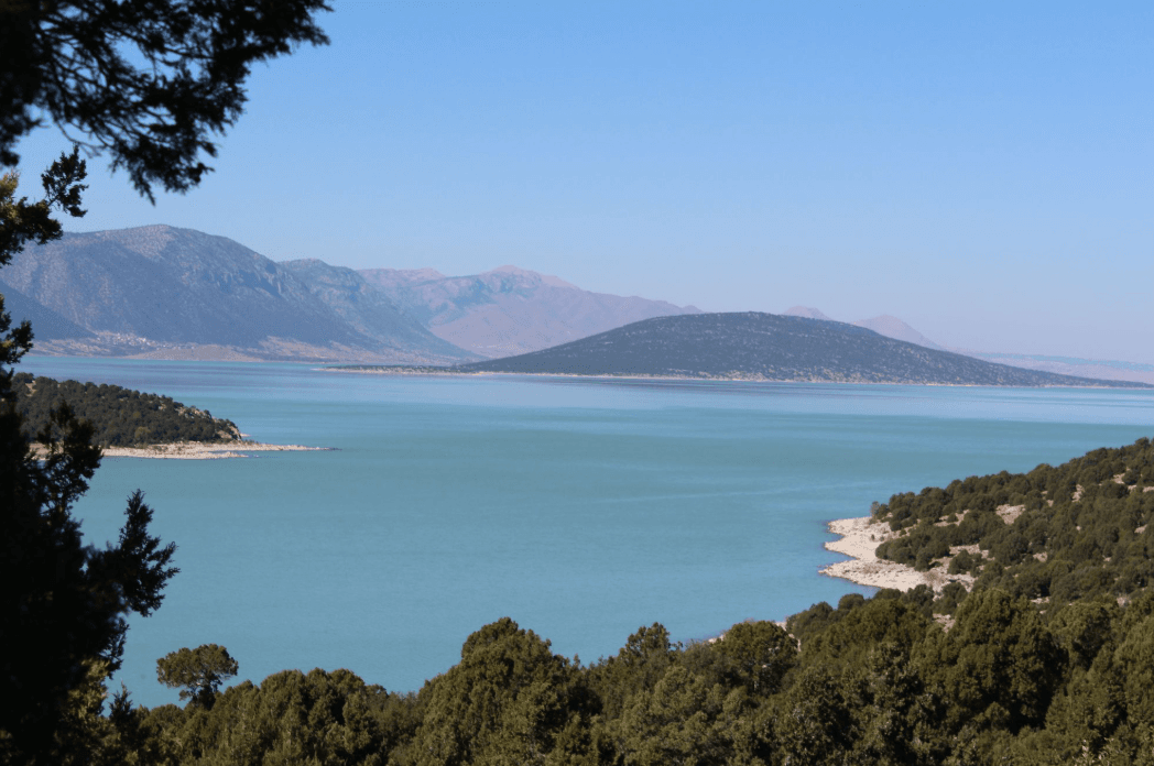
Beyşehir Lake
Location | Provinces of Konya and Isparta boundaries | ||||||||
|---|---|---|---|---|---|---|---|---|---|
Surface Area | 651 km² | ||||||||
Length | 50 km | ||||||||
Width | 14–26 km | ||||||||
Depth | Maximum: 10-12 m Average: 8-9 m | ||||||||
Historical Periods | Neolithic Ottoman Roman-Byzantine Seljuk | ||||||||
Beyşehir Gölü is located in the southwest of Türkiye, within the boundaries of the provinces of Konya and Isparta. As a component of the Lake Region, this lake is the largest natural freshwater lake in Anatolia. With a surface area of 651 km², the lake stretches approximately 50 km in a northwest-southeast direction and varies in width between 14 and 26 km. Its elevation above sea level ranges from 1,115 to 1,121 metres, with an average depth of 8 to 9 metres and a maximum depth of around 10 to 12 metres.
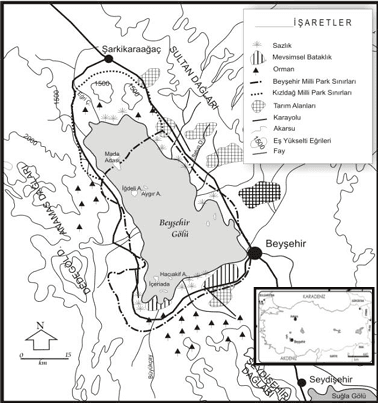
Location and Physical Map of Beyşehir Lake (
The lake lies within a tectonic depression and is surrounded by high mountain ranges such as the Taurus Mountains, Anamas, and Sultan Mountains. Beyşehir Gölü is fed by snowmelt, surface runoff, and groundwater. The lake’s waters flow into Suğla Gölü via its natural outflow, the Beyşehir (Çarşamba) Çayı.
Beyşehir Gölü lies within a transitional zone between the Mediterranean and Central Anatolian climates. This characteristic results in high biodiversity in terms of flora and fauna. The lake’s surroundings are enriched with forested areas, reed beds, marshes, and wetlands. Forest species in the region include black pine, juniper, oak, and oriental beech. Fish species inhabiting the lake include carp, perch, pike-perch, bleak, and mirror carp.
Beyşehir Gölü contains approximately 30 islands of varying sizes and numerous rocky outcrops. The largest of these is Mada Adası, which covers an area of about 8,220 hectares and contains arable land. Throughout history, the island has provided refuge to various communities including Christian Greeks, Muslim Turks, Russian Kazakhs, Chechens, and Yörüks.
Remains of settlements from the Roman and Byzantine periods have been identified on the islands, with traces of fortresses, walls, temples, and harbors observed on some. In modern times, settlement continues only on Mada Adası.
Beyşehir Gölü and its surroundings have been inhabited since prehistoric times. The Erbaba Höyüğü, dating to around 6,000 BCE, is an example of these early settlements. During the Roman, Byzantine, Seljuk, and Ottoman periods, the influence of different cultures is evident around the lake.
Fluctuations in the lake’s water level over time have directly affected human settlement in the region. In the early 20th century, major floods between 1910 and 1911 were directly linked to the Konya Plain Irrigation Project. During these floods, approximately 30 villages and 25,000 to 30,000 decares of land were submerged. Such interventions in the lake’s natural regime have also contributed to long-term risks of desiccation.
Beyşehir Gölü and its surroundings were declared the “Beyşehir Gölü National Park” on 20 February 1993. The national park covers an area of 88,750 hectares. It holds significance for the conservation of biological diversity, the sustainable use of natural resources, and environmental education.
The lake is an important stopover for migratory birds. Particularly during September and October, large flocks of ducks, grebes, cormorants, storks, and gulls are observed over the lake. The first breeding colonies of the Dalmatian pelican in Türkiye were identified here. Although the lake surface partially freezes in winter, limiting its value as a wintering site, it remains highly significant during migration periods.
In terms of ecotourism, the lake’s surroundings are valued for nature walks, photography, birdwatching, and cultural heritage. Cultural tourism is enhanced by structures such as the Eflatunpınar Hittite Water Monument, the ruins of Kubadabad Palace, and the Eşrefoğlu Camii.
Beyşehir Gölü (Konya Belediyesi)
Beyşehir Belediyesi. “Gezilecek Yerler.” beysehir.bel.tr. Accessed May 11, 2025.
Dinç, Abdurrahman, and Rahile Öztürk. “Beyşehir Gölü Milli Parkı’nın Ekoloji ve Turizm Bakımından Araştırılması.” *Derleme Dergisi*, 2013.https://dergipark.org.tr/en/download/article-file/417825. Accessed May 11, 2025.
Konya Valiliği. *Beyşehir Gölü Tanıtım Filmi*. YouTube video, 3:34. September 17, 2020.https://youtu.be/PtWHUEbohMs?si=GO6BvT_jh2kVMa5n
Konya Valiliği. “Beyşehir Gölü.” *konya.gov.tr*. Accessed May 11, 2025.http://konya.gov.tr/beysehir-golu
Muşmal, Hüseyin. “Geçmişten Günümüze Beyşehir Gölü Mada Adası’nda İskân ve Beşerî Faaliyetler.” *Yalova Sosyal Bilimler Dergisi* 14, no. 2 (2024): 150–162. Accessed May 11, 2025.https://dergipark.org.tr/tr/download/article-file/4146014
Muşmal, Hüseyin. “XX. Yüzyılın Başlarında Beyşehir Gölü ve 1910–1911 Yılları Büyük Taşkın Hadiseleri.” *Türkiyat Araştırmaları Dergisi*, no. 40 (2016): 219–234.https://dergipark.org.tr/tr/download/article-file/257919. Accessed May 11, 2025.
T.C.Beyşehir Kaymakamlığı Governorship. “Beyşehir Gölü.” *beysehir.gov.tr*. Accessed May 11, 2025.
Üçüncü, Berna Burcu, and Hüseyin Muşmal. *Tarih Süreçte Beyşehir Gölü ve Adalarında Hayat*. Konya: Palet Yayınları, 2014. Accessed May 11, 2025.

Beyşehir Lake
Location | Provinces of Konya and Isparta boundaries | ||||||||
|---|---|---|---|---|---|---|---|---|---|
Surface Area | 651 km² | ||||||||
Length | 50 km | ||||||||
Width | 14–26 km | ||||||||
Depth | Maximum: 10-12 m Average: 8-9 m | ||||||||
Historical Periods | Neolithic Ottoman Roman-Byzantine Seljuk | ||||||||
Geological and Hydrological Structure
Climate and Natural Life
Islands and Settlements
Historical Process and Floods
National Park Status and Conservation
Birdwatching and Ecotourism