


This article was automatically translated from the original Turkish version.
+1 More
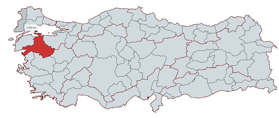
Balıkesir
Country | Türkiye | ||||||||
|---|---|---|---|---|---|---|---|---|---|
Region | Marmara Region | ||||||||
Population | 1,276,096 | ||||||||
Area | 14,583 km² | ||||||||
Climate | Mediterranean climate | ||||||||
Important Structure | Taksiyarhis Church Antandros Ancient City Cyzicus Ancient City Clock Tower Zağnos Paşa Mosque | ||||||||
Governor | İsmail Ustaoğlu | ||||||||
Metropolitan Municipality Mayor | Ahmet Akın | ||||||||
Area Code(s) | 266 | ||||||||
License Plate Code | 10 | ||||||||
Balıkesir is a strategic province located in the northwestern part of Türkiye, with coastlines on both the Marmara and Aegean Seas. Throughout history, it has been home to numerous civilizations including the Mysians, Hittites, Phrygians, Persians, Romans, Byzantines, and Seljuks. During the Ottoman period, it served as the center of the Karesi Beylik.
Today, the city stands out for its historical heritage, natural beauty, and rich agricultural products. It possesses significant potential in tourism, industry, and agriculture through important districts such as Ayvalık, Edremit, Bandırma, and Gönen. Situated at the foot of the Kaz Dağları, Balıkesir attracts attention with its famous olives, höşmerim dessert, Susurluk ayran, and the natural and cultural value of Manyas Bird Sanctuary. Additionally, having gained metropolitan status in 2012, it has expanded its administrative structure and continues to develop under a modern municipal approach.
Balıkesir and its surroundings have been under the rule of many civilizations throughout history and possess a rich historical past. In ancient times, the Mysians inhabited this region but did not establish an independent state. The Mysians remained under the dominion successively of Troy, the Hittites, the Phrygians, the Persians, Alexander the Great, and the Pergamon Kingdoms.
After the Pergamon Kingdom ceded the region to the Roman Empire in 133 BCE, it became part of Rome and was administered for many years as part of the Roman province of Asia.
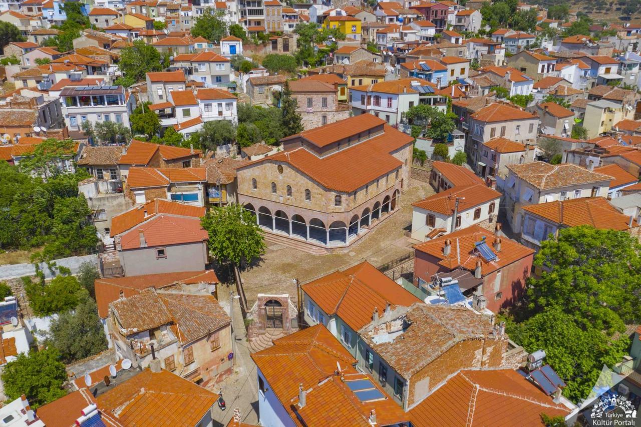
Taksiyarhis Museum
Following the division of the Roman Empire in 395 CE, Balıkesir and its surroundings came under the control of the Eastern Roman (Byzantine) Empire. During the Byzantine period, the region held considerable military and economic importance, though it later suffered from Arab raids. During the reign of the first Umayyad Caliph Muawiya, between 670 and 678 CE, Muslim Arab forces briefly held the region during their campaigns to conquer Constantinople. However, Byzantine dominance in the region persisted for many centuries.
After the Battle of Manzikert in 1071, the gates of Anatolia opened to the Turks, and Süleyman Şah of the Kutalmışoğlu dynasty seized Mysian cities from the Byzantines and brought them under Seljuk control. However, following the Crusades and the death of I. Kilij Arslan, the Seljuks were forced to withdraw from western Anatolia, and the Mysian cities returned to Byzantine control. The Byzantines conducted mass massacres against Turkish populations in certain areas to prevent their consolidation.
From 1206 onward, Turkmen uç beyler launched raids into the region, weakening Byzantine authority especially around the Edremit Gulf. In the 1260s, Turkish tribes fleeing Mongol pressure migrated to western Anatolia and the Marmara region, leading to widespread Turkification of the area. As the Seljuk state weakened, the uç beyler began acting independently, and by the end of the 13th century, the Karesi Beylik was established.
The Karesi Beylik was founded by Karesi Bey (Kara İsa) and encompassed numerous settlements including Balıkesir, Edremit, Bergama, Burhaniye, and Bigadiç. A powerful maritime beylik, Karesi established close relations with the Ottoman Beylik. In 1345, Ottoman Sultan Orhan Gazi incorporated the Karesi Beylik into Ottoman territory. During this process, renowned Karesi commanders Evrenos Bey, Hacı İlbey, and Ece Halil joined the Ottoman navy and played a major role in the Ottoman transition to Rumelia.
During the Ottoman period, Balıkesir was known as the Karesi Sanjak and served as an important administrative center. It became one of the Şehzade sanjaks and developed in agriculture, animal husbandry, and trade under Ottoman administration. However, during the decline of the Ottoman Empire in the 17th and 18th centuries, Balıkesir experienced waves of migration and rebellions. Following the 93 War (1877–1878 Russo-Turkish War) and the Balkan Wars (1912–1913), the region accepted immigrants from the Balkans and the Caucasus.
After the Ottoman Empire’s defeat in the First World War (1914–1918) and its signing of the Armistice of Mudros, the Greek occupation of İzmir on 15 May 1919 triggered a major resistance movement in Balıkesir. On 18 May 1919, under the leadership of Vehbi Bolak, the “Resistance Against Annexation Committee” was formed, and the local population organized against the occupation. Following the Greek occupation of Ayvalık on 29 May 1919, local Kuva-yi Milliye units launched their first armed resistance actions. After the Balıkesir Congresses, local resistance forces became more organized, though they were unable to fully halt the Greek army’s advance.
From 22 June 1920, the Greek occupation accelerated, and Balıkesir and its surroundings suffered extensive destruction. With the launch of the Turkish Army’s Great Offensive in 1922, Turkish forces rapidly reclaimed occupied territories, and Balıkesir was liberated from occupation on 6 September 1922.
After the proclamation of the Republic, Balıkesir gained provincial status in 1923 and began rapid development. In 2012, Law No. 6360 granted Balıkesir metropolitan municipality status, and today it continues to grow as an important center in agriculture, industry, and tourism.
Balıkesir is one of the largest provinces in northwestern Türkiye, strategically positioned between the Marmara and Aegean Regions. It lies between 39° 20’ and 40° 30’ north latitudes and 26° 30’ and 28° 30’ east longitudes. To the east it borders Bursa and Kütahya, to the south Manisa and İzmir, and to the west Çanakkale. Through its Ayvalık district, Balıkesir shares a maritime border with the Greek island of Lesbos and is one of only six Turkish provinces with coastlines on both the Marmara and Aegean Seas.
Balıkesir covers an area of 14,583 km², with a balanced distribution between urban centers and rural areas. The province’s territory lies within the Southern Marmara Section of the Marmara Region and the western interior of the Aegean Region, featuring a terrain that slopes from northwest to southeast. The average elevation of Balıkesir is approximately 145 meters, with higher elevations in certain areas.
Balıkesir exhibits diverse topography with both flat plains and high mountains. The highest point in the province is Akdağ Tepesi in Dursunbey district, rising to 2,089 meters. Other important mountains include:
Balıkesir features extensive and fertile plains where agriculture and animal husbandry are intensively practiced. The most important among them are:
Balıkesir is rich in water resources. The main rivers in the province are:
Balıkesir is rich in both natural and artificial lakes. Its most important lakes include:
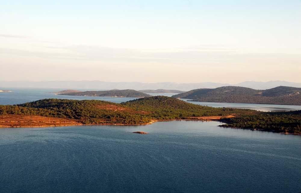
Ayvalık Şeytan Sofrası View
Balıkesir has a coastline stretching 290.5 km, of which 115.5 km borders the Aegean Sea and 175 km the Marmara Sea. Within its boundaries lie numerous islands, including the Ayvalık Islands (22 islands) and the Marmara Islands. Cunda (Alibey) Island, located in Ayvalık district, is the largest island accessible by road. Marmara Island, Avşa Island, and Paşalimanı Island are also among the most important islands along Balıkesir’s Marmara coastline.
Balıkesir lies in a transitional climate zone. The Aegean coast experiences a Mediterranean climate, the interior has a continental climate, and the Marmara coast shows influences of the Black Sea climate.
Thirty-one percent of the province is covered by forests. Major tree species include black pine, red pine, beech, hornbeam, oak, willow, alder, and plane tree. The Kaz Dağları and Madra Dağları boast rich vegetation, with the Kazdağı fir protected as an endemic species.
Balıkesir is a fertile province known for agriculture and animal husbandry. It is among Turkey’s leading provinces in the production of olives, wheat, sunflower, tobacco, and fruits. In addition, large and small livestock farming is intensively practiced in regions such as Gönen, Manyas, and Susurluk.
Overall, Balıkesir is one of Türkiye’s important cities, distinguished by its rich natural resources, sea coasts, forested areas, fertile plains, and historical heritage.
With a population of 1,276,096, Balıkesir ranks among Türkiye’s medium-sized metropolitan cities. Following the enactment of Law No. 6360 in 2012, all settlements within the provincial boundaries were incorporated into the Metropolitan Municipality.
Balıkesir has a balanced structure between its provincial center and rural settlements. The provincial center is divided into two major districts: Altıeylül and Karesi. Districts with high population density include Karesi (190,427), Altıeylül (185,351), Edremit (173,689), Bandırma (167,363), and Gönen (75,486). The districts with the lowest populations are Marmara (11,708) and Balya (12,695).
The urbanization rate in Balıkesir is approximately 75%. However, the rural population remains significant, especially in areas where agriculture and animal husbandry are widespread. Bandırma, Edremit, and Altıeylül are the most urbanized districts, while Dursunbey, Sındırgı, and Balya have higher rural populations.
Traditionally a source of internal migration, Balıkesir has become a destination for migration since the 2000s. Particularly developed districts such as Bandırma and Edremit, due to their industry and tourism, attract migrants. Coastal districts such as Ayvalık, Burhaniye, and Erdek experience significant seasonal population increases during the summer months.
Balıkesir’s population growth rate is below the national average. However, since gaining metropolitan status, its population has shown steady growth due to development in industry, tourism, and agriculture.
Throughout history, Balıkesir has hosted diverse ethnic groups and cultural diversity. Various Oghuz Turkic tribes, particularly Turkmen and Yörük groups, settled in the region during the Ottoman period. After the 93 War (1877–1878 Russo-Turkish War), Bosniaks, Albanians, Pomaks, Circassians, and Tatars from the Balkans and Caucasus were resettled in Balıkesir and its surroundings. These communities are concentrated especially in Bandırma, Gönen, Manyas, Susurluk, Ayvalık, and Altıeylül districts.
Today, Balıkesir’s demographic structure is cosmopolitan, with Turks, Yörük, Turkmen, Bosniaks, Albanians, Pomaks, Circassians, and Tatars living together. The majority of the population is Sunni Muslim, and traditional Anatolian culture has merged with modern lifestyles.
The literacy rate in Balıkesir exceeds 97%. Balıkesir University is a major higher education institution in the province, with vocational colleges located in many districts. Due to employment opportunities in industry, agriculture, and tourism, the unemployment rate is below the national average.
Balıkesir’s population has a balanced age distribution, though the youth population is lower compared to major metropolitan areas. The average age is around 38, and approximately 15% of the population is aged 65 or older. This situation indicates that Balıkesir is a net exporter of young people and that its elderly population is growing. Gender distribution is nearly equal, though in urban centers the female population is slightly higher, while in rural areas the male population is somewhat more numerous.
Balıkesir has a diversified economy based on agriculture, industry, animal husbandry, mining, and tourism. Thanks to its vast fertile lands, strategic location, and natural resources, it holds an important place in the Turkish economy.
Balıkesir is one of Turkey’s leading provinces in agricultural production. Due to its climate and soil structure, it produces a wide variety of crops, particularly olives, cereals, sunflowers, tobacco, vegetables, and fruits.
Balıkesir is one of Turkey’s most intensive regions for animal husbandry.
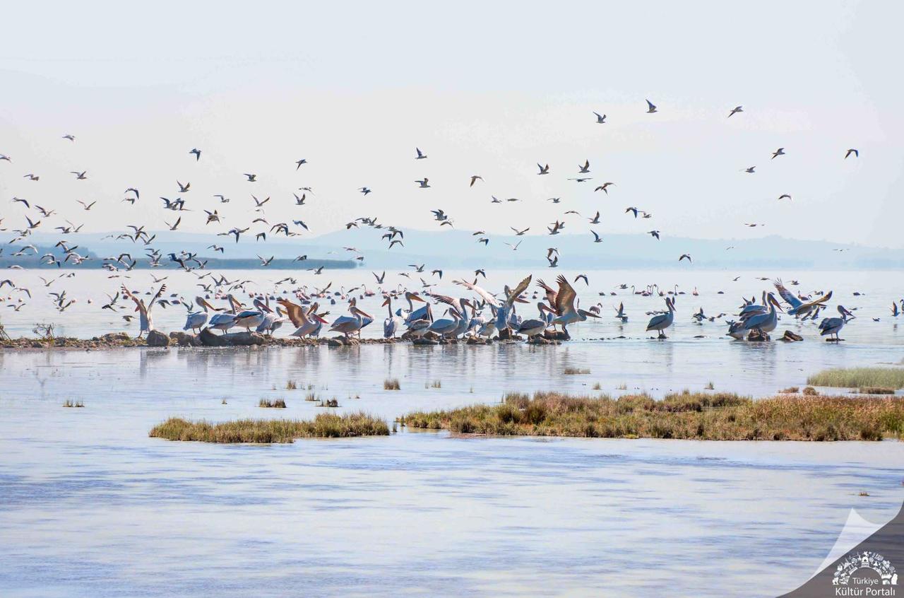
Manyas Bird Sanctuary National Park
In recent years, Balıkesir has rapidly developed in industry, with concentrations in Bandırma, Gönen, Susurluk, Balıkesir Center, Edremit, and Burhaniye districts.
The Balıkesir Organized Industrial Zone (OSB) and Bandırma OSB are key centers strengthening the province’s industrial infrastructure. In recent years, interest from foreign investors has increased.
Balıkesir is notable for its rich underground resources, particularly boron, which plays a significant role in the provincial economy.
Balıkesir is a key transportation hub connecting the Marmara and Aegean regions.
Balıkesir, one of the few provinces in Türkiye with coastlines on both the Marmara and Aegean Seas, is among the country’s major tourism centers due to its natural beauty, historical heritage, and thermal resources. With destinations such as Ayvalık, Cunda, Edremit, Kaz Dağları, and Manyas Bird Sanctuary, it offers a unique combination of sea, nature, history, and thermal tourism.
Balıkesir’s coastline holds significant tourism value. Ayvalık and Cunda Island stand out for their historical fabric. Ayvalık’s shores are especially favored for summer tourism due to their wide sandy beaches. Sarımsaklı Beach attracts attention with its long shoreline, while Cunda Island draws visitors with its historical structures and natural landscape.
The Edremit Gulf is notable for both coastal and thermal tourism. Akçay and Altınoluk are lively during summer months for sea tourism. Ören (Burhaniye) is a region noted for its beaches and surrounding natural areas. Erdek and the Marmara Islands are important tourism centers along the Marmara Sea coast, with increasing visitor numbers during summer. Avşa, Marmara, and Paşalimanı Islands are among the most active destinations for sea tourism in summer.
Balıkesir offers diverse opportunities for nature tourism through its forests, national parks, and wetlands. Kaz Dağları National Park stands out for hiking, camping, and ecotourism due to its rich vegetation and elevations. Hasanboğuldu and Sutüven Waterfalls, located in the Kaz Dağları region, are notable natural attractions.
Manyas Bird Sanctuary, a wetland on the shores of Manyas Lake, is an important site for birdwatching as it hosts migratory birds. Şahinderesi Canyon, located between Altınoluk and Kaz Dağları, is evaluated for nature tourism with its walking trails. Kapıdağ Peninsula is another region noted for its natural structure and coastal features.
Balıkesir has hosted numerous civilizations throughout history and contains various historical sites. Among ancient cities, Hadrianoutherai, Antandros, and Kyzikos are prominent. Antandros Ancient City, located within Edremit district boundaries, is known for its remains from antiquity. Kyzikos Ancient City, near Erdek, bears traces from the Roman period.
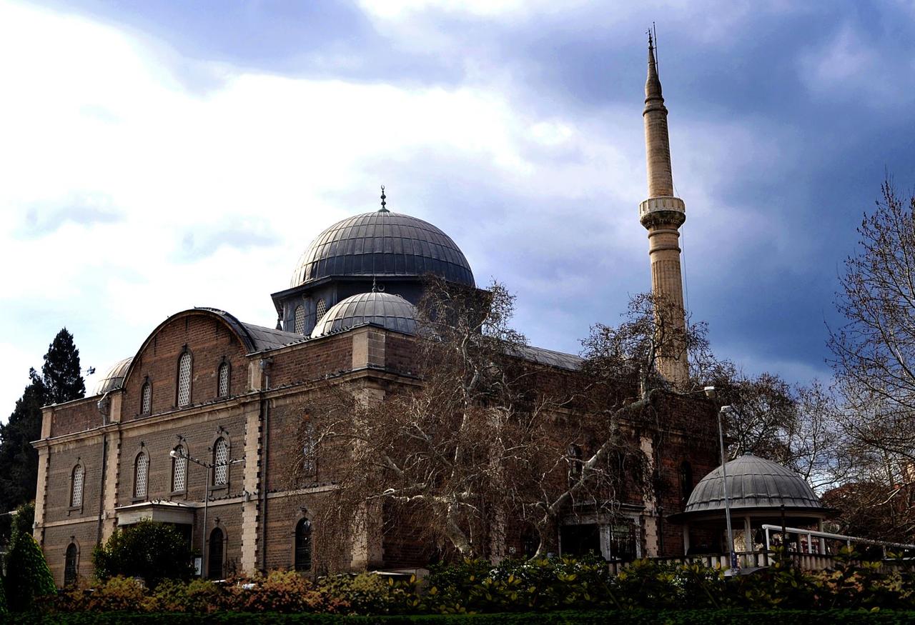
Zağnos Paşa Mosque
Ottoman-era monuments include Zağnos Paşa Mosque and Clock Tower in Balıkesir city center, both considered important historical structures. Alibey Mosque and Taksiyarhis Church, located on Cunda Island, are valuable relics from different historical periods.
Balıkesir possesses significant potential for thermal tourism due to its hot spring sources. Gönen Spas are known for their long-used thermal waters. Edremit-Güre Spas, located at the foot of Kaz Dağları, host facilities dedicated to thermal tourism. Susurluk and Sındırgı spas are other areas where thermal tourism is practiced using underground hot water sources.
Balıkesir Büyükşehir Municipality. "Belediye Tarihçesi." Accessed February 11, 2025.https://balikesir.bel.tr/belediye-tarihcesi
Balıkesir İl Kültür ve Turizm Müdürlüğü. "Balıkesir Kültür ve Turizm Bilgileri." Accessed February 11, 2025.https://balikesir.ktb.gov.tr/.
Ministry of Culture and Tourism. "Balıkesir Genel Bilgiler." Accessed February 11, 2025.https://www.kulturportali.gov.tr/turkiye/balikesir/genelbilgiler
Mücteba İlgürel. "Balıkesir." *TDV İslâm Ansiklopedisi.* Accessed February 11, 2025.https://islamansiklopedisi.org.tr/balikesir.
T.C.Balıkesir Valiliği. "Şehrimiz." Accessed February 11, 2025.http://www.balikesir.gov.tr/sehrimiz.
Turkish Statistical Institute (TÜİK). "Adrese Dayalı Nüfus Kayıt Sistemi Sonuçları 2024." Accessed February 11, 2025.https://data.tuik.gov.tr/Bulten/Index?p=Adrese-Dayali-Nufus-Kayit-Sistemi-Sonuclari-2024-53783

Balıkesir
Country | Türkiye | ||||||||
|---|---|---|---|---|---|---|---|---|---|
Region | Marmara Region | ||||||||
Population | 1,276,096 | ||||||||
Area | 14,583 km² | ||||||||
Climate | Mediterranean climate | ||||||||
Important Structure | Taksiyarhis Church Antandros Ancient City Cyzicus Ancient City Clock Tower Zağnos Paşa Mosque | ||||||||
Governor | İsmail Ustaoğlu | ||||||||
Metropolitan Municipality Mayor | Ahmet Akın | ||||||||
Area Code(s) | 266 | ||||||||
License Plate Code | 10 | ||||||||
No Discussion Added Yet
Start discussion for "Balıkesir (Province)" article
History
Geography
Mountains and High Pastures
Plains and Rivers
Lakes and Coasts
Climate and Vegetation
Population
Balıkesir Districts and Populations (2024)
Population Distribution and District Populations
Urbanization and Rural Population
Migration and Population Movements
Ethnic and Cultural Structure
Education and Socioeconomic Status
Age and Gender Distribution
Economy
Agriculture and Animal Husbandry
Industry and Trade
Mining
Transportation and Logistics
General Assessment of Balıkesir’s Economy
Tourism
Sea and Coastal Tourism
Nature and Ecotourism
Historical and Cultural Tourism
Thermal Tourism