


This article was automatically translated from the original Turkish version.
+1 More
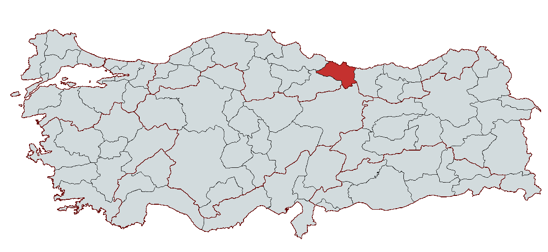
Army
Country | Türkiye | ||||||||
|---|---|---|---|---|---|---|---|---|---|
Region | Black Sea Region | ||||||||
Population | 770711 | ||||||||
Area | 5952 km² | ||||||||
Climate | Black Sea Climate | ||||||||
Important Structure | Osman Pasha Şadırvanı Ünye Castle Taşbaşı Culture Center (Old Prison-Church) | ||||||||
Area Code(s) | 452 | ||||||||
License Plate Code | 52 | ||||||||
Governor | Muammer Erol | ||||||||
Metropolitan Mayor | Hilmi Güler | ||||||||
Ordu is a province located in Türkiye's Black Sea Region, known for its historical and cultural richness. It attracts attention with its natural beauty, fertile soils, and abundant vegetation. Ordu is also one of the most important agricultural centers of the Black Sea and makes a significant contribution to the country's economy through its hazelnut production. Its cultural heritage is equally rich, featuring historical fortresses, traditional architecture, and highland pastures. Ordu, attracting both domestic and international tourists, is an important tourism destination due to its natural and cultural values. Its geographical location and historical past have made it a significant center both economically and culturally.
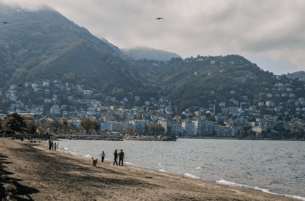
Ordu (Source: Pexels/Samer Daboul)
The history of Ordu spans a process extending from the Ancient Age to the present day. This historical process bears traces of various civilizations.
The earliest known settlements in the territory of Ordu date back to the 7th century BC. The area around the Kirazlimanı Cemetery, within the boundaries of Ordu province, was inhabited by the ancient site of Bozukkale (Kotyora). The Greek commander Xenophon, in the 4th century BC, described the local populations of the Ordu region in his work “The Anabasis,” noting the presence of a settlement at Kotyora. Although Kotyora was not a Greek colony, it was abandoned during the reign of King Pharnaces I of Pontus in the 2nd century BC, and its inhabitants were relocated to Giresun.
The territory of Ordu came successively under the control of the Cimmerians, Milesians, Persians, and then Macedonia under Alexander the Great from 675 BC onward. After Alexander’s death, the region remained under the dominion of the Kingdom of Pontus from 280 to 63 BC. The Kingdom of Pontus, which ruled the region during this period, was ultimately ended by the Roman Empire in 63 AD.
During the Roman and Byzantine periods, Ordu became an important settlement due to its strategic position along the Black Sea coast. As part of the Byzantine Empire, the region experienced an ethnic and cultural transformation with the spread of Christianity. In 1204, following the Latin conquest of Constantinople, the Empire of Trebizond was established, and Ordu became part of its territory. The Empire of Trebizond was dissolved by the Ottoman Empire in 1461, but left a significant cultural impact on Ordu throughout its history.
The Turkish conquest of Ordu began toward the end of the 13th century. With the expansion of the Seljuk State into Anatolia during the 13th century, Turkish settlements in the Ordu region accelerated. The first Turkish settlements in the Ordu territory were established particularly by Turks belonging to the Çepni tribe. In the 1270s, the Hacı Emiroğulları Beylik settled in and conquered the Ordu territory.
In the 14th century, Ordu remained under the dominion of the Hacı Emiroğulları Beylik, which established the administrative and social order of the Turkish tribes that had settled in the region. The Turks who settled in Ordu during this period were primarily from the Oghuz tribes of Çepni, Döğer, Eymir, and others. By 1396, the entire territory of Ordu had come under complete Turkish control. Turkish settlements formed village and hamlet centers, which gradually evolved into Ordu’s administrative units.
Ordu joined the Ottoman Empire in 1455. The Ottoman period initiated the process of thorough Turkish settlement and the establishment of residential units in Ordu. The earliest Ottoman records of Ordu are based on the 1455 Tapu Tahrir Defteri. According to these records, the proportion of non-Turkish population in Ordu remained low compared to the Turkish population.
By the 16th century, Ordu had become an important administrative center. It was designated as one of the administrative seats of the Canik Eyalet, governing districts such as Giresun, Bayburt, and surrounding areas. From the 16th century onward, Ordu’s urbanization process accelerated, supported by various commercial activities, artisans, and trade merchants. During this period, agricultural economic activities intensified and Ordu’s settlement areas expanded.
After the proclamation of the Republic, Ordu continued as a district of Trabzon Vilayet in 1920. However, by a law enacted on 4 April 1920, Ordu was established as an independent district and gained provincial status in 1923. During this period, rapid urbanization and economic development began in Ordu, with new settlement areas being established.
By the end of the 20th century, Ordu had become a rapidly growing and developing city. The 1939 Erzincan earthquake caused extensive damage in Ordu, but the city’s reconstruction was completed in a short time. Today, Ordu continues to exist as an important tourist and commercial center in the Black Sea Region, as well as a developed industrial and agricultural region.
Ordu province is located in Türkiye’s Black Sea Region and occupies a strategic position as a border province between eastern and western Black Sea areas. Situated between 40°18’ and 41°08’ north latitudes and 36°52’ and 38°12’ east longitudes, Ordu has a surface area of 5,952 km², covering 0.8% of Türkiye’s total land. Ordu is bordered by the Black Sea to the north, Samsun to the west, Giresun to the east, and Sivas and Tokat provinces to the south.
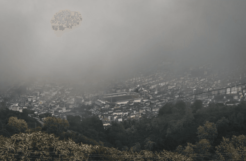
Ordu (Source: Pexels/Samer Daboul)
Ordu’s geographical structure consists of narrow coastal plains followed by the North Anatolian Mountains rising behind the Black Sea coast. These mountains form a range known as the Canik Mountains, running parallel to the Black Sea. To the east of the Melet River lie the Giresun Mountains. The elevation of the mountains decreases from east to west, with the highest peaks in the Erdemkırı Mountains west of Mesudiye district not exceeding 2,000 meters. Other major elevations in Ordu include Kırklar Hill (3,039 m), Gündeliç Hill (2,700 m), Seyit Hill (2,450 m), and Yağlıtepe (2,619 m).
Ordu is a province with rich potential for highland pasture tourism. Notable pastures within its boundaries include Çambaşı, Çukuralan, Keyfalan, Perşembe, Güllüyazı, Düzdağ, and Yedigöl. These pastures attract attention for their natural beauty and the recreational opportunities they offer.
Ordu is a province that hosts numerous rivers and small lakes. Rivers such as Melet Çayı, Turnasuyu, Bülbül Creek, Civil Creek, and Akçay are important water sources for the province. These rivers flow through areas near the provincial center and surrounding settlements. Although Ordu does not have large lakes, small lakes such as Gaga Lake in Fatsa and Ulugöl in Gölköy are present.
Ordu has a coastline of approximately 100 kilometers along the Black Sea, which is more indented and irregular compared to other Black Sea provinces. Major coastal projections include Vona (Çamburnu) and Yasun Cape. Vona cove, in particular, possesses natural harbor characteristics. The majority of Ordu’s coastline consists of cliffs, while low-lying areas feature small plains formed by alluvial deposits from rivers. This coastal structure makes Ordu an important region for tourism.
Ordu has a typical Black Sea climate, with climatic conditions varying with altitude due to the high mountains. A humid and temperate climate prevails along the Black Sea coast, while the inland areas exhibit a more continental climate. The region is noted for its rich flora, with mountainous areas covered by forests. The high mountains and pastures contribute significantly to the region’s biological diversity.
Although located in Türkiye’s Black Sea Region, Ordu possesses a significant economic structure based on rich agricultural resources, a developing industrial sector, livestock farming, and fisheries. Its economy largely depends on agriculture, livestock, forest products, mining, and industry.
Ordu is one of Türkiye’s provinces with the highest number of registered farmers, ranking prominently in this sector with over 120,000 farmers. Approximately 41.4% of the province’s land is used for agriculture, demonstrating Ordu’s strength in the agricultural sector. The most prominent agricultural product, best suited to Ordu’s climate and soil structure, is the hazelnut. Hazelnut forms the backbone of Ordu’s agricultural production, with nearly 100 million hazelnut trees in the province. Ordu accounts for approximately 60–75% of Türkiye’s hazelnut production and a significant portion of global hazelnut output. Following hazelnut, kiwi is the second most important crop, alongside maize, potatoes, beans, soybeans, wheat, barley, citrus fruits, tea, cabbage, and barbunya.
Ordu also has significant potential in livestock farming. Livestock farming is widespread particularly in the districts of Aybastı, Gölköy, Mesudiye, and Korgan. Sheep and cattle breeding are the main activities in Ordu’s livestock sector. In addition, beekeeping has developed considerably, and Ordu now supplies 15% of Türkiye’s honey production, becoming an important production center.
With its 110-kilometer coastline, Ordu plays a significant role in fishing and aquatic product production. The province produces approximately 25,000–35,000 tons of fish annually, including herring, anchovy, mullet, mackerel, kalkan, and barbunya. Additionally, abundant quantities of bonito, torik, zargana, and mackerel are found in inland waters. Aquaculture is also a growing sector; Ordu has 30 freshwater fish farms and several marine fish farms, with a total annual production capacity of 3,250 tons.
Ordu is very rich in forest resources, with 41% of its land covered by forests. Forests contain species such as fir, fir, beech, oak, hornbeam, chestnut, poplar, pine, and maple. Annually, Ordu produces 250,000 cubic meters of industrial timber and 125,000 stere of firewood. Additionally, the province has 200,000 hectares of forestland and 50,000 hectares of shrubland. Forest products contribute significantly to both the local economy and industry.
Ordu is also an important province for mining. The region is among Türkiye’s richest in terms of mineral deposits, with 40% of the active mining areas in the Eastern Black Sea Region located in Ordu. Metallic minerals such as copper, lead, zinc, gold, silver, and manganese are extracted, along with industrial raw materials such as basalt and bentonite. Additionally, the hot spring water in Fatsa district provides potential for health tourism.
Ordu’s industrial sector began rapid development after the 1970s. Alongside its agriculture-based economy, the food industry, particularly hazelnut processing plants, stands out. Ordu hosts factories that extract kernels from hazelnut shells, as well as industries producing flour, animal feed, confectionery, dairy products, soybean oil, and beverages. The textile sector has also shown growth in recent years. Ordu’s organized industrial zones are a major source of employment, with approximately 7,000 people working in businesses in the region. This number will increase further with new OSB investments.
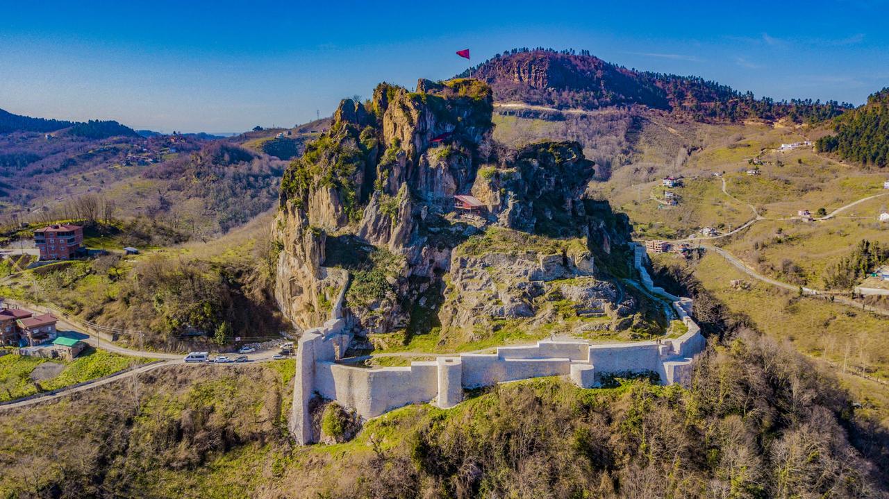
Ünye Castle (Photo: Ünye Municipality)
The current governor of Ordu is Muammer Erol. He has been serving as Governor of Ordu since 21 August 2023, in accordance with the Presidential Appointment Decree No. 2023/376 published in the Official Gazette No. 32275 on 10 August 2023.
Karadeniz Valiliği. "Fiziki ve Tarihi Çevre." Accessed February 21, 2025.https://karadeniz.gov.tr/fiziki-ve-tarihi-cevre-5/.
Karadenizinfo. "Ordu Ekonomi." Accessed February 21, 2025.https://www.karadenizinfo.com/ordu-ekonomi.
Ministry of Culture and Tourism. "Ordu: Ne Yenir?" Accessed February 21, 2025.https://www.kulturportali.gov.tr/turkiye/ordu/neyenir?ilId=77&keyword=&etiket=&hariciEtiket=&kategori=0&gorsel=0&sayfa=3&sayi=12.
Ordu Valiliği. "Kültür ve Turizm." Accessed February 21, 2025.http://www.ordu.gov.tr/kultur-ve-turizm.
Ordu Valiliği. "Ordu'nun Ekonomik Yapısı Değerlendirildi." Accessed February 21, 2025.http://www.ordu.gov.tr/ordunun-ekonomik-yapisi-degerlendirildi
Ordu Valiliği. "Ordu'nun Tarihçesi." Accessed February 21, 2025.http://www.ordu.gov.tr/ordunun-tarihcesi.
Ordu Valiliği. "Vali Muammer Erol." Accessed February 21, 2025.http://www.ordu.gov.tr/vali-muammer-erol
Ordu İl Kültür ve Turizm Müdürlüğü. "Coğrafya." Accessed February 21, 2025.https://ordu.ktb.gov.tr/TR-106499/cografya.html
Ordu İl Kültür ve Turizm Müdürlüğü. "Genel Bilgiler." Accessed February 21, 2025.https://ordu.ktb.gov.tr/TR-106498/genel-bilgiler.html
Ordu İl Kültür ve Turizm Müdürlüğü. "Ordu'nun Tarihçesi Özet II." Accessed February 21, 2025.https://ordu.ktb.gov.tr/TR-339667/ordu39nun-tarihcesi-ozet-ii.html.
Ordu İl Kültür ve Turizm Müdürlüğü. "Paşaoğlu Konağı Etnografya Müzesi." Accessed February 21, 2025.https://ordu.ktb.gov.tr/TR-322002/pasaoglu-konagi-etnografya-muzesi-altinorduordu.html.
Ünye Belediyesi. *Ünye Kalesi [JPG].* Accessed February 21, 2025.https://www.unye.bel.tr/sehir-rehberi/unye-kalesi/

Army
Country | Türkiye | ||||||||
|---|---|---|---|---|---|---|---|---|---|
Region | Black Sea Region | ||||||||
Population | 770711 | ||||||||
Area | 5952 km² | ||||||||
Climate | Black Sea Climate | ||||||||
Important Structure | Osman Pasha Şadırvanı Ünye Castle Taşbaşı Culture Center (Old Prison-Church) | ||||||||
Area Code(s) | 452 | ||||||||
License Plate Code | 52 | ||||||||
Governor | Muammer Erol | ||||||||
Metropolitan Mayor | Hilmi Güler | ||||||||
History
Ancient Period and Early History
Roman and Byzantine Periods
Seljuk and Turkish Beylik Periods
Ottoman Period
Republican Period
Late 20th Century and Present
Geographical Structure
Mountains and Hills
Highland Pastures
Rivers and Lakes
Coastline and Plain Structure
Climate and Vegetation
Economic Structure
Agriculture
Livestock Farming
Fishing and Aquatic Products
Forestry
Mining
Industry
Tourism and Historical Structures
Regional Cuisine
Administration
Governor