

`jacques-pervititch` ile İlgili Madde Sonuçları
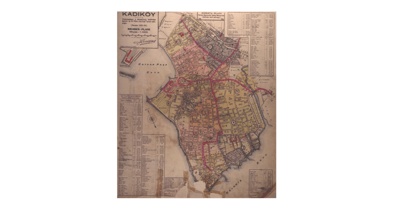
Pervititch Maps
Pervititch Maps are insurance maps created in the first half of the 20th century that meticulously document the urban fabric of Istanbul. Prepared by Croatian cartographer Jacques Pervititch between 1922 and 1945, these maps were originally commissioned by insurance companies to assess fire risks. Over time, however, they have become an invaluable source of information on Istanbul’s architectural structure, street layout, and social life. Pervititch Maps The Pervititch maps are the product of a
EN
Yağmur Yıldız Parıltı
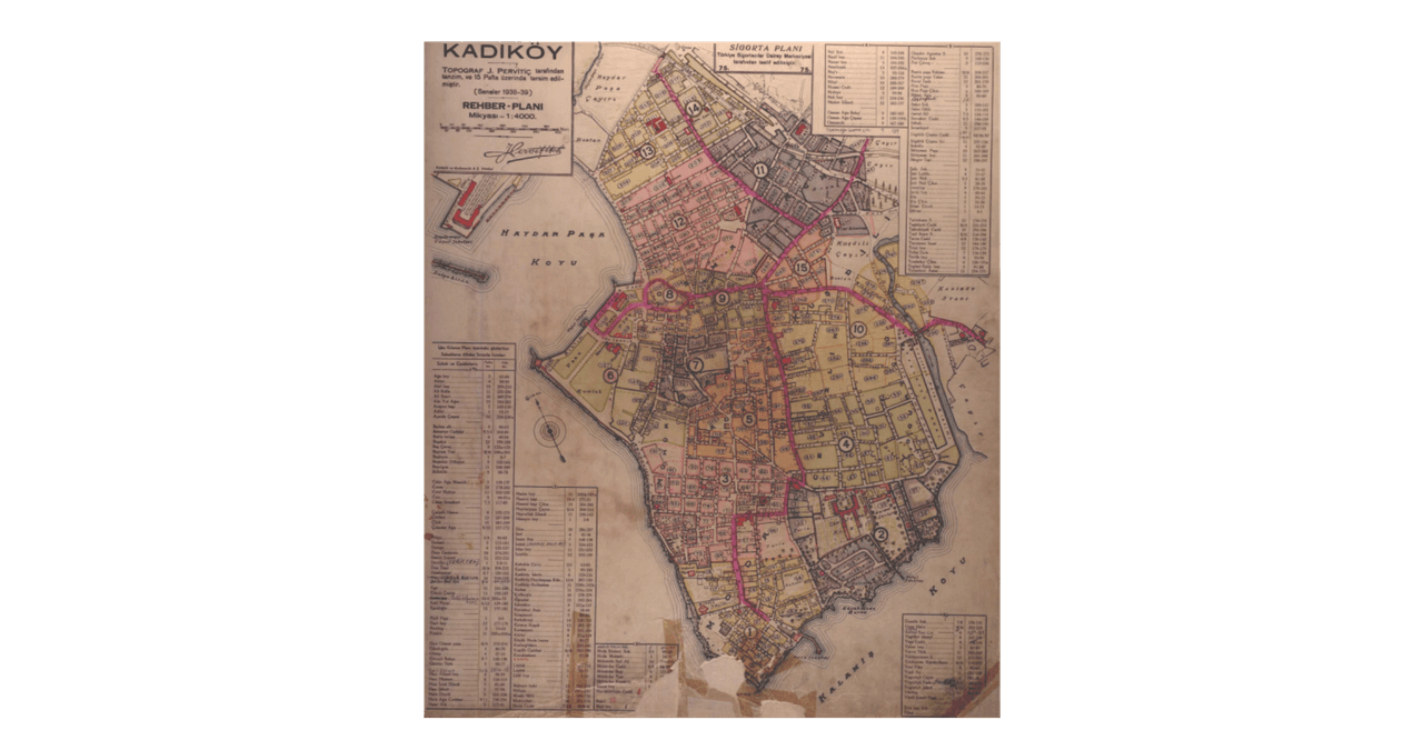
Pervititch Maps
Pervititch Maps are insurance maps that meticulously documented Istanbul’s urban fabric during the first half of the 20th century. Prepared by Croatian cartographer Jacques Pervititch between 1922 and 1945, these maps were originally created for insurance companies to assess fire risks. Over time, however, they became an invaluable source of information on Istanbul’s architectural structure, street layout, and social life. Kadıköy Guide Plan (Salt Research Archive) " image-alternate="" image-ele
EN
Yağmur Yıldız Parıltı
Pervititch Haritaları
Pervititch Haritaları, 20. yüzyılın ilk yarısında İstanbul'un kentsel dokusunu ayrıntılı biçimde belgeleyen sigorta haritalarıdır. 1922-1945 yılları arasında Hırvat asıllı kartograf Jacques Pervititch tarafından hazırlanan bu haritalar, yangın risklerini değerlendirmek amacıyla sigorta şirketleri için oluşturulmuştur. Ancak zamanla, İstanbul'un mimari yapısı, sokak düzeni ve sosyal yaşamına dair bir kaynak haline gelmiştir. Kadıköy Rehber Planı (Salt Araştırma Arşivi) " image-element-format="rig
TRYağmur Yıldız Parıltı