

`ekoturizm` ile İlgili Madde Sonuçları

Ilıca Şəlaləsi
Ilıca Şəlaləsi, Türkiyənin Qara Dəniz Bölgəsində, Kastamonu vilayətinin Pınarbaşı rayonuna bağlı Ilıca kəndi sərhədləri daxilində yerləşən mühüm təbii quruluşdur. Horma Kanyonunun dik yamaclarından gələn Zarı Çayı, 10 metr hündürlükdən axaraq təbii bir göl əmələ gətirir. Küre Dağları Milli Parkına yaxın yerləşən bu şəlalə, bölgədəki ekoturizm fəaliyyətləri baxımından böyük əhəmiyyətə malikdir. Mövqe və Çatımlılıq Ilıca Şəlaləsi, Kastamonu şəhər mərkəzindən 91 kilometr, Pınarbaşı rayon mərkəzində
AZ
Mehmet Salih Çoban
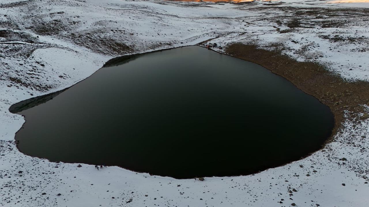
Lake Aygır
Lake Aygır is a maar lake located within the borders of the Adilcevaz district of Bitlis province, on the southern foothills of Mount Süphan. It is approximately 6–8 kilometers from the district center and 130 kilometers from the Bitlis city center. The lake, situated at an altitude of 1942 meters above sea level, was formed as a result of the volcanic activities of Mount Süphan. Formation and Geomorphology Aygır Lake is a typical maar lake. As a result of the blockage of the main cone belonging
EN
Melahat Pamuk
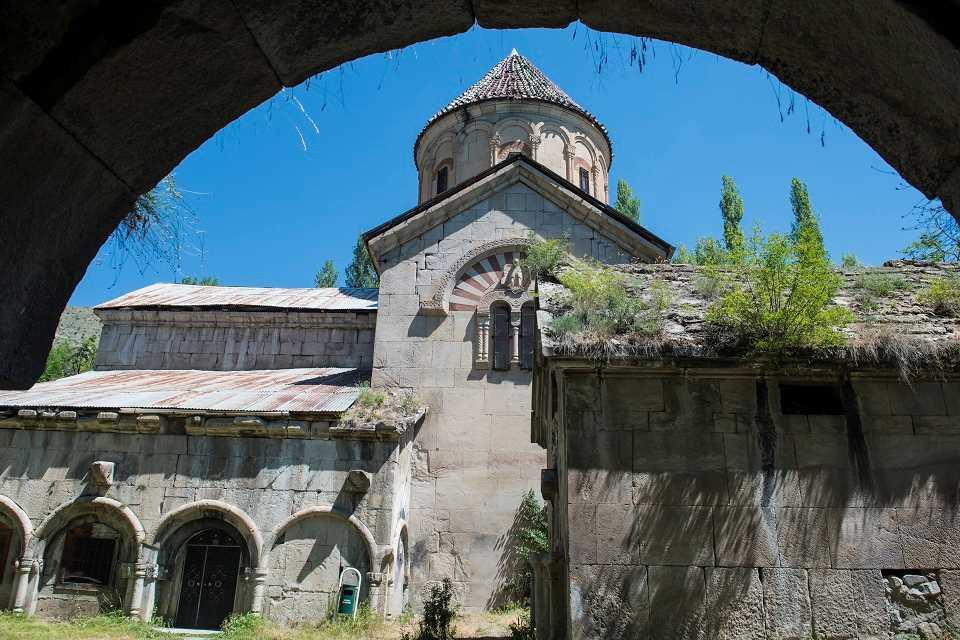
Erzurum Stone Mosque
The Stone Mosque (Haho Church) is a historic structure located in Bağbaşı (formerly Haho) village in the Tortum district of Erzurum province. Constructed between 976 and 1001 by III. David of the Georgian Bagratid dynasty in the late 10th century, the building originally served as a monastery church dedicated to the Virgin Mary. Over time, it was used for various purposes and was eventually converted into a mosque in the 19th century, acquiring the name “Stone Mosque.” Historical Background and
EN
Ahsen Güneş
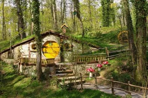
Ormanya
Located within the Kocaeli province and recognized as one of Europe's largest wildlife parks, Ormanya stands out for its sustainable ecotourism practices, nature education opportunities, and contributions to biodiversity. This project, which aims to blur the boundaries between urban life and the natural environment, is considered a holistic model of environmental awareness, biological conservation, and ecological living practices beyond simply being a recreational area. Ormanya serves as a pione
ENAhsen Güneş
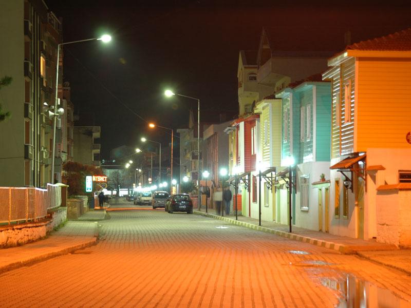
Ayancık (District)
Ayancık is a coastal district located west of Sinop. The district center is located in the Ayancık Stream Valley, between Maltepe and Ayantepe. A significant portion of the population lives in rural areas. Forestry, fishing, and agriculture are among the most prominent economic activities. The district boasts a variety of natural and cultural sites. Ayancık (Sinop Governorship) History Ayancık and its surrounding area, in the Western Black Sea region of Paphlagonia, bears traces of settlement da
EN
Emre Zengin
 In
InInternational Day for Biosphere Reserves
International Biosphere Reserves Day is an international observance held annually on November 3, promoting the maintenance of balanced relationships between humans and nature, sustainable development, and ecosystem conservation. The day highlights the significance of biosphere reserves designated under UNESCO’s Man and the Biosphere (MAB) Programme. Biosphere reserves are defined as terrestrial or aquatic ecosystems where ecological, economic, cultural, and social relationships between humans an
EN
Nursena Güller
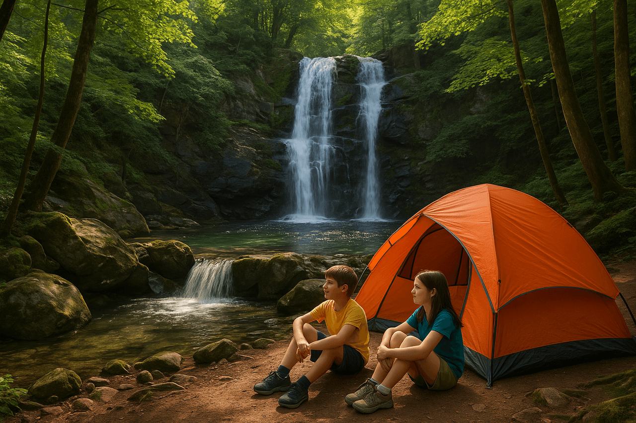
Erikli Double Waterfall
Erikli Çifte Şelale is a natural waterfall located within the boundaries of Teşvikiye Village in the Çınarcık district of Yalova. This waterfall is situated approximately 29 kilometers from the city center along the Erikli Yaylası route. The majority of the path to the waterfall is accessible by vehicle, while the final section is completed via marked hiking trails through the forest. These trails are well-signposted and suitable for nature walking. Structure of the Waterfall As its name suggest
EN
Yusuf İslam Tuğla
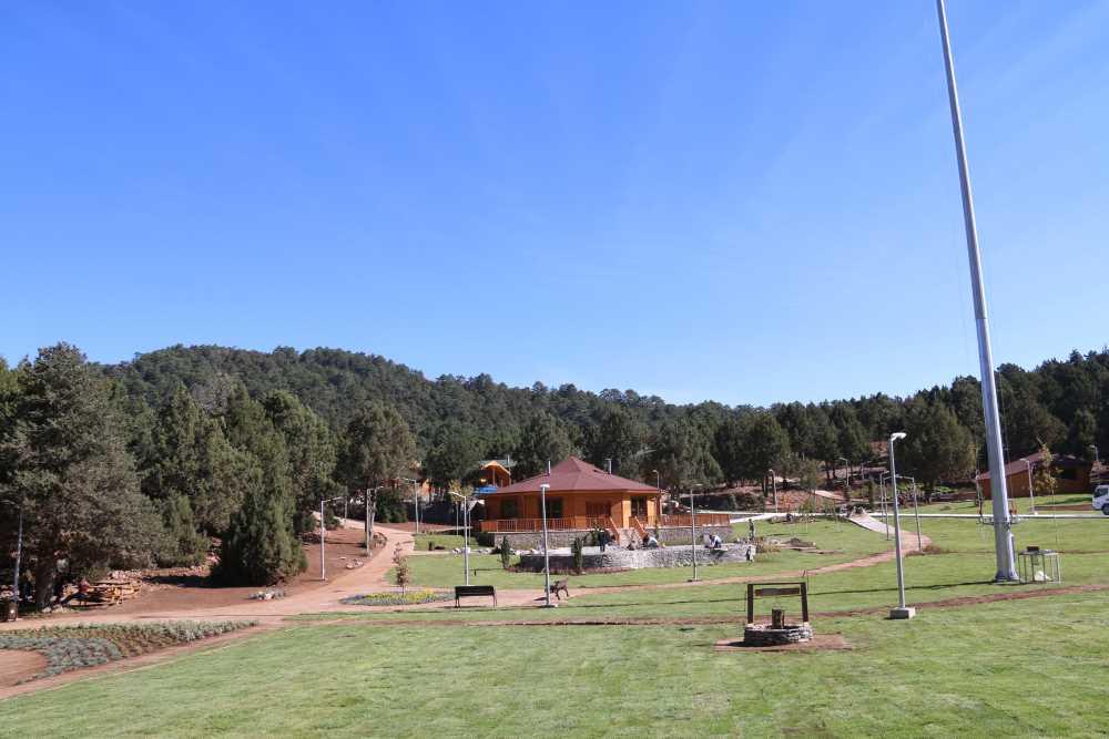
Denizli Bağbaşı Yaylası
Denizli Bağbaşı Yaylası; Denizli ilinin Pamukkale ilçesi sınırları içerisinde yer alan, doğa turizmi odaklı bir yerleşkedir. Kervansaray Mahallesi, Alparslan Caddesi üzerinde konumlanan yaylanın rakımı 1400 metredir. Tesis yılın dört mevsiminde faaliyete açık olup; doğa, çadır ve karavan turizmi gibi alternatif turizm uygulamaları için kullanılmaktadır. Tarihçe ve Gelişim Bağbaşı Yaylası ve bünyesindeki teleferik tesisi, Denizli Büyükşehir Belediyesi tarafından projelendirilmiş ve 17 Ekim 2015 t
TR
Muhammed Musab Kardaş
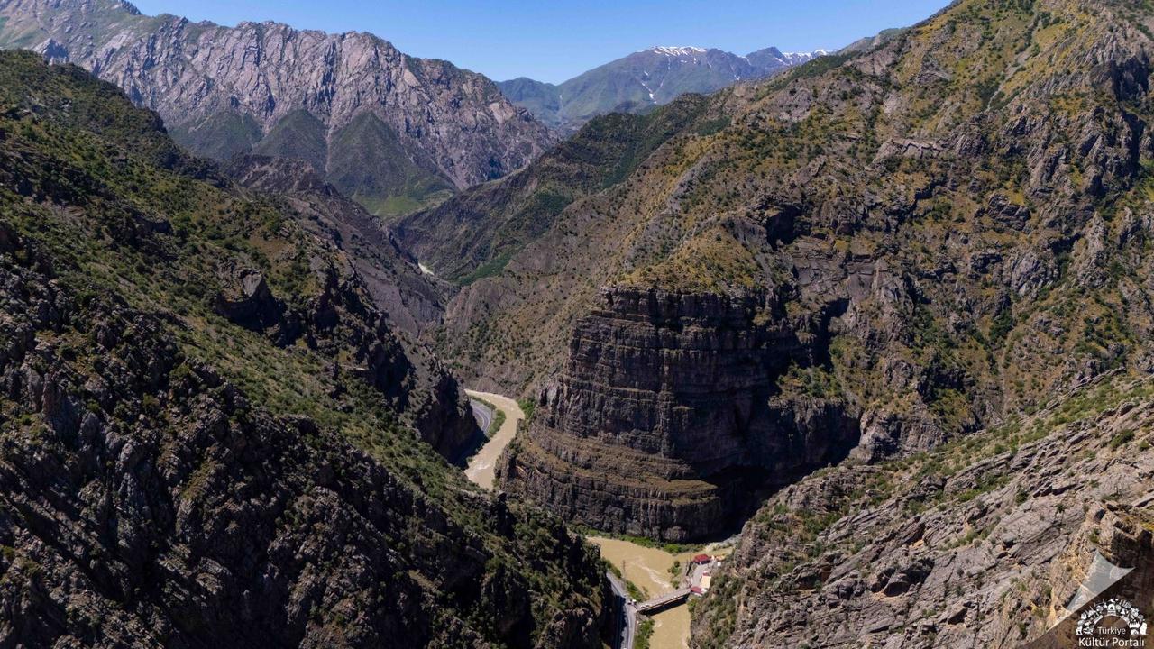
Zap Suyu Vadisi
Zap Suyu Vadisi, Hakkari il sınırları içerisinde konumlanan, Türkiye'nin debisi en yüksek akarsularından biri olan Zap Suyu'nun aşındırma faaliyetleri sonucunda meydana gelmiş, dik yamaçlı ve derin kanyon özellikleri gösteren bir vadi sistemidir. Fiziksel ve Hidrografik Yapı Zap Suyu, Hakkari ilinin en büyük akarsuyu olup sularını Musul'un güney bölgesinde Dicle Nehri ile birleştirmektedir. Akarsuyun toplam uzunluğu 310 kilometre iken, Türkiye sınırları dahilindeki uzunluğu 189 kilometredir ve H
TR
Gözde Cabadak
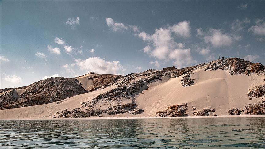
Sokotra Adası
Sokotra Adası, Hint Okyanusu’nun kuzeybatısında, Aden Körfezi ile Arap Denizi’nin kesişme noktasında yer alan ve dört ada ile iki kaya adacığından oluşan Sokotra Takımadaları'nın en büyüğüdür. Yemen ana karasının güneyinde, Afrika Boynuzu’nun ise doğusunda stratejik bir konumda yer alan ada, milyonlarca yıllık izolasyonu sayesinde yeryüzünün en özgün ve bozulmamış ekosistemlerinden birine ev sahipliği yapmaktadır. Sahip olduğu yüksek orandaki endemik tür çeşitliliği nedeniyle UNESCO tarafından 2
TR
Emirhan Polat