

`geological-formation` Related Article Results
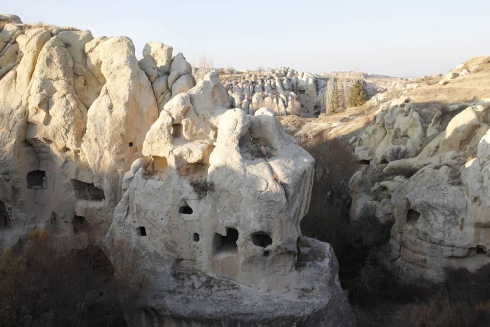
Gomeda Valley
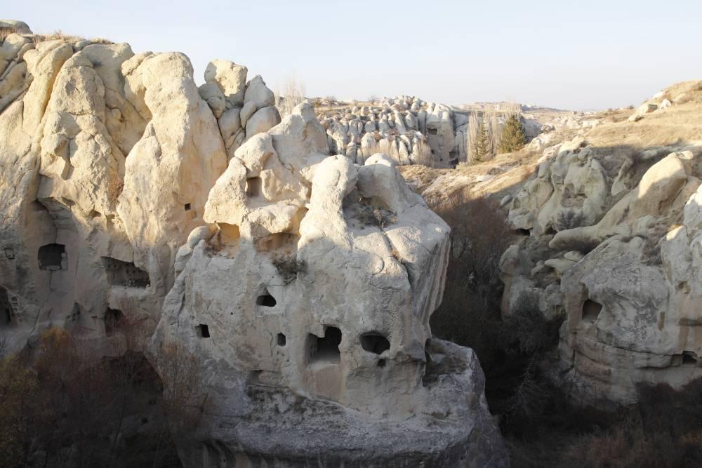
Gomeda Valley is located approximately 2 kilometers southwest of the Mustafapaşa neighborhood in the Ürgüp district of Nevşehir Province, Türkiye. Geographically situated west of Mustafapaşa and north of Ayvalı Village, the valley is one of the most notable geomorphological features within the Cappadocia region. Historically known by the Greeks as “Kanavuria,” the valley has been identified as one of the fissures of Elevres. Gomeda Valley (Ürgüp Municipality) " image-alternate="" image-element-f
EN
Melike Saraç
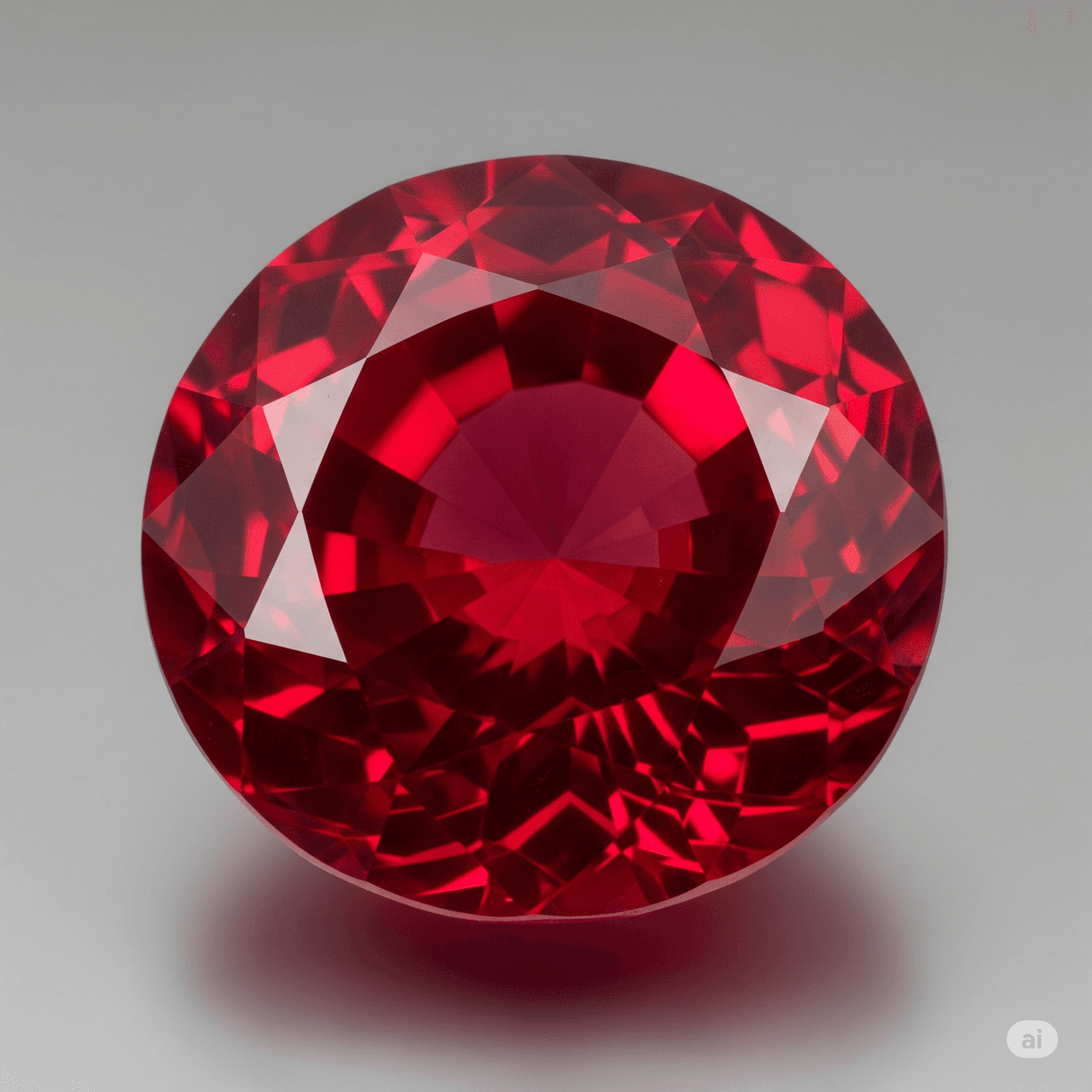
Yakut Stone
Ruby is a precious gemstone belonging mineralogically to the corundum group and characterized by its red color. This mineral, with the chemical formula Al₂O₃, acquires its distinctive red hue due to the presence of chromium. With a hardness of 9 on the Mohs scale, it is one of the hardest natural minerals after diamond. Throughout history, ruby has been valued in various cultures for both its aesthetic appeal and symbolic meanings. Mineralogical Properties and Geochemical Structure Ruby is the r
EN
Okan Kanpolat
 Ku
KuKula Fairy Chimneys
Kula Fairy Chimneys is a geological area in the Kula district of Manisa, place, known for its natural formations. These structures, shaped over time by erosion and weather conditions, contribute significantly to the region’s tourism value, important. Kula Fairy Chimneys (https://www.kulturportali.gov.tr/turkiye/manisa/gezilecekyer/kula-per-bacalari) " image-alternate="" image-element-format="right"> Historical and Geological Significance The Kula Fairy Chimneys were formed through wind and wa
EN
İsmail Aykurt
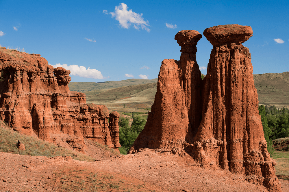
Narman Peribacaları
Narman Fairy Chimneys are geological formations located in the Narman district of Erzurum province in Türkiye. The area is situated approximately 90 kilometers from the city center of Erzurum, at the 7th kilometer of the Narman-Pasinler highway. Covering an area of about 6300 hectares, the fairy chimneys are easily accessible and lie very close to the town of Narman. Narman Peribacaları (Erzurum İl Kültür ve Turizm Müdürlüğü) " image-element-format="right" image-source="https://cdn.t3pedia.org/m
EN
Hatice Senem Turan
KuKula Fairy Chimneys
Kula Peri Bacaları is a geological area located in the Kula district of Manisa, notable for its natural formations. These structures, shaped over time by erosion and weather conditions, contribute significantly to the region’s tourism value. Kula Peri Bacaları (https://www.kulturportali.gov.tr/turkiye/manisa/gezilecekyer/kula-per-bacalari) " image-alternate="" image-element-format="right"> Historical and Geological Significance Kula Peri Bacaları were formed through wind and water erosion on
EN
İsmail Aykurt
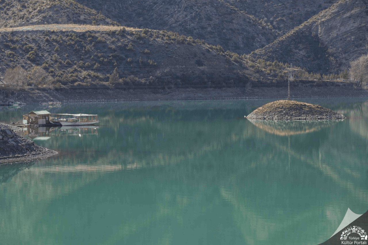
Tortum Lake
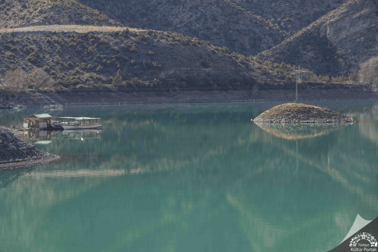
Tortum Lake is a natural landslide-dammed lake located within the boundaries of the Uzundere district in Erzurum Province, in Eastern Anatolia, Türkiye. Situated in the transition zone between the Black Sea and Eastern Anatolia regions, the lake is of natural origin, both in terms of its geological formation and environmental characteristics. Tortum Lake extends approximately 8.2 kilometers in length and 1.4 kilometers in width along a southwest-northeast axis and lies at an elevation of 1010 me
EN
Sümeyra Uzun
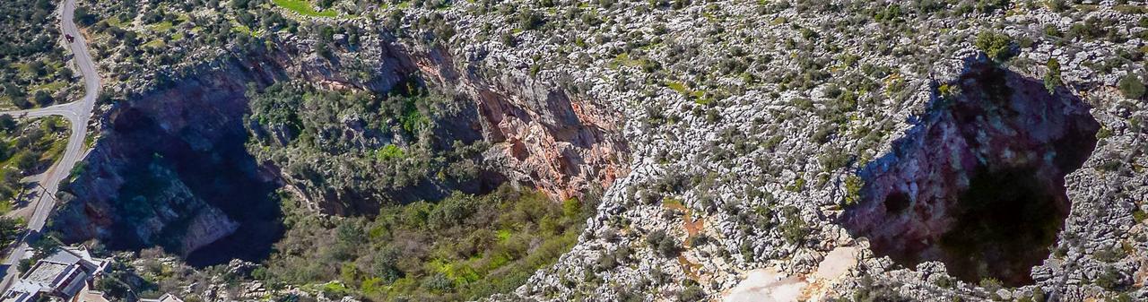
Silifke Cennet Cehennem Caves
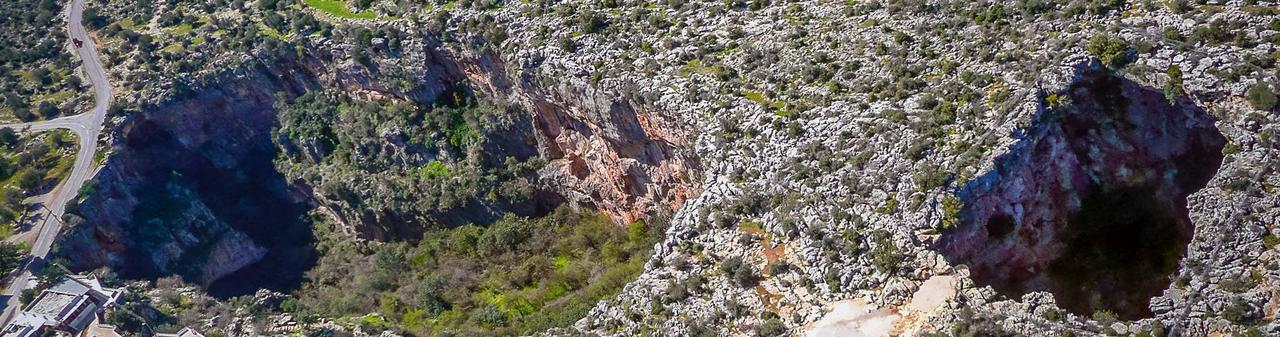
Cennet Obruğu Location and Physical Characteristics Heaven Obruğu is located approximately 25 km from the town center of Silifke, 2 km from Narlıkuyu Harbor and 5 km from Korykos (Kızkalesi) place. This natural formation is a collapse caused by the dissolution of limestone layers by underground water movements. The mouth of this Ellipse shaped depression measures 250 by 110 meters and has a depth of 70 meters. Geological Formation and Structure Cennet Obruğu is a collapse structure formed by und
EN
Bilal Utku Karakoç
Gomeda Valley
Gomeda Valley is located approximately two kilometers southwest of the village of Mustafapaşa in the district of Ürgüp, Nevşehir province, Türkiye. Geographically situated west of Mustafapaşa and north of Ayvalı Village, the valley is one of the most distinctive geomorphological areas within the Cappadocia region. Historically known as “Kanavuria” by the Greeks, the valley has been identified as one of the ravines of Elevres. Geological Formation The valley was shaped by erosion from rain, wind,
EN
Melike Saraç
Tortum Lake
Tortum Lake is a natural landslide-dammed lake located within the boundaries of the Uzundere district in Erzurum province, in the Eastern Anatolia Region of Türkiye. Situated in the transition zone between the Black Sea and Eastern Anatolia regions, the lake is of natural origin both in terms of its geological formation and environmental characteristics. Tortum Lake extends approximately 8.2 kilometers in length and 1.4 kilometers in width along a southwest-northeast axis and lies at an elevatio
EN
Sümeyra Uzun
Silifke Cennet Cehennem Caves
Paradise Sinkhole Location and Physical Characteristics Paradise Sinkhole is located approximately 25 km from the town center of Silifke, 2 km from Narlıkuyu Port and 5 km from Korykos (Kızkalesi)place. This natural formation is a collapse caused by the dissolution of limestone layers by underground water movements. The entrance of this elliptical sinkhole measures 250 by 110 meters and has a depth of 70 meters. Geological Formation and Structure The Paradise Sinkhole is a collapse structure for
EN
Bilal Utku Karakoç