


This article was automatically translated from the original Turkish version.
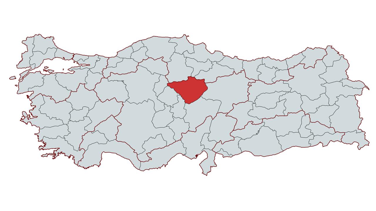
Yozgat
Country | Türkiye | ||||||||
|---|---|---|---|---|---|---|---|---|---|
Region | Central Anatolia Region | ||||||||
Population | 413.161 (2024) | ||||||||
Area | 14.074 km² | ||||||||
Climate | Continental Climate | ||||||||
Important Structure | Büyüknefes Ancient City Saat Kulesi Sarıkaya Roman Baths Kerkenes Ruins Çapanoğlu Camii | ||||||||
Area Code(s) | 354 | ||||||||
License Plate Code | 66 | ||||||||
Governor | Mehmet Ali Özkan | ||||||||
Mayor | Kazım Arslan | ||||||||
Yozgat is a city located in the Central Anatolia Region of Turkey, known for its historical past, geographical position, and prominence in agriculture and livestock farming. Built on the Bozok Plateau, the city has served as a settlement for many civilizations throughout history and lies along some of Anatolia’s most important trade routes. During the Ottoman period, Yozgat was known as the Bozok Sanjak and after the proclamation of the Republic, it attained provincial status and continued its development. Today, its population structure is changing due to declining rural populations and migration movements, with the economy largely based on agriculture and livestock. The city also attracts attention for its natural beauty, cultural heritage, and historical structures.
Yozgat has been an important settlement throughout history due to its fertile soils and strategic location. Archaeological excavations have shown that human habitation in the region dates back to the 3000s BCE. Alişar Höyüğü is recognized as a major center from the Hittite period onward. The Hittites, Phrygians, Lydians, Persians, Romans, and Byzantines all ruled over Yozgat’s territory.
During the Hittite period, Yozgat and its surroundings became one of the key centers of the Hittite Empire, with excavations at Alişar Höyüğü uncovering artifacts from that era. After the fall of the Hittites, the region came under the control of the Phrygians and Lydians, followed by the Persians. Yozgat, situated on the Persian “Royal Road” trade route, fell under Macedonian control during Alexander the Great’s eastern campaigns in the Hellenistic period.
In the Roman period, the region was known by the important city of Tavium and served as a commercial hub under Roman administration. Yozgat retained its significance during the Byzantine era, particularly from the 7th century onward, becoming a target of Arab raids.
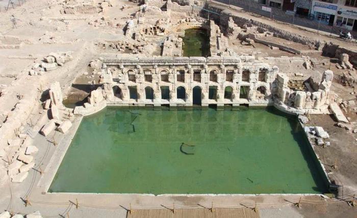
Sarıkaya Roman Bath - Yozgat Governorate
After the Battle of Manzikert in 1071, Yozgat came under Seljuk rule. The Seljuks undertook various construction activities in the region, building roads, caravanserais, and mosques. During the Mongol invasions, the area suffered significant damage and subsequently came under the control of the Ilkhanids and the Eretna Beylik, among other Turkic states in Anatolia.
During the Ottoman period, Yozgat was known as the Bozok Sanjak and became one of the important administrative centers of the Ottoman state. In the 18th century, the Çapanoğlu family assumed governance of the region under Ottoman authority and made significant contributions to Yozgat’s development. The Çapanoğulları built mosques, caravanserais, and other structures, transforming Yozgat into a center of culture and trade.
Yozgat witnessed important events during the War of Independence. In 1919, uprisings in Yozgat resisted the National Movement, but following the struggle led by Mustafa Kemal Atatürk, the region came under the control of the Turkish Army.
After the proclamation of the Republic, Yozgat became one of Turkey’s developing provinces, with economic structures strengthened through reforms in education and agriculture. In 1927, by decision of the Grand National Assembly, the name “Bozok” was officially changed to “Yozgat.”
Yozgat lies in the eastern part of the Central Anatolia Region, between 34° and 36° east longitude and 39° and 40° north latitude. It borders Sivas to the east, Kırıkkale and Kırşehir to the west, Çorum and Amasya to the north, and Nevşehir and Kayseri to the south. With an area of 14,074 km², Yozgat covers approximately 1.8% of Turkey’s total land area.
The highest point within the province’s boundaries is Hamzasultan Hill at 2,272 meters. To the north of the city lie the Deveci Mountains, while the Bozok Plateau is located to the south. The majority of Yozgat’s terrain consists of rolling plains and plateau areas.
Yozgat exhibits the typical continental climate of the Central Anatolia Region. Summers are hot and dry, while winters are cold and snowy. The annual average temperature is 9.5°C, with the coldest months being January and February, and the hottest being July and August. The average annual rainfall is 525 mm, with the highest precipitation occurring in spring and winter months.
Microclimatic conditions are observed in some districts. Particularly Çekerek and Aydıncık, due to their lower elevations, exhibit relatively milder climatic characteristics.
Yozgat’s topography consists of rolling plains, plateaus, and highlands. Land use is composed of 51.4% plateaus, 37.7% mountains, and 10.9% valleys. The main rivers are tributaries of the Yeşilırmak and Kızılırmak river basins.
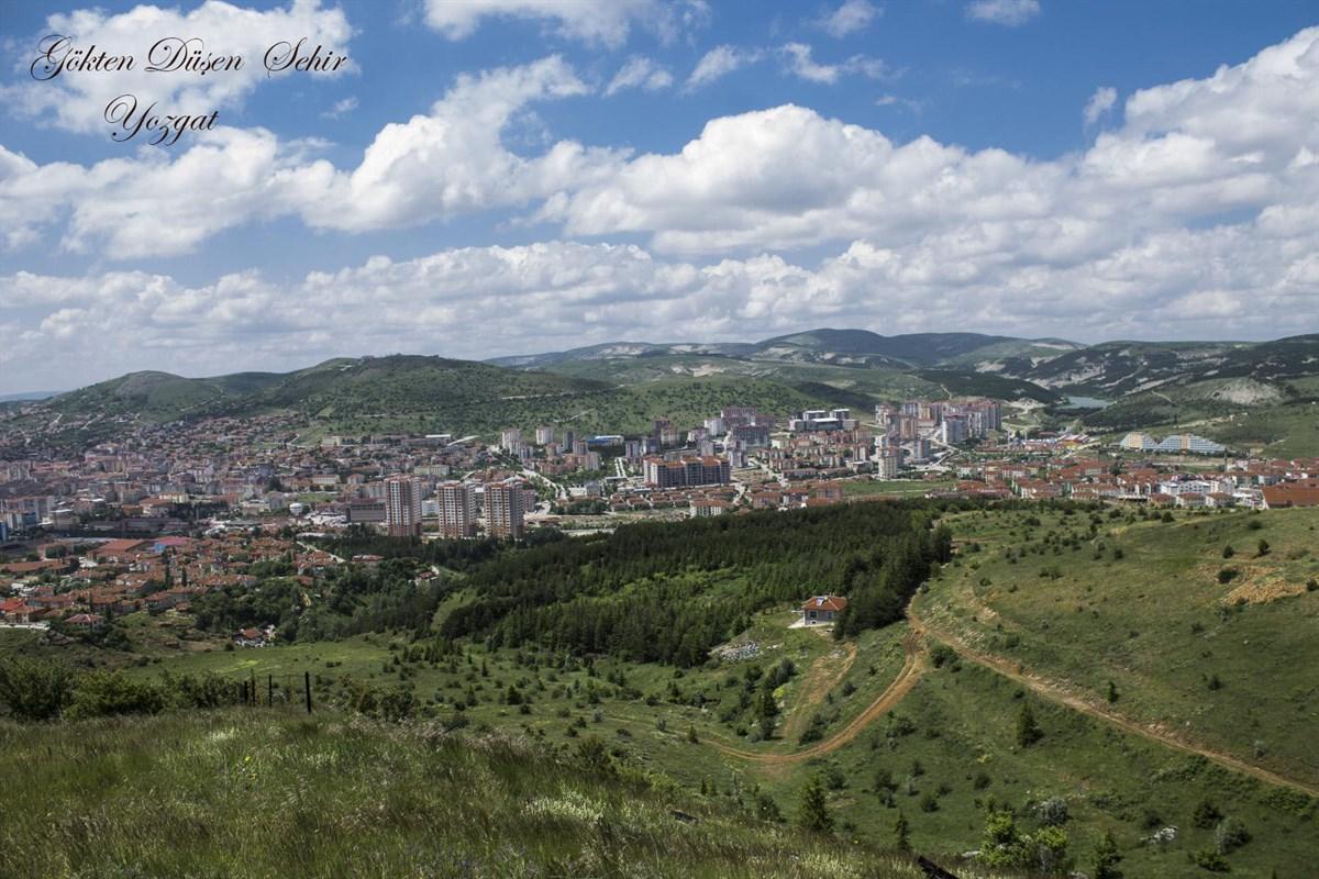
Yozgat View from Above - Yozgat Governorate
Yozgat is situated on the Bozok Plateau, one of the largest plateau areas in Central Anatolia. The plateau is deeply cut by the Kızılırmak and Delice Rivers, with its elevation decreasing toward the northwest and west. Its average elevation ranges between 1,200 and 1,400 meters. The southern part of the plateau is covered by lava flows, where rivers have carved deep valleys.
Mountainous areas cover a wide expanse across the province. The most important mountain ranges in Yozgat are:
Valley areas in the province are limited and generally formed by alluvial deposits in depressions between hills. The most important valleys are:
Yozgat possesses various mineral deposits due to its underground resources. The main minerals extracted across the province include:
The main rivers within the province are:
The major dams within the province’s boundaries are:
Yozgat’s population structure has undergone significant changes over the years. The province’s population reached 682,919 in 2000 but declined due to migration waves to 432,560 in 2014 and further to 413,161 in 2024. This situation has placed Yozgat among the provinces with the lowest population growth rates in Turkey.
Yozgat’s economy is predominantly based on agriculture and livestock. As of 2001, the agricultural sector accounted for 28.4% of the province’s Gross Domestic Product (GDP), ranking first. Although the agricultural sector’s share has gradually decreased, as of 2021, 77.3% of the provincial population still works in agriculture. Developing agro-based industries is considered vital for the province’s economic growth.
Manufacturing industry in Yozgat is also developing. The province has skilled labor in metal products, textiles, food, and mineral products. Its location in Turkey’s 5th investment incentive zone provides advantages for investment. In 2012, exports amounted to 9.6 million TL while imports reached 18.4 million TL. Leading manufacturing sectors include food, mineral products, clothing, and furniture production.
Investments in mining and energy sectors are also of importance. Due to its distance from seaports, Yozgat faces challenges in accessing international markets for industrial production. However, sectoral investments and incentives are strengthening the province’s economic dynamics.
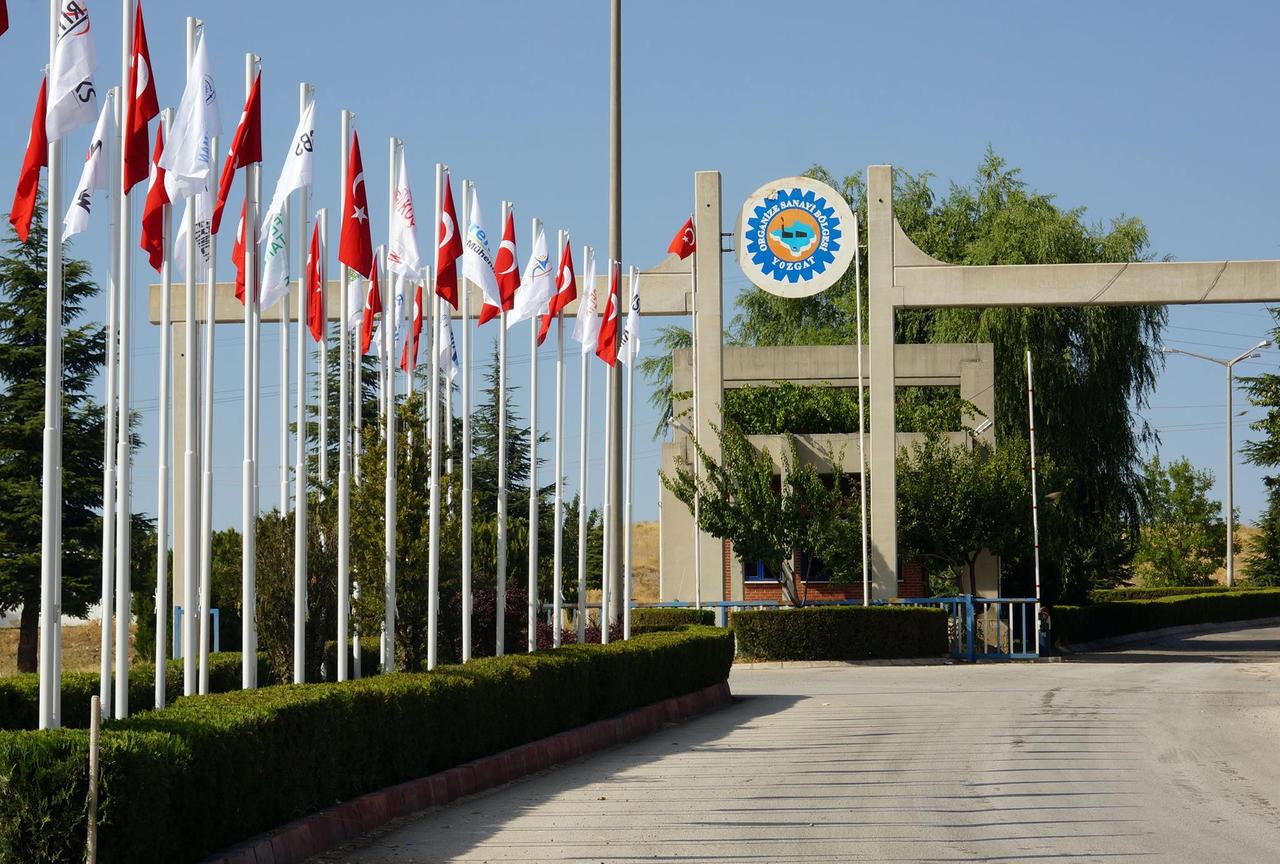
Yozgat Organized Industrial Zone - Yozgat OSB
Yozgat is a developing city in terms of transportation networks, educational institutions, and urban transit systems. Within the city, buses and minibuses are widely used for transportation.
Yozgat’s public transportation system consists of minibuses and municipal buses. Urban mobility is provided through public transit and taxi services.
Yozgat hosts one state university:
Çapanoğlu Mosque
Built in 1779 during the Ottoman period by the Çapanoğulları family, it is one of the city’s most important architectural works. The mosque features two minarets and a single dome.
Kerkenes Ruins
Located in the Sorgun district, the Kerkenes Ruins are the remains of an ancient city founded by the Medes in the 6th century BCE. The walls and temple remains uncovered during excavations hold significant archaeological value.
Basilica Therma (Sarıkaya Roman Bath)
Located in the Sarıkaya district, this bath dates to the Roman period and is among the most important historical remains in the region. The bath’s hot water springs remain active to this day.
Çeşka Underground City
Located near the city center of Yozgat, this underground city dates to the Byzantine period and was used for defensive purposes.
The governorship of Yozgat is currently held by Mehmet Ali Özkan. The following individuals have served as governors from the past to the present:
The administration of Yozgat Municipality is currently led by Kazım Arslan as of 2024. The following individuals have served as mayors from the past to the present:
Karatay Üniversitesi, KARSEM. "Yozgat Hakkında Bilinmesi Gerekenler." Accessed February 8, 2025.https://karsem.karatay.edu.tr/yozgat-hakkinda-bilinmesi-gerekenler
Ministry of Environment, Urbanization and Climate Change, Republic of Türkiye,Yozgat İl Directorate. "Genel Bilgiler." Accessed February 8, 2025.https://yozgat.csb.gov.tr/genel-bilgiler-i-2301
Ministry of National Education, Republic of Türkiye,Yozgat İl Directorate. “İlimiz Hakkında (Tarihçe).” Accessed February 8, 2025.https://yozgat.meb.gov.tr/www/ilimiz-hakkinda-tarihce/icerik/2357
T.C. Devlet Su İşleri Genel Müdürlüğü, 12. Bölge Müdürlüğü. "Yozgat Su Kaynakları." Accessed February 8, 2025.https://bolge12.dsi.gov.tr/Sayfa/Detay/1141.
T.C. Ministry of Environment, Urbanization and Climate Change,Yozgat İl Directorate. "İlimiz Coğrafyası." Accessed February 8, 2025.https://yozgat.csb.gov.tr/ilimiz-cografyasi-i-2341
T.C. Ministry of National Education,Yozgat İl Directorate. "İlimiz Hakkında (Coğrafya)." Accessed February 8, 2025.https://yozgat.meb.gov.tr/www/ilimiz-hakkinda-cografya/icerik/2356.
Türkiye Diyanet Vakfı İslam Ansiklopedisi. "Yozgat." Accessed February 8, 2025.https://islamansiklopedisi.org.tr/yozgat.
Yozgat Belediyesi. "Tarihçe." Accessed February 8, 2025.https://www.yozgat.bel.tr/icerik/tarihce
Yozgat Organize Sanayi Bölgesi. "Yozgat Tarihi." Accessed February 8, 2025.https://yozgatosb.org.tr/yozgat-tarihi/
Yozgat Sosyo-Ekonomik Raporu 2019. "Demografi ve Nüfus Yapısı." Kalkınma Ajansı, 2019.
Yozgat Valiliği. "Geçmiş Dönem Valilerimiz." Accessed February 8, 2025.http://www.yozgat.gov.tr/gecmis-donem-valilerimiz
Yozgat Valiliği. "Yer Şekilleri." Accessed February 8, 2025.http://www.yozgat.gov.tr/yer-sekilleri.
Yozgat Valiliği. "Yer Şekilleri." Accessed February 8, 2025.http://www.yozgat.gov.tr/yer-sekilleri#:~:text=K%C4%B1z%C4%B1l%C4%B1rmak%20Vadisi%20boyunca%20kuzeydo%C4%9Fu%2Dg%C3%BCneybat%C4%B1,a%20do%C4%9Fal%20bir%20s%C4%B1n%C4%B1r%20olu%C5%9Fturmu%C5%9Ftur
Yozgat Valiliği. "İklim." Accessed February 8, 2025.http://www.yozgat.gov.tr/iklim.
Yozgat Valiliği. “Yozgat Hakkında.” Accessed February 8, 2025.http://www.yozgat.gov.tr/yozgat-hakkinda.
Yozgat Çamlık Gazetesi. “Yozgat’ın İlk Belediye Başkanını Tanıyor Musunuz? İşte Gelmiş Geçmiş Yozgat Belediye Başkanları.” Accessed February 8, 2025.https://www.yozgatcamlik.com/haber/16063165/yozgatin-ilk-belediye-baskanini-taniyor-musunuz-iste-gelmis-gecmis-yozgat-belediye-baskanlari

Yozgat
Country | Türkiye | ||||||||
|---|---|---|---|---|---|---|---|---|---|
Region | Central Anatolia Region | ||||||||
Population | 413.161 (2024) | ||||||||
Area | 14.074 km² | ||||||||
Climate | Continental Climate | ||||||||
Important Structure | Büyüknefes Ancient City Saat Kulesi Sarıkaya Roman Baths Kerkenes Ruins Çapanoğlu Camii | ||||||||
Area Code(s) | 354 | ||||||||
License Plate Code | 66 | ||||||||
Governor | Mehmet Ali Özkan | ||||||||
Mayor | Kazım Arslan | ||||||||
History
Yozgat in Antiquity
Seljuk and Ottoman Periods
National Struggle and Republican Period
Geographical Structure
Location and Boundaries
Climate
Landforms
Plateaus
Mountains
Valleys
Natural Resources and Minerals
Rivers and Dams
Population and Demographic Structure
Population Distribution and Change
Migration Movements and Population Decline
Economy
Infrastructure
Urban Transportation
Universities and Educational Infrastructure
Districts
Historical Structures
Administration
Governor
Municipal Administration