


This article was automatically translated from the original Turkish version.
+1 More
Grape
Name | Obtained from the cultivated black grape | ||||||||
|---|---|---|---|---|---|---|---|---|---|
Geographical Location | 23 km from Erzincan | ||||||||
Province | Erzincan | ||||||||
Region | Eastern Anatolia Region | ||||||||
Natural Resources | Erzincan Grape Esence Mountains Seven Lakes | ||||||||
Important Places | Akkoyunlu Mosque - Hacı Nutullah Mosque - Aygır Lake Bayırdağ Picnic Area Karakaya Picnic Area | ||||||||
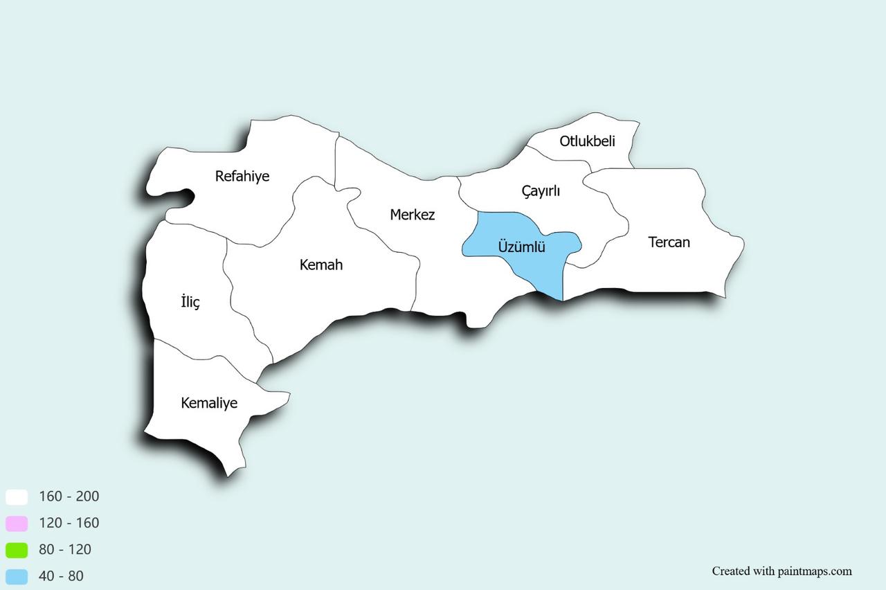
Üzümlü is a district of Erzincan Province located 23 km away from the provincial center. With an area of 410 km², Üzümlü had a population of 11,376 as of 2014. The district’s name is derived from a unique black grape variety grown in the region. It gained district status in 1987 through legislation and previously functioned as a town under the direct administration of Erzincan city center.
The region where Üzümlü is located has witnessed historical developments since antiquity. This area came under the influence of civilizations such as the Hittites and Phrygians and was used as a settlement site. The settlement, believed to date back to around 3000 BCE, played an important role as a religious and commercial center during the Hittite period. The Urartians who followed the Hittites also utilized the region, which fell within the boundaries of the Urartian Kingdom. Additionally, the area remained inhabited during the Roman and Byzantine periods.
The presence of ancient settlements and archaeological finds demonstrates that Üzümlü was regarded as a strategic region by various civilizations throughout history. The historical role of these settlements reveals that the area has been continuously inhabited for a long time and reflects its cultural diversity.
Following the Seljuk conquest of Anatolia, the Üzümlü region began to be settled by Turks. The Seljuk period laid the groundwork for the region to become an important cultural and commercial center. During the Ottoman Empire, Üzümlü continued to develop, particularly due to its agricultural potential. Located within the vast territories of the Ottoman Empire, Üzümlü thrived as an economic and cultural settlement.
During this period, numerous Ottoman-era mosques, bridges, fountains, and other structures were built in the district. These buildings are integral elements of both religious and social life. Üzümlü’s traditional stone architecture preserves traces of the Ottoman era and contributes to the preservation of the region’s cultural heritage.
After the proclamation of the Republic, Üzümlü entered a new phase of development as a district of Erzincan Province. Agriculture and animal husbandry remained the primary sources of livelihood for the local population. The district’s significance as a major production center for grape cultivation and fruit farming played a key role in shaping its economy. Traditional handicrafts in the district are also an important cultural value.
The 1939 Erzincan Earthquake caused extensive destruction in the district, but it was quickly rebuilt. This recovery process demonstrates the resilience and determination of the local population. Reconstruction efforts after the earthquake marked a stage in Üzümlü’s modernization process.
Üzümlü is located 23 km east of the Erzincan city center and covers an area of 410 km². To the east lies Tercan, to the west the Erzincan Central District, to the north Çayırlı, and to the south the Pülümür District of Tunceli Province. Üzümlü’s geographical structure is predominantly mountainous and rugged, a condition that has shaped agricultural and settlement activities in the region.
Üzümlü lies within the influence of a continental climate. Summers are hot and dry, while winters are cold and snowy. This climatic structure is a key factor affecting agricultural activities and has shaped the region’s agrarian economy. At the same time, this climate type provides favorable conditions for grape cultivation.
Üzümlü’s water resources are among the most important factors ensuring the sustainability of agricultural activities in the region. Rivers, irrigation systems, and groundwater sources constitute the primary water supplies used by the local population for farming.
Üzümlü possesses a rich cultural heritage. Historical structures, religious sites, and cultural traditions reflect the values passed down from the past to the present. In this regard, the district contains numerous historical mosques, tombs, and ruins.
Among Üzümlü’s historical structures are important monuments such as Akkoyunlu Camii, Hacı Nutullah Camii, and Şeyh Karpu’z Türbesi Mağarası. These buildings bear traces of both Ottoman and Seljuk architecture. Additionally, the Altıntepe Castle, with its remains dating to the Urartian period, holds significant archaeological importance. Excavations at Altıntepe Castle reveal the historical richness of the region.
Üzümlü is also a district where local traditions are actively preserved. The annual Grape Festival and other local events are organized to strengthen the district’s cultural richness and community cohesion. These events aim to promote the local culture and contribute to tourism.
Due to its location along important historical routes such as the Silk Road and the Cibice Pass, Üzümlü carries traces of many civilizations from antiquity to the present.
Altıntepe Höyük, with its Urartian remains, attracts the interest of history enthusiasts. This höyük is known for its settlement areas, temples, and tombs from the Urartian period. The Küçük Höyük, located northeast of Altıntepe, is another relic of the ancient era. In addition, rock tombs at the Şeyh Karpuz Cave and Köy Tepesi sites further enrich Üzümlü’s historical fabric.
Bayırbağ Village contributes to the region’s cultural heritage through its historical fountains, inns, and the inscription on the mosque fountain.Karakaya Village’s Köroğlu Stones and kale ruins represent another example of the region’s historical structures.
Aygır Lake and Seven Lakes attract great interest among climbers and nature walkers. The Esence Mountains offer numerous opportunities for exploration to nature lovers. Çamlık Han served as an important accommodation center along the region’s historical trade routes and provides visitors with rest facilities.
For those interested in water sports, the Karasu River and Sansa Pass are suitable locations for rafting. Rafting and paragliding events initiated by Recep Yazıcıoğlu and conducted with international participation have made significant contributions to promoting Erzincan and Üzümlü.
Another important attraction in the region is the kaynarca (hot spring) and social facilities in the Çermik locality of Karakaya Village. These facilities serve as a health tourism destination for tourists drawn by the healing waters and Hıdırellez celebrations.
Picnic areas such as the surroundings of Pahnik Çayı and recreational sites like Çaho’s Lake are popular among visitors seeking to spend time immersed in nature. These areas offer both the opportunity to enjoy natural beauty and to engage in outdoor activities.
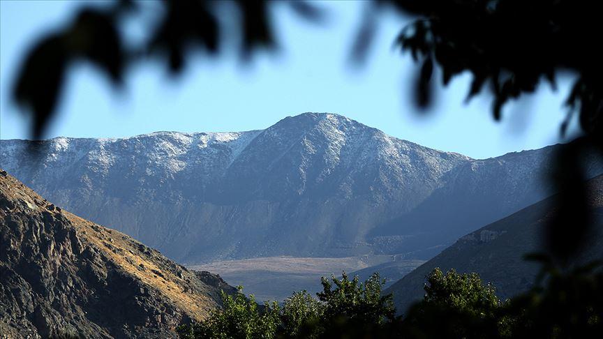
Esence Dağı(Anadolu Ajansı)
Akkoyunlu Camii: Built during the Akkoyunlu period, the mosque was restored in 1965 and continues to function as a mosque today.
Hacı Nutullah Camii: Located in Karakaya Village, this mosque has a history of approximately 200 years. It is notable for its wooden decorations and was commissioned by Hacı Nutullah Efendi. It remains an active mosque today.
Şeyh Karpuz Türbesi Mağarası: Found on the hilltop of the central village, this cave measures approximately 30 m². A fine stream of water flows from a stone inside. The cave is considered sacred by locals and is frequently visited by pilgrims.
Aygır Lake: Located on Keşiş Mountain, Aygır Lake is a crater lake. This lake in the northern part of the district is one of the region’s key tourist attractions due to its natural beauty.
Hıdırellez Lake: Located north of Çadırtepe Village, Hıdırellez Lake is known for its abundant spring waters and distinctive natural environment.
Bayırdağ (Değirmenönü) Recreation Area: Located in Bayırbağ Village along the banks of Pahnik Çayı, this recreation area has completed infrastructure development and is one of the region’s important recreational sites due to its rich tree cover and natural setting.
Karakaya (Çermik) Recreation Area: Çermik in Karakaya Village is known for its cold waters and healing hot springs emerging from the ground. Trout farming ponds are also located here. The Kaynarca Festival is held annually on May 20.
Şeyh Karpuz Mağarası: This cave, located on the hilltop of Üzümlü Village, is approximately 4–5 m² in area and 3 m high. Considered sacred by locals, the cave contains lines carved into its stone walls and niches for placing candles. According to legend, a watermelon was seen growing here in mid-winter, leading the people to regard the site as the tomb of a saint. Additionally, an event that occurred near this cave during the Russian occupation holds an important place in local folklore.
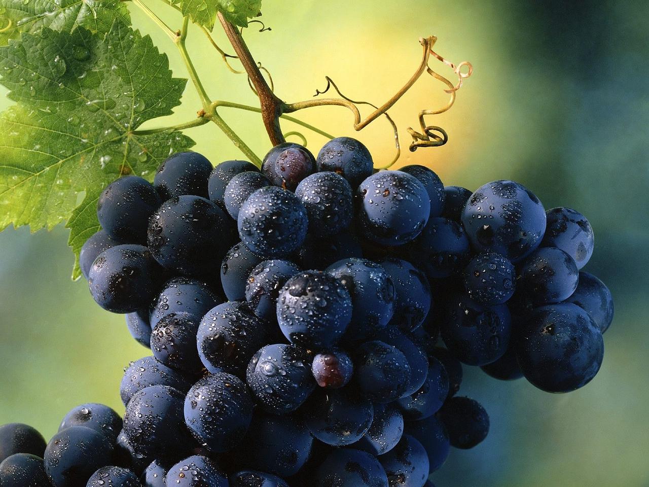
Cimin Grape (Erzincan Provincial Special Administration)
The Erzincan Grape, grown in the Üzümlü (Cimin) region, is distinguished by its black color and flattened oval shape. The average weight of each grape is 3–4 grams, with seed count typically ranging from 1 to 4. The skin thickness is medium, and the grapes have an aromatic, sweet, and pleasant flavor. The clusters are conical and robust, with weights varying between 300 and 1500 grams. The Erzincan Grape is ideal for table use.
Product Composition The grape berries contain nitrogen (0.36%), phosphorus (0.01%), potassium (0.20%), magnesium (0.008%), and calcium (0.04%), while the leaves contain nitrogen (1.75%), phosphorus (0.30%), potassium (0.49%), magnesium (0.11%), calcium (1.47%), iron (66.0), zinc (29.95), and copper (36.25).
Growing Conditions of the Grape The Erzincan Grape grows under the influence of the region’s unique geographical conditions, climate, humidity, temperature, and wind.
Geographical Location: The Erzincan Plain is part of the Euphrates Basin in Eastern Anatolia and lies between 38°18 and 40°42 east longitudes and 39–40°06 north latitudes. This region is characterized by vineyards established on slopes and alluvial cones at elevations of 1300–1500 meters. In Erzincan, vineyards rise as high as 1700 meters in Bayırbağ Village.
Climate Characteristics: The most beneficial rainfall in Erzincan occurs during winter, early spring, and after harvest in autumn. Grapes receive rain during the dry summer months, which helps prevent fungal diseases. Grapes require water from early June to mid-September, with the highest demand occurring during the first week of July and August.
Relative Humidity: The average relative humidity in Erzincan is approximately 58%. Low humidity combined with high temperatures can lead to excessive evapotranspiration, potentially damaging grape leaves and berries.
Temperature: The Erzincan Grape can grow in areas with average annual temperatures ranging from 9 to 12°C. Erzincan’s average annual temperature is 10.7°C, with summer averages reaching 22.6°C. For healthy grape development, temperatures should not fall below 15–20°C.
AA. "Esence Dağı’na Mevsimin İlk Karı Yağdı." *Anadolu Ajansı*, September 11, 2019,https://www.aa.com.tr/tr/turkiye/esence-dagina-mevsimin-ilk-kari-yagdi/1578515. Accessed April 19, 2025.
Erzincan Valiliği. "Erzincan Üzümü." Erzincan Valiliği. Accessed April 19, 2025.http://www.erzincan.gov.tr/erzincan-uzumu
Erzincan Valiliği. “Üzümlü.” Erzincan Valiliği. Accessed April 19, 2025.http://www.erzincan.gov.tr/uzumlu
Erzincan İl Özel İdaresi. "Cimin Üzümü." Accessed April 19, 2025.http://erzincanilozelidaresi.gov.tr/cimin-uzumu
Üzümlü Kaymakamlığı. “Üzümlü Tarihi.” Üzümlü Belediyesi. Accessed April 19, 2025.http://uzumlu.gov.tr/uzumlutarih1
Üzümlü Kaymakamlığı. “Üzümlü Turizm.” Üzümlü Belediyesi. Accessed April 19, 2025.http://www.uzumlu.gov.tr/uzumlu-truzim1
Üzümlü Kaymakamlığı. “İlçemiz.” Üzümlü Belediyesi. Accessed April 19, 2025.http://www.uzumlu.gov.tr/ilcemiz
Grape
Name | Obtained from the cultivated black grape | ||||||||
|---|---|---|---|---|---|---|---|---|---|
Geographical Location | 23 km from Erzincan | ||||||||
Province | Erzincan | ||||||||
Region | Eastern Anatolia Region | ||||||||
Natural Resources | Erzincan Grape Esence Mountains Seven Lakes | ||||||||
Important Places | Akkoyunlu Mosque - Hacı Nutullah Mosque - Aygır Lake Bayırdağ Picnic Area Karakaya Picnic Area | ||||||||
History of Üzümlü (Erzincan)
Ancient Period and Early Settlements
Seljuk and Ottoman Periods
Republican Era and Subsequent Developments
Geographical Structure
Climate
Water Resources
Cultural Heritage
Historical Structures
Traditions and Festivals
Tourism in Üzümlü District
Historical Sites
Erzincan Grape