


This article was automatically translated from the original Turkish version.
+2 More
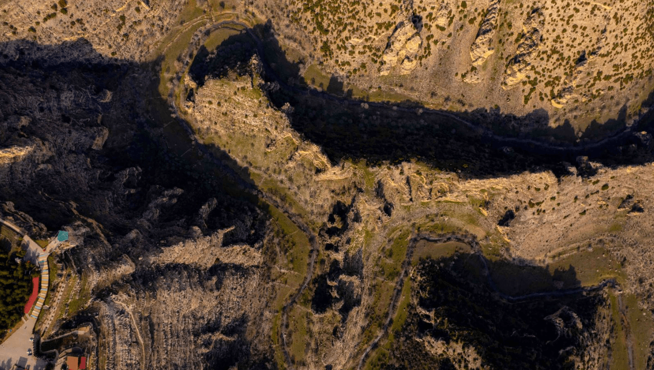
Ulubey Canyon
Location | Ulubey - Uşak / Türkiye | ||||||||
|---|---|---|---|---|---|---|---|---|---|
Formation Shape | Erosion (erosive effect of the Ulubey and Banaz rivers) | ||||||||
Geological Structure | Sedimentary rocks, Limestone | ||||||||
Nature Park Declaration | 2013 | ||||||||
Ulubey Canyon is located within the boundaries of the Ulubey district in Uşak Province in the Aegean Region of Türkiye. The canyon system, formed over thousands of years by the erosive activity of the Ulubey and Banaz rivers, consists of a main canyon connected to numerous large side canyons. It is recognized as the second largest canyon in the world after the Grand Canyon in Arizona, USA.
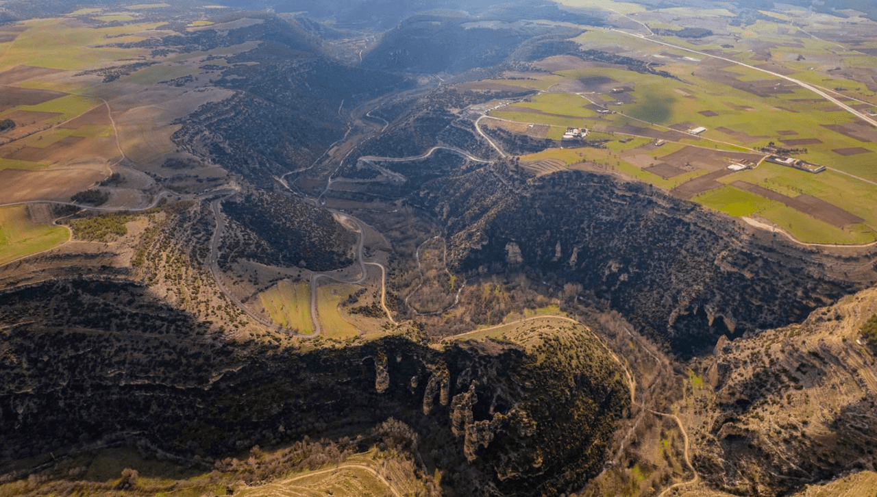
Ulubey Canyon (Culture Portal)
The canyon has been shaped over time by the geological structure and tectonic activity of the region. Located in the southern and southwestern parts of Ulubey district, this canyon system was formed through the erosion of sedimentary rock layers and is notable for its steep cliffs. The Ulubey and Banaz rivers, flowing along the canyon floor, have carved these deep valleys over thousands of years of erosion.
The canyon is home to rich flora and fauna. The canyon floor and its surroundings, exhibiting microclimate effects, provide an environment conducive to both natural habitats and agriculture. Sources clearly indicate that various fruits and vegetables can be cultivated in the region. Particularly, the agricultural terraces on the canyon slopes demonstrate the interaction between the ecosystem and human activity.
The area surrounding the canyon is significant not only for its natural features but also for its historical and archaeological heritage. The ancient city of Pepouza, associated with the Montanist sect of early Christianity, is located within Ulubey Canyon and adds archaeological depth to the region. Additionally, ancient water channels, caves, and rock-cut tombs constitute the primary structures forming the canyon’s historical fabric.
The Clandras Aqueduct, located in the eastern part of the canyon, is an architectural structure from antiquity that transported water to Pepouza. This aqueduct is valuable not only as a functional element but also as an example of ancient engineering.
Ulubey Canyon was declared a Nature Park in 2013 and subsequently developed for nature tourism. A glass observation terrace offering views of the canyon opened to the public in 2015. The structure is built at a height of 150 meters with a 135-square-meter glass floor, constructed with 30-millimeter-thick bulletproof glass. The glass panels have a load-bearing capacity of 801.2 kg/m² and are accompanied by a 302-square-meter cafeteria.
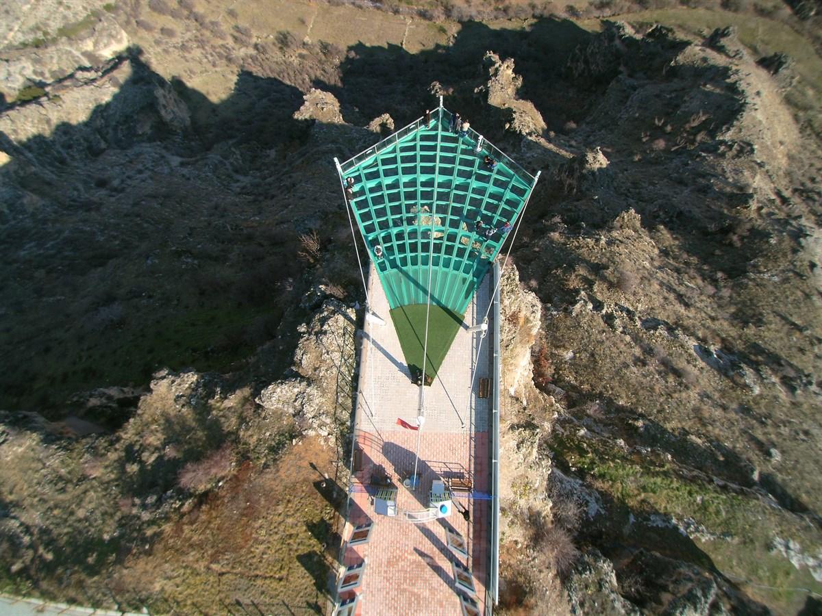
Glass Terrace (Ulubey District Governorship, Republic of Türkiye)
Numerous nature-based activities can be conducted within the canyon, including hiking, camping and caravan tourism, rock climbing, zip-lining, photo safaris, and balloon tours. Balloon tours began in 2025. The canyon also features local stalls selling Uşak-specific carpets and kilims, as well as cafes and restaurants serving regional cuisine.
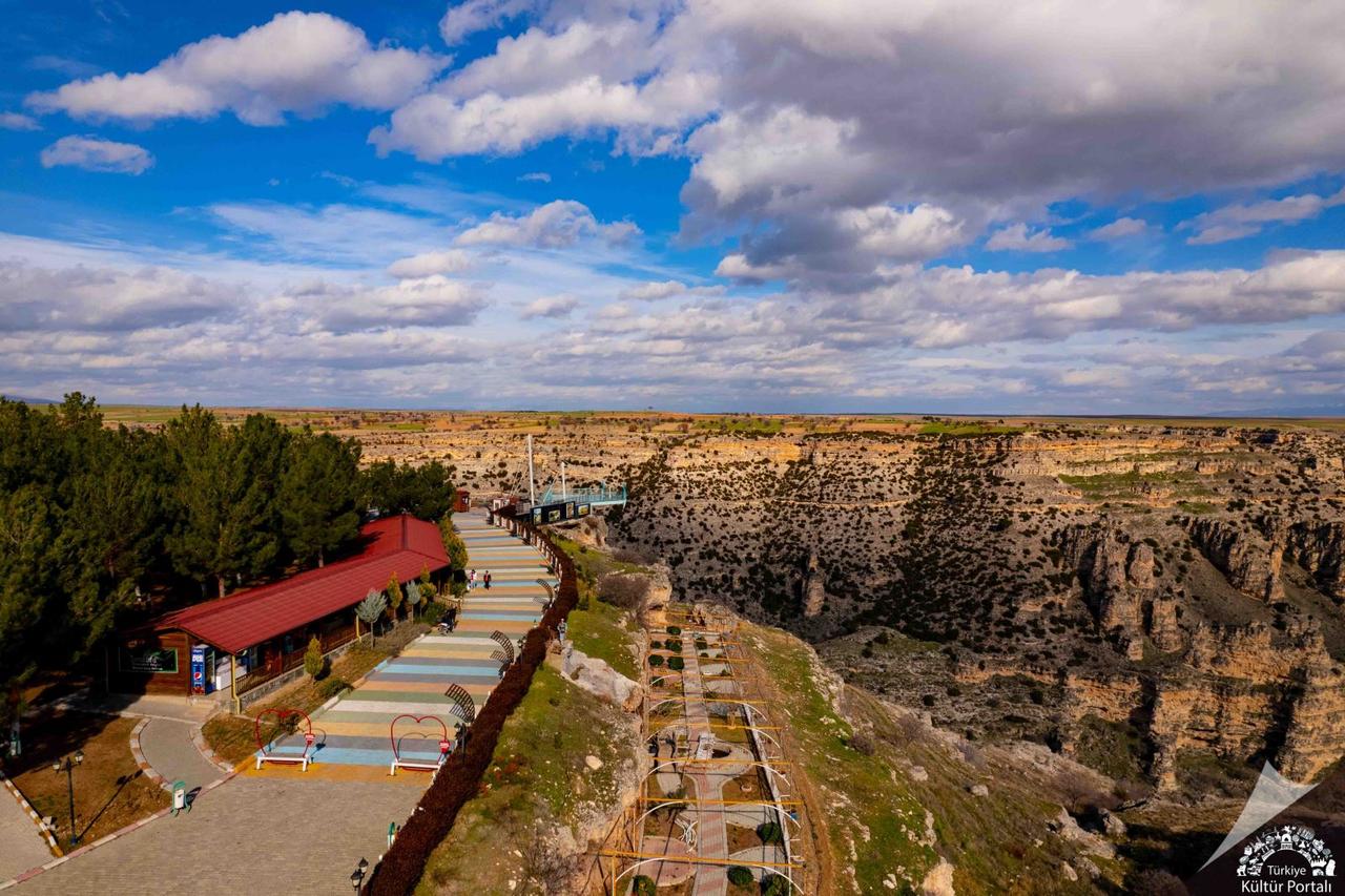
Ulubey Canyon Facilities (Culture Portal)
The canyon, located 29 kilometers from the center of Uşak, is accessible by public transportation operating throughout the day. For accommodation, options include camping areas, bungalow houses, and hotels in Uşak city center.
Some sections of the Dokuzsele Stream, which flows through Ulubey Canyon, are closed to tourism due to pollution. However, according to statements by local authorities, these areas are planned to be opened to tourism once wastewater treatment facilities are completed. The goal is to develop new projects in line with the conservation of the canyon’s natural values and the principles of sustainable tourism.
T.C. Kültür ve Turizm Bakanlığı. “Ulubey Kanyonu – Uşak.” *Türkiye Kültür Portalı*. Accessed April 22, 2025.https://www.kulturportali.gov.tr/turkiye/usak/gezilecekyer/ulubey-kanyonlari
T.C. Ulubey Kaymakamlığı. "Ulubey Kanyonları ve Cam Teras." Ulubey Kaymakamlığı Resmî Web Sitesi. Accessed April 22, 2025.http://www.ulubey.gov.tr/ulubey-kanyonlari-ve-cam-teras
T.C. Uşak Provincial Directorate of Culture and Tourism. "Ulubey Kanyonları ve Cam Teras (Ulubey Canyons and Glazier Terrace)." T.C. Kültür veTurizm Bakanlığı Uşak İl Müdürlüğü. Accessed April 22, 2025.https://usak.ktb.gov.tr/TR-295250/ulubey-kanyonlari-ve-cam-teras-ulubey-canyons-and-glazi-.html
Uşak Belediyesi. “Ulubey Kanyonları.” Accessed April 22, 2025.https://www.usak.bel.tr/icerik/ulubey-kanyonlari

Ulubey Canyon
Location | Ulubey - Uşak / Türkiye | ||||||||
|---|---|---|---|---|---|---|---|---|---|
Formation Shape | Erosion (erosive effect of the Ulubey and Banaz rivers) | ||||||||
Geological Structure | Sedimentary rocks, Limestone | ||||||||
Nature Park Declaration | 2013 | ||||||||
Geological Structure and Formation Process
Biological Diversity and Agricultural Potential
Historical and Archaeological Value
Tourism Potential and Facilities
Recent Developments and Environmental Sensitivity