


This article was automatically translated from the original Turkish version.
+2 More
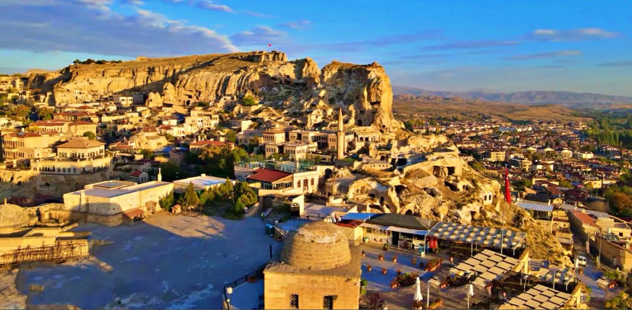
Temenni Tepesi
Address | Ürgüp Türkiye Nevşehir | ||||||||
|---|---|---|---|---|---|---|---|---|---|
Elevation | 80 metres | ||||||||
Surrounding Structures and Remnants | Kılıçarslan Türbesi Tahsinağa Kütüphanesi Aziz Yeorgios Kilisesi Taka Mezarlar | ||||||||
Temenni Tepesi is a hill located at the center of the Ürgüp district in Nevşehir province, Türkiye. It rises prominently above the urban fabric with a height of 80 meters. On its southern, eastern, and western slopes, rock walls reach up to approximately 30 meters in height. This hill is visible from various points in Ürgüp and occupies a strategic position within the town center.
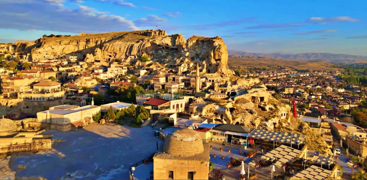
Temenni Tepesi (Kapadokya Kültür Yolu)
The geological structure of Temenni Tepesi consists of tuff layers, consistent with the general geological character of the region. Access to the summit is provided via a tunnel approximately 80 to 100 meters in length, carved directly into the rock. Due to its structure, the hill has good wind exposure and offers a broad panoramic view of the surrounding landscape under open-air conditions.
The hill derives its name from the practices of wish-making and tying cloth offerings performed at the tombs located on its summit. The word “Temenni” means “wish” in Turkish. This naming reflects the popular perception of the hill as a place of wishes.
Temenni Tepesi (Ürgüp Belediyesi)
Rock-cut tomb structures known locally as “taka mezarlar” found around Temenni Tepesi indicate that the area has been used as a burial ground since antiquity. These tombs are deeply carved into the rock and arranged to accommodate multiple burials. Typically, they feature shelf-like niches: one individual is buried in the lowest level and two each on the left and right sides. The location and construction of these tombs suggest that the site was designated for individuals of specific social status.
The tomb located at the point of access to the hill is popularly known as the “Kılıçarslan Tomb” and is traditionally attributed to Sultan IV. Rükneddin Kılıçarslan of the Anatolian Seljuks. Another tomb in the same area is also claimed to belong to Sultan III. Alaaddin Keykubat. However, existing historical and archaeological evidence does not provide definitive proof that these tombs are associated with these sultans. Researchers suggest that these structures may be representative tombs.
The tomb was constructed in 1268 by Vecihi Paşa and repaired in 1852 with the permission of Ottoman Sultan Abdülmecid by the Governor of Kayseri, Muhammed Vecihi. The turquoise marble inscription plaque on the tomb is currently preserved at the Ürgüp Museum. Ottoman archival records indicate that a türbedar (tomb custodian) was officially appointed to oversee the maintenance and protection of the tomb.
Another kumbet located at the center of the hill was built in 1855 by Tahsin Ağa, who had been exiled from the palace. He placed his collection of 817 handwritten manuscripts in this structure and established it as the Tahsinağa Public Library. The building was also used as a madrasa and contributed over time to the educational and cultural life of the region. The first librarian was Hacı Derviş of Ürgüp, followed by his son Nail Derviş.
In 1914, the library was placed under the authority of the Ministry of Education. In subsequent years, under the leadership of Mustafa Güzelgöz, known locally as “Eşekli Kütüphaneci,” the library was relocated to the district center in 1952. With this move, the building lost its original function.
On the southwest slope of Temenni Tepesi, remains of a hall identified as belonging to the Church of Saint George have been found. Most of the church’s wall structures have been largely destroyed, with only a portion of the interior space surviving to the present day. This indicates that the hill was used by different religious communities across various historical periods.
During the Seljuk period, Ürgüp occupied a strategic position along the routes connecting the cities of Konya and Niğde. One of the structures from this era, the Altıkapılı Tomb, is located in the city center. Dating to the 13th century, this tomb features a hexagonal plan, arched windows on each facade, and an open-roof design. The tomb, traditionally associated with a mother and her two daughters, reflects the architectural characteristics of the period.
Kapodokya Kültür Yolu. "Temenni Tepesi." Accessed May 29, 2025.https://kapadokyakulturyolu.com.tr/index.php/tr/place/39
T.C. Ministry of National Education. "Ürgüp'ün Tarihçesi." Nevşehir Ürgüp İlçe Milli Eğitim Müdürlüğü. Accessed May 29, 2025.https://urgup.meb.gov.tr/www/urgupun-tarihcesi/icerik/737
Ürgüp Belediyesi. "Temenni Tepesi." Ürgüp Belediyesi Resmi Web Sitesi. Accessed May 29, 2025.https://urgup.bel.tr/tr/sosyal-tesis/temenni-tepesi

Temenni Tepesi
Address | Ürgüp Türkiye Nevşehir | ||||||||
|---|---|---|---|---|---|---|---|---|---|
Elevation | 80 metres | ||||||||
Surrounding Structures and Remnants | Kılıçarslan Türbesi Tahsinağa Kütüphanesi Aziz Yeorgios Kilisesi Taka Mezarlar | ||||||||
Geomorphological Structure and Access
Naming
Archaeological Findings and Ancient Necropolises
Kılıçarslan Gazi Tomb (Representative Tomb)
Tahsinağa Library Kumbet
Remains of the Church of Saint George
Seljuk Period and Regional Significance