


This article was automatically translated from the original Turkish version.
+2 More
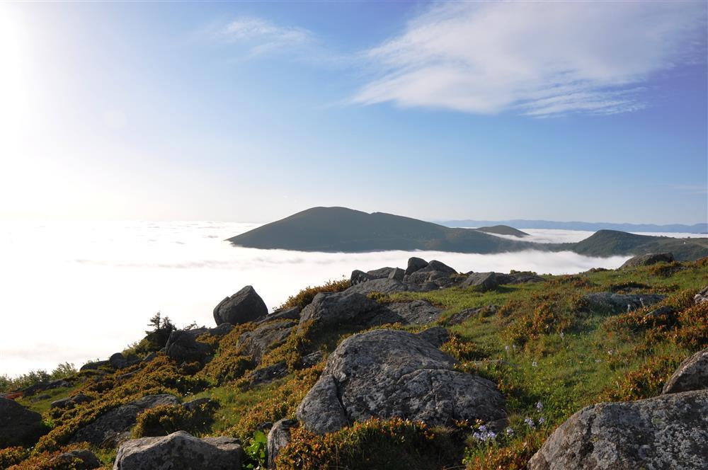
Sis Mountain Pasture
Location | Giresun and Trabzon provincial boundary Türkiye | ||||||||
|---|---|---|---|---|---|---|---|---|---|
Highest Point | Ali Meydan Tepesi (2,182 metres) | ||||||||
Elevation | Approximately 1,770 metres | ||||||||
Vegetation Cover | Natural flora covered with yellow and purple flowers | ||||||||
Protection Status | Declared a Tourism Centre in 2011 | ||||||||
Protected Area | 379 hectares (Tourism Centre); 55 hectares (Type B Recreation Area) | ||||||||
Sis Dağı Yaylası is located on the border between Giresun and Trabzon provinces in Türkiye’s Eastern Black Sea Region. It lies approximately 40 kilometers inland from the coastal area of Görele district, which is under Giresun’s administration. The plateau is situated on Sis Dağı, part of the Eastern Black Sea mountain range. The highest point of Sis Dağı, Ali Meydan Tepesi, reaches an elevation of 2,182 meters, while the plateau itself has an average elevation of approximately 1,770 meters.
Sis Dağı Yaylası is characterized by snow cover that persists on the ground until early July. The area features a natural flora marked by yellow and purple flowers. Relief features are prominent on the upper slopes due to variations in topography and gradient. Along the plateau’s routes, there are trails and paths suitable for outdoor sports.
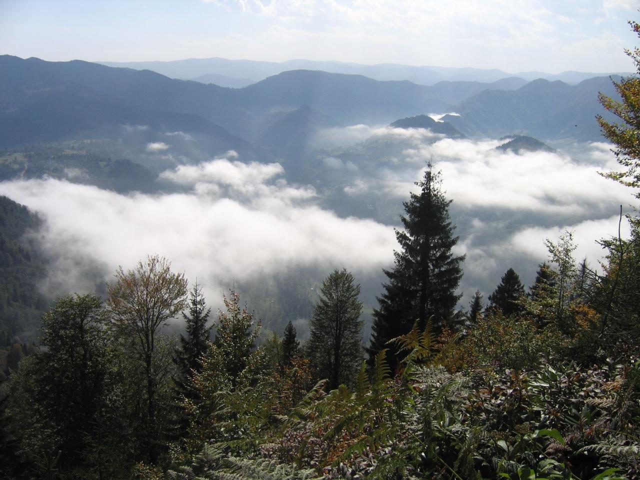
Sis Dağı Yaylası (Türkiye Kültür Portalı)
Sis Dağı Yaylası was designated as a Tourism Center by a decision of the Council of Ministers in 2011. The total area of the plateau is approximately 379 hectares. The Sis Dağı Recreation Area within this zone was officially registered as a “Type B Recreation Area” on 30 December 2016 and covers 55 hectares. The recreation area is located in the Çağlayan village of Çanakçı district, Giresun province, at the Sandık Gölü locality. Protection and operational responsibilities are managed by the Görele Forest Management Unit under the Tirebolu Forest Directorate. Planning authority for development has been granted to Şalpazarı Municipality, but no zoning or implementation plans have yet been approved.
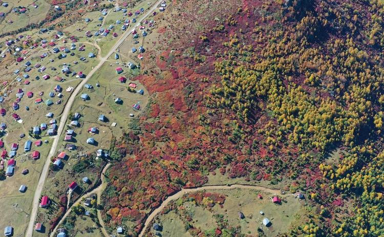
Autumn at Sis Dağı Yaylası (AA)
Sis Dağı Yaylası is a settlement area inhabited by villages and hamlets belonging to Giresun and Trabzon provinces. Every year, on specific dates, events are organized under the name Sis Dağı Festivals, with participation from local villagers and hamlets.
Sis Dağı Yaylası serves as a regional center for outdoor sports and plateau tourism. Its natural landscape and protected areas provide suitable environments for various activities. Due to its location on the border between Giresun and Trabzon provinces, it holds significance for the tourism potential of both regions. The area is officially designated as a “Tourism Center” and “Recreation Area”.
Access to Sis Dağı is provided via a village road approximately 40 kilometers long, extending from the coast inland to Espiye district. The journey to the plateau along this route takes approximately 1.5 to 2 hours.
Anadolu Ajansı. “Trabzon-Giresun sınırındaki 2 bin 182 rakımlı Sis Dağı'nda güz zamanı.” Accessed May 23, 2025.https://www.aa.com.tr/tr/yasam/trabzon-giresun-sinirindaki-2-bin-182-rakimli-sis-daginda-guz-zamani/3019539
Karadeniz Kalkınma Ajansı. "Sis Dağı B Tipi Mesire Alanı." Karadeniz Kalkınma Ajansı Resmi Web Sitesi. Accessed May 18, 2025.https://www.karadeniz.gov.tr/sis-dagi-b-tipi-mesire-alani/.
T.C. Kültür ve Turizm Bakanlığı. "Sis Dağı Turizm Merkezi." Giresun İl Kültür ve Turizm Müdürlüğü Resmi Web Sitesi. Accessed May 18, 2025.https://giresun.ktb.gov.tr/TR-206830/sis-dagi-turizm-merkezi.html.
T.C. Kültür ve Turizm Bakanlığı. "Sis Dağı Turizm Merkezi." Giresun İl Kültür ve Turizm Müdürlüğü Resmi Web Sitesi. Accessed May 18, 2025.https://giresun.ktb.gov.tr/TR-217086/sis-dagi-turizm-merkezi.html.
T.C. Ministry of Culture and Tourism. "Sis Dağı Yaylası." *Türkiye Kültür Portalı*. Accessed May 18, 2025.https://www.kulturportali.gov.tr/turkiye/giresun/gezilecekyer/sis-dagi-yaylasi
Sis Mountain Pasture
Location | Giresun and Trabzon provincial boundary Türkiye | ||||||||
|---|---|---|---|---|---|---|---|---|---|
Highest Point | Ali Meydan Tepesi (2,182 metres) | ||||||||
Elevation | Approximately 1,770 metres | ||||||||
Vegetation Cover | Natural flora covered with yellow and purple flowers | ||||||||
Protection Status | Declared a Tourism Centre in 2011 | ||||||||
Protected Area | 379 hectares (Tourism Centre); 55 hectares (Type B Recreation Area) | ||||||||
No Discussion Added Yet
Start discussion for "Sis Mountain Pasture" article
Vegetation
Protection Status and Management
Settlement and Cultural Activities
Tourism and Recreation
Access