This article was automatically translated from the original Turkish version.
+1 More
Sırakayalar Waterfall
Province | Bayburt | ||||||||
|---|---|---|---|---|---|---|---|---|---|
District | Central | ||||||||
Village | Sırakayalar | ||||||||
Formation Type | Natural Waterfall | ||||||||
Elevation | 1911 metres | ||||||||
Area | 36 hectares | ||||||||
Basic Feature | Freezing in winter to form icicles | ||||||||
Usage Area | Nature Tourism | ||||||||
Prominent Season | Winter (icing), Spring (vegetation) | ||||||||
Sırakayalar Waterfall is a natural waterfall located within the boundaries of Sırakayalar village in the central district of Bayburt province, in Türkiye’s Black Sea Region. It consists of two distinct cascading drops and possesses recreational potential.
Sırakayalar Waterfall is situated 16 kilometers from the center of Bayburt province.【1】Administratively, it lies within the boundaries of the central district of Bayburt province, at the settlement of Sırakayalar village, from which it derives its name. Located at geographic coordinates 40.103° north latitude and 40.237° east longitude, the waterfall site is situated at an elevation of 1911 meters above sea level.【2】
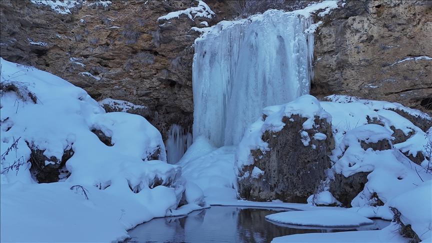
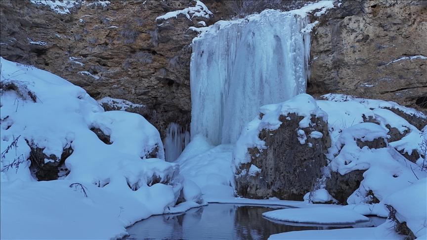
Sırakayalar Şelalesi (Anadolu Ajansı)
Analysis of its topographic structure reveals that the basin in which the waterfall is located exhibits characteristics of an upper slope relief with a western aspect. The total area of the site, recorded with a slope gradient of 0%, spans 36 hectares. The region falls under the jurisdiction of the Bayburt Forest Management Directorate and the Bayburt Forest Management Office for forestry administration and oversight. Cartographically registered under map sheet H44d2, the official status of the waterfall area is listed in current records as an "Unregistered" natural area.
From a morphodynamic perspective, the waterfall is not a single drop but comprises two distinct cascade structures: one at the entrance to Sırakayalar village and another within its interior. The water flowing from these cascades converges at lower elevations to form a stream channel.
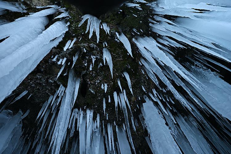
Sırakayalar Şelalesi (Anadolu Ajansı)
The waterfall’s discharge and surrounding morphological features exhibit significant seasonal variations depending on the climatic cycle and seasonal conditions of the basin. During spring and summer, melting snow from winter and regional precipitation cause an increase in water flow, resulting in vigorous cascading. During this period, the area around the waterfall supports lush vegetation and a variety of flowering plant species.
In winter, under the continental climate conditions prevailing in the region, air temperatures can drop below minus 15 degrees Celsius during nighttime. As a result of this thermal drop, the water flowing from the waterfall begins to freeze. This freezing process leads to the formation of vertical ice stalactites exceeding 10 meters in length along the waterfall’s surface. This hydrological transformation temporarily halts the water’s movement and creates a complete layer of ice across the site.
Sırakayalar Waterfall, with its two cascade levels and seasonal transformations, serves as a focal point for domestic and international tourists, nature enthusiasts, and university students throughout the year. Recreational use of the area varies according to seasonal conditions. During summer months, the waterfall and its immediate surroundings are heavily utilized as picnic and leisure areas. In winter, the frozen water surfaces and ice stalactites attract visitors who photograph the site, supporting landscape photography activities.
Anadolu Ajansı. "Bayburt'ta Sırakayalar Şelalesi buz tuttu." Accessed May 12, 2026.
Anadolu Ajansı. "Bayburt'ta yeşilin tonları arasındaki Sırakayalar Şelalesi ilgi görüyor." Accessed May 12, 2026.
Doğu Karadeniz Kalkınma Ajansı. "Sırakayalar Şelalesi." Accessed May 12, 2026.
Kültür Portalı. "Sırakayalar Şelalesi - Bayburt." Accessed May 12, 2026.
https://karadeniz.gov.tr/sirakayalari-selalesi-1/
https://www.aa.com.tr/tr/yasam/bayburtta-sirakayalar-selalesi-buz-tuttu/3791917
https://www.aa.com.tr/tr/yasam/bayburtta-yesilin-tonlari-arasindaki-sirakayalar-selalesi-ilgi-goruyor/3591576
https://www.kulturportali.gov.tr/turkiye/bayburt/gezilecekyer/sirakayalar-selalesi
[1]
Anadolu Ajansı, "Bayburt'ta Sırakayalar Şelalesi buz tuttu," Erişim Tarihi: 12.05.2026.
https://www.aa.com.tr/tr/yasam/bayburtta-sirakayalar-selalesi-buz-tuttu/3791917
[2]
Doğu Karadeniz Kalkınma Ajansı (DOKA) / Karadeniz Turizm Portalı, "Sırakayaları Şelalesi 1," Erişim Tarihi: 12.05.2026.

Sırakayalar Waterfall
Province | Bayburt | ||||||||
|---|---|---|---|---|---|---|---|---|---|
District | Central | ||||||||
Village | Sırakayalar | ||||||||
Formation Type | Natural Waterfall | ||||||||
Elevation | 1911 metres | ||||||||
Area | 36 hectares | ||||||||
Basic Feature | Freezing in winter to form icicles | ||||||||
Usage Area | Nature Tourism | ||||||||
Prominent Season | Winter (icing), Spring (vegetation) | ||||||||
No Discussion Added Yet
Start discussion for "Sirakayalar Waterfall" article
Geographical Location and Physical Characteristics
Seasonal Variations and Hydrological Conditions
Social Use and Environmental Management