


This article was automatically translated from the original Turkish version.
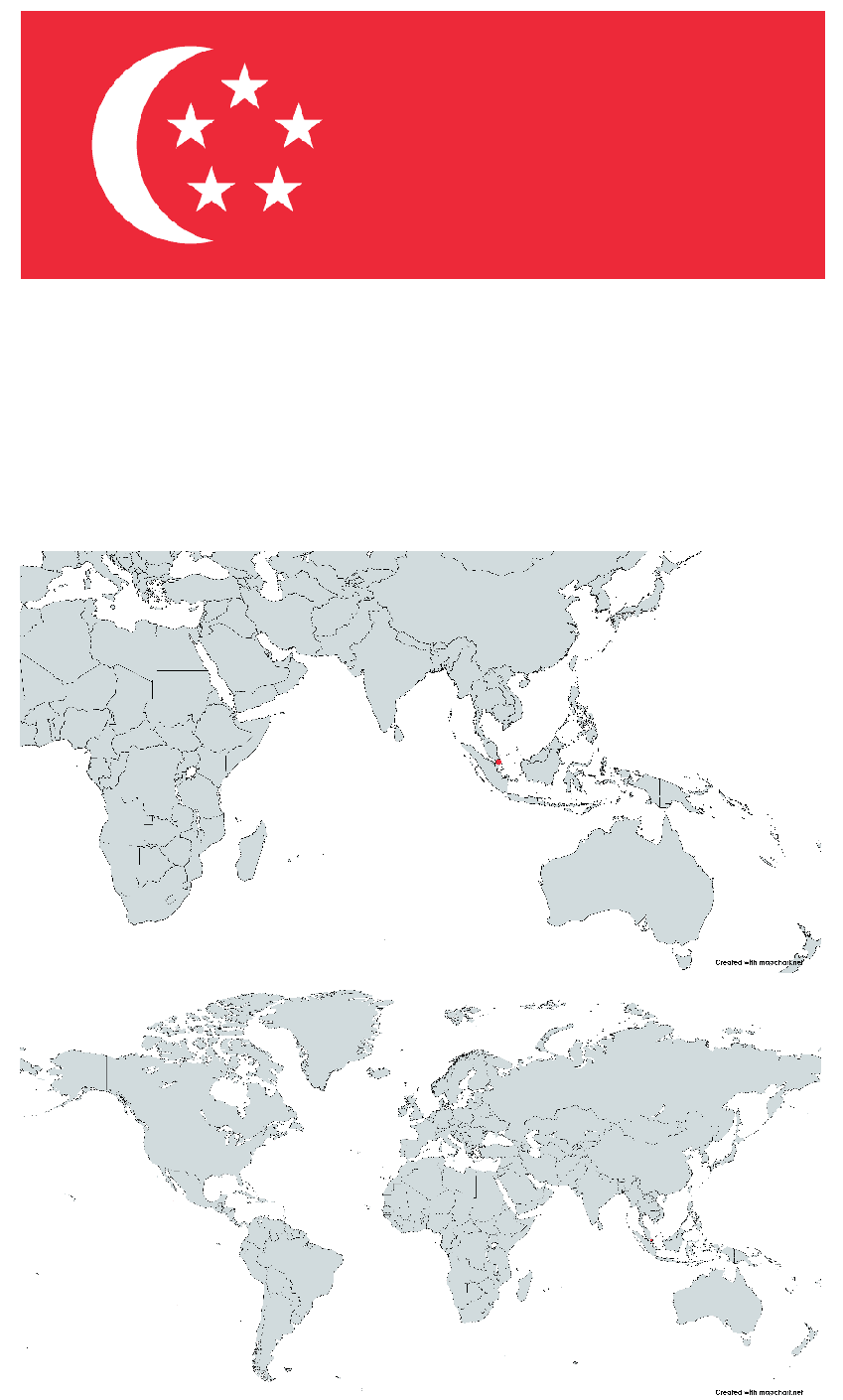
Republic of Singapore (Singapur Cumhuriyeti, Republik Singapura)
GDP per Capita | 84.734 USD (2023) | ||||||||
|---|---|---|---|---|---|---|---|---|---|
GDP | 501.43 billion USD (2023) | ||||||||
Ethnic Structure | Chinese (%76.2) Malay (%15.0) Indian (%7.4) Other (%1.4) | ||||||||
Climate | Tropical climate hot and humid throughout the year monsoon seasons (November–March and June–September) | ||||||||
Internet Domain | .sg | ||||||||
Telephone Code | +65 | ||||||||
Time Zone | UTC+8 (Singapore Standard Time - SST) | ||||||||
Currency | Singapore Dollar (SGD) | ||||||||
Population | 5.94 million | ||||||||
Area (km²) | 734.3 | ||||||||
Independence | 9 August 1965 (separation from Malaysia) | ||||||||
Prime Minister | Lawrence Wong (as of 15 May 2024) | ||||||||
President | Tharman Shanmugaratnam (as of 14 September 2023) | ||||||||
System of Government | Parliamentary republic | ||||||||
Official Language | Malay (national language) English Chinese (Mandarin) Tamil | ||||||||
Capital | Singapore (City-state) | ||||||||
Singapore is an island nation located at the southern tip of the Malay Peninsula in Southeast Asia. Despite its small land area of 734.3 km², it is one of the most densely populated countries in the world, with a population of approximately 6 million. Its geographic position at the intersection of major sea routes has made it a significant trading center throughout history. The country consists of the main island of Pulau Ujong and about 60 surrounding smaller islands; it has a tropical climate characterized by high temperatures, humidity, and abundant rainfall throughout the year. Although its natural resources are limited, it is notable for its deep-water ports and advantages in fishing.
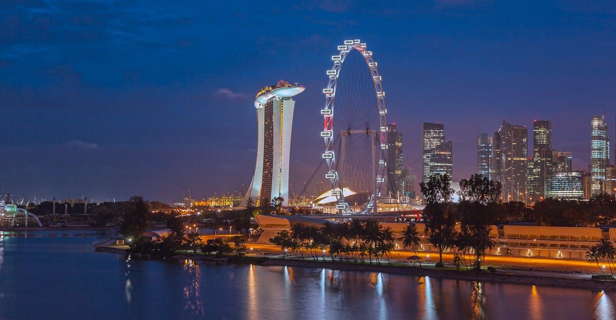
Singapore’s history began in the 14th century as a Malay trading port known as Temasek, but it declined and remained in obscurity for a long period after the 17th century. The foundations of modern Singapore were laid in 1819 when the British established it as a trading colony. The country gained independence in 1965 by separating from the Federation of Malaysia and has since exhibited rapid economic growth. Today, it is one of the world’s most prosperous nations, with strong international trade links and a high per capita GDP. The majority of its population is Chinese (76.2%), while Malays (15%), Indians (7.4%), and other ethnic groups (1.4%) enrich its cosmopolitan character; the official languages are English, Mandarin, Malay, and Tamil.
The foundation of its economic success lies in its strategic location, well-educated workforce, and business-friendly policies. Singapore is a global hub in sectors such as finance, technology, biotechnology, and logistics, and is known as one of Asia’s “Four Tigers.” The country has a fully urbanized structure, with the majority of its population concentrated along the southern coast and central areas. Governed by a parliamentary democracy, Singapore is notable for the uninterrupted rule of the People’s Action Party (PAP) since 1959. Investments in education, healthcare, and infrastructure support high living standards, while it faces demographic challenges such as an aging population and low fertility rates.
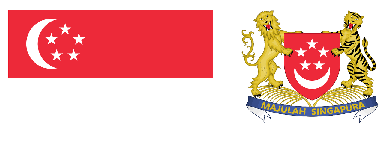
Singapore Flag and Coat of Arms
Name: Majulah Singapura ("Onward Singapore")
Composer and Lyricist: Zubir Said (1907-1987)
Adoption Date: 9 August 1965 (along with Singapore’s declaration of independence)
Official Status: National Anthem of the Republic of Singapore
Original Composition Year: 1956-57
Singapore’s national anthem, "Majulah Singapura" ("Onward Singapore"), was composed in 1956-57 during a period when the nation’s identity was being strengthened by composer and lyricist Zubir Said. It was first performed in 1958 at the Victoria Theatre. Originally composed as a theme for Singapore’s municipal government, it became a symbol aligned with the national consciousness of the time.
When Singapore gained internal self-government in 1959, minor modifications were made to the anthem, and it was re-performed alongside the adoption of the new national flag by presidential appointment. In 1965, upon Singapore’s declaration of independence, the anthem was formally adopted as the national anthem.
In 2000, a minor revision to the arrangement gave the anthem a more solemn and impactful tone. This new arrangement was composed by Phoon Yew Tien and recorded at the Victoria Concert Hall. It was officially launched in 2001.
Although Singapore has four official languages (Malay, English, Mandarin Chinese, and Tamil), the anthem is sung only in Malay. Malay is recognized as the national language and holds the status of the indigenous language. Translations in other languages are used solely for ease of reading. The first four lines of the anthem are also used as the presidential salute.
Singapore’s history is shaped by a rich past marked by its strategic location, influences from diverse civilizations, and its extraordinary transformation in the modern era. The island has long served as a vital stop along trade routes, evolving through colonialism and independence to become today’s global power.
The earliest known records of Singapore date back to the 3rd century, when Chinese sources referred to a settlement as "Pu-luo-chung," possibly derived from the Malay word "pulau," meaning island. However, information from this period is limited, and the island remained obscure for centuries. In the 13th and 14th centuries, Singapore emerged as Temasek or Tumasik and became part of the Srivijaya Empire centered in Sumatra. During this time, the island functioned as a port for merchants active along the maritime routes connecting the Malay Peninsula, Sumatra, and surrounding regions. Chinese traveler Wang Dayuan’s 14th-century records describe Temasek as a bustling hub filled with pirates and traders. According to legend, in 1299, Sang Nila Utama, a Srivijaya prince fleeing Palembang, claimed to have seen a lion on the island and named it "Singapura" (Lion City) in Sanskrit. However, archaeological evidence shows that lions never inhabited the region, suggesting the story is a symbolic origin myth. By the late 14th century, Temasek came under the control of the Majapahit Empire from Java and lost much of its commercial significance after being destroyed by Majapahit forces in 1377.
After the Majapahit attack, Singapore faded into obscurity during the 15th century with the rise of the Malacca Sultanate. During this period, the island persisted as a small fishing village, primarily inhabited by indigenous seafaring communities known as Orang Laut. Portugal’s capture of Malacca in 1511 revived Singapore’s strategic potential, but the island became more of a haven for pirates than an active port. Records indicate that the Portuguese burned the island in 1613, reflecting the chaotic nature of this era. Under the control of the Johor Sultanate from the 17th to 18th centuries, Singapore remained peripheral to regional trade, as commerce through the Strait of Malacca was channeled through ports such as Penang and Malacca. Until 1819, Singapore remained a sparsely populated, swampy island with only a few hundred indigenous inhabitants.
Singapore’s modern history began in the 19th century with British colonialism. In 1818, Sir Thomas Stamford Raffles of the British East India Company sought a base to counter Dutch dominance in the region and expand trade with China. On 29 January 1819, Raffles arrived in Singapore and found only about 150 locals. On 6 February 1819, he signed an agreement with Sultan Hussein Shah of Johor and Temenggong Abdul Rahman, granting the British the right to trade and settle on the island in exchange for an annual payment and protection. Raffles declared Singapore a free port, making it a duty-free trading center. The 1824 Anglo-Dutch Treaty (London Treaty) formalized British control over Singapore, with the Dutch relinquishing their claims over Malaya. In 1826, Singapore, Malacca, and Penang were united under the name "Straits Settlements" and administered by the British East India Company. After the Company’s dissolution in 1858, the region came under direct control of the Colonial Office in London in 1867. The opening of the Suez Canal in 1869 transformed Singapore into a vital bridge in global trade; its commerce in rubber, tin, and spices made it one of the most important ports in the British Empire in Asia. Immigrants from China, India, and the Malay Peninsula rapidly increased the population, turning Singapore into a cosmopolitan center.
At the beginning of the 20th century, Singapore became a strategic naval base for the British. During World War I, military installations such as Fort Canning and Changi were constructed to strengthen the island. However, World War II marked a dramatic turning point in Singapore’s history. On 8 February 1942, the Japanese army crossed the Johor Strait and launched an assault on the island. On 15 February, British General Arthur Percival surrendered with 80,000 troops. This event went down in history as "the greatest defeat of the British Empire." During the Japanese occupation (1942-1945), Singapore was renamed "Syonan-to" (Light of the South); civilians suffered from food shortages, mass executions such as the Sook Ching massacre, and forced labor. On 5 September 1945, following Japan’s surrender, the British returned, but the occupation had shattered confidence in colonial rule and ignited demands for independence. In 1946, the Straits Settlements were dissolved, and Singapore became a separate crown colony. The first elections were held in 1948; in 1955, limited self-government was achieved under the leadership of David Marshall. In 1959, the People’s Action Party (PAP), led by Lee Kuan Yew, won the general elections, and Britain granted Singapore full internal self-government, excluding defense and foreign affairs.
The independence movement gained momentum in the 1960s. A 1962 referendum led Singapore to join the Federation of Malaysia on 16 September 1963. However, this union proved unsustainable due to ethnic tensions (including the 1964 riots between Malays and Chinese), economic policy disagreements, and political rivalries. On 9 August 1965, Singapore separated from Malaysia and declared itself an independent republic. Under Prime Minister Lee Kuan Yew, the new state faced challenges such as unemployment, a housing crisis, and tense relations with neighboring countries (particularly Malaysia and Indonesia). Lee’s export-oriented industrialization policies, incentives for foreign investment, and disciplined governance transformed Singapore. In the 1960s, ports and refineries were developed; in the 1970s, finance, electronics, and petrochemicals emerged as key sectors. As a founding member of ASEAN in 1967, Singapore maintained close ties with the West while pursuing a neutral foreign policy during the Cold War. By the time Lee Kuan Yew stepped down in 1990, Singapore was among Asia’s leaders in per capita income. Under the leadership of Goh Chok Tong (1990-2004) and Lee Hsien Loong (2004-present), the country solidified its position as a global center for finance, technology, and innovation. Although Singapore faces new challenges in the 21st century such as an aging population, migration policies, and environmental issues, its rise from a small fishing village to a global power remains remarkable.
Singapore is an island nation located in Southeast Asia, at the southern tip of the Malay Peninsula, approximately 137 kilometers north of the Equator. Positioned at 1°22′N latitude and 103°48′E longitude, the country has a total land area of 719 km², comprising the main island of Pulau Ujong and about 60 surrounding smaller islands. Its strategic location draws attention as it lies at the eastern entrance of the Strait of Malacca, between the Malay Peninsula and Sumatra, part of Indonesia. Singapore is physically connected to Malaysia via the 14-kilometer-long Johor Causeway across the Johor Strait. It is also distinguished by its fully urbanized structure as a city-state. Its geographic features, both natural and human-made, present a model of maximum efficiency within a limited area.
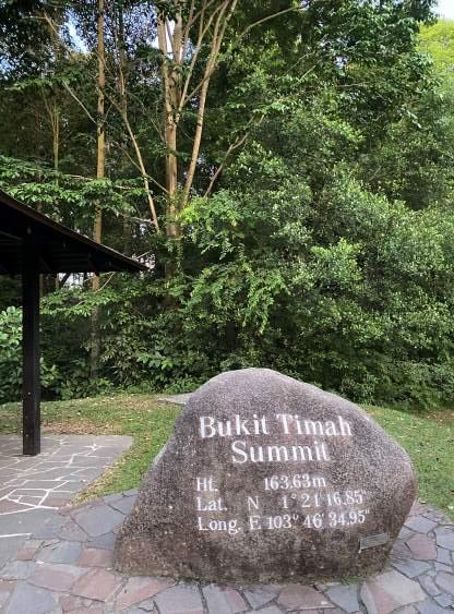
Singapore’s topography is generally low and flat, lacking prominent mountain ranges; however, a gently undulating plateau composed of granite rock formations and associated hills exists in the island’s center. The highest point in the country is Bukit Timah Hill, standing at 166 meters (some sources cite 163.63 meters), representing Singapore’s summit. Located in the island’s center, this hill is preserved within the Bukit Timah Nature Park and harbors remnants of tropical rainforest. The granite formation indicates ancient rock uplift rather than volcanic activity in the island’s geological past.
Other significant hills include Bukit Batok (140 meters) and Bukit Gombak (133 meters), both located in the western part of the island and surrounded by urban development. Mount Faber (105 meters), situated in the south, is known for its panoramic views and cable car system. Singapore’s average elevation does not exceed 15 meters, and these hills provide a gentle undulation to the island’s geography. Due to intense urbanization, these hills are typically integrated into parks or residential areas; for example, the Bukit Batok area is densely populated with modern housing. This structure, better described as "hilly" rather than mountainous, gives Singapore’s geography a simple yet functional character.
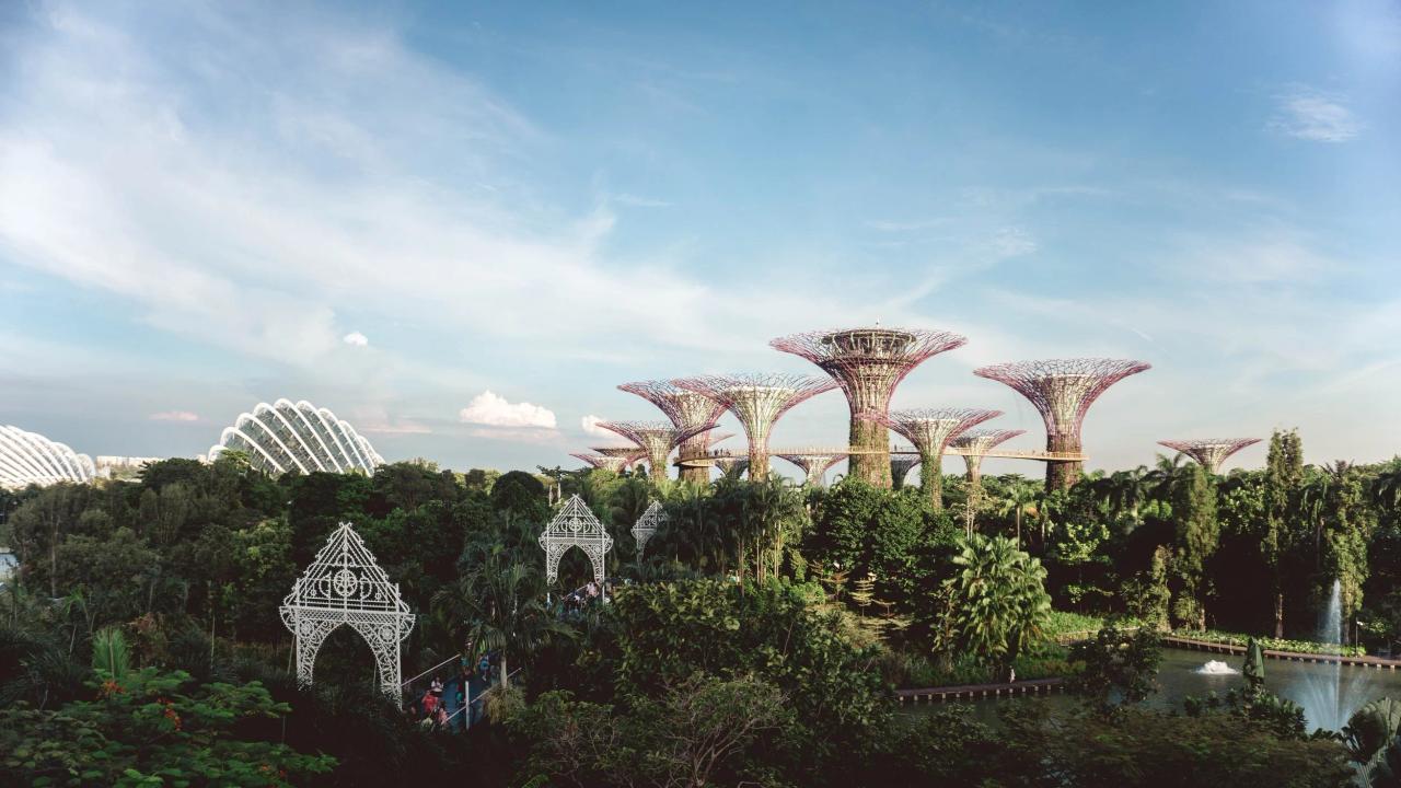
Plains cover a large portion of Singapore’s geography and form the foundation of urban development. The island is characterized by broad lowlands extending from the coast to the center; historically covered by swamps and mangrove forests, these areas were opened for settlement from the 19th century onward through drainage and land reclamation. The Southern Coast hosts Singapore’s widest and most densely populated plains; areas such as Marina Bay and Tanjong Pagar have been built on land reclaimed from the sea and are filled with financial centers and skyscrapers. The Eastern Coast (areas such as Changi and Bedok) is notable for its airport and housing projects, while the Northeast Region (Punggol, Sengkang) contains new plains developed for modern public housing. The Western Region features Jurong and Tuas, which are dominated by flatlands used for industrial and port activities. Land use for agriculture accounts for only 1% of the total area (0.9% arable land, 0.1% permanent crops), indicating that nearly all plains are utilized for urban purposes. Due to their proximity to sea level, these lowlands are protected against flooding by earth embankments, drainage channels, and pumps. Land reclamation has increased Singapore’s land area by 25%, and the plains have become the economic backbone of the island.
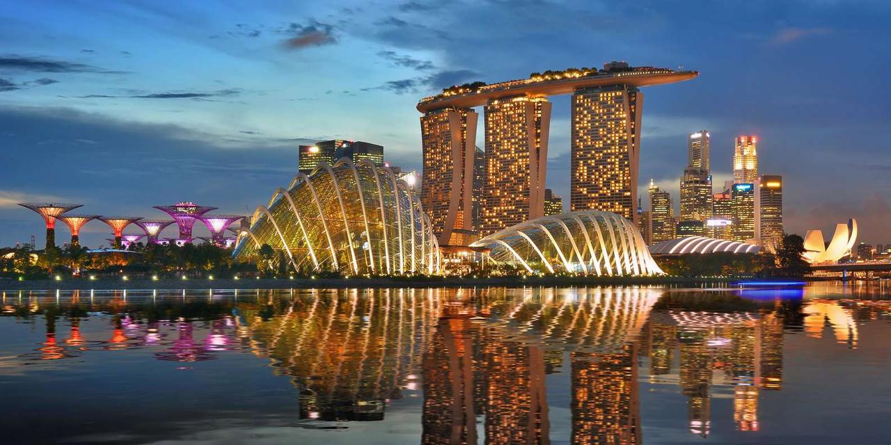
Singapore’s river system is limited due to its island structure and small land area; instead of large, long rivers, it has short, narrow, and mostly human-modified waterways. The most famous river is the Singapore River, approximately 3.2 kilometers long, flowing through the island’s center into Marina Bay. During the British colonial era, the Singapore River was the center of trade, lined with warehouses and vessels; today, after extensive cleanup, it is a tourist attraction surrounded by vibrant areas such as Clarke Quay.
Kallang River, at 10 kilometers, is Singapore’s longest waterway; it originates in the northeast, flows through residential areas such as Bishan and Toa Payoh, and reaches the Kallang Basin in the south. This river has been widened and supported by canals for flood control. Rochor River (1.6 km) and Geylang River (3 km) are smaller streams flowing through urban areas and are typically enclosed in concrete channels. Jurong River is located in the western industrial area of Jurong and plays a role in transporting industrial waste. Other rivers such as Sungei Pandan and Sungei Ulu Pandan are also found in the west and contribute to the drainage system. Annual rainfall of 2,200 millimeters increases river flow, but their short lengths and urban pressures have limited natural flow, transforming most into functional canals. Singapore’s rivers are used primarily for flood management and water collection rather than hydropower potential.
Singapore has no natural lakes; the island is poor in freshwater reservoirs, a condition historically linked to widespread swamps. However, numerous artificial reservoirs (dams) have been constructed to meet water needs and reduce flood risks. There are 17 major reservoirs across the country, forming the foundation of Singapore’s drinking water supply. MacRitchie Reservoir, built in 1867, is one of the oldest and largest reservoirs, located in the island’s center and surrounded by rainforest and walking trails. Upper Seletar Reservoir, in the north, is known for its iconic 40-meter-high tower and was completed in 1969. Lower Peirce Reservoir, near MacRitchie and built in 1912, offers a tranquil natural setting. Bedok Reservoir, in the east, was created in 1986 by filling an old sand quarry and lies within an urban area. Marina Barrage, completed in 2008, is a dam that separates a freshwater basin from the sea; it serves both water storage and flood control functions. These reservoirs collect rainwater and meet approximately 50% of Singapore’s water demand; the remainder is supplied through imports from Malaysia, NEWater (recycled water), and desalination. Reservoirs are integrated with parks and recreational areas, contributing to the urban landscape.

Singapore’s geography extends beyond mountains, plains, rivers, and lakes; its tropical climate, coastal structure, and environmental dynamics also play a significant role. The 193-kilometer coastline was historically covered by mangrove forests and swamps; however, land reclamation has transformed these areas into ports (Jurong, Keppel, Pulau Bukom), beaches (Sentosa), and residential zones. The country’s natural resources are limited to fishing and deep-water ports; forest cover accounts for only 3.3% of the land, while 95.7% is designated for urban use. The equatorial climate features year-round temperatures of 26–28°C, humidity above 80%, and two monsoon seasons (northeast: December–March; southwest: June–September). Sudden floods (flash floods) and seasonal haze from Indonesia are natural hazards. Water pollution, industrial waste, and limited freshwater sources present environmental challenges; however, Singapore stands out with a 61% recycling rate for waste (2015). Land reclamation has increased the island’s size by 25% and created artificial islands such as Jurong Island.
Singapore’s geography demonstrates how a small island nation optimizes its natural features. Low hills, broad plains, regulated rivers, and artificial reservoirs provide a functional foundation for both life and the economy within a limited area. Through its strategic location and effective planning, Singapore has become a global center despite its geographic constraints.
Singapore is an island nation located at the southern tip of the Malay Peninsula in Southeast Asia. Its geographic position, at the intersection of vital sea routes, has given it immense commercial and military significance throughout history. With a land area of 734.3 km², Singapore’s boundaries are defined by its entirely insular structure and its relationships with neighboring countries.
Singapore has no land border; it is a fully insular nation surrounded entirely by water. Its total border length is recorded as 0 kilometers, as the only physical connection is the man-made Johor Causeway. Maritime boundaries are defined by a 193-kilometer coastline encompassing the main island of Pulau Ujong and approximately 60 smaller surrounding islets. Singapore’s maritime boundaries are bordered to the north by the Johor Strait, to the south and west by the Strait of Malacca, and to the east by the South China Sea. The Johor Strait is a narrow waterway separating Singapore from Malaysia, narrowing to as little as 600 meters in places. The Strait of Malacca separates Singapore from Sumatra, part of Indonesia, and is one of the world’s busiest maritime trade routes. Singapore’s maritime jurisdiction areas are defined under international law: territorial waters extend 3 nautical miles (approximately 5.6 km), and the exclusive fishing zone extends within and beyond limits determined by treaties and practices. Land reclamation projects have increased Singapore’s land area by 25%, artificially expanding its boundaries; for example, areas such as Jurong Island and Tuas have been created from reclaimed sea land.
Singapore’s boundaries are shaped not by natural barriers but by water. However, these maritime boundaries have occasionally led to disputes with neighboring countries. For instance, past disagreements have arisen with Malaysia over Pedra Branca (a rocky islet) and with Indonesia over certain maritime boundaries; these issues have generally been resolved through platforms such as the International Court of Justice (ICJ). In 2008, the ICJ ruled that Pedra Branca belongs to Singapore, but sovereignty over the nearby Middle Rocks and South Ledge was partially awarded to Malaysia. Singapore’s boundaries reinforce its role in global trade by enabling control over its strategic ports and sea lanes.
Singapore has only two neighboring countries: Malaysia and Indonesia. This neighborly relationship is defined by maritime boundaries and close geographic proximity, despite the absence of a physical land connection.
Singapore’s boundaries and neighbors directly influence its global significance. The Strait of Malacca, through which 40% of global oil trade passes, makes Singapore a control point for this traffic. With a commercial fleet of 3,202 vessels (2023), Singapore leads in maritime trade, and its ports (Jurong, Keppel, Pulau Bukom) convert its relationships with neighbors into economic advantages. The proximity of Singapore’s maritime boundaries to Malaysia and Indonesia shapes its security policies; the Singapore Armed Forces and the Maritime Security Task Force (MSTF) patrol these waters. Moreover, Singapore’s relations with its neighbors reflect mutual dependencies on issues such as water resources (the 1962 Water Agreement with Malaysia), labor mobility, and regional stability.
Singapore’s boundaries and neighbors demonstrate how an island nation transforms geographic isolation into an advantage. Its water-surrounded structure, lack of a land border, and position between Malaysia and Indonesia keep Singapore both vulnerable and strategically positioned. This balance, maintained through effective governance and diplomacy, has enabled Singapore to become a global center for trade and finance.
Singapore is an island nation located in Southeast Asia, approximately 137 kilometers north of the Equator at latitude 1°22′N. Due to its location, it exhibits a typical equatorial climate. This climate is characterized by high temperatures, high humidity, and abundant rainfall throughout the year; seasonal variations are determined not by traditional seasons but by monsoon periods and transitional phases. Singapore’s climate is shaped by its geographic structure and its position surrounded by seas; as a tropical region, the island is largely protected from natural disasters, though it faces certain environmental challenges.
Singapore’s climate exhibits the classic features of equatorial regions: stable high temperatures, high humidity levels, and consistent rainfall throughout the year. The average daily temperature ranges between 26–28°C; minimum temperatures typically fall between 23–25°C, while maximums reach 31–34°C. Temperature differences between day and night or across the year are only a few degrees, indicating no seasonal variation. Humidity levels are generally above 80% and often approach 100%, especially during rainy periods, creating a stifling sensation. The annual average rainfall is approximately 2,200 millimeters, making it a vital source for Singapore’s water collection systems. The climate is moderated by the island’s structure and surrounding seas; ocean currents and sea surface temperatures minimize temperature fluctuations. While Singapore’s climate provides a suitable environment for tropical rainforest development, urbanization has significantly reduced this natural cover.
Singapore’s equatorial climate exposes the island nation to certain natural hazards. The most common risk is flash floods; heavy rainfall causes flooding in low-lying areas where drainage systems are insufficient. The government has addressed this issue by developing comprehensive drainage channels, pumps, and reservoirs (e.g., Marina Barrage). Another significant environmental problem is seasonal haze; smoke from forest fires in Indonesia, particularly between June and September, degrades Singapore’s air quality. PM2.5 (particulate matter) levels during these periods can reach 50–100 µg/m³, increasing health risks. Tropical storms or typhoons are rare in Singapore due to its proximity to the Equator; the island is protected from major storms affecting neighboring regions such as the Philippines or Vietnam. However, climate change poses long-term threats such as rising sea levels and increasing temperatures that could impact Singapore’s future.
Singapore’s climate profoundly affects both the natural environment and human life. Tropical conditions historically supported dense rainforests and mangrove swamps across the island; however, urbanization has reduced this cover to just 3.3% (2018). Conservation areas such as Bukit Timah and Central Catchment strive to preserve this natural heritage. The climate has limited agriculture (only 1% of land is arable) but supported fishing. Socially, high humidity and temperatures make living conditions challenging; thus, air-conditioned buildings and public transportation are widespread. Year-round rainfall sustains water collection systems; 17 reservoirs store rainwater to meet 50% of drinking water needs. The climate also influences tourism; tropical beaches (Sentosa) and green spaces (Botanic Gardens) attract visitors throughout the year.
Singapore’s climate, with its equatorial characteristics, creates a stable, predictable, and tropical pattern. This climate, shaped by monsoon periods and transitional phases, defines both the natural structure and modern life of the island nation. Despite challenges such as floods and haze, effective infrastructure and planning have enabled Singapore to turn these conditions into advantages.
Singapore, located approximately 137 kilometers north of the Equator at 1°22′N latitude, exhibits a typical equatorial climate. This climate is characterized by high temperatures, high humidity, and abundant rainfall throughout the year; however, instead of the classical four seasons, it is defined by monsoon periods and the transitional phases between them. Singapore’s rainfall and seasonal characteristics are shaped by its island structure, its position surrounded by seas, and its tropical geography.
Singapore receives consistent and abundant rainfall throughout the year; the annual average rainfall is approximately 2,200 millimeters. This provides a vital source for the island’s water collection systems while simultaneously increasing the risk of flash floods. Rainfall typically occurs as short but intense downpours (showers), often accompanied by thunder. Due to its tropical climate, rainfall distribution is relatively even throughout the year; however, it concentrates during monsoon periods. Daily rainfall amounts, especially during peak monsoon periods, can reach 50–100 millimeters. Approximately 70–80% of rainfall originates from local convection (cloud formation due to rising warm air) and moisture brought by monsoon winds. Singapore’s island structure and surrounding seas ensure continuous moisture replenishment. Rainfall typically intensifies in the afternoon and early evening (14:00–18:00), triggered by the day’s peak heat causing air to rise. Urbanization accelerates surface runoff, and drainage systems play a critical role in directing this water to reservoirs.
Singapore does not have the classical four seasons (spring, summer, autumn, winter); instead, its climate is defined by two distinct monsoon periods and the inter-monsoon periods between them. Temperatures remain constant at 26–28°C year-round, and humidity levels stay between 80–100%; thus, seasonal differences are perceived through rainfall patterns and wind directions.
Impacts of Rainfall and Seasons
Singapore’s rainfall and seasonal characteristics combine the stability of its equatorial climate with monsoon dynamics. This structure, shaped by the intense rainfall of the northeast monsoon, the lighter showers of the southwest monsoon, and the sudden rains of transitional periods, affects both the natural and urban life of the island nation. Effective infrastructure and planning have turned these climatic conditions to Singapore’s advantage.
Singapore is an island nation located at the southern tip of the Malay Peninsula in Southeast Asia. Despite its small land area of 734.3 km², it has a population of approximately 5,940,000, making it one of the most densely populated countries in the world. With approximately 8,300 people per square kilometer, this reflects Singapore’s fully urbanized structure. Its demographics exhibit a multicultural society, rapid urbanization, low fertility rates, and migration-driven characteristics.
Singapore’s total population, according to 2024 estimates, is 6,028,459, with nearly equal gender distribution: 3,013,630 males and 3,014,829 females (gender ratio: 1 male/1 female). The population growth rate is 0.87% (2024), placing it 105th globally and indicating that growth is largely supported by migration. The birth rate is 8.8 births per 1,000 people (203rd place), while the death rate is 4.3 deaths per 1,000 people (209th place), both very low. The net migration rate is 4.2 migrants per 1,000 people (24th place), reflecting Singapore’s dependence on foreign labor. The population has a 100% urban distribution, and the capital, Singapore, encompasses the entire island as a single urban area of 6.081 million (2023). Population density is especially high along the southern coasts and central areas (e.g., Orchard Road, Marina Bay).
Singapore’s age structure reveals a rapidly aging population:
The median age is 39.4 years (males: 38; females: 40.6), ranking 68th globally. The total dependency ratio is 35.4%; the youth dependency ratio is 16.2%, the elderly dependency ratio is 19.1%, and the potential support ratio (number of elderly per working person) is 5.2 (2021). Singapore has one of the world’s lowest total fertility rates: 1.17 children per woman (225th place, 2024), far below the replacement level of 2.1. The aging population is projected to increase by 21% between 2019 and 2050, becoming one of the world’s largest elderly populations (UN data). This situation creates economic pressures such as a shrinking workforce and increased elderly care costs.
Singapore is a multi-ethnic society, with its population divided into four main categories:
This diversity was shaped by migration beginning in the British colonial era. Chinese arrived as laborers from the 1820s and formed the majority of the population by 1860. Malays, as the indigenous population, have deep historical roots, while Indians were typically brought to work in plantations and construction. The "Others" category includes international migrants attracted by Singapore’s status as a global financial hub.
Singapore’s official languages reflect its multicultural structure:
Religious distribution is also diverse:
Malay holds the status of national language, while English serves as the common language of communication and dominates education.
Migration is a fundamental factor shaping Singapore’s demographics. In the 19th century, the population grew through labor migration from China, India, and the Malay Peninsula; after World War II, the focus shifted to professional migrants. In 2015, foreign-born individuals constituted 46% of the population. The government incentivizes highly skilled workers with permanent residency or citizenship, while imposing restrictions on low-skilled workers (construction, service sectors), including bans on family sponsorship and employer levies. Simultaneously, emigration from Singapore to countries abroad in fields such as finance, IT, and medicine is increasing; these movements are often permanent.
Singapore’s life expectancy is 86.7 years (males: 84; females: 89.5; 2024), ranking second globally. The infant mortality rate is 1.5 per 1,000 live births (226th place), and the maternal mortality rate is 7 per 100,000 live births (157th place), both very low. Health expenditures account for 5.6% of GDP (2021); the doctor density is 2.46 per 1,000 people, and hospital bed density is 2.5 per 1,000 people (2019). The literacy rate in education is 97.5% (males: 98.9%; females: 96.1%; 2019), with an average of 17 years spent in school (2020). These indicators reflect Singapore’s high living standards.
In Singapore, marriage age is delayed (average age at first childbirth: 30.5; 2015), and single-person households are increasing. Obesity rates are 6.1% (2016), alcohol consumption is 1.81 liters per person (2019), and smoking prevalence is 16.5% (2020), all relatively low. The Gini coefficient is 45.9 (2017), indicating high income inequality; the lowest 10% of earners receive 1.6% of income, while the highest 10% receive 27.5%. Malays have lower income levels compared to Chinese and Indians (2005: Malay households: SGD 3,050; Chinese: SGD 4,570; Indian: SGD 4,120).
Singapore has one of the world’s lowest total fertility rates at 1.17 (2024), preventing population renewal. Women’s educational and career priorities delay marriage and childbearing. The aging population (14.3% aged 65+) reduces the workforce while increasing social security burdens. Migration offsets this gap, but cultural integration and foreign worker policies remain controversial.
Singapore’s demographics reflect multiculturalism, urbanization, and modern life. Despite challenges such as low fertility and aging, a dynamic population structure is maintained through migration and high living standards. These characteristics make Singapore unique both regionally and globally.
Although Singapore is a small island nation in Southeast Asia, it plays an active and balanced role in international relations. With a land area of 734.3 km² and a population of approximately 6 million (2024 estimate), Singapore’s foreign policy is designed for survival and influence on the global stage. Its core principles include military deterrence, good relations with neighbors, commitment to ASEAN, an open market economy, and support for a multilateral trading system. While maintaining a delicate balance between major powers such as the United States and China, Singapore focuses on regional and global cooperation.
Singapore’s foreign policy is shaped by pragmatism and realism. As a small state, Singapore adopts a realistic perspective toward regional and global dynamics, embracing the following fundamental principles:
These principles align Singapore’s foreign policy with the goals of a small state: protecting its interests and becoming a global actor.
Singapore follows a careful balancing act in its relations with superpowers such as the United States and China:
Singapore avoids taking sides between these two powers; for example, in disputes over the South China Sea, it prefers to remain neutral and act as a mediator.
Singapore maintains close ties with its neighbors and ASEAN (Association of Southeast Asian Nations) countries:
CFR. "Singapore: Small Asian Heavyweight." Accessed March 16, 2025.https://www.cfr.org/backgrounder/singapore-small-asian-heavyweight.
Forbes. "Singapore." Accessed March 16, 2025.https://www.forbes.com/places/singapore/.
Lonely Planet. "Battlebox." Accessed March 16, 2025.https://www.lonelyplanet.com/singapore/singapore-city/colonial-district-the-quays/attractions/battlebox/a/poi-sig/365751/1322394
Lonely Planet. "Gardens by the Bay." Accessed March 16, 2025.https://www.lonelyplanet.com/singapore/singapore-city/colonial-district-the-quays/attractions/gardens-by-the-bay/a/poi-sig/1490451/1322394.
Lonely Planet. "Singapore Zoo." Accessed March 16, 2025.https://www.lonelyplanet.com/singapore/singapore-city/northern-central-singapore/attractions/singapore-zoo/a/poi-sig/365409/1323900.
Lonely Planet. "Singapore." Accessed March 16, 2025.https://www.lonelyplanet.com/singapore.
Ministry of Foreign Affairs, Singapore. "About Singapore Foreign Policy." Accessed March 16, 2025.https://www.mfa.gov.sg/Overseas-Mission/Bangkok/About-Singapore/Foreign-Policy.
Singapore Tourism Board. "Top Things to Do." Accessed March 16, 2025.https://www.visitsingapore.com/things-to-do/top-things-to-do/?anchorid=unique-experiences.
Trading Economics. "Singapore Inflation CPI." Accessed March 16, 2025.https://tradingeconomics.com/singapore/inflation-cpi
World Bank. "Singapore Overview." Accessed March 16, 2025.https://www.worldbank.org/en/country/singapore/overview.
İsmail Hakkı Göksoy. "SİNGAPUR." *TDV İslâm Ansiklopedisi.* Accessed March 16, 2025.https://islamansiklopedisi.org.tr/singapur#2.

Republic of Singapore (Singapur Cumhuriyeti, Republik Singapura)
GDP per Capita | 84.734 USD (2023) | ||||||||
|---|---|---|---|---|---|---|---|---|---|
GDP | 501.43 billion USD (2023) | ||||||||
Ethnic Structure | Chinese (%76.2) Malay (%15.0) Indian (%7.4) Other (%1.4) | ||||||||
Climate | Tropical climate hot and humid throughout the year monsoon seasons (November–March and June–September) | ||||||||
Internet Domain | .sg | ||||||||
Telephone Code | +65 | ||||||||
Time Zone | UTC+8 (Singapore Standard Time - SST) | ||||||||
Currency | Singapore Dollar (SGD) | ||||||||
Population | 5.94 million | ||||||||
Area (km²) | 734.3 | ||||||||
Independence | 9 August 1965 (separation from Malaysia) | ||||||||
Prime Minister | Lawrence Wong (as of 15 May 2024) | ||||||||
President | Tharman Shanmugaratnam (as of 14 September 2023) | ||||||||
System of Government | Parliamentary republic | ||||||||
Official Language | Malay (national language) English Chinese (Mandarin) Tamil | ||||||||
Capital | Singapore (City-state) | ||||||||
National Anthem of Singapore
History
Early Period and Temasek Era
Years of Obscurity and the Malacca Period
20th Century: War, Occupation, and the Struggle for Autonomy
Independence and the Rise of Modern Singapore
Geography
Mountains and Hills
Plains and Lowlands
Rivers and Streams
Lakes and Water Bodies
Additional Geographic Features and Environmental Conditions
Boundaries and Neighbors
Strategic Context
Climate
General Characteristics
Natural Hazards and Environmental Impacts
Geographical and Societal Impacts of Climate
Climate Data and Comparisons
Rainfall and Seasonal Characteristics
Rainfall Characteristics
Seasonal Characteristics: Monsoons and Transitional Periods
Data and Comparisons
Demographics
Population Structure and Growth
Age Distribution and Aging
Ethnic Composition
Language and Religion
Migration and Population Dynamics
Health and Education Indicators
Social and Economic Conditions
Demographic Challenges
International Relations
Fundamental Principles of Foreign Policy
Relations with Major Powers
Regional Relations