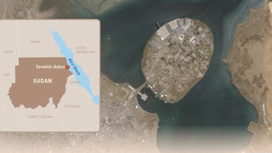
This article was automatically translated from the original Turkish version.
Location | Red Sea Sudan coast | ||||||||
|---|---|---|---|---|---|---|---|---|---|
Historical Significance | Ottoman strategic port (16th–19th centuries) | ||||||||
Function | Connection point for Africa–Hejaz pilgrimage and trade routes | ||||||||
After the 19th Century | Loss of port significance due to British influence | ||||||||
After 2017 | Restoration efforts through Türkiye–Sudan cooperation (TİKA) | ||||||||
Sevakin Island is a strategically significant island located in the Red Sea, near the northern coast of Sudan in northeastern Africa. With an area of approximately 3 km², the island has historically occupied a critical position along the north-south trade routes of the Red Sea, serving as a key node for maritime control and security. Its geographic location has made it an ideal platform for the construction of port facilities and military use. Throughout history, the island has been utilized by various civilizations and states for different purposes, particularly becoming a central hub for both commercial and military activities during the Ottoman Empire.
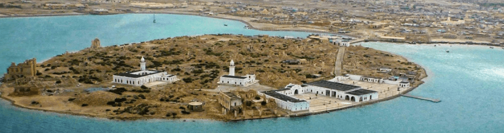
Sevakin Island (AA)
Sevakin Island is situated approximately 6–7 kilometers off the western coast of the Red Sea, near the northeastern border of Sudan. Due to its position along north-south maritime trade routes, the island holds strategic importance for both port operations and military surveillance.
Physically, the island is a small landmass composed of volcanic and sedimentary rock formations, covering an area of about 3 km². Its coastline is characterized by coves and shallow water areas capable of forming natural harbors. These features have influenced the construction of ports and piers throughout history. The island’s topography consists of gentle slopes and plateaus rising from the coast toward the interior; this terrain has provided specific advantages for both settlement and defense.
In terms of climate, the island lies within the hot and arid tropical zone typical of the Red Sea. Summers are marked by high temperatures and humidity, while winters are relatively mild with low precipitation. These climatic conditions have resulted in limited freshwater resources and restricted possibilities for permanent settlement or agricultural activity on the island.
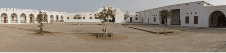
Sevakin Island (AA)
In addition to its natural environment, the waters surrounding the island are bordered by coral reefs and shallow lagoons; this has created navigational challenges for maritime traffic while enabling fishing and small-scale marine resource utilization near the island.
Sevakin Island has gained strategic and economic importance throughout history due to its location at the crossroads of Red Sea and East African trade routes. During ancient and medieval periods, it served as a key stopover for Arab, African, and Indian Ocean-based merchants, fulfilling both port functions and a central role in regional control.
Before the 16th century, Sevakin was under the influence of local Arab and African states in the region. The island held a critical position in securing trade routes between Ethiopia and Sudan and in controlling maritime traffic in the Red Sea. Although its harbor was shallow and narrow, it was suitable for small and medium-sized trading vessels.
In the early 16th century, the Ottoman State began using Sevakin as a strategic base to regulate maritime and overland trade in the Red Sea region and to secure the pilgrimage routes to Hejaz and Mecca. Under Ottoman administration, the island functioned as both a military and commercial center.
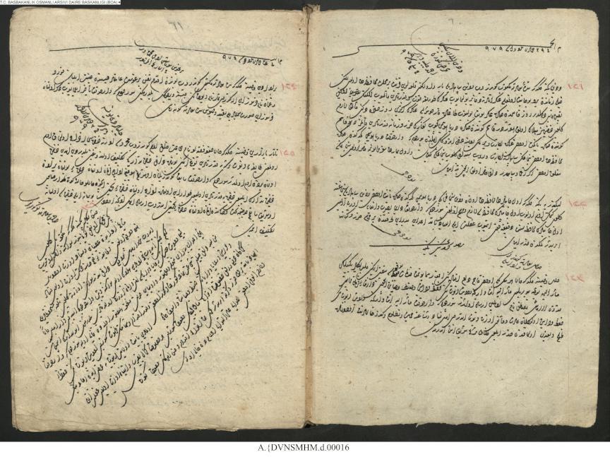
Document dated 1571 bearing the title "Decree to the Governor of Habesh" detailing how local tribes attacked Sevakin but order was restored and peace secured, as reported to the Grand Vizier (
Document sent to the Grand Vizier stating that order was restored and peace secured after local tribes attacked Sevakin (AA)
By the late 19th century, power dynamics in the Red Sea had shifted, and Ottoman control over Sevakin Island weakened. From 1882 onward, the island came under British control, leading to a reconfiguration of its administrative and commercial role. The British administration, seeking to diminish the island’s regional significance, promoted the emerging Port Sudan as the primary port and implemented policies to relegate Sevakin to a secondary harbor function.
The British period also brought physical changes to the island’s infrastructure. Existing structures were repurposed for administrative use; Ottoman architectural layouts were altered to accommodate new functions; however, conservation and restoration efforts remained limited, resulting in the deterioration and eventual ruin of many buildings.
The legal end of Ottoman sovereignty over Sevakin coincided with the aftermath of the Treaty of Lausanne. Following Sudan’s independence in 1956, the island remained within Sudan’s national borders. Since then, Sevakin has largely lost its former commercial function; economic activity shifted to Port Sudan, and the island transformed into a settlement experiencing population decline.
In the 17th century, Evliya Çelebi visited Sevakin and described it as a vibrant port and commercial center. The settlement served as a hub where goods from interior Africa were collected and transshipped via the Red Sea to other ports. It also experienced significant human traffic as one of the key transit points for pilgrims undertaking the Hajj.
Evliya Çelebi’s accounts highlight three key aspects:
Evliya Çelebi’s descriptions demonstrate that Sevakin functioned as an international hub of trade and cultural exchange.
Ottoman control, though relatively brief, led to the establishment of an administrative and social structure on the island. The local population was in direct contact with Ottoman military and administrative presence; some structures, including small mosques and storage buildings, were constructed during this period. These buildings formed the physical infrastructure supporting the island’s religious and commercial functions.
Throughout the Ottoman period, Sevakin Island was regarded as a strategic naval base along the Red Sea and Indian Ocean trade routes. It maintained its significance in controlling trade connections between Europe and Africa and in providing security and logistical support for Ottoman-Hejaz relations.
Commercial activities on Sevakin involved the transport of both land- and sea-based goods. Major traded commodities included:
Throughout the Ottoman period, Sevakin Island served as a critical military center for securing naval dominance over the Red Sea and the eastern African coast and for safeguarding the pilgrimage routes to Hejaz and Mecca. Due to its geographic location and port capacity, the island was regarded by the Ottoman administration as an ideal base for monitoring seaborne threats, regulating trade routes, and managing relations with local powers.
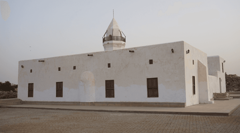
Sevakin Island (AA)
The Ottoman administration organized the island’s defense by stationing a small garrison. The garrison’s primary duties included:
The garrison structure combined military fortifications with the natural terrain, strategically positioned at key defensive points around the island.
The fortifications built on Sevakin Island were designed to defend against seaborne assaults and to maintain internal military control. These defenses were supported by small artillery batteries, watchtowers, and garrison compounds, transforming the island into a compact and resilient defensive system capable of withstanding threats from both sea and land.
The island served as a central base for controlling the main north-south maritime routes of the Red Sea. Through its military presence, the Ottoman administration fulfilled the following responsibilities:
These activities ensured the integration of military and economic control.
Sevakin Island functioned as a hub supporting communication between other Ottoman bases in the Red Sea and administrative units in Hejaz. Logistically, the island served as:
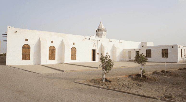
Sevakin Island (AA)
Throughout history, Sevakin Island has fulfilled economic and commercial functions as a vital control point along Red Sea trade routes. Especially between the 16th and 19th centuries, the island served as an intermediate port, customs checkpoint, and storage facility in regional and international trade.
Small-scale piers and storage facilities were constructed at the island’s ports, with loading and unloading operations organized according to vessel type. Coastal infrastructure was positioned to accommodate both small boats and medium-sized merchant ships, ensuring safe berthing. The port and storage infrastructure was systematically organized to maintain continuous commodity flows, with specialized storage methods developed for goods such as spices and grain.
Sevakin Island established direct economic links with the coastal areas and inland regions of neighboring Africa. Trade conducted through the island diversified local markets and generated income sources for regional populations. This interaction strengthened economic ties between Sevakin and the coastal towns and hinterlands of the Red Sea.
Alçı, Güneş, and Nurettin Gemici. “Sevâkin’de Osmanlılara Atfedilen İki Ev Örneği.” *İslam Tetkikleri Dergisi – Journal of Islamic Review* 12, no. 1 (2022): 473–517. Accessed October 27, 2025.https://dergipark.org.tr/en/download/article-file/2038297
Anadolu Ajansı. "Afrika'nın Kapısı: Sevakin Adası." Accessed October 27, 2025.https://www.aa.com.tr/tr/dunya/afrikanin-kapisi-sevakin-adasi/1015097
Anadolu Ajansı. “Kızıldeniz’de Bir Türk Adası: Sevâkin.” Anadolu Ajansı. Accessed October 27, 2025.https://www.aa.com.tr/tr/analiz-haber/kizildeniz-de-bir-turk-adasi-sev%c3%a2kin/1016929
Anadolu Ajansı. “Osmanlı'nın Sevakin Adası'ndaki Faaliyetleri Tarihi Belgelerde.” Accessed October 27, 2025.https://www.aa.com.tr/tr/turkiye/osmanlinin-sevakin-adasindaki-faaliyetleri-tarihi-belgelerde/1030436
Orhun, Fatma Çalık. “Sevâkin Adası ve Türkiye’nin Afrika Politikası.” *International Social Sciences Studies Journal (SSS Journal)* 5, no. 35 (2019): 2500-2511. Accessed October 27, 2025.https://sssjournal.com/files/sssjournal/882781607_03_5-35.ID1475_Orhun_2500-2511.pdf
Orhun, Fatma Çalık. “Suakin: Osmanlı İmparatorluğu’nda Kuzeydoğu Afrika Limanı.” *Tarih ve Gelecek Dergisi* 5, no. 1 (2019): 63–78. Accessed October 27, 2025.https://dergipark.org.tr/tr/download/article-file/704586
T.C. Turkish Cooperation and Coordination Agency (TİKA). "TİKA Sevakin Adası’ndaki ilk çalışmalarını tamamladı." TİKA. Accessed October 25, 2025.https://tika.gov.tr/detail-tika_sevakin_adasi_ndaki_ilk_calismalarini_tamamladi/
Çetin, Firdevs. “Evliya Çelebi İle Nil Boyunca Seyahat / Travel Along the Nile with Evliya Çelebi.” *Akademik İncelemeler Dergisi* 10, no. 1 (2015): 1–29. Accessed October 27, 2025.https://dergipark.org.tr/tr/download/article-file/17937

Location | Red Sea Sudan coast | ||||||||
|---|---|---|---|---|---|---|---|---|---|
Historical Significance | Ottoman strategic port (16th–19th centuries) | ||||||||
Function | Connection point for Africa–Hejaz pilgrimage and trade routes | ||||||||
After the 19th Century | Loss of port significance due to British influence | ||||||||
After 2017 | Restoration efforts through Türkiye–Sudan cooperation (TİKA) | ||||||||
Geographic Location and Physical Characteristics
Historical Significance
Status Before the Ottoman Period
Ottoman Period and Administrative Control
British Administration and Post-Ottoman Political Status
Evliya Çelebi’s Observations on Sevakin
Cultural and Social Impacts
Strategic Importance
Commercial Activities
Ottoman Military and Strategic Activities
Military Base and Garrison Structure
Fortifications and Defensive Arrangements
Maritime Security and Trade Control
Strategic Communication and Logistics
Economic and Commercial Functions
Structural and Technological Features of Trade
Interaction with the Regional Economy