


This article was automatically translated from the original Turkish version.
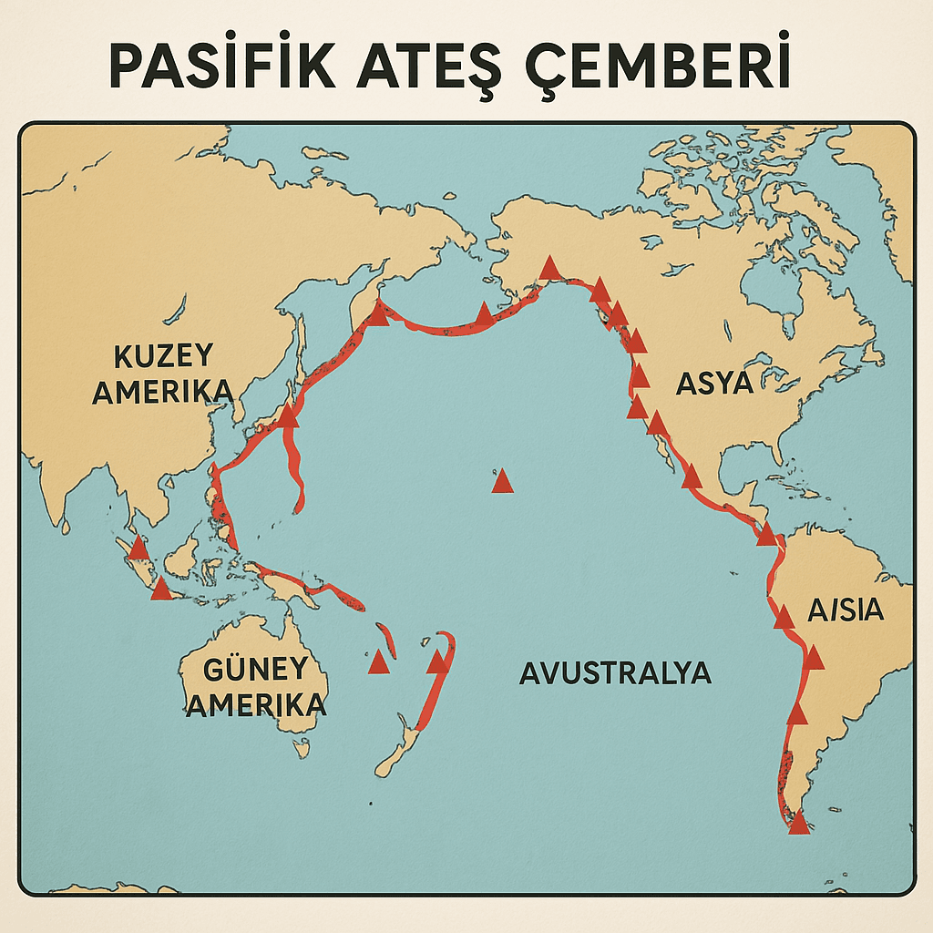
Pacific Ring of Fire
Definition | A tectonic belt shaped like a horseshoe extending around the Pacific Ocean with high volcanic and seismic activity | ||||||||
|---|---|---|---|---|---|---|---|---|---|
Length | Approximately 40,000 kilometers | ||||||||
Percentage of Active Volcanoes | About 75% of the world's active volcanoes are located in this region | ||||||||
Earthquake Rate | Approximately 90% of the world's earthquakes occur in the Pacific Ring of Fire | ||||||||
Plate Movements | Subduction zones are the most common type of movement; other movements include transform faults and seafloor spreading at ocean ridges | ||||||||
Important Regions | Japan, Indonesia, the Philippines, Alaska, California, Chile, New Zealand | ||||||||
Important Natural Disasters | Destructive earthquakes and tsunami events such as the 2011 Tōhoku earthquake (Japan, magnitude 9.0) | ||||||||
Pacific Ring of Fire is a roughly 40,000-kilometer horseshoe-shaped tectonic belt surrounding the Pacific Ocean characterized by high levels of seismic and volcanic activity. This region hosts approximately 75 percent of the world’s active volcanoes and accommodates about 90 percent of all earthquakes globally. As one of the most tectonically active areas on Earth, the Pacific Ring of Fire is considered one of the most prominent regions where the plate tectonics theory is clearly observable.
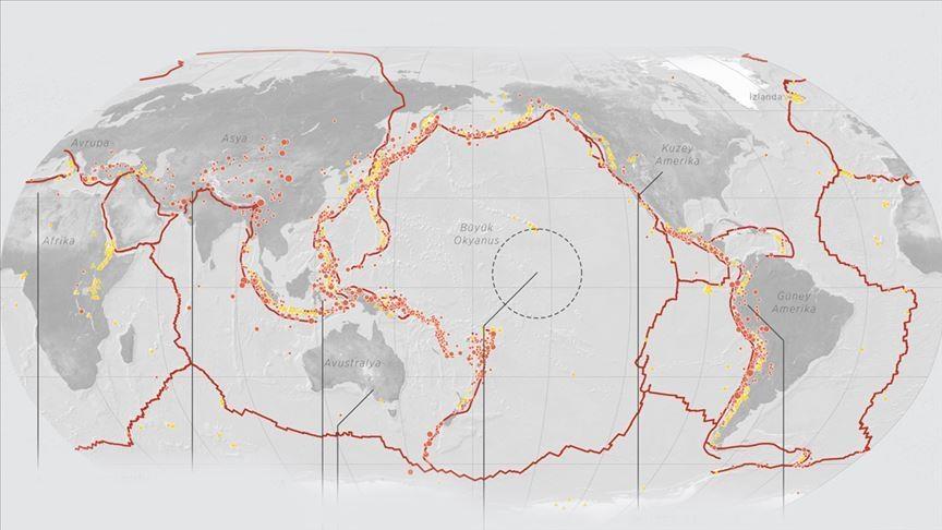
Pasifik Ateş Çemberi (AA)
The formation of the Pacific Ring of Fire is evaluated within the framework of the plate tectonics theory. Earth’s lithosphere consists of tectonic plates of varying sizes that are in constant motion. The Pacific Plate is bordered by the North American, South American, Nazca, Cocos, Philippine, Australian, Antarctic and Eurasian plates. These boundaries are predominantly subduction zones, where the denser oceanic plate sinks beneath the lighter continental plate. This process, known as subduction, triggers magma generation under high pressure, leading to volcanism.
The types of plate interactions observed along the Pacific Ring of Fire include:
The Pacific Ring of Fire is one of the world’s most active seismic zones. According to the United States Geological Survey (USGS), the earthquakes occurring in this region exceed global averages in both frequency and magnitude. The 9.0 magnitude Tōhoku earthquake in Japan in 2011 and the subsequent tsunami provide a striking example of the destructive potential of this ring.
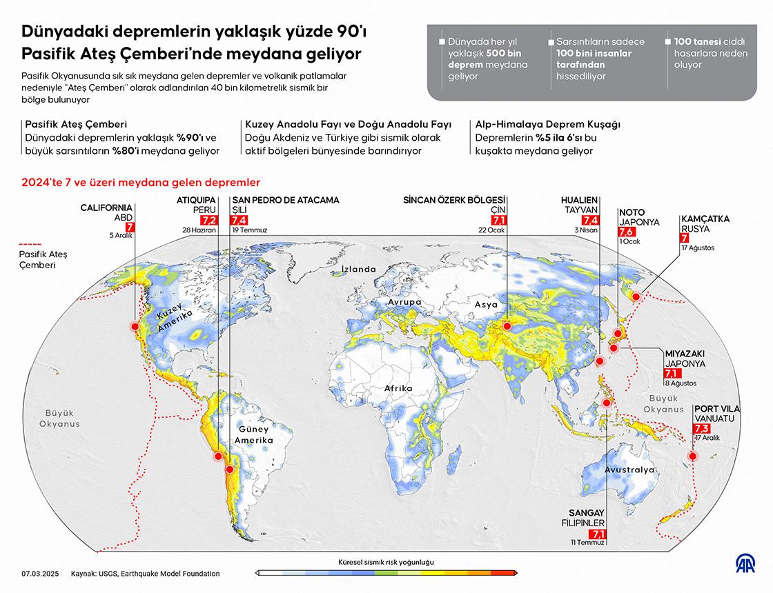
Pasifik Ateş Çemberi (AA)
This zone is also exceptionally volcanically active, hosting more than 450 of the world’s approximately 1,500 active and potentially active volcanoes. Notable examples include Mount Fuji in Japan, Krakatoa in Indonesia, Villarrica in Chile, and numerous volcanoes in the U.S. state of Alaska. Volcanic eruptions are significant geological events, causing both lava flows and global climatic effects.
The Pacific Ring of Fire extends through the following countries and regions:
These regions are designated as high-risk areas due to their significant population densities and infrastructure investments.
Countries along the Pacific Ring of Fire frequently face devastating natural disasters. Earthquakes and volcanic eruptions not only cause physical destruction but also lead to substantial human and economic losses. As a result, many countries in the region have developed early warning systems, disaster education programs, building codes and emergency response plans as part of their disaster risk reduction strategies.
However, due to the region’s geological nature, it is impossible to eliminate these risks entirely.
The Pacific Ring of Fire is one of the most extensively studied geodynamic regions in Earth sciences. Seismic networks, GPS monitoring systems, seafloor observation instruments and satellite imaging technologies are used to continuously track tectonic activity in the region. These studies not only enhance understanding of earthquakes and volcanic events but also contribute to the development of models for potential disaster scenarios.
Anadolu Ajansı (AA). “Dünyadaki Depremlerin Yaklaşık Yüzde 90’ı Pasifik Ateş Çemberi’nde Meydana Geliyor.” Accessed May 27, 2025.
TÜBİTAK Bilim Genç. “Bunu Biliyor Muydunuz? Pasifik Ateş Çemberi.” Accessed May 27, 2025.https://bilimgenc.tubitak.gov.tr/bunu-biliyor-muydunuz.
U.S. Geological Survey (USGS). “What Is the Ring of Fire?” Accessed May 27, 2025.https://www.usgs.gov/faqs/what-ring-fire#faq.

Pacific Ring of Fire
Definition | A tectonic belt shaped like a horseshoe extending around the Pacific Ocean with high volcanic and seismic activity | ||||||||
|---|---|---|---|---|---|---|---|---|---|
Length | Approximately 40,000 kilometers | ||||||||
Percentage of Active Volcanoes | About 75% of the world's active volcanoes are located in this region | ||||||||
Earthquake Rate | Approximately 90% of the world's earthquakes occur in the Pacific Ring of Fire | ||||||||
Plate Movements | Subduction zones are the most common type of movement; other movements include transform faults and seafloor spreading at ocean ridges | ||||||||
Important Regions | Japan, Indonesia, the Philippines, Alaska, California, Chile, New Zealand | ||||||||
Important Natural Disasters | Destructive earthquakes and tsunami events such as the 2011 Tōhoku earthquake (Japan, magnitude 9.0) | ||||||||
No Discussion Added Yet
Start discussion for "Pacific Ring of Fire" article
Geological Background and Plate Interactions
Earthquakes and Volcanic Activity
Geographic Distribution
Disaster Vulnerability and Risk Management
Scientific Research and Technological Monitoring