


This article was automatically translated from the original Turkish version.
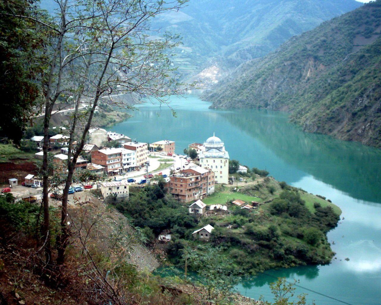
Özkürtün
Location | Özkürtün Village, Kürtün District, Gümüşhane / Türkiye | ||||||||
|---|---|---|---|---|---|---|---|---|---|
General Information | Distance to district center: 10 km Population: 2,275 Elevation: Approximately 650 m Distance to provincial center: 45 km | ||||||||
Neighborhoods | Karaçukur Süme Cayra | ||||||||
Mayor | Yakup Turgut | ||||||||
Özkürtün is a township located in the Black Sea Region of Türkiye, under the jurisdiction of Gümüşhane province. Natural features such as Kürtün Dam Lake, Erikbeli Plateau, and the Saz Area form the geographical structure of the township. Özkürtün stands out for its highland lifestyle, traditional rural settlement pattern, and local social structure. Due to its proximity to the Black Sea coast, Özkürtün is one of the settlements that combine various characteristics of both inland and coastal cultures.
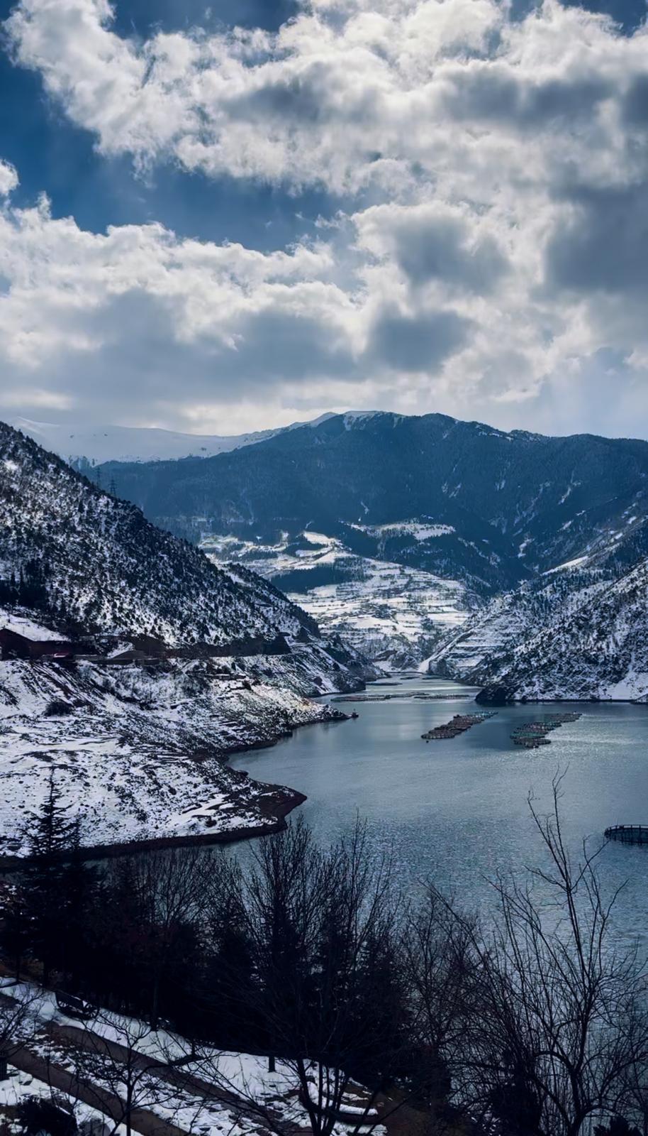
Özkürtün - Emre Zengin (Author)
Özkürtün township, belonging to the Kürtün district of Gümüşhane, stretches along the Harşit Valley and is situated on the shores of Kürtün Dam Lake. It is 10 km from the district center and approximately 45 km from the city center of Gümüşhane. Thanks to a road network connected via the Zigana Pass or Doğankent, it is about a 1.5-hour drive from provinces such as Trabzon and Giresun. Due to its location, Özkürtün provides easy access to both highland plateaus in the interior and coastal cities.
The historical roots of Özkürtün extend back to the 16th century. The region was organized as a subdistrict in the 1950s and gained township status in 1992 through the merger of the villages of Cayra, Süme, and Konacık. In 1994, with the inclusion of Karaçukur Neighborhood, it acquired its current administrative structure. Today, it comprises three neighborhoods—Cayra, Süme, and Karaçukur—and is administered by Özkürtün Municipality.
As of 2022, the population of Özkürtün is 2,275. The population increases significantly during the summer months due to the arrival of citizens from abroad and families coming to the plateaus. In this township, where traditional Black Sea village life continues, neighborhood relations and communal activities form the foundation of social life.
The Kürtün Dam, built on the Harşit Creek, has been transformed into a recreational area. The township municipality has installed bungalows, viewing platforms, walking trails, and picnic areas along the shoreline, making the dam a destination for rest and nature observation for both local residents and visitors.
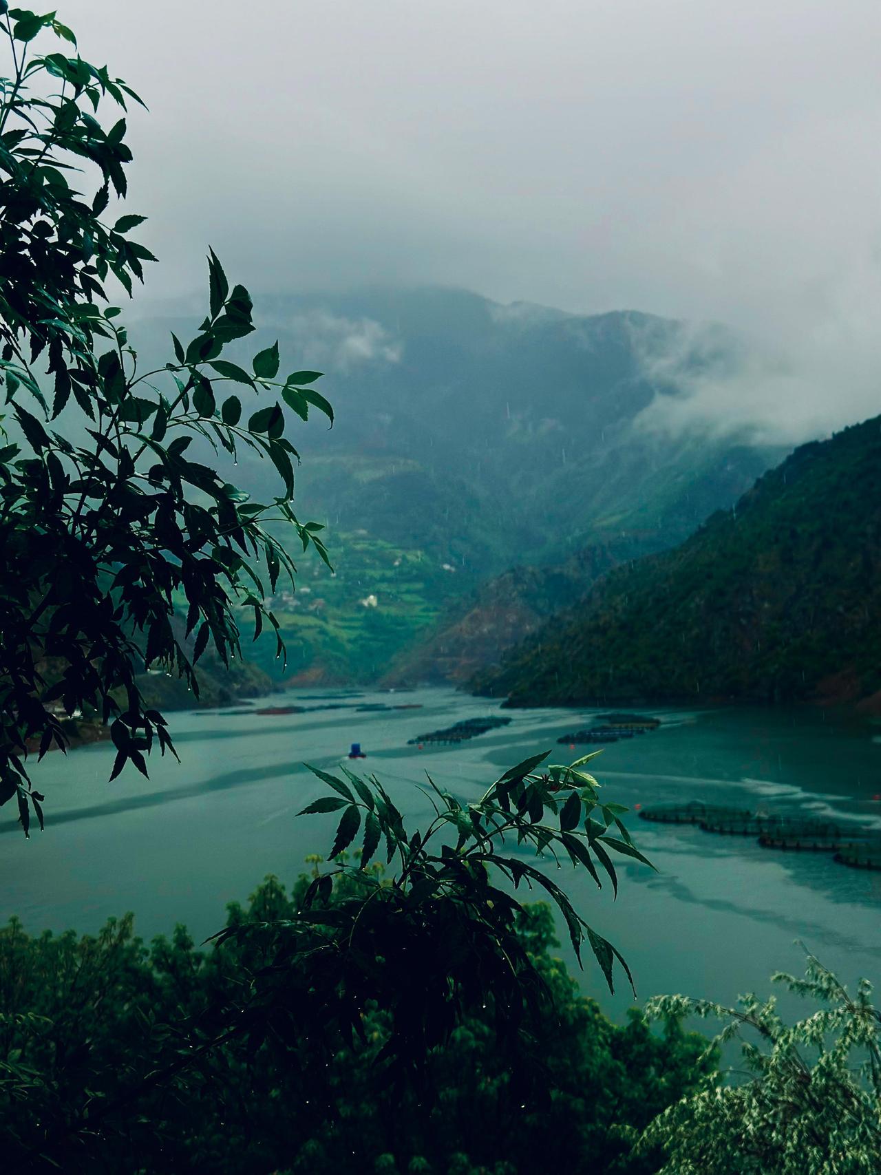
Kürtün Dam Lake - Emre Zengin (Author)
Kadırga Plateau, located within the boundaries of Özkürtün Township in the Kürtün district of Gümüşhane, is a highland noted for its historical and cultural elements. Situated at an elevation of 2,200 meters in the upper reaches of the Black Sea region, one of its structures is an open-air mosque with a history of 563 years. It is known that Fatih Sultan Mehmet held Friday prayers here during his 1461 campaign to Trabzon, and this tradition has continued to the present day. The mosque is designed as an open area enclosed only by two minarets and low stone walls, without a roof. During the summer months, particularly on the third Friday of July during the Otçu Festival, thousands gather on the grass to perform Friday prayers in this mosque.
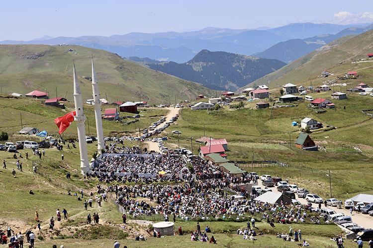
Kadırga Plateau - Anadolu Ajansı
This historical castle, located in Süme Neighborhood, was built on a natural rock formation and is believed to have been used for surveillance. Although access is difficult, the castle preserves its historical structure and is one of Gümüşhane’s rocky defensive constructions.
Located within the boundaries of Özkürtün, Erikbeli Plateau is situated at the end of the Süme Creek Valley at an elevation of approximately 1,800 meters. With a history dating back to the 15th century, the plateau was declared a tourism center by the Ministry of Culture and Tourism in 1991. Its natural water sources, lush vegetation, and clean air make it suitable for camping, hiking, and nature photography.
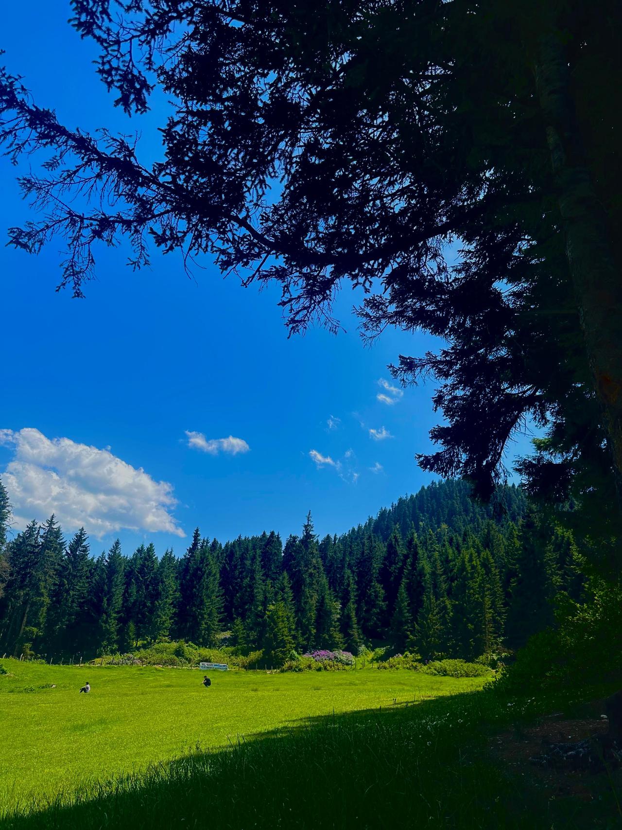
Erikbeli Plateau - Emre Zengin (Author)
The Saz Area, located along the Erikbeli road, is one of Özkürtün’s natural and cultural heritage sites. This wetland, surrounded by reed beds, lies along migratory bird routes and contributes to local biodiversity. Traditionally used for animal husbandry and grazing, the area is also valued by the local population as a place to spend time immersed in nature. The region has potential for development in ecotourism.
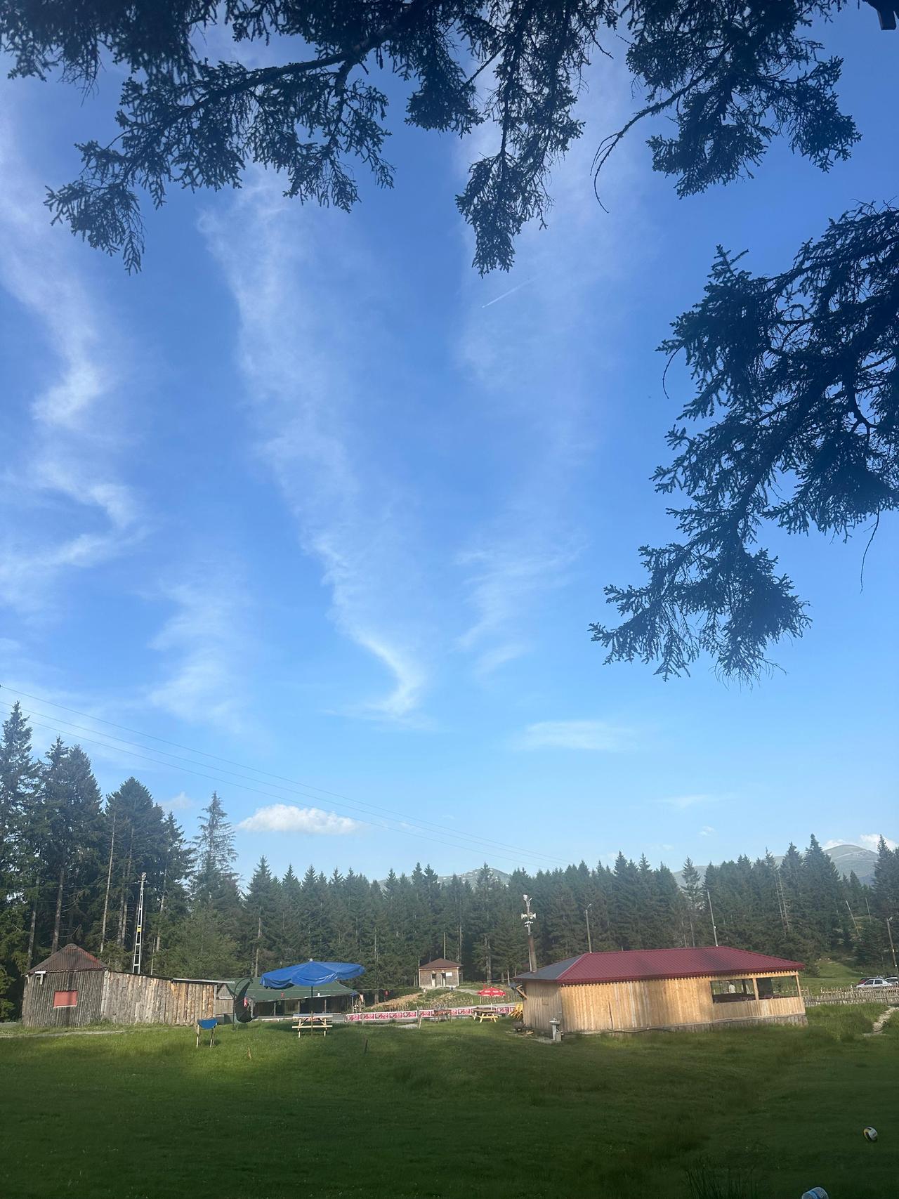
Saz Area - Emre Zengin (Author)
The economy of Özkürtün is primarily based on agriculture, animal husbandry, and financial contributions from the population that migrates abroad. In addition to crops such as maize, beans, cabbage, and potatoes, forest fruits and wild herbs are also utilized in local cuisine. In recent years, with projects supported by the Eastern Black Sea Development Agency (DOKA), the production of regional products such as jams, pickles, and erişte has been encouraged through women’s cooperatives.
The local population continues traditional highland pastoral activities by moving to plateaus during the summer months. Otçu festivals, weddings, and plateau fairs are among the cultural events in the region. Folk music, horon dance, traditional clothing, and local dishes are among the cultural elements observed in Özkürtün.
Anadolu Ajansı. “Üstü Açık Tarihi Camide Cuma Namazı Geleneği Devam Ettiriliyor.” aa.com.tr, Accessed April 14, 2025.
Gümüşkoza Haber. "Kürtün Barajı Gümüşhane’nin Gözdesi Oldu." gumuskoza.com.tr. Date Published August 18, 2023. Accessed April 14, 2025.Link
Karadeniz Kültür Envanteri. "Kadırga Yaylası Üstü Açık Cami." Accessed April 14, 2025.Link
Kuşakkaya Gazetesi. “Özkürtün’de Hayata Geçen Projelerle Yöresel Kültür Yaşatılıyor.” kusakkaya.com.tr. Accessed April 14, 2025.
T.C. Ministry of Culture and Tourism. “Yapmadan Dönme: Gümüşhane.” gumushane.ktb.gov.tr. Accessed April 14, 2025.Link
T.C. Ministry of Culture and TourismGümüşhane İl Directorate of Culture and Tourism. "Süme Kalesi." Accessed April 14, 2025.Link
T.C.Gümüşhane İl Directorate of Culture and Tourism. "Kadırga Yaylası." Accessed April 14, 2025.Link
Turkish Statistical Institute (TÜİK). "Adrese Dayalı Nüfus Kayıt Sistemi Sonuçları, 2022." tuik.gov.tr. Accessed April 14, 2025.Link
Özkürtün Belediyesi. "Genel Bilgiler." ozkurtun.bel.tr. Accessed April 14, 2025.
Özkürtün Belediyesi. "Medya Albümü." Accessed April 15, 2025.Link

Özkürtün
Location | Özkürtün Village, Kürtün District, Gümüşhane / Türkiye | ||||||||
|---|---|---|---|---|---|---|---|---|---|
General Information | Distance to district center: 10 km Population: 2,275 Elevation: Approximately 650 m Distance to provincial center: 45 km | ||||||||
Neighborhoods | Karaçukur Süme Cayra | ||||||||
Mayor | Yakup Turgut | ||||||||
No Discussion Added Yet
Start discussion for "Özkürtün (Gümüşhane)" article
Geographical Location and Transportation
Historical Development and Administrative Structure
Natural Beauty and Tourism
Kürtün Dam Lake
Kadırga Plateau
Süme Castle
Erikbeli Plateau
Saz Area (Özkürtün Sazlık)
Economy and Local Production