


This article was automatically translated from the original Turkish version.
Mission Planner is a comprehensive ground control station (GCS) software developed for open-source autopilot projects. Created by Michael Oborne, this application provides a central platform for configuring, controlling, and planning missions for unmanned vehicles (UAVs, helicopters, rovers, etc.). This application is compatible exclusively with the Windows operating system and is free to use with a community-based structure.
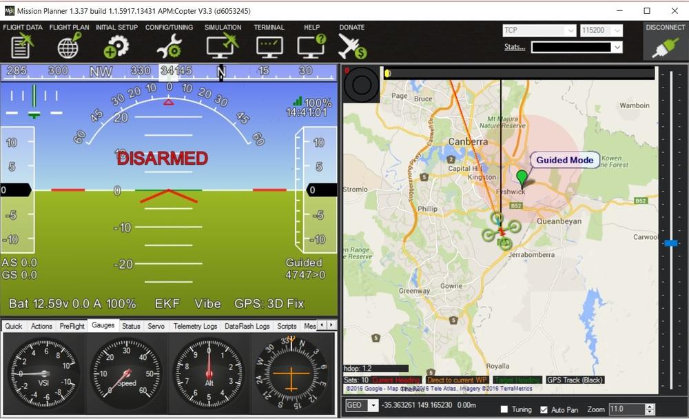
Mission Planner Initial Screen (ArduPilot)
Mission Planner enables communication between the vehicle controller and the computer, allowing users to configure essential system parameters and monitor the vehicle in real time. Thanks to its map-based interface, users can define mission waypoints and create autonomous missions. The built-in parameters assist the vehicle in autonomous operation. Additionally, it allows users to record mission logs, analyze them, and utilize advanced debugging tools. The software uses the MAVLink communication protocol, enabling real-time transmission of sensor data, position information, and status/error messages to the user.
One of the main functions of Mission Planner is its use as a mission planner. With this function:
Created missions can be directly uploaded to the autopilot controller and modified as needed.
The software presents telemetry data from the vehicle to the user through graphs and indicators. During flight, the vehicle’s position, speed, altitude, battery status, system alerts, and sensor performance can be monitored and evaluated via the HUD (Heads-Up Display). Additionally, real-time logging of telemetry data enables detailed post-mission analysis through advanced graphical tools.
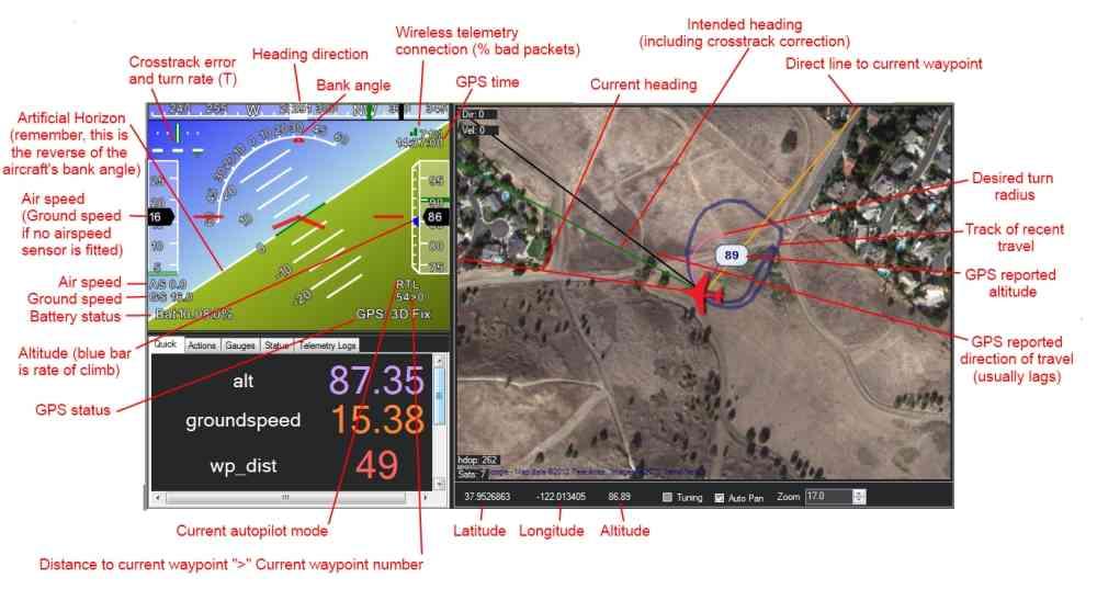
HUD - Heads-Up Display - Screen (ArduPilot)
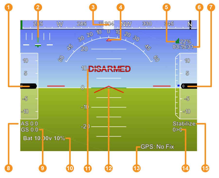
Detailed HUD - Heads-Up Display - Screen (ArduPilot)
Mission Planner allows users to adjust parameters of the vehicle controller to ensure more stable operation. Basic settings such as PID tuning, sensor calibration, and flight modes, as well as more complex configurations, can be managed through this software. Additionally, it informs users of incorrect or incomplete settings, helping to ensure more reliable system performance.
ArduPilot Development Team. “Flight Data Screen Overview — Mission Planner Ground Control Station.” ArduPilot Documentation. Accessed January 24, 2026.https://ardupilot.org/planner/docs/mission-planner-ground-control-station.html.

General Features
Mission Planning
Mission Monitoring and Telemetry
Defining Parameters and System Settings