


This article was automatically translated from the original Turkish version.
Lake-effect snow is a type of precipitation that occurs when relatively warm lake or sea surfaces destabilize cold polar air masses as they pass over them, leading to the acquisition of heat and moisture. During this process, the cold air mass warms and gains moisture from below as it moves over the water, creating atmospheric instability. As a result, cumulus-type clouds form and produce snowfall. This type of precipitation typically affects narrow areas and can lead to rapid accumulation of heavy snow.
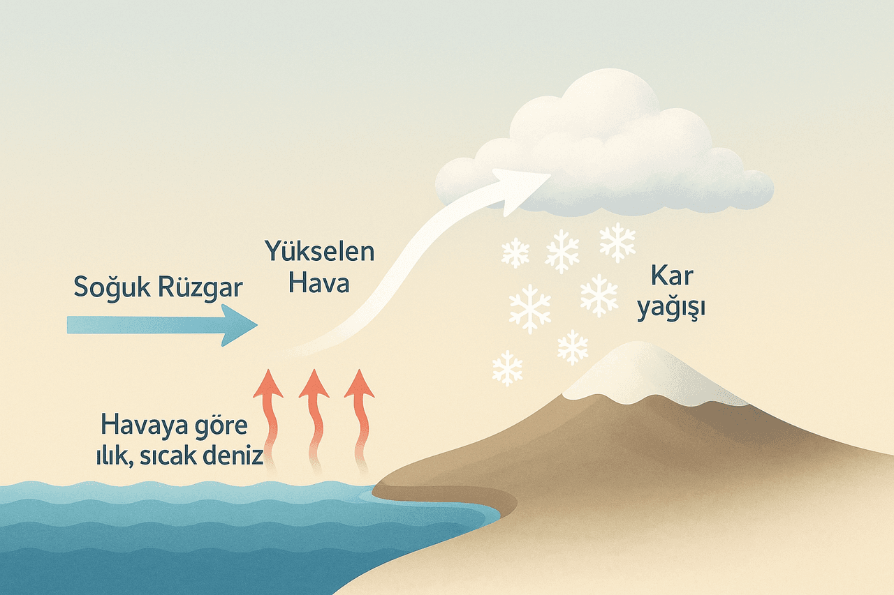
Deniz etkili kar yağışının oluşumu. (Yapay zeka ile oluşturulmuştur.)
The formation process of lake-effect snow occurs in the following stages:
This process is frequently observed along the coasts of the Black Sea and the Sea of Marmara.
The lake-effect snow event that affected Istanbul between 17 and 19 February 2015 is a classic example of lake-effect snowfall. During this period, a cold air mass originating from the north moved across the Black Sea before reaching Istanbul. As the cold air passed over the sea, it absorbed moisture and became unstable, resulting in intense snowfall over the city.
During this event, snow depths measured 40 cm at Atatürk Airport, 39 cm at the Sarıyer Meteorological Station, 27 cm in Kartal, 18 cm at Sabiha Gökçen Airport, and 3 cm in Kumköy. Additionally, numerous flights were canceled or diverted to other airports due to the heavy snowfall.
Istanbul Lake-Effect Snowfall. (ENKA)
Bilim Genç. "Deniz Etkili Kar Yağışı Nedir?" TÜBİTAK Bilim Genç, January 16, 2023.https://bilimgenc.tubitak.gov.tr/makale/deniz-etkili-kar-yagisi-nedir. Accessed May 7, 2025.
YouTube. Hava Delisinin Not Defteri. Alıntı: ENKA. 17 - 19 Şubat İstanbul Kar Yağışı ve Radar Animasyonu. Accessed May 7, 2025.

No Discussion Added Yet
Start discussion for "Marine-Influenced Snowfall (MIS)" article
Formation Mechanism
The Lake-Effect Snow Event in Istanbul on 17–19 February 2015