


This article was automatically translated from the original Turkish version.
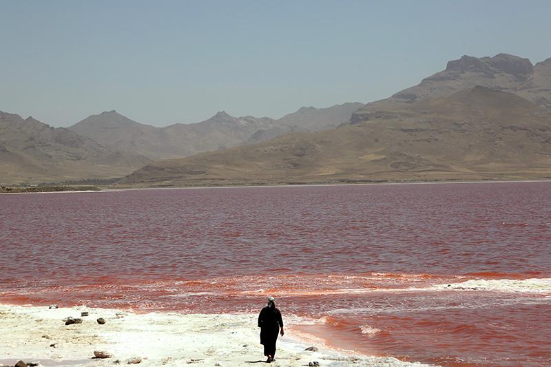
Lake Urmia
Location | Iran northwest | ||||||||
|---|---|---|---|---|---|---|---|---|---|
Feature | saline closed basin lake | ||||||||
Surface Area | 5,200 km² (previous), 80-90% reduction | ||||||||
Depth | Average 5 m | ||||||||
Ecology | Reddish in color, important habitat for flamingos and birds | ||||||||
Causes of Degradation | Excessive water use, dams, climate change | ||||||||
Effects | Salt storms, health problems, agricultural damage | ||||||||
Protection | Water management projects, investigations, regional cooperation | ||||||||
Lake Urmia (Persian: دریاچه ارومیه, Daryāche-ye Orūmīyeh), located in the northwestern part of Iran between the provinces of Azerbaijan, is a saline and endorheic lake. With a surface area of approximately 5,200 km², it was historically the second largest lake in the Middle East. The lake holds regional significance both geologically and ecologically and was designated a biosphere reserve by UNESCO in 1975.
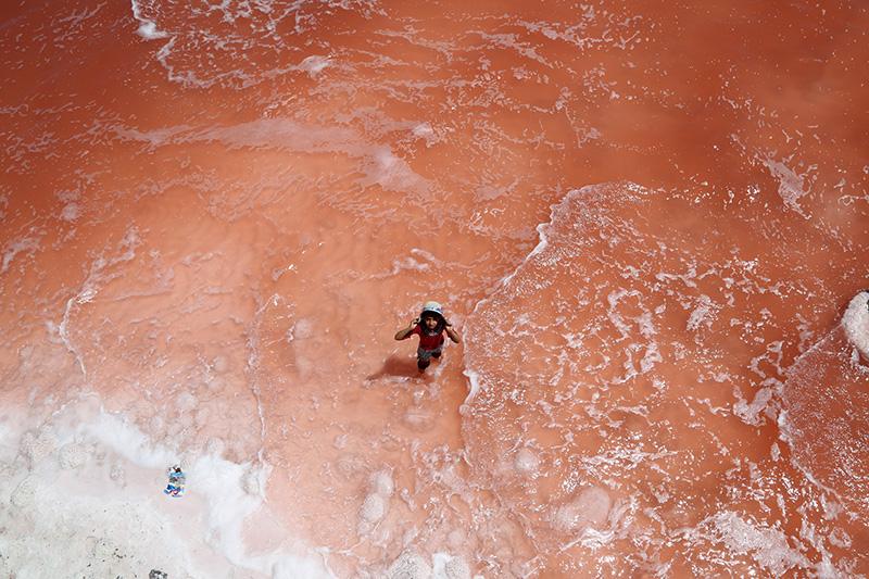
Urmiye Gölü (AA)
Lake Urmia is one of the saline water bodies with high sodium content. Its average depth is around five meters and it is fed by short and medium-sized rivers in the region. As the lake lies in an endorheic basin, it receives water only from precipitation and river inflow and has no outflow. This characteristic makes its hydrological balance extremely sensitive. Regional climatic conditions and hydrological changes directly affect the lake’s water level.
Due to its high salinity, Lake Urmia serves as a habitat for extremophilic microorganisms that give the lake its reddish-pink hue. This feature has led to the lake being called the “Red Lake.” Additionally, the lake provides a critical habitat and breeding ground for numerous migratory bird species, especially flamingos. Its role as both a feeding and resting area for these birds underscores the importance of preserving its biological diversity.
Since the early 2000s, a dramatic loss of water has been observed in Lake Urmia. According to NASA satellite data, the lake’s surface area has shrunk by approximately 80 to 90 percent between the 1990s and 2020. The causes of this desiccation process are explained by the following factors:
The desiccation of the lake has produced multifaceted negative impacts on the regional environment and human life:
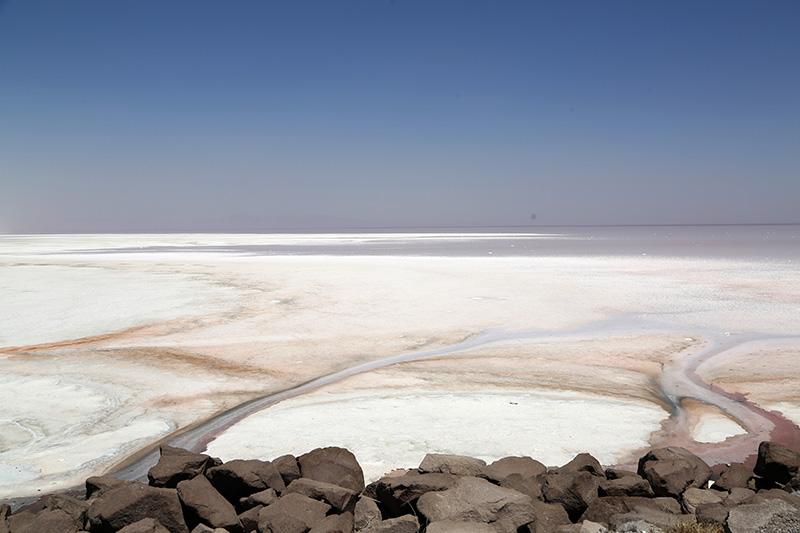
Urmiye Gölü (AA)
The Iranian government launched comprehensive projects in 2013 to revive Lake Urmia. These include:
However, due to economic constraints, bureaucratic obstacles, and lack of regional cooperation, the impact of these efforts has remained limited. In 2024, official investigations were launched in Iran due to negligence regarding the desiccation process.
The Dying Lake Urmia (YouTube)
Lake Urmia serves as a significant case study in international environmental policy as an indicator of regional climate change and human intervention. Its preservation is critically important not only for Iran but also for neighboring countries in terms of sustainable water management strategies and regional cooperation. Experts emphasize that integrated basin management, climate change adaptation, and community-based conservation approaches are essential for the lake’s future.
Anadolu Ajansı. 2023. “Urmiye Gölü’nün Kuruması Tehlikesi İran’ı ve Bölgeyi Tehdit Ediyor.” AA. Accessed May 31, 2025.https://www.aa.com.tr/tr/dunya/urumiye-golunun-kurumasi-tehlikesi-irani-ve-bolgeyi-tehdit-ediyor/2295716
Anadolu Ajansı. 2023. “Urmiye Gölü’nün Kuruması İnsan Eliyle Başladı, İklim Değişikliğiyle Hızlandı.” AA. Accessed May 31, 2025.https://www.aa.com.tr/tr/yesilhat/cevre-hikayeleri/urmiye-golunun-kurumasi-insan-eliyle-basladi-iklim-degisikligiyle-hizlandi/1817410
Anadolu Ajansı. 2024. “İran’da Urmiye Gölü’nün Kurumasına İlişkin Soruşturma Başlatıldı.” AA. Accessed May 31, 2025.https://www.aa.com.tr/tr/dunya/iranda-urumiye-golunun-kurumasina-iliskin-sorusturma-baslatildi/2972201
Earth Observatory NASA. 2017. “Red Lake: Urmia.” NASA. Accessed May 31, 2025.https://earthobservatory.nasa.gov/images/88395/red-lake-urmia
Earth Observatory NASA. 2023. “Lake Urmia Shrivels Again.” NASA. Accessed May 31, 2025.https://earthobservatory.nasa.gov/images/151913/lake-urmia-shrivels-again
Gökyüzünden Coğrafya. "Yok olmak üzere olan Urmiye Gölü." YouTube. Accessed May 31, 2025.https://www.youtube.com/watch?v=WkkdX1hh2Lk

Lake Urmia
Location | Iran northwest | ||||||||
|---|---|---|---|---|---|---|---|---|---|
Feature | saline closed basin lake | ||||||||
Surface Area | 5,200 km² (previous), 80-90% reduction | ||||||||
Depth | Average 5 m | ||||||||
Ecology | Reddish in color, important habitat for flamingos and birds | ||||||||
Causes of Degradation | Excessive water use, dams, climate change | ||||||||
Effects | Salt storms, health problems, agricultural damage | ||||||||
Protection | Water management projects, investigations, regional cooperation | ||||||||
Geographical and Hydrological Characteristics
Ecological Value
Desiccation Process: Causes and Developments
Environmental, Economic and Social Impacts
Management and Conservation Efforts
International Dimension and Future Perspectives