


This article was automatically translated from the original Turkish version.
+1 More
Kütahya
Country | Türkiye | ||||||||
|---|---|---|---|---|---|---|---|---|---|
Region | Aegean Region | ||||||||
Population | 571.078 (2023) | ||||||||
Area | 11.875 km² | ||||||||
Climate | Continental Climate | ||||||||
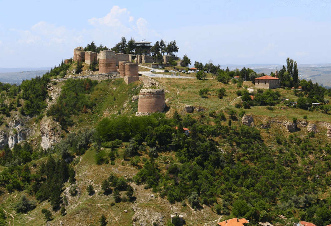
Important Structure | Karagöz Mosque Aizanoi Ancient City Phrygia Valley Kütahya Castle | ||||||||
Area Code(s) | 274 | ||||||||
License Plate Code | 43 | ||||||||
Governor | Musa Işın | ||||||||
Mayor | Eyyüp Kahveci | ||||||||
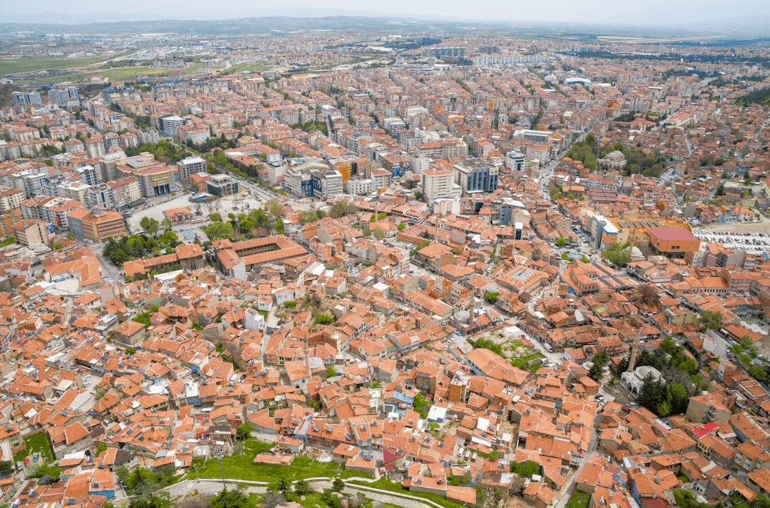
Kütahya is an important city located in the Anatolia region of place in Türkiye and has served as a home to many civilizations throughout its history. This city, whose historical roots extend back to 3000 BCE, possesses a rich cultural heritage bearing traces of various civilizations. Although known in antiquity as "Katiaenion," the settlement gradually adopted its current name following the Turkish settlement in the region. Due to its geographical location and strategic value, Kütahya has changed hands many times throughout history. The legacies of major civilizations such as the Phrygians, Lydians, Persians, Macedonians, Romans, Byzantines, Seljuks, Germiyanids and the Ottoman Empire have left deep imprints on Kütahya’s past.
Kütahya (Source: Pexels/Murat Halıcı)
The earliest settlement in Kütahya dates back to the Hittite period. The city’s ancient name was known as “Katiaenion.” The Phrygians were the first settlers of Kütahya, migrating into Anatolia in the 12th century BCE and establishing a vast kingdom there. In 676 BCE, the Cimmerians conquered the Phrygian Kingdom and gained dominance over Kütahya, marking the region’s first major political transformation. The Lydians and Persians subsequently ruled these lands, followed by the Macedonians after the victories of Alexander the Great.
During the Roman Empire, Kütahya became an important trade center. With its incorporation into Roman rule, significant structures were built in the city, and it gained further importance as a bishopric center following the adoption of Christianity. During the Byzantine Empire, the city continued to develop as both a military strategic location and a religious center.
Following the Battle of Manzikert, the Turks rapidly conquered Anatolia, and Kütahya was taken by the Seljuks in 1074. The city became one of the important frontier outposts of the Seljuk Empire; although it was temporarily lost during the Crusades, it was recaptured by the Seljuks in 1182. During the Seljuk period, Kütahya was developed with numerous mosques, medreses and caravanserais. This period transformed the city into a significant cultural and religious center.
After the collapse of the Seljuks, Kütahya became the capital of the Germiyanids Beylik. The Germiyanids elevated Kütahya into an important economic and cultural center. The Germiyanid period marked one of the city’s most brilliant eras, during which many architectural works were constructed. In 1429, by the will of II. Yakup, Kütahya was incorporated into Ottoman territories.
Upon coming under Ottoman rule, Kütahya became an important sanjak center. During the Ottoman period, numerous mosques, medreses, hammams and fountains were constructed. Particularly, Kütahya became the center of Ottoman ceramic art, hosting world-renowned ceramic works. Additionally, under Ottoman administration, Kütahya emerged as a major cultural and trade center. In 1833, the city was occupied by the son of Egypt’s governor Kavalalı Mehmet Ali Pasha, but it returned to Ottoman control following the Treaty of Kütahya signed between the Ottoman Empire and Egypt.
After the proclamation of the Republic, Kütahya achieved significant progress in the fields of industry and education. The city’s industrial infrastructure was modernized and new factories were established. Moreover, Kütahya continues to stand out for its historical and cultural heritage and has become a major tourist destination today.
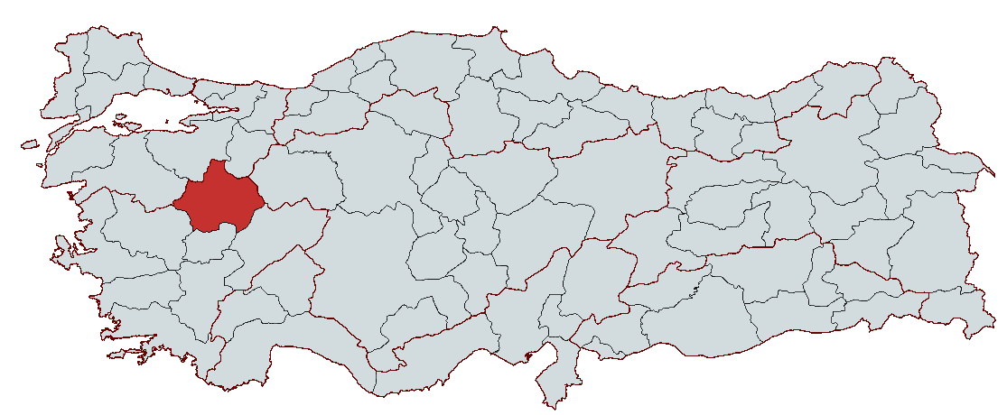
Kütahya Province is located in the western interior part of the Aegean Region. Geographically, it lies at a transition point between the Aegean Region and the Central Anatolia Region. This characteristic has led to its designation as the “Kütahya Plateau.” The province covers an area of 11,875 km², accounting for 1.5% of Turkey’s territory. To the north lies Bursa, northeast lies Bilecik, east lies Eskişehir and Afyon, south lies Uşak, and to the west lie Manisa and Balıkesir provinces.
Kütahya lies between 38° 70’ and 39° 80’ north latitudes and 29° 00’ and 30° 30’ east longitudes. This location places it close to both Central Anatolia and the Aegean Region, making it a strategically significant settlement area.
Kütahya has a topography largely composed of mountains and plateaus. Approximately 57.5% of the province’s land is covered by mountains. Due to its position between mountain ranges and plateaus, Kütahya encompasses a wide variety of landforms.
The main mountains in Kütahya include Akdağ (2,089 m), Eğrigöz Mountain (2,181 m), Vellice Mountain (1,764 m), Yeşildağ (1,953 m), Murat Mountain (2,312 m), and Şaphane Mountain (2,121 m). Murat Mountain is the highest peak in the province, rising to 2,312 meters. These mountains play a vital role in shaping Kütahya’s physical structure.
Kütahya is also known for numerous plains situated between mountain ranges and river valleys. Some of the largest plains in the province include the Kütahya Plain (93 km²), Simav Plain (100 km²), Tavşanlı Plain, and the Altıntaş-Aslanapa Plains. These plains are covered with alluvial soils and are highly fertile for agriculture. The Kütahya Plain lies at an average elevation of 930 meters above sea level and is irrigated by the waters of the Porsuk River.
Kütahya is rich in rivers. Its largest river is the Porsuk River, which originates in the Murat Mountains and flows to Eskişehir before emptying into the Black Sea. Other important rivers include the Simav (Susurluk) River, Kirmasti River, and Gediz River. These rivers feed into the Marmara, Aegean and Black Sea basins. Kütahya also has several lakes. Simav Lake, covering an area of 4 km², is a natural lake, while the Porsuk and Enne Dams were constructed for drinking water supply and irrigation purposes.
Kütahya’s climate can be described as a mixture of the climatic characteristics of the Aegean, Marmara and Central Anatolia Regions. Therefore, it exhibits a transitional climate. The province is generally under the influence of a continental climate. Summers are hot and dry, while winters are cold and snowy. The annual average temperature in Kütahya is 10.6°C, with lower temperatures in higher altitude areas. Precipitation is most abundant during the winter and spring months, with an annual average rainfall of 568 mm.
Kütahya is rich in natural resources. The province’s soil contains volcanic rocks and fertile land, making it highly suitable for agriculture. Major agricultural products include wheat, barley, sugar beet, vegetables and fruits. Additionally, the province is endowed with rich mineral deposits, including marble, lignite and limestone. Mining and ceramic production are widespread in Kütahya, making them important natural resources contributing to the local economy.
Kütahya’s industry is supported by its mineral reserves, porcelain and ceramic production, food industry and agriculture-based sectors. The province hosts 467 industrial establishments, the majority of which were established by the private sector. Key sectors in Kütahya’s industrial structure include food product manufacturing (32%), manufacturing of metal and non-metallic mineral products (17%), and wood and mushroom product manufacturing (10%). Additionally, there are industrial facilities in textiles, chemicals, machinery, automotive and metal industries.
Kütahya’s mineral reserves are among the richest in Turkey. This richness is particularly concentrated in boron, magnesite, coal, iron and chromium deposits. Therefore, more effective utilization of these underground resources is of great importance for enhancing Kütahya’s industrial potential.
One of the most notable factors in the development of industry in Kütahya is its strong position in ceramic and porcelain production. Approximately 80% of porcelain produced in Turkey is manufactured in Kütahya, making this sector a vital component of the provincial economy. Moreover, the combination of ceramic and porcelain production with Kütahya’s historical heritage and cultural value has contributed significantly to commercial vitality. With increased production capacity and the growth of local manufacturers, the ceramic trade has become more dynamic.
Agriculture and livestock also play a significant role in Kütahya’s economy. The province offers a favorable environment for agricultural production due to its fertile soils and climate. Approximately 66% of the local economy derives from agricultural and livestock activities. Major agricultural products include wheat, barley, sugar beet, fruit and vegetables. Livestock farming is also well-developed, with small and large animal husbandry serving as important income sources. However, further development in this sector requires increased investment by local entrepreneurs and the adoption of more modern production techniques.
Kütahya derives a large portion of its economy from foreign trade. As of 2012, the province exported goods worth $145,487,000 and imported goods worth $119,629,000. Leading export items include porcelain, ceramics, minerals and soil products, machinery and parts, chemicals and metals. Major export markets include Germany, Spain, France, the USA and Iran. Imports are primarily sourced from Germany, China, Italy, Russia and France.
Kütahya has an active labor force of 207,000 people, of whom 195,000 are employed and 12,000 are unemployed. The labor force participation rate is 45.6%, and the employment rate is 43.0%. Industry, one of the main sectors of the provincial economy, employs the majority of this workforce. A significant portion of industrial establishments in Kütahya operate in food, mining and porcelain sectors. Moreover, the number of industrial enterprises in the province increases annually, and most existing businesses are small and medium-sized enterprises.
Kütahya holds a strategic position as a major transportation hub. It lies at a crossroads connecting the Marmara and Mediterranean regions with Central Anatolia and the Aegean region. The province’s road infrastructure covers a total network of 911 km of roads. Of this, 483 km are state roads and 428 km are provincial roads. The majority of these roads are asphalt-paved.
Kütahya is a junction for major road connections linking Marmara to the Mediterranean and Central Anatolia to the Aegean. However, the failure of main road connections to meet desired standards remains a factor slowing the province’s development. Kütahya is also significant in terms of rail transport. The provincial center is connected to the Haydarpaşa-Konya-Adana railway line via the Alayunt station and to the Kütahya-Balıkesir line. Currently, there is no airport in Kütahya.
The road infrastructure is being improved through projects such as the Çavdarhisar-Gediz-Abide road and the Tavşanlı-Emet-Simav road. Since 2002, infrastructure improvements have enhanced the quality of the road network and increased the number of bridges and viaducts. Additionally, the proximity of Zafer Airport and high-speed rail projects will make significant contributions to the future transportation infrastructure.
Kütahya, with a population of approximately 600,000, has a population density concentrated in the city center, while traditional lifestyles prevail in rural areas. The ethnic composition of Kütahya is predominantly Turk, with significant communities of Turkmen and Yörük origin. Turkish is the spoken language, with dialectal variations differing by locality.
Religiously, the population is predominantly Sunni Muslim, with individuals adhering to Alevi and Ja’fari beliefs also present. Migration, especially accelerated by industrial development, has led to a wave of population movement from rural areas to the city. As a result, settlement patterns in Kütahya have diversified across both urban and rural areas.
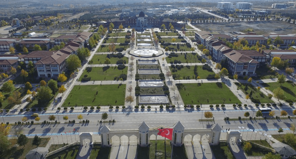
Educational levels are higher in the city center, where educational institutions such as Dumlupınar University constitute a significant portion of the youth population. Kütahya’s demographic structure has been shaped by industry, migration and education; while urbanization increases, traditional rural lifestyles are still maintained.
Dumlupınar University (Source: DPÜ News)
Kütahya Castle (Source: Mustafa Akın)
Musa Işın currently serves as the Governor of Kütahya. He was appointed to the position of Governor of Kütahya by Presidential Decree No. 2023/376 dated 10.08.2023. The governors who have served in the city are as follows:
BEBKA. "Invest in Kütahya – Yatırım Ortamı." Accessed February 7, 2025.Accessed Adresi.
BEBKA. "Kütahya Yerel Ekonomik Gelişme Programı (Afet Yönetimi, Kentsel Hizmetler, İnsan ve Toplum, 2016-2018)." Bursa Eskişehir Bilecik Kalkınma Ajansı. Kütahya İli Yerel Ekonomik Gelişme Programı (2016-2018). Accessed February 7, 2025.Accessed Adresi
BEBKA. "Kütahya Yerel Ekonomik Gelişme Programı (Turizm, Sanayi, Ulaşım, 2015-2017)." Bursa Eskişehir Bilecik Kalkınma Ajansı. Kütahya Yerel Ekonomik Gelişme Programı (2015-2017). Accessed February 7, 2025.Accessed Adresi.
Karatay Üniversitesi. "Kütahya Hakkında Bilinmesi Gerekenler." Accessed February 7, 2025.Accessed Adresi.
Kütahya Belediyesi. "Tarihi Yerler." Kütahya Belediyesi Resmî Web Sitesi. Accessed February 7, 2025.Accessed Adresi.
Kütahya Ticaret of Commerce and Industry. "Kütahya’nın Sosyo-Ekonomik Yapısı." Accessed February 7, 2025.Accessed Adresi.
Kütahya Ticaret ve Sanayi Odası. "Kütahya Ekonomisine Bir Bakış." Kütahya Ticaret ve Sanayi Odası Resmî Web Sitesi. Accessed February 7, 2025.
Kütahya Valiliği. "Kütahya Valisi Musa Işın." T.C. Kütahya Valiliği Resmî Web Sitesi. Accessed February 7, 2025.Accessed Adresi.
Kütahya Valiliği. "Tarihçe." T.C. Kütahya Valiliği Resmî Web Sitesi. Accessed February 7, 2025.Accessed Adresi.
Ministry of Transport and Infrastructure of the Republic of Turkey. "Ulaşımda ve Erişimde 2002/2023 – Kütahya." Accessed February 7, 2025.Accessed Adresi.
T.C. Ministry of Culture and Tourism. "Kütahya’nın Adı." Kültür Portalı. Accessed February 7, 2025.Accessed Adresi.
T.C. Ministry of Culture and Tourism. "Kütahya’nın Tarihi." *Kütahya İl Kültür veTurizm Müdürlüğü. Accessed February 7, 2025.Accessed Adresi.
Tripod. "Kütahya Ekonomisi." Tripod Web Sitesi. Accessed February 7, 2025.Accessed Adresi.
Tripod. "Kütahya'nın Tarihçesi." Tripod Web Sitesi. Accessed February 7, 2025.Accessed Adresi.
Tripod. "Kütahya’nın Konumu." Tripod Web Sitesi. Accessed February 7, 2025.Accessed Adresi.

Kütahya
Country | Türkiye | ||||||||
|---|---|---|---|---|---|---|---|---|---|
Region | Aegean Region | ||||||||
Population | 571.078 (2023) | ||||||||
Area | 11.875 km² | ||||||||
Climate | Continental Climate | ||||||||
Important Structure | Karagöz Mosque Aizanoi Ancient City Phrygia Valley Kütahya Castle | ||||||||
Area Code(s) | 274 | ||||||||
License Plate Code | 43 | ||||||||
Governor | Musa Işın | ||||||||
Mayor | Eyyüp Kahveci | ||||||||
History
Ancient Period and Early Civilizations (3000 BCE – 6th Century BCE)
Roman and Byzantine Periods (133 BCE – 395 CE)
Seljuk Period and Turkish Rule (1071 – 1300)
Germiyanids Beylik (1300 – 1429)
Ottoman Period (1429 – 1922)
Republican Period and Present Day (1923 – Today)
Geographical Structure
Location and Boundaries
Landforms
Mountains
Plains
Rivers and Lakes
Climate
Natural Resources
Economic Structure
Industry and Production Structure
Agriculture and Livestock
Exports and Imports
Employment and Labor Force
Infrastructure and Transportation
Demographic Structure
Historical Structures
Districts
Local Administration