


This article was automatically translated from the original Turkish version.
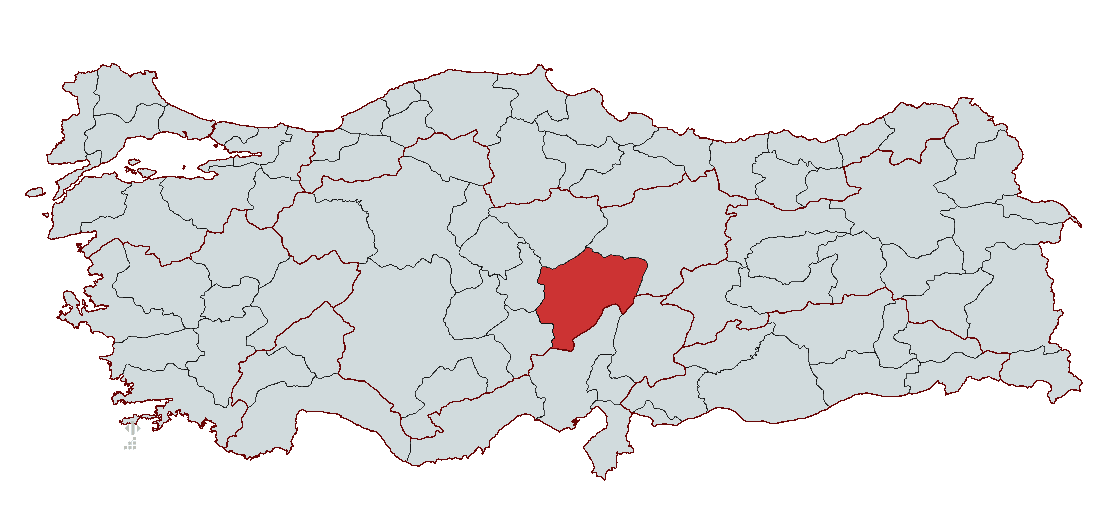
Country | Türkiye | ||||||||
|---|---|---|---|---|---|---|---|---|---|
Region | Central Anatolia Region | ||||||||
Population | 1,445,683 | ||||||||
Area | 16,975 km² | ||||||||
Climate | Continental | ||||||||
Important Structure | Kayseri Castle Kapuzbaşı Waterfalls Sultan Sazlığı Erciyes Mountain Kültepe Archaeological Site | ||||||||
Area Code | 352 | ||||||||
License Plate Code | 38 | ||||||||
Governor | Gökmen Çiçek | ||||||||
Metropolitan Municipality Mayor | Memduh Büyükkılıç | ||||||||
Kayseri is an important city located in the southern part of the Anadolu region and has served as a home to many civilizations throughout history. Geographically, it forms a transition point between southern Inner Anatolia and the Taurus Mountains. Kayseri, one of Türkiye’s most developed cities in terms of industry, trade, education and tourism, attracts attention with its deep historical roots, rich cultural heritage and natural beauty.
Throughout history, Kayseri has been under the rule of many civilizations including the Hittites, Assyrians, Phrygians, Romans, Byzantines, Selçuklular and Ottomans. Kültepe (Kaniş Karumu), one of the earliest sites in Anatolia where written documents have been found, demonstrates the region’s significant role as a trade center. During the Seljuk period, Kayseri became one of Anatolia’s most important centers of learning and commerce and retained its importance during the Ottoman era, becoming a hub of modern industry and trade with the proclamation of the Republic.
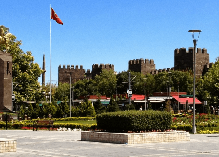
Kayseri Kalesi
Kayseri, at an elevation of 1,071 meters, covers an area of 16,975 square kilometers and lies between latitudes 37°45' and 38°18' north and longitudes 34°56' and 36°58' east. The city is bordered by Sivas to the east, Yozgat to the north, Nevşehir to the west, Niğde to the southwest, Adana and Kahramanmaraş to the south.
One of the city’s most important natural features is Erciyes Dağı. At 3,916 meters, it is Turkey’s fifth highest mountain and holds great significance for winter tourism and mountaineering. Other prominent elevations in the province include Aladağ, Dumanlı Dağları, Binboğa, Hınzır and Soğanlı Dağları.
The most important river in Kayseri is Kızılırmak, of which 128 kilometers flow directly through the province. Other rivers include Zamantı Çayı, Sarımsaklı Suyu, Kestuvan Suyu and Değirmendere. Important lakes include Camız Gölü, Çöl Gölü, Sarıgöl, Yay Gölü and Tuzla Gölü.
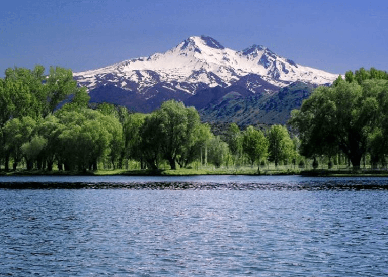
Erciyes Dağı
Kayseri has a continental climate characterized by hot, dry summers and cold, snowy winters. The annual average temperature is 10.6°C and the annual average rainfall is 424.6 mm. Most precipitation occurs in spring.
Kayseri consists of 16 districts: Akkışla, Bünyan, Develi, Hacılar, İncesu, Kocasinan, Melikgazi, Pınarbaşı, Sarıoğlan, Sarız, Tomarza, Yahyalı, Talas, Özvatan, Felahiye and Yeşilhisar. According to the Address Based Population Registration System, its population is 1,445,683, making it the 15th most populous province in Türkiye. The population density is 85 people per square kilometer.
Kayseri is one of Türkiye’s leading cities in industry and trade. The Kayseri Organize Sanayi Bölgesi, Mimarsinan Organize Sanayi Bölgesi and İncesu Organize Sanayi Bölgesi form the backbone of the province’s industrial infrastructure. Furniture, metalworking, textiles, food and construction are the pillars of Kayseri’s industry. The city also hosts the Kayseri Serbest Bölgesi, a major center for export and import activities.
Kayseri’s geographical structure provides favorable conditions for agricultural production. Major agricultural products include wheat, barley, sugar beet, potato, sunflower, legumes, forage crops, apple and grape. The province also engages in large and small livestock farming, beekeeping and aquaculture.
Kayseri is also rich in both nature and kültür tourism.
Kayseri contains numerous historical sites:
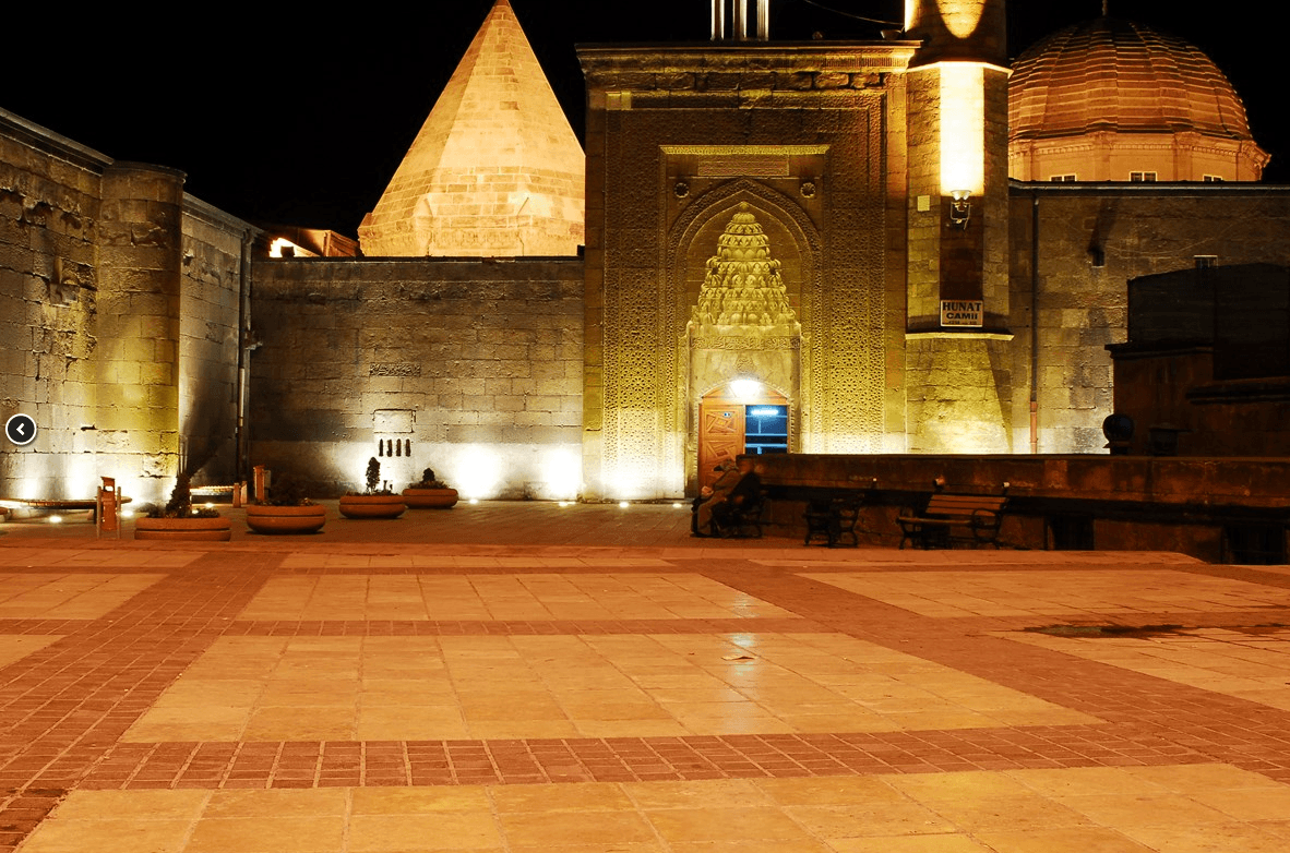
Hunat Hatun Külliyesi
Kayseri is a well-developed province in terms of education. It hosts five universities:
In addition, Kayseri has 16 public education centers, 295 dormitories, BİLSEM and measurement and evaluation centers.
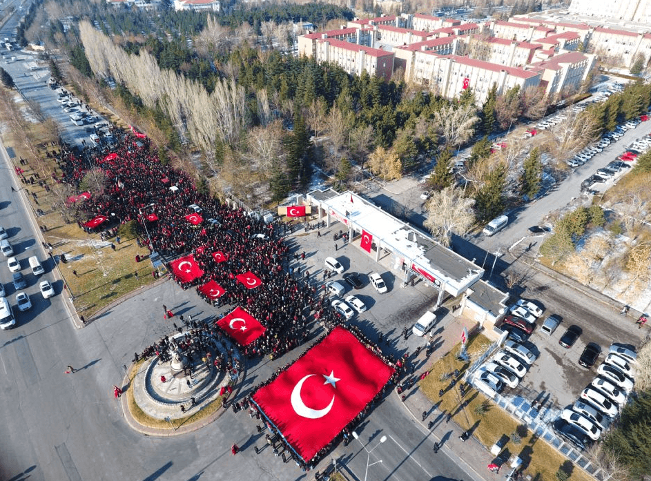
Erciyes Üniversitesi
Kayseri has a well-developed transportation infrastructure.
Kayseri has also developed in the field of spor.
Kayseri is one of Türkiye’s important cities historically, culturally and economically. With its natural beauty, advanced industry, universities and historical heritage, it continues to attract both domestic and foreign tourists.
Devlet Hava Meydanları İşletmesi (DHMİ). "Kayseri Şehir Tarihçesi." Accessed February 10, 2025.https://www.dhmi.gov.tr/sayfalar/havalimani/kayseri/SehirTarihcesi.aspx
Erciyes Üniversitesi. "Fotoğraf Galeri." Yeşil Kampüs. Accessed February 10, 2025.https://yesilkampus.erciyes.edu.tr/FotografGaleri.html
Kayseri Valiliği. "Kayseri Tarihi." Accessed February 10, 2025.http://www.kayseri.gov.tr/kayseri-tarihii.
T.C. Kültür ve Turizm Bakanlığı. "Kayseri Tarihçesi." Accessed February 10, 2025.https://kayseri.ktb.gov.tr/TR-54965/tarihce.html.
T.C. Ministry of Agriculture and Forestry,Kayseri İl Directorate of Agriculture and Forestry. "Genel Kayseri Tarihi." Accessed February 10, 2025.https://kayseri.tarimorman.gov.tr/Menu/53/Genel-Tarihi.
Türkiye Diyanet Vakfı İslam Ansiklopedisi. "Kayseri." Accessed February 10, 2025.https://islamansiklopedisi.org.tr/kayseri
Country | Türkiye | ||||||||
|---|---|---|---|---|---|---|---|---|---|
Region | Central Anatolia Region | ||||||||
Population | 1,445,683 | ||||||||
Area | 16,975 km² | ||||||||
Climate | Continental | ||||||||
Important Structure | Kayseri Castle Kapuzbaşı Waterfalls Sultan Sazlığı Erciyes Mountain Kültepe Archaeological Site | ||||||||
Area Code | 352 | ||||||||
License Plate Code | 38 | ||||||||
Governor | Gökmen Çiçek | ||||||||
Metropolitan Municipality Mayor | Memduh Büyükkılıç | ||||||||
History
Geographical Structure
Mountains
Rivers and Lakes
Climate
Population and Administrative Structure
Economy and Industry
Agriculture and Livestock
Tourism
Nature Tourism
Cultural Heritage
Education
Transportation
Sports