


This article was automatically translated from the original Turkish version.
+1 More
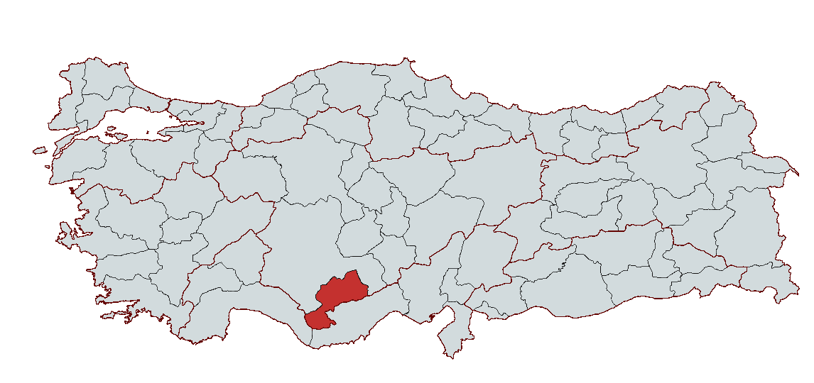
Karaman
Country | Türkiye | ||||||||
|---|---|---|---|---|---|---|---|---|---|
Region | Central Anatolia Region | ||||||||
Population | 262,791 (2023) | ||||||||
Area | 8,869 km² | ||||||||
Climate | Continental Climate | ||||||||
Important Structure | Tol Medrese Karaman Castle Sarkıt Dikit Cave Yunus Emre Tomb | ||||||||
Area Code(s) | 338 | ||||||||
License Plate Code | 70 | ||||||||
Governor | Mehmet Fatih Çiçekli | ||||||||
Mayor | Savaş Kalaycı | ||||||||
Karaman is a historically and culturally significant city located in the interior Anatolia region of Türkiye. Karaman, one of the oldest settlement centers in Anatolia, has served as a home to various civilizations from the Hittites to the Ottomans. Known as Larende during classical antiquity, the city became the capital of the Karamanoğlu Beylik in 1256 and adopted the name Karaman during the Ottoman period. It was officially registered as Türkiye’s 70th province on 15 June 1989.
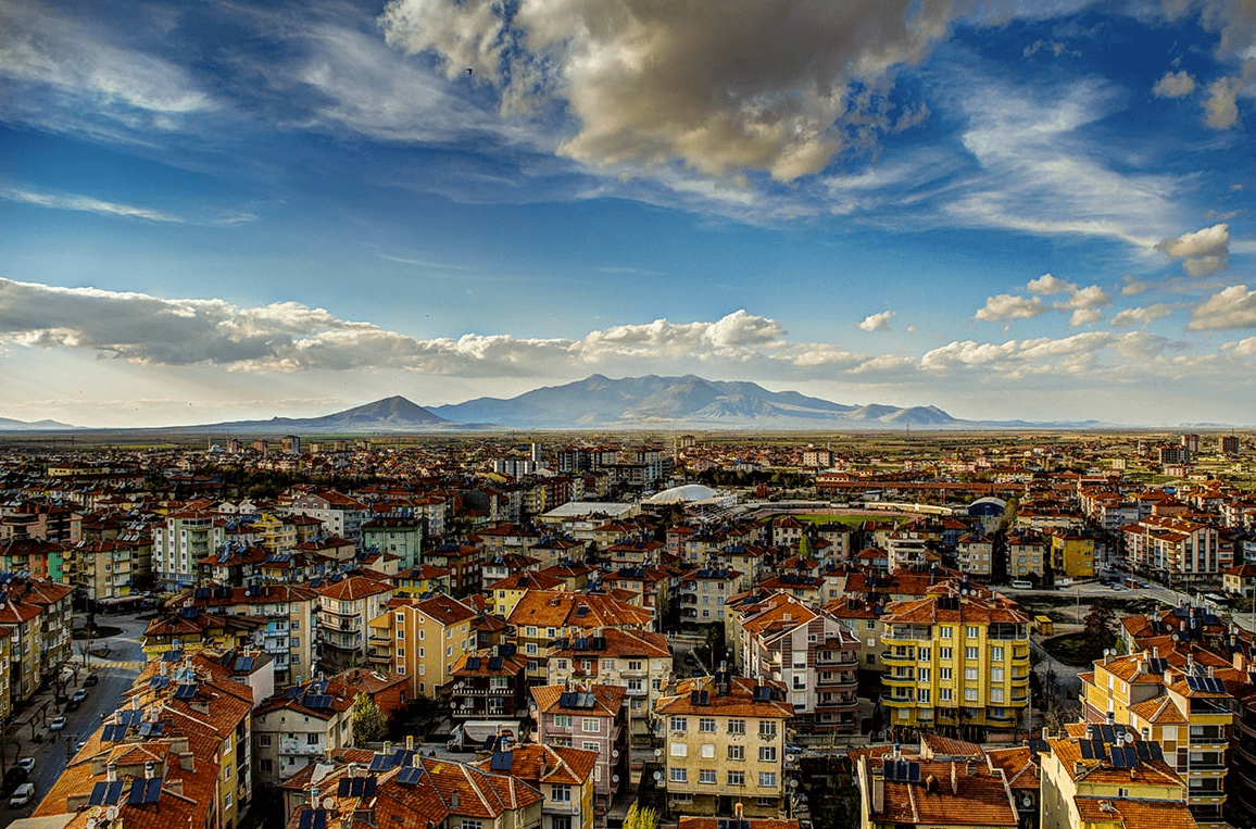
Karaman, Türkiye (Source: Karaman Municipality)
The earliest settlement traces in Karaman and its surroundings date back to the Neolithic Age (circa 8000 BCE). During the Hittite period, the region functioned as a military and commercial center and was subsequently governed by the Phrygians, Lydians, Persians, Hellenistic kingdoms, Romans, and Byzantines. Particularly during the Roman and Byzantine eras, evidence indicates intensive agricultural and livestock activities in the area.
Following the Battle of Manzikert in 1071, Turkic tribes settled in Karaman and its surroundings, bringing the region under the control of the Seljuk Sultanate of Anatolia. In the late 13th century, as the Seljuk state weakened, the Karamanoğulları Beylik gained strength in the region and declared Larende its capital.
Karamanoğlu Mehmet Bey made a significant contribution to the preservation of the Turkish language and culture by issuing a decree in 1277 that declared Turkish the official language. At its height, the beylik extended over a vast territory encompassing Konya, Karaman, Niğde, Kayseri, Adana and Antalya. After prolonged conflicts with the Ottomans, Fatih Sultan Mehmet incorporated the Karamanoğulları Beylik into Ottoman territories in 1469.
During the Ottoman period, Karaman was administered first as a beylerbeylik and later as a sancak center. In the 19th century, under the Ottoman vilayet system, Karaman was attached to the Konya Vilayet. It gained municipal status in 1911 and was elevated to provincial status in 1989.
Throughout history, Karaman has been regarded as one of Anatolia’s key cities due to its location along major trade routes, its role as a host to multiple civilizations, and its status as the center of the Karamanoğulları Beylik. Today, it continues its development process in industry, agriculture and trade while preserving its rich historical heritage.
Located in the southern part of Türkiye’s interior Anatolia region, Karaman lies between 37°11' north latitude and 33°15' east longitude. With an area of 8,924 km², it borders Mersin to the east, Konya to the west, Aksaray and Niğde to the north, and Antalya to the south. Situated at an average elevation of 1,039 meters above sea level, Karaman features a terrain characterized by plateaus and plains.
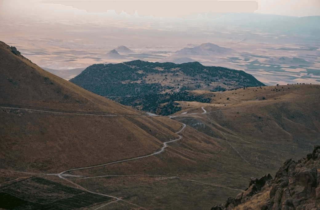
Karaman, Türkiye (Source: Pexels/Talha Aytan)
Karaman lies under the influence of the northern extensions of the Taurus Mountains. The most prominent highland areas in the region are Karadağ (2,271 m) and Erenler Mountain. Additionally, the plateaus in the north and Güllük Mountain form significant elevated areas within Karaman’s provincial boundaries.
Karaman possesses fertile agricultural lands, with its most important plains being:
Due to its location within the Konya Closed Basin, Karaman has a limited river network. The main rivers in the city are:
Among the lakes in Karaman, Başkuyu Lake and the Karadağ crater lakes hold geological and ecological significance.
Karaman generally exhibits continental climate characteristics. Summers are hot and dry, while winters are cold and snowy. The natural vegetation consists primarily of steppes. Plants such as geven, yavşan otu, and kekik are widespread, while juniper and black pine forests are found in higher elevations.
Karaman is a province whose economy is largely based on agriculture and agro-industry and holds a significant position in Türkiye’s economy, particularly in the food industry. The province stands out due to its fertile agricultural lands, strong industrial infrastructure, and growing potential for foreign trade. Agricultural production, especially fruit and cereal cultivation, forms a cornerstone of its economic structure, and the industrial sector has developed largely in support of this production.
As of 2021, Karaman ranked 28th in Türkiye in terms of gross domestic product per capita, with a per capita income of 70,495 TL, placing it close to the national average. Although industrialization has accelerated in the province, it has not yet fully developed into a fully-fledged industrial city.
Industrial facilities, primarily concentrated in the food manufacturing sector and led by the Karaman Organized Industrial Zone (OSB), are expanding. Additionally, the establishment of the Karaman Technology Development Zone and a second OSB is ongoing. The province also hosts a designated free zone, with investments continuing to strengthen its industrial infrastructure.
Karaman possesses fertile agricultural land, with 37% of its total area used for agriculture. Although 71% of agricultural land is suitable for irrigation, insufficient irrigation infrastructure means only 43.5% of total agricultural land is actually irrigated. Agricultural activities are primarily based on cereal and fruit production, with the main agricultural products being:
Karaman is one of Türkiye’s largest apple-producing centers and ranks among the top three provinces nationally in apple production. With the highest number of certified apple trees in the country, Karaman’s annual output varies with climatic conditions but remains competitive with Isparta. In 2022, it accounted for 15.6% of Türkiye’s total apple production.
Karaman also has significant potential in vegetable production. Tomatoes, dry onion, cucumber, fresh bean, and other vegetables are cultivated over extensive agricultural areas. Vegetable farming holds an important place in agricultural production, particularly for local markets and as industrial raw material.
The livestock sector focuses on large and small ruminant farming as well as beekeeping. As of 2018, Karaman had 68,266 head of cattle, 470,774 sheep, and 192,079 goats. In small ruminant farming, Merino sheep and Angora goats are particularly prominent. Beekeeping is also well-developed; in 2022, approximately 323.9 tons of honey were produced, and beeswax production reached significant levels.
Karaman’s industry is largely shaped by agro-based food manufacturing. As one of Türkiye’s most important biscuit and chocolate production centers, Karaman accounts for approximately 35% of the country’s biscuit output. Other key sub-sectors of the food industry include:
In terms of industrial output and trade volume, Karaman has seen growth, with four firms from the province included in the Istanbul Chamber of Industry’s “Top 500 and Second 500 Large Industrial Establishments” list in 2021. All four firms operate in the food industry. The Organized Industrial Zone provides employment for approximately 15,879 people, and employment rates continue to rise with the expansion of industrial facilities.
Historically situated along the Silk Road, Karaman has long been a center of commercial activity. Today, domestic and foreign trade continue to represent significant economic potential. Major products exported from the province include:
In return, Karaman imports various consumer goods from other provinces, including textiles, construction materials, industrial raw materials, automotive products and fuel.
Karaman has also gained momentum in foreign trade, achieving exports totaling $310 million to 154 countries in 2022. Major export products include biscuits, chocolate, cocoa products, sugar-based goods, pasta and bulgur. Karaman’s export-oriented industrial structure, particularly in the food sector, makes a significant contribution to Türkiye’s foreign trade objectives.
The strengthening of transportation and logistics infrastructure plays a vital role in Karaman’s economic development. Key projects underway include:
To further enhance its industrial infrastructure, Karaman is implementing the Second Organized Industrial Zone and Free Zone projects. Upon completion, these investments are expected to significantly boost the province’s industrial and commercial potential.
As of 2023, Karaman has a population of 263,960, with the majority residing in urban centers. The province’s demographic structure is notable for its high proportion of young and working-age population: 51% of the total population is under 35 years of age, and 68% falls within the 15–64 working-age bracket.
With an urbanization rate of 76.25%, migration from rural areas to urban centers is a key demographic dynamic in Karaman. Primary drivers of internal migration include land fragmentation, the spread of mechanized agriculture, greater employment opportunities in cities, and better access to education and healthcare services in urban areas. Additionally, emigration to Europe and Middle Eastern countries since the 1960s has led to population decline in villages; however, the return of expatriates during summer months generates economic activity in the city.
According to TÜİK’s Index of Living Conditions in Provinces, Karaman ranks 25th among Türkiye’s 81 provinces, performing above the national average in terms of security, housing access and infrastructure. With ongoing industrialization and infrastructure investments, Karaman’s population growth and urbanization process are expected to continue accelerating.
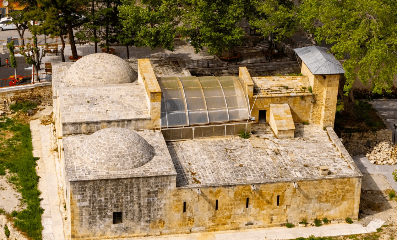
Tol Medrese, Karaman (Source: Culture Portal)
Mehmet Fatih Çiçekli is currently serving as Governor of Karaman, having been appointed by Presidential Decree published in the Official Gazette on 19 September 2024, numbered 32667, and assuming office on 26 September 2024.
Gümüşçü, Osman. "XVI. Yüzyıl Larende (Karaman) Kazasında Yerleşme ve Nüfus." T.C. Karaman İl Kültür ve Turizm Müdürlüğü Yayınları.
Karaman Haberleri. "Karaman’ın Coğrafi Yapısı." Karaman Haberleri Web Sitesi. Accessed February 11, 2025.
Karaman Valiliği. "Ekonomi ve Sanayi." T.C. Karaman Valiliği Resmî Web Sitesi. Accessed February 11, 2025.
Karaman Valiliği. "Karaman Ekonomisi." T.C. Karaman Valiliği Resmî Web Sitesi. Accessed February 11, 2025.
Karaman Valiliği. "Kültür ve Turizm." T.C. Karaman Valiliği Resmî Web Sitesi. Accessed February 11, 2025.
Karaman Valiliği. "Tarihsel Gelişim." T.C. Karaman Valiliği Resmî Web Sitesi. Accessed February 11, 2025.
Karaman Valiliği. "İlin Coğrafi Bilgileri." T.C. Karaman Valiliği Resmî Web Sitesi. Accessed February 11, 2025.
Karaman'da Yatırım. "Coğrafi Yapı ve Ulaşım." Karaman Yatırım Destek Ofisi. Accessed February 11, 2025.
Karaman'da Yatırım. "Demografi." Karaman Yatırım Destek Ofisi. Accessed February 11, 2025.
Karaman'da Yatırım. "Karaman Ekonomisi." Karaman Yatırım Destek Ofisi. Accessed February 11, 2025.
Karamanlı Belediyesi. "Karaman Tarihçesi." T.C. Karamanlı Belediyesi Resmî Web Sitesi. Accessed February 11, 2025.
Karamanlı Belediyesi. "Karaman'ın Coğrafi Yapısı." T.C. Karamanlı Belediyesi Resmî Web Sitesi. Accessed February 11, 2025.
Karamanoğlu Mehmetbey Üniversitesi. "Karaman Tarihi." T.C. Karaman İl Kültür ve Turizm Müdürlüğü Yayınları. Accessed February 11, 2025.
Polat, Bayram. "Karaman İli Dini Tarihi ve Günümüz İnanç Coğrafyası." T.C. Karaman İl Kültür ve Turizm Müdürlüğü Yayınları.
Sanayi ve Teknoloji Bakanlığı ve Mevlana Kalkınma Ajansı. "Karaman İli Sanayi ve Ekonomi Analizi." 2019. Accessed February 11, 2025.
T.C. Karaman İl Kültür ve Turizm Müdürlüğü. "Karaman Nüfusu." T.C. Kültür ve Turizm Bakanlığı Karaman İl Müdürlüğü. Accessed February 11, 2025.
Ünal, Tahsin. "Karamanoğulları Tarihi." T.C. Karaman İl Kültür ve Turizm Müdürlüğü Yayınları.

Karaman
Country | Türkiye | ||||||||
|---|---|---|---|---|---|---|---|---|---|
Region | Central Anatolia Region | ||||||||
Population | 262,791 (2023) | ||||||||
Area | 8,869 km² | ||||||||
Climate | Continental Climate | ||||||||
Important Structure | Tol Medrese Karaman Castle Sarkıt Dikit Cave Yunus Emre Tomb | ||||||||
Area Code(s) | 338 | ||||||||
License Plate Code | 70 | ||||||||
Governor | Mehmet Fatih Çiçekli | ||||||||
Mayor | Savaş Kalaycı | ||||||||
History
Geographical Structure
Mountains and Plateaus
Plains and Alluvial Plains
Rivers and Lakes
Climate and Vegetation
Economic Structure
Agriculture and Livestock
Industry and Manufacturing
Domestic and Foreign Trade
Infrastructure
Logistics and Infrastructure Development
Demographic Structure
Historical Structures
Administration
Governor