


This article was automatically translated from the original Turkish version.
+1 More
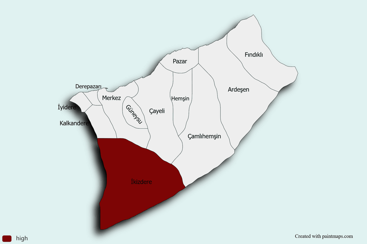
İkizdere (District)
Province | Rize | ||||||||
|---|---|---|---|---|---|---|---|---|---|
Surface Area | 898 km² | ||||||||
Elevation | 570 m | ||||||||
Population | 1.875 (TÜİK, 2021) | ||||||||
Administrative Structure | 1 municipality, 29 villages | ||||||||
Mayor | Abdi Eşki | ||||||||
District Governor | Ali Özdaş | ||||||||
İkizdere is a district of Rize province in the Black Sea Region of Türkiye. It is located approximately 56 kilometers southwest of the city center of Rize and about 20 kilometers from the Black Sea coast. The district is known for its natural beauty, historical structures, and cultural richness, and serves as an important center particularly for tea cultivation and highland tourism.
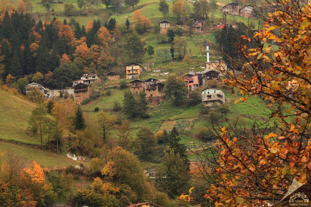
İkizdere (İkizdere Municipality)
The settled history of İkizdere is layered with civilizations dating back to antiquity, situated at the intersection of the coastal mountains of the Black Sea and the Kaçkar Range. The region functioned continuously as a cultural and commercial crossroads due to its strategic location, transitioning from Persian rule to the Kingdom of Pontus, and later under Roman and Byzantine administration.
In 1461, following the conquest of the Empire of Trebizond by Fatih Sultan Mehmet, the settlement was incorporated into Ottoman administration and was known at that time as “Kuray-ı Seb’a,” meaning “Seven Villages.” This name referred to the seven village communities in the area and established İkizdere as a nahiye center within the Ottoman sanjak structure. In 1878, with the organization of Rize as a sanjak center, Kuray-ı Seb’a officially gained nahiye status; by the late 19th century, it continued to exist as an administrative unit under the Lazistan Sanjak of Trabzon Vilayet.
Parallel to the course of the First World War, the Russian occupation of the region on 15 February 1916 led to a two-year period of administrative change. Following the withdrawal of Russian forces on 11 March 1918, İkizdere returned to Ottoman control and shortly thereafter became part of the administration of the Republic of Türkiye.
In the early years of the Republic, the name “Kuray-ı Seb’a” was officially removed from records in 1933 and replaced with “İkizdere.” In 1945, the settlement was placed under the jurisdiction of Güneyce, which was then the district center, as a bucak. In 1952, it attained full district status under Rize province.
Today, İkizdere is one of the youngest districts of Eastern Black Sea, preserving traces of administrative changes from antiquity to the Republic, including stone bridges, wooden houses, and highland pastures that mark the transition between the Black Sea and continental climates.
İkizdere is located in the northeastern part of Rize province at the confluence of the Çamlık and Cimil rivers. It has a total area of 898 km² and an elevation of 570 meters at the district center. The district features a mountainous and rugged terrain, characterized by narrow valleys, high plateaus, and glacial basins resembling crater lakes.
Due to its topography, rivers formed in the valleys flow northward directly into the Black Sea. The main water source, the İkizdere River, originates from the confluence of the Çamlık and Cimil rivers and contributes to energy production through a small-scale hydroelectric power plant. Additionally, the Karadere River and its smaller tributaries play a vital role in irrigation and drinking water supply for the region.
In the higher elevations, the highland pastures of Çağrankaya, Ovit, and Demirkapı, along with mineral water springs in Ilıcaköy and Şimşirli, are located. These highlands, with elevations reaching 1,800 to 2,500 meters and seasonally varying vegetation, support both permanent settlement and tourism. Glacial cirques and small lakes at the peaks reveal the region’s geomorphological diversity.
In terms of climate, İkizdere lies within the typical Black Sea climatic zone, characterized by high humidity and abundant rainfall throughout the year, especially during autumn and spring. Average annual precipitation exceeds 2,000 mm. This moist and temperate climate creates favorable conditions for the cultivation of tea, particularly in lowland areas, as well as for forest products.
Vegetation is stratified according to elevation:
These geographical and climatic features enable İkizdere to support forestry, hydroelectric energy, highland pastoralism, and tea cultivation while simultaneously enhancing regional tourism with unique natural values.
According to 2021 data, İkizdere’s population is 1,875. The district has one municipality and 29 villages. The majority of the population resides in rural areas, where traditional ways of life continue to exert influence.
The economy of İkizdere is based on a balanced combination of sectors determined by its geographic and climatic conditions. The district’s rugged terrain and narrow valleys limit the availability of land for large-scale agriculture, prompting the local population to adopt a diversified livelihood model.
Small-scale (sheep, goat) and large-scale (cattle) livestock farming are widespread livelihood sources within the traditional shepherd system. Professional knowledge passed down through master-apprentice relationships plays a role in every stage, from animal care to marketing. Seasonal grazing on high pastures ensures both animal health and the preservation of alpine ecosystems. Additionally, beekeeping is an important secondary sector due to the region’s floral diversity; İkizdere honey is marketed through local branding initiatives, adding economic value to the region.
The majority of İkizdere’s land area is covered by dense forests, which serve as a source of primary forest products such as logs, timber, and firewood. Planned logging operations conducted in collaboration between local cooperatives and the Forest Management Directorate generate employment and provide regular revenue to the district budget. Moreover, locally distinctive fir, spruce, and alder logs meet growing demand from the woodchip industry.
A small-scale hydroelectric power plant (HES) operates on the İkizdere River, formed by the confluence of the Çamlık and Cimil rivers. This facility partially meets the region’s electricity needs and provides modest cost savings for local residents. Additionally, the commercial exploitation of mineral water springs in Ilıcaköy and Şimşirli creates an additional income source and prepares infrastructure for balneotourism.
In the narrow valleys, slope farming produces maize, potatoes, and small quantities of beans, largely meeting household needs. Tea cultivation is limited to small areas near sea level, contributing modest but economically significant yields. In recent years, the collection of local mushrooms and medicinal plants has emerged as a seasonal supplementary income option.
İkizdere holds significant potential for ecotourism due to its myriad shades of green and geomorphological diversity. The highland pastures of Çağrankaya, Ovit, and Demirkapı offer infrastructure for day trips and overnight stays, featuring glacial lakes, waterfalls, and forest walking trails. The opening of the Ovit Tunnel has expanded winter tourism opportunities, improving access to areas suitable for skiing and mountaineering. Additionally, Ilıcaköy, home to mineral water springs, is strengthening health tourism through the development of therapeutic facilities.
İkizdere’s culture, shaped by highland pastoral life, includes social rituals centered around shepherding traditions. Summer highland festivals feature folk dances performed to the music of horon, kemençe, and tulum, alongside craft stalls that reinforce local identity. Traditional stone houses, wooden mosques, and kümbets represent the region’s architectural heritage. Water mills, though no longer maintained, remain part of the cultural memory as sites once used for grinding grain.
İkizdere’s cuisine combines the staple ingredients of the Black Sea with high-altitude influences:
Kocaeli Rizeliler Derneği. “Rize İkizdere İlçesi.” Kocaeli Rizeliler Derneği Resmî Web Sitesi. Accessed April 17, 2025.https://kocaelirizelilerdernegi.com/rize-ikizdere-ilcesi/
İkizdere Belediyesi. "İkizdere Fotoğrafları." İkizdere Belediyesi. Accessed April 20, 2025.https://www.ikizdere.bel.tr/foto/ikizdere
İkizdere Kaymakamlığı Governorship. "İlçemiz." T.C. İkizdere District Governorship Official Website. Accessed April 17, 2025.http://www.ikizdere.gov.tr/ilcemiz

İkizdere (District)
Province | Rize | ||||||||
|---|---|---|---|---|---|---|---|---|---|
Surface Area | 898 km² | ||||||||
Elevation | 570 m | ||||||||
Population | 1.875 (TÜİK, 2021) | ||||||||
Administrative Structure | 1 municipality, 29 villages | ||||||||
Mayor | Abdi Eşki | ||||||||
District Governor | Ali Özdaş | ||||||||
No Discussion Added Yet
Start discussion for "İkizdere (District)" article
History
Geography and Climate
Population
Economy
Tourism, Culture and Cuisine