


This article was automatically translated from the original Turkish version.
+2 More
Haymana (District)
Province | Ankara | ||||||||
|---|---|---|---|---|---|---|---|---|---|
Geographic Region | Central Anatolia | ||||||||
Population | 27,298 (2021) | ||||||||
District Governor | Osman SAK | ||||||||
Mayor | Levent KOÇ | ||||||||
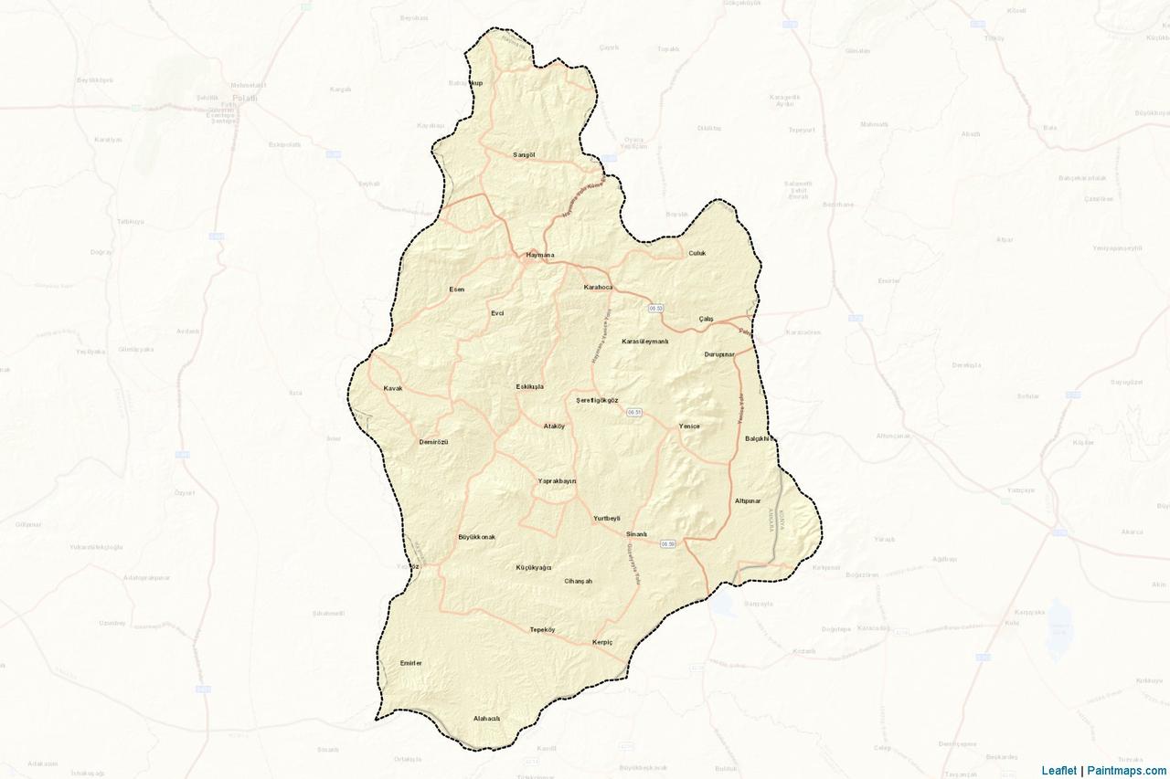
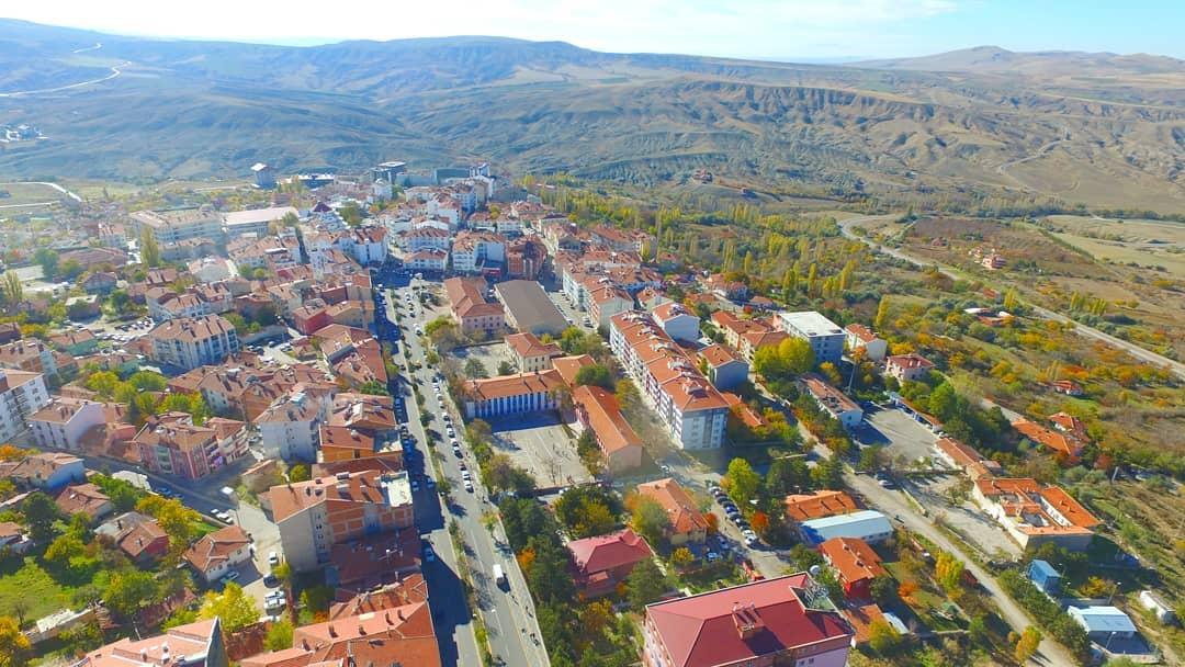
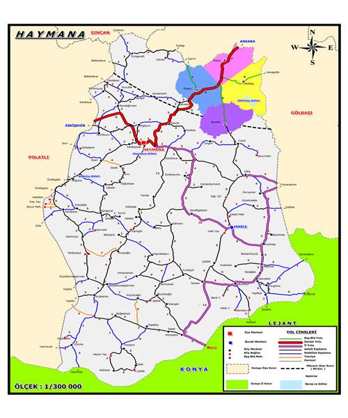
Haymana is a district of Ankara province located in the Central Anatolia Region of Türkiye. The district is approximately 75 kilometers from the capital and has a large surface area with an average elevation of 1,260 meters. Access to the district is provided by road, and public transportation makes it easily reachable from Ankara as well as neighboring districts. To the east of the district lies Balâ, to the south Kulu and Cihanbeyli, to the west Polatlı, and to the north Gölbaşı. Two-thirds of the district’s territory is occupied by the Haymana Plateau.
Ankara, Haymana (Haymana Belediyesi)
The history of Haymana dates back to ancient times. Archaeological research in the region has revealed settlement traces extending as far back as the Hittite period. Subsequently, Haymana came under the rule of various civilizations including the Phrygians, Persians, Romans, and Byzantines. After the Battle of Manzikert, it fell under the control of the Seljuks. During the Turkish War of Independence, Haymana gained significant importance, as some fronts of the Battle of Sakarya were fought on its territory. For this reason, the district contains numerous martyrs’ memorials and monuments.
There are various legends regarding the origin of the name Haymana. The most well-known attributes the name to Hayme Ana, the mother of Osman Gazi, founder of the Ottoman State. According to the legend, Hayme Ana died in the area where the current district center stands and was buried there. Over time, the name “Hayme Ana” evolved into “Haymana” among the local population.
At the same time, the etymological origin of the word “Haymana” is noteworthy. In Kaşgarlı Mahmud’s Divanü Lügati’t-Türk, the term “haymana” is used to mean pasture, meadow, or greenery. This meaning aligns with the district’s geographical structure and its historical usage.
Historical sources refer to the region by different names.
In the 18th century, during the administrative organization of the Ankara region, this area was named “Haymanateyn”. Additionally, Ankara Sharia Registers from 1588–1590 mention the region as “Büyük Haymana” and “Küçük Haymana”. These references demonstrate that Haymana has long been an important center in terms of settlement and administration.
Geographically, Haymana is a typical Central Anatolian district, notable for its extensive steppe lands and pastures. It experiences a continental climate with hot, dry summers and cold, snowy winters. This natural environment has shaped agricultural and livestock activities in the district. Cereals such as wheat and barley are widely cultivated, while cattle and sheep farming remain vital sources of livelihood for the local population.
According to current data from the Haymana Subprovince, the total population of Haymana district as of 2021 is 27,298. Of this, 7,693 reside in the district center, while the remaining 19,605 live in rural neighborhoods (outer villages). These figures indicate that a significant portion of Haymana’s population lives outside the urban center, with non-central populations playing a decisive role in the district’s demographic structure.
Due to limited economic opportunities in Haymana and migration trends toward major cities, especially Ankara, the district’s population is gradually declining. This migration, particularly among the youth, has also led to an increase in the average age of the remaining population. The demographic structure of the district is quite diverse, with predominantly Turkish and Kurdish communities living alongside groups of other ethnic origins.
Ankara, Haymana Haritası (
The economy of Haymana district is primarily based on agriculture, livestock farming, and thermal tourism.
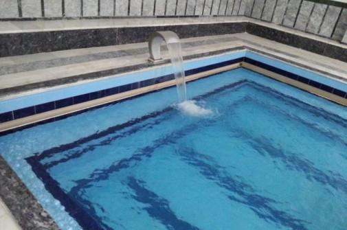
Haymana is best known for its thermal springs. The district hosts numerous thermal hotels and spa facilities. The thermal water, with a temperature of approximately 44–45 degrees Celsius, is believed to be beneficial for rheumatism, skin diseases, and musculoskeletal disorders. This characteristic has made Haymana an attractive health tourism destination for both domestic and international visitors. Thermal tourism has contributed significantly to the district’s economic prosperity, created new employment opportunities, and attracted investment.
Ankara, Haymana Kaplıcaları (Haymana Belediyesi)
Haymana’s cultural identity has been shaped by the dense presence of Turkish and Turkmen communities. The local population actively preserves traditional Turkmen culture, which manifests in local music, dance, clothing, and daily life. Moreover, traditional crafts such as handicrafts and weaving are still widely practiced in the villages surrounding Haymana. Historical and cultural structures such as the Haymana Thermal Baths make significant contributions to the district’s cultural heritage. Additionally, traces of the Turkish War of Independence are visible throughout the district; battlefields and monuments provide historical depth.
Haymana’s cuisine reflects the rich flavors of the Central Anatolia Region. Meat dishes are very common in Haymana. Traditional dishes such as meat cooked in a tandır oven and kuymak are among the most representative examples of local cuisine. Additionally, appetizers such as tarator, bulgur pilaf, and kısır are frequently consumed. Baked dough products also hold an important place in Haymana’s culinary tradition. Delicacies such as bazlama, gözleme, and simit are commonly enjoyed during breakfast and other meals.
Ankara İl Kültür ve Turizm Müdürlüğü. "Haymana." Accessed May 8, 2025.https://ankara.ktb.gov.tr/TR-152772/haymana.html.
Haymana Kaymakamlığı. "İlçemizin Tarihçesi." Accessed May 8, 2025.https://www.haymana.gov.tr/ilcemizin-tarihcesi.
Haymana Kaymakamlığı. “İlçemiz Nüfusu.” Haymana Kaymakamlığı Resmî Web Sitesi. Accessed May 8, 2025.http://www.haymana.gov.tr/ilcemiz-nufusu
Haymana Municipality. "Haymana Hakkında." Haymana Belediyesi. Accessed May 8, 2025.https://www.haymana.bel.tr/sayfa/haymana-hakkinda.
Haymana İlçe National Education Directorate. "İlçemiz Hakkında." Haymana District National Education Directorate. Accessed May 8, 2025.https://haymana.meb.gov.tr/www/ilcemiz-hakkinda/icerik/356.
Turkiye Statistical Institute (TÜİK). *Adrese Dayalı Nüfus Kayıt Sistemi Sonuçları, 2024*. Accessed May 14, 2025.https://data.tuik.gov.tr/Bulten/Index?p=Adrese-Dayali-Nufus-Kayit-Sistemi-Sonuclari-2024-53783

Haymana (District)
Province | Ankara | ||||||||
|---|---|---|---|---|---|---|---|---|---|
Geographic Region | Central Anatolia | ||||||||
Population | 27,298 (2021) | ||||||||
District Governor | Osman SAK | ||||||||
Mayor | Levent KOÇ | ||||||||
History
Geography and Climate
Population and Demographic Structure
Economic Structure and Tourism
Culture and Cuisine