


This article was automatically translated from the original Turkish version.
+2 More
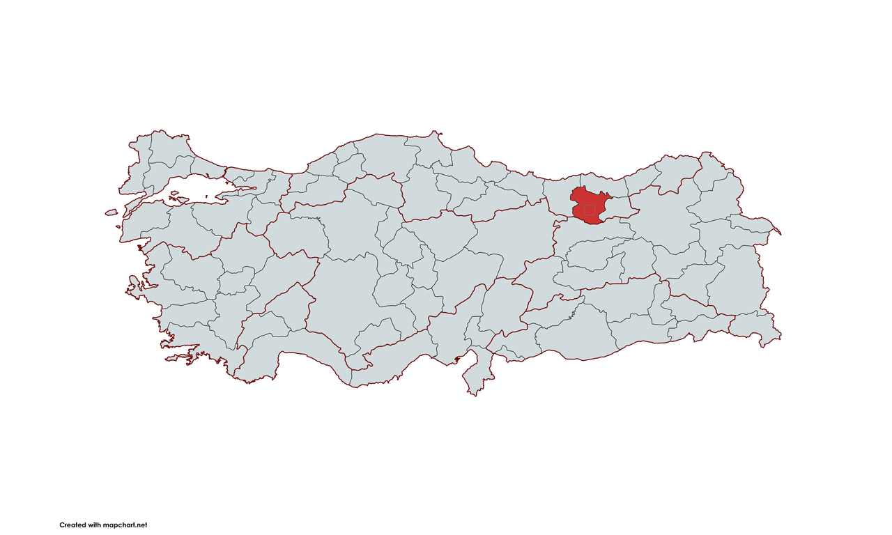
Gümüşhane
Country | Türkiye | ||||||||
|---|---|---|---|---|---|---|---|---|---|
Region | Black Sea | ||||||||
Population | 170,000 people (approximately) | ||||||||
Area | 6,678 km² | ||||||||
Climate Type | Continental Climate | ||||||||
Important Structure | Zigana Pass Gümüşhane Castle Kızlar Hamamı Santa Ruins Karaca Cave | ||||||||
Area Code(s) | 456 | ||||||||
License Plate Code | 29 | ||||||||
Governor | Aydın BARUŞ | ||||||||
Mayor | Vedat Soner BAŞER | ||||||||
Gümüşhane is a city located in the interior regions of Türkiye's Black Sea Region and has held strategic importance throughout history due to its position along trade routes. Named after the silver deposits found in the region, Gümüşhane has served as a home to many civilizations throughout history and became an economically significant merkez during the Ottoman period. The city, known for its surrounding natural beauty, historical structures, and unique cuisine, is today an important destination for both historical and nature tourism.
Gümüşhane has been a city bearing traces of many civilizations and distinguished by its cultural heritage. The city's history has been shaped by the richness of its natural resources and its geographical location; Gümüşhane has been under the rule of major civilizations such as the Hittites, Urartians, Persians, Romans, Byzantines and Ottomans, each contributing to the region's development. The city's history is particularly linked to silver mining, which has been a key etken in shaping Gümüşhane's economic structure.
The earliest settlement traces in Gümüşhane extend back to the Hittites. The Hittites ruled a large part of Anatolia between 2000 and 1200 BCE, and the Gümüşhane region fell within their sphere of influence. However, there are no definitive findings regarding exactly when the area became a settlement. Although it is not certain whether the Hittites engaged in silver mining, given the ancient origins of the region's silver deposits, it is likely that these mines were utilized during the Hittite period.
The Urartians emerged as another major civilization to influence the region after the Hittites. In the 9th century BCE, the Urartians established a powerful civilization in Eastern Anatolia and its surroundings, and Gümüşhane became part of this territory. The Urartians constructed water channels and dam systems and carried out active work to extract valuable minerals such as silver. During this period, the processing of silver and copper played a significant role in regional trade.
In the 6th century BCE, the Persian Empire took control of the region following the Urartians, further highlighting Gümüşhane's strategic position. The Persians placed great önem on silver mining activities in the area. Subsequently, Roman rule marked one of the most important periods in Gümüşhane's history. During the Roman era, particularly between the 1st century BCE and the 2nd century CE, the processing of silver mines in the region intensified, and Gümüşhane became an important üretim center.
The Roman Empire operated the region's silver mines and sourced the silver needed to mint coins from here. Gümüşhane's name began to become synonymous with silver mining from the Roman period onward. The mining and processing activities carried out during this era were among the most important factors shaping the local economy.
Following the division of the Roman Empire, Gümüşhane came under the rule of the Byzantine Empire (Eastern Rome). The Byzantines continued to utilize the region's mineral resources inherited from Rome. The Byzantine period was one in which Gümüşhane's economic and cultural structure was further developed. The Byzantines promoted not only silver mining but also agriculture and animal husbandry, diversifying life in the region. Additionally, during the Byzantine period, the bölge became acquainted with Christianity, leading to an increase in religious structures through the construction of churches.
The Ottoman Empire incorporated Gümüşhane into its territories from the late 15th century and transformed the region into an important trade center. Particularly, Gümüşhane's geographical location made it a significant hub for trade and transportation during the Ottoman era. The Ottomans continued silver mining and established the region as a major center for silver production. During this period, the silver and other minerals found in Gümüşhane held great değer for both local trade and the central administration of the Ottoman Empire.
During the Ottoman period, the increase in Armenian and Rum settlements led to intensified mining activities in the region. These communities were involved in both silver craftsmanship and trade, contributing significant economic vitality to the area. Gümüşhane remained the center of silver production until the final years of the Ottoman Empire.
With the establishment of the Republic, Gümüşhane's economic structure underwent a major değişim. The halk, who previously relied on agriculture and animal husbandry, increasingly turned toward these sectors as industrialization and financial development progressed. In the early years of the Republic, Gümüşhane had an economy based on agriculture, with farming and animal husbandry taking center stage in rural areas.
Today, Gümüşhane has become an important tourism center due to its natural wealth, historical fabric, and cultural heritage. The city's tarihsel past, centered on silver mining and a rich cultural legacy, has made it a significant city both locally and nationally. Ancient settlement sites, castles, and churches in the city preserve traces of the past. Gümüşhane's history of hosting various civilizations has endowed it with considerable cultural diversity and richness.
Located between the Black Sea Region and Eastern Anatolia, Gümüşhane has occupied a strategically attractive position throughout history. Surrounded by high mountains and narrow valleys, the city possesses a natural defensive advantage while also having rich potential for agriculture and animal husbandry. Gümüşhane's geographical structure has had a significant impact on the development of civilizations throughout history.
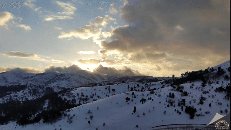
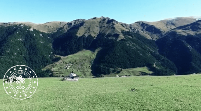
(Gümüşhane Panorama)
Gümüşhane lies to the east of the Black Sea while also being yakın to Eastern Anatolia. The city is surrounded by high mountains and rugged terrain, and this mountainous yapı has ensured that Gümüşhane has historically been a defensible settlement area. Throughout history, this geographical advantage has made the city important both militarily and commercially. Civilizations such as the Romans and Ottomans took advantage of Gümüşhane's natural richness, engaged with its mineral resources, and operated its silver production centers.
The influence of mountainous areas has also shaped the development of Gümüşhane's infrastructure. These mountainous structures have caused transportation routes in the region to be narrow and difficult. However, these challenges provided strategic advantages that major civilizations in Gümüşhane's history used to gain control of the region. Thanks to these mountains, the city has been both defensible and connected to surrounding settlements.
Gümüşhane's climate has played a significant role in shaping the region's economic activities and lifestyle. Located in a transitional zone between the Black Sea and continental climates, Gümüşhane experiences hot and dry summers and cold, snowy winters. These climatic characteristics have limited agricultural activity in the region. However, Gümüşhane's fertile soils and high mountainous areas are suitable for the cultivation of certain crops.
One of the most important economic activities in Gümüşhane's history has been agriculture. Particularly during the Ottoman Empire, agricultural products held great importance, and Gümüşhane's agricultural output reached neighboring settlements. Wheat, barley, and maize were primarily cultivated, while fruit growing also became widespread. However, mountainous terrain and climatic challenges have restricted the extent of arable land, making this a factor affecting the sustainability of agriculture.
Gümüşhane's surface features are highly rugged. The city lies within the interior regions of the Eastern Black Sea Mountains, resulting in significant elevation differences between high-altitude areas and valleys.
General Characteristics: The landscape is shaped by mountainous areas, wide valleys, highland pastures, and river basins.
1. Elevation: The elevation of the provincial center is approximately 1,150 meters, but in some areas this height exceeds 3,000 meters.
2. Rugged Terrain: Arable land is limited; agriculture is mostly conducted on valley floors and small plateaus.
Gümüşhane is home to many important rivers that feed the Eastern Black Sea and Eastern Anatolia basins. The main rivers are:
1. Harşit Çayı: The most important river in the city, flowing through the provincial center and emptying into the Black Sea.
2. Kelkit Çayı: A tributary of the Euphrates River, extending through the Kelkit Valley and playing an important role in agricultural irrigation.
3. Karadere and Karamustafa Deresi: Rivers used for local irrigation and contributing to small-scale hydropower production.
Dams in the region are used for irrigation and energy production:
1. Torul Dam: Located on the Harşit Çayı, used for energy production and irrigation.
2. Köse Dam: Important for agricultural irrigation and drinking water supply.
3. Gümüşhane Damlaçimen Dam: Another important dam used to karşılamak the city's drinking water needs.
Gümüşhane has been a city distinguished by mining activities throughout history. The region's rich mineral deposits hold great economic importance.
1. Silver: The city derives its name from the rich silver deposits extracted historically in the area.
2. Gold: Recent studies have shown the presence of gold reserves in Gümüşhane.
3. Copper: One of the region's underground riches and has played an important role in mining since ancient times.
4. Lead and Zinc: Contain significant reserves in terms of cevher deposits.
5. Iron: Small-scale iron mining activities are also carried out in the city.
6. Marble and Limestone: Natural taş quarries used in the construction industry.
Although wide flatlands are scarce in Gümüşhane, some fertile plains exist:
1. Kelkit Plain: One of the city's largest agricultural areas, suitable especially for cereal and fruit production.
2. Şiran Plain: Another important flatland area where agriculture and animal husbandry are developed.
3. Köse Plain: Another plain area with small-scale agricultural fields.
Gümüşhane is a city surrounded by mountains, which significantly influence its climate and vegetation cover. The main mountains are:
1. Zigana Mountain (2,511 m): An important site for winter tourism, home to the Zigana Ski Center.
2. Gümüşhane Mountains: Numerous high-altitude mountains are found throughout the city.
3. Artabel Lakes Mountains: A region known for its natural beauty and protected as a national park.
4. Süme Mountain: An important area where the local population practices transhumance.
5. Gavur Mountain: A strategic location that has been left with traces of many civilizations throughout history.
Gümüşhane has many important plateaus and highland pastures for transhumance, which hold great significance for animal husbandry and organic agriculture:
1. Kadırga Plateau: A region where traditional plateau festivals are held and animal husbandry is intensive.
2. Taşköprü Plateau: A plateau distinguished by its natural beauty and agricultural areas.
3. Artabel Plateau: A tourist plateau region famous for its natural lakes.
Gümüşhane's population has fluctuated from the Ottoman period through the Republic to the present day. The main factors influencing these fluctuations include economic structures, transportation infrastructure, industrialization, and local governance policies.
Gümüşhane's history experienced a significant period of growth during the Ottoman Empire. From the 16th century onward, the Ottoman Empire began operating the region's silver and other mineral resources, increasing interest in the city. As Gümüşhane became a trade center, the population settling in the region increased, and population density and economic activity gained momentum. During this period, Gümüşhane held the status of an important trade point in the northeastern Ottoman Empire. The city housed diverse social groups including artisans, merchants, miners, and villagers.
With the proclamation of the Republic, Gümüşhane's economy began to change. Although large-scale industrial investments were not made in the early years of the Republic, a social structure based on agriculture and animal husbandry remained dominant. However, limited investments in industry and economic infrastructure led to a slowdown in population growth. Although Gümüşhane remained important in agriculture, the necessary investments for industrial development were lacking. This durum led to a reduction in employment opportunities in the city, prompting people to migrate to larger cities or other regions.
In present-day Gümüşhane, a structure is observed where industry and economic development are limited, and rural settlements are widespread. Due to its distance from major cities and limited transportation infrastructure, Gümüşhane has not yet achieved the desired level of economic performance. The city center has moved away from the vibrant population growth of past periods, and many settlements have become rural.
The population in the city continues to emigrate. This situation arises as a consequence of the city's weak economic power and local infrastructure problems. At the same time, Gümüşhane lacks sufficiently developed infrastructure in education and healthcare services, which affects the living standards of the local population.
Gümüşhane's economy has been largely shaped by its underground wealth and natural resources throughout historical süreç. During the Ottoman Empire, the city became an important trade center due to its mineral deposits, but as mining activities declined over time, the economy shifted toward other sectors. Agriculture, animal husbandry, and forestry laid the foundations of Gümüşhane's economy, while in recent years tourism and local food production have also become important components.
Gümüşhane's economic structure was shaped not only by agriculture but also by animal husbandry. The high mountainous areas provided a suitable ortam for the development of small-scale animal husbandry. Raising sheep, goats, and cattle in Gümüşhane served as a livelihood for the local population. Animal husbandry became one of the fundamental pillars of the regional economy during the Ottoman period. Milk and meat production were prominent, and by-products such as wool and leather were processed and traded. Despite all these developments, mining remained the primary source of income for the city during the Ottoman era.
Gümüşhane's history derives its name from its silver deposits. From the 16th century onward, the Ottoman Empire processed the region's silver and other valuable minerals, transforming the city into an important economic center. During the Ottoman period, Gümüşhane's silver mines were not merely a local source of wealth but also contributed to the empire's foreign trade. These mines played a significant role in the Ottoman economy and attracted merchants and workers to the region.
With the proclamation of the Republic, Gümüşhane's economy shifted toward a structure based primarily on agriculture and animal husbandry. The decline of mining led to changes in the city's economic structure, bringing agriculture and animal husbandry to the forefront. Gümüşhane's geographical structure, rich natural resources, and fertile soils supported agricultural activities. Major agricultural products in the region include hazelnuts, potatoes, wheat, barley, maize, and legumes, with hazelnut production becoming a major economic faaliyet.
Animal husbandry has also been an important component of Gümüşhane's economy. Large and small livestock farming is widespread in the city, particularly sheep and cattle breeding. Additionally, Gümüşhane's forested areas provide significant economic contributions through timber and forest product production. Forestry has served both as a livelihood for the local population and as an important part of the city's economic structure.
Gümüşhane is a city distinguished by its historical and natural attractions. It features important tourist sites such as the Santa Ruins, Karaca Cave, Satala Ancient City, and Tomara Waterfall. Traditional handicrafts and folk music are key elements of the region's culture. The city's cuisine stands out with local delicacies such as siron and pestil-köme. Local festivals and events held in the city play a vital role in preserving cultural vitality.
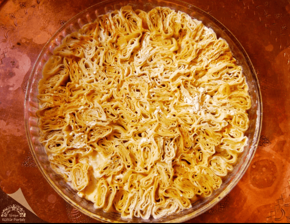
(Gümüşhane Sironu)
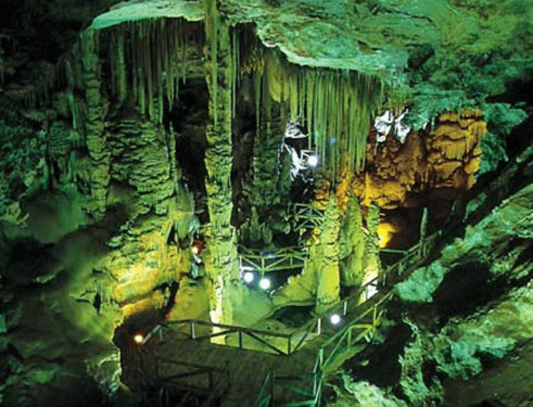
(Karaca Cave)
Gümüşhane consists of six districts. These districts play an important role in shaping both the economic structure and cultural diversity of Gümüşhane:
Gümüşhane has been a city hosting many civilizations throughout history. As a result, various historical structures are scattered throughout the city:
1. Gümüşhane Castle: This kale, which surrounds the city, bears traces from the Roman, Byzantine, and Ottoman periods and is one of Gümüşhane's most important symbols.
2. Santa Ruins: Located near the city center, this ancient city is filled with remains from the Roman and Byzantine periods.
3. Çakırgöl Plateau: This plateau is significant not only for its historical and natural richness but also as a space reflecting Gümüşhane's cultural heritage.
4. Süleymaniye Mosque: One of the examples of Ottoman architecture, this mosque is one of Gümüşhane's important religious structures.
5. Zeytinlik Church: One of Gümüşhane's historical churches and a symbol of the region's Christian heritage.
(Santa Ruins)
Since September 25, 2024, the governorship of Gümüşhane has been held by Aydın Baruş. Governor Baruş was appointed to the position of Gümüşhane Governor by Presidential Decree No. 321 dated September 18, 2024. Previously, Baruş served as governor in Bolu, Malatya, and Isparta. He speaks English, is married, and is the father of two children. Some of the governors who have served in Gümüşhane from the past to the present include:
Although Gümüşhane does not have metropolitan status, the office of the municipal mayor of the provincial center has been held since March 31, 2024, by Vedat Soner BAŞER
BAŞER was elected from the Nationalist Movement Party. Some of the mayors who have served in the city from the past to the present include:
Gümüşhane Belediyesi. "Gümüşhane Tarihi." Accessed February 15, 2025.https://www.gumushane.bel.tr/gumushane-rehberi/gumushane-tarihi/
Gümüşhane Valiliği. "Gümüşhane Tarihçesi." Accessed February 15, 2025.http://www.gumushane.gov.tr/tarihce
T.C. Kültür ve Turizm Bakanlığı. "Gümüşhane Kültür ve Turizm Müdürlüğü." Accessed February 15, 2025.https://gumushane.ktb.gov.tr/TR-220333/gumushane.html
T.C. Ministry of Environment, Urbanization and Climate Change. "Resmi Web Sitesi." Accessed February 15, 2025.https://www.csb.gov.tr/
Tuncel, Metin. "Gümüşhane." Türkiye Diyanet Vakfı İslam Ansiklopedisi. Accessed February 15, 2025.https://islamansiklopedisi.org.tr/gumushane

Gümüşhane
Country | Türkiye | ||||||||
|---|---|---|---|---|---|---|---|---|---|
Region | Black Sea | ||||||||
Population | 170,000 people (approximately) | ||||||||
Area | 6,678 km² | ||||||||
Climate Type | Continental Climate | ||||||||
Important Structure | Zigana Pass Gümüşhane Castle Kızlar Hamamı Santa Ruins Karaca Cave | ||||||||
Area Code(s) | 456 | ||||||||
License Plate Code | 29 | ||||||||
Governor | Aydın BARUŞ | ||||||||
Mayor | Vedat Soner BAŞER | ||||||||
No Discussion Added Yet
Start discussion for "Gümüşhane (Province)" article
History
Hittite and Urartian Periods
Persian and Roman Periods
Byzantine Period
Ottoman Period
Republican Era and Beyond
Geography and Climate
Geographical Location and Mountainous Structure
Climate and Agricultural Activities
Landforms
Rivers and Dams
Rivers:
Dams:
Natural Resources and Minerals
Main Minerals
Plains
Mountains
Plateaus
Population and Demographics
Ottoman Period
Republican Period
Present Day
Economy
Ottoman Period
Agriculture and Animal Husbandry
Mining
Republican Period
Tourism, Culture and Cuisine
Districts
Historical Structures
Administration
Governor
Municipal Administration