This article was automatically translated from the original Turkish version.
+1 More
Location | Nilüfer Bursa Türkiye | ||||||||
|---|---|---|---|---|---|---|---|---|---|
Ancient Name | Apollonia ad Rhyndacum | ||||||||
Date | 6th century BCE | ||||||||
Prominent Remains | Temple of Apollo, ancient theater, walls, Hagios Georgios Church | ||||||||
Natural Feature | Lake Uluabat, Weeping Plane Tree | ||||||||
Livelihood Source | Fishing, agriculture, tourism | ||||||||
Protection Status | Site area | ||||||||
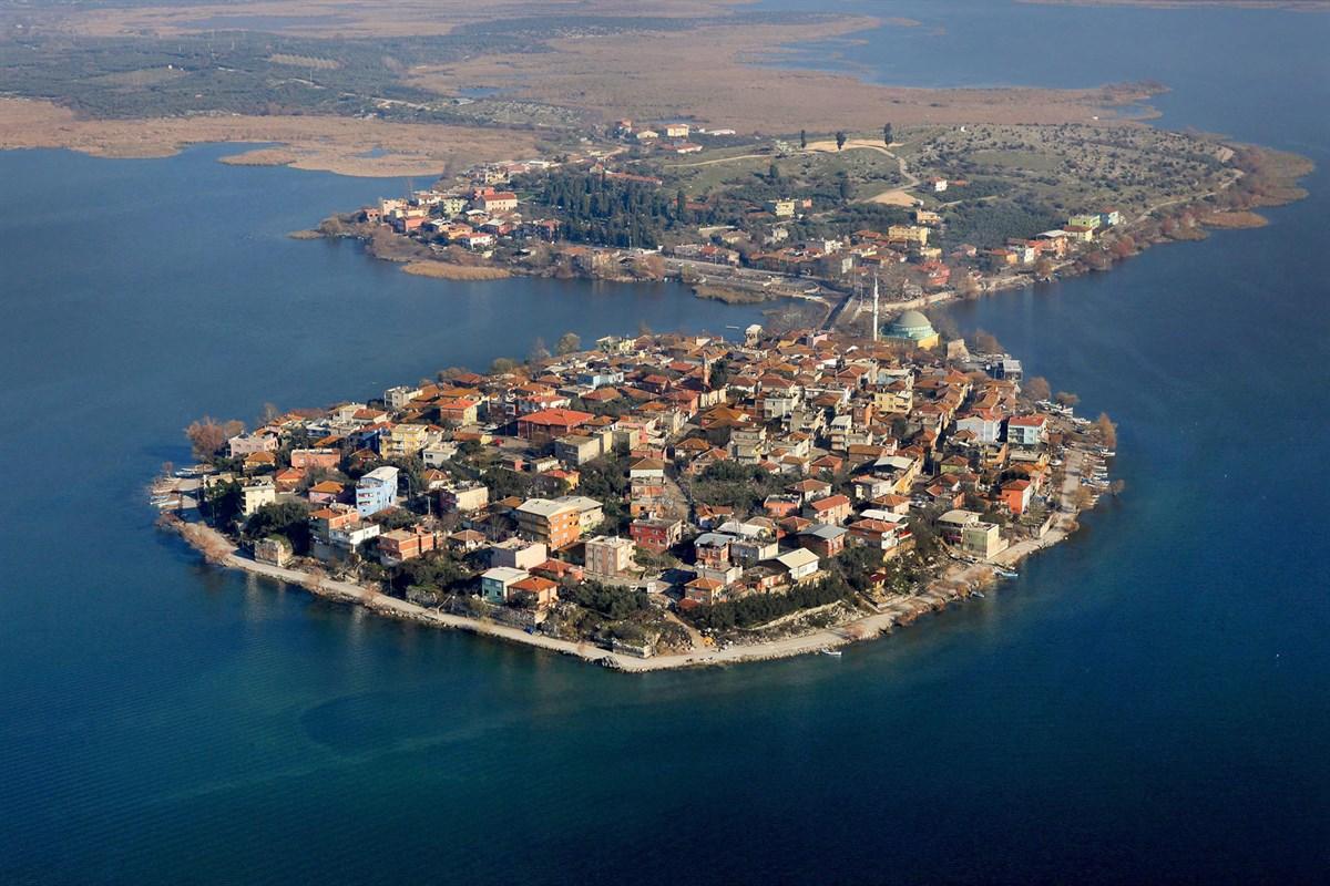
Gölyazı is a settlement located on a deep peninsula at the eastern end of Lake Uluabat, within the Nilüfer district of Bursa Province in Türkiye. The village is accessible via a 7-kilometre road branching off from the 35th kilometre of the Bursa–İzmir highway. It is situated on the northern shore of the lake, surrounded by islands. Gölyazı, built on one of the two peninsulas of Lake Uluabat, features a unique natural landscape shaped by the lake’s misty atmosphere and wetland surroundings, with water depths ranging from 2 to 4 metres.
Gölyazı (T.C. Bursa Valiliği)
The history of Gölyazı extends back to the 6th century BCE. In antiquity, the settlement was known as Apollonia ad Rhyndacum, meaning “Apollonia on the Rhyndacus.” This name distinguished it among the nine different cities named Apollonia in ancient Anatolia, referencing the Rhyndacus River—the modern Orhaneli/Kocaçay River—that feeds Lake Apolyont (Uluabat).
During the Roman period, the town developed further and became a religious centre in the Byzantine era. It is known that coins with crayfish reliefs were minted in the region during the 1st century CE. Due to limited archaeological excavations, historical knowledge has largely been derived from the study of discovered coins. Numerous imperial Byzantine coins have also been found in Gölyazı.
During the Ottoman period, following the 1303 Dimboz victory, the region was opened to Turkish settlement by Osman Gazi. In the early 14th century, it became a refuge for people fleeing from Prusa (Bursa) and Apamea (Mudanya), who could no longer withstand Ottoman raids.

Gölyazı (T.C. Nilüfer Kaymakamlığı)
Gölyazı and its surroundings feature a multi-layered settlement structure spanning from antiquity through the Byzantine and Ottoman periods. Major remains include architectural traces of the Temple of Apollo on Kız Adası, the ruins of an ancient theatre located on the peninsula, and remnants of surrounding defensive walls. The structure locally known as “Deliktaş,” believed to have been an aqueduct, and the ancient fortress known as “Taş Kapı” also provide examples of the region’s ancient infrastructure.
Significant Byzantine-era structures include the Hagios Konstantinos Monastery Church on Manastır Adası and the Hagios Georgios Church, built in the 19th century by the Greek community. Additionally, the Church of Saint Panteleimon, restored by Nilüfer Municipality and repurposed as a cultural centre, exemplifies the continuity of urban heritage into the present day. Gölyazı also contains a mosque and a bathhouse, both dated to the Ottoman period, though their exact construction dates are unknown. These structures are key elements reflecting Gölyazı’s rich archaeological and architectural heritage, all of which are officially registered as a protected site.
During the Ottoman period, Gölyazı was a settlement where Turkish and Greek communities coexisted, with the Greek population forming the majority. As part of the 1924 population exchange, Turkish migrants from Thessaloniki and its surroundings were resettled in the area and gradually integrated into local agricultural and fishing activities. Today, Gölyazı is a neighbourhood that preserves its former Greek village identity while being inhabited by the Turkish population that arrived after the exchange.
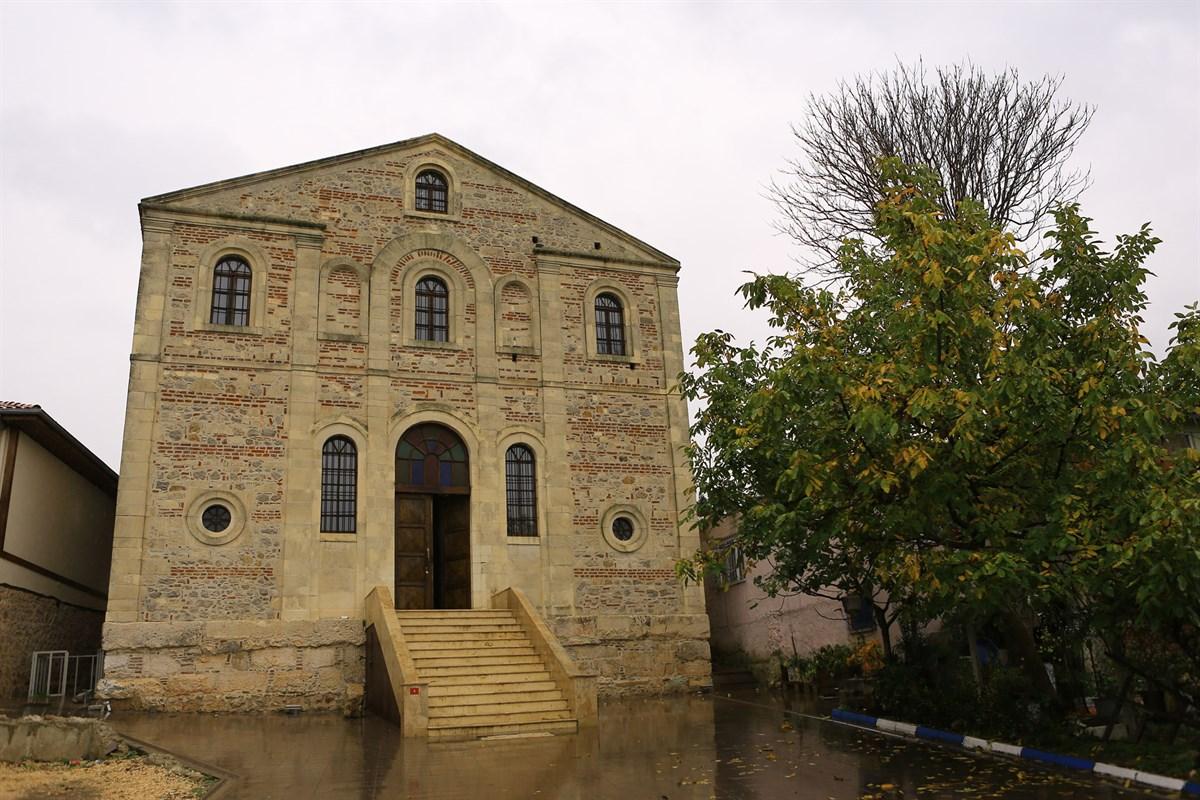
Gölyazı (T.C. Bursa Valiliği)
The people of Gölyazı have traditionally relied on agriculture, fishing, and more recently, tourism for their livelihood. Lake Uluabat is home to species such as the tench, carp, and a small local fish known as “feki.” Once a symbol of the region, the crayfish no longer holds economic significance. Fish markets along the lake shore, fishing boats, and women engaged in net-making are integral parts of the local economy.

Gölyazı (Türkiye Kültür Portalı)
One of Gölyazı’s symbolic landmarks is the “Ağlayan Çınar” (Crying Plane Tree), a monumental tree estimated to be around 750 years old. It is named for the reddish fluid that seeps from its trunk on certain days of the week. This tree stands at the entrance of the bridge connecting the peninsula to the mainland and is under special protection.
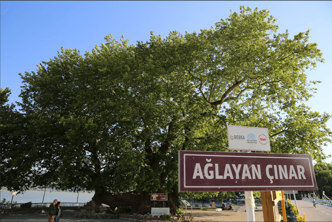
Ağlayan Çınar (T.C. Nilüfer Kaymakamlığı)
Gölyazı, located 42 kilometres from the city centre of Bursa, is reached by turning south from the 35th kilometre of the Bursa–İzmir highway. A 7-kilometre road leads from this junction to the village. For travellers coming from İzmir, this point is approximately 25 to 30 kilometres beyond the first visible view of the lake.
Bursa Valiliği. “Cennetten Bir Köşe: Gölyazı.” Bursa Valiliği Resmî Web Sitesi. Accessed June 22, 2025.http://www.bursa.gov.tr/cennetten-bir-kose-golyazi.
Ministry of Culture and Tourism. "Gölyazı Köyü." *Türkiye Kültür Portalı*. Accessed June 22, 2025.https://www.kulturportali.gov.tr/turkiye/bursa/gezilecekyer/golyazi-koyu.
Nilüfer Kaymakamlığı. "Gölyazı." Nilüfer Kaymakamlığı Resmî Web Sitesi. Accessed June 22, 2025.http://www.nilufer.gov.tr/golyazi.

Location | Nilüfer Bursa Türkiye | ||||||||
|---|---|---|---|---|---|---|---|---|---|
Ancient Name | Apollonia ad Rhyndacum | ||||||||
Date | 6th century BCE | ||||||||
Prominent Remains | Temple of Apollo, ancient theater, walls, Hagios Georgios Church | ||||||||
Natural Feature | Lake Uluabat, Weeping Plane Tree | ||||||||
Livelihood Source | Fishing, agriculture, tourism | ||||||||
Protection Status | Site area | ||||||||
History
Archaeological and Architectural Remains
Social and Ethnic Structure
Economy and Livelihood
Natural Features and Symbolic Values
Transportation