


This article was automatically translated from the original Turkish version.
+2 More
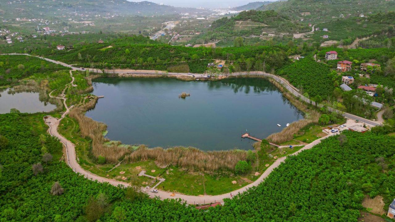
Gaga Lake
Location | Örencik Village Fatsa District Ordu Province Türkiye | ||||||||
|---|---|---|---|---|---|---|---|---|---|
Lake Type | Landslide-originated freshwater lake | ||||||||
Depth | 10–15 metres | ||||||||
Nutrition Sources | Spring sources, Surface runoff, Precipitation | ||||||||
Biological Characteristics | Aquatic plants: Reed, emergent and submerged species; Animals: Carp, migratory birds (e.g. swan), various waterfowl; Ecological importance: Located on migration route; Suitable area for birdwatching | ||||||||
Conservation Status | Grade 1 and Grade 3 Natural Site Area | ||||||||
Purpose of Use | Viewing terrace Walking paths Picnic area Recreation Canoeing Birdwatching; Tourism potential: Increasing through promotion and landscape initiatives | ||||||||
Gaga Lake is a small freshwater lake located within the boundaries of the Fatsa district in Ordu Province, in Türkiye’s Black Sea Region. It lies approximately 10 kilometers southeast of Fatsa, at the 7th kilometer of the Fatsa-Aybastı highway, within the boundaries of the village of Örencik (known as Sefaköy in other sources). The lake is situated at an elevation of approximately 65 meters above sea level. Locally, the lake is also known as "Kiliseli Göl". Various legends are told by local communities regarding the small island in the center of the lake and the lake itself.
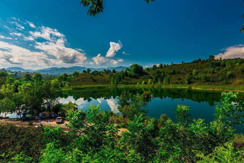
Gaga Gölü (TC.Kültür Ve Turizm Bakanlığı)
Gaga Lake was formed as a result of a landslide. The area where the lake is located is characterized by a volcanic interbedded flysch facies composed of limestone, sandstone, marl, clay, agglomerate, and tuff from the Upper Cretaceous period. This landslide affected an area of approximately 6 km² and occurred between the Bolaman Çayı and the Yassıtaş locality. The landslide material moved northeastward, creating a rugged topography. Some of the depressions in this area gradually dried up, while others were drained for agricultural use. Today, only Gaga Lake and İmzo Lake, located approximately 800 meters southwest of it, remain as permanent water bodies.
Gaga Lake is not a typical landslide-dammed lake; rather, it formed when water filled a depression between the toe of the landslide mass and a structural uplift on the opposite side. The lakebed is likely the former valley of a tributary stream from before the landslide event. The lake is not directly fed by any river. Its water sources are surface runoff, groundwater springs, and precipitation. Additionally, subsurface seepage into the lakebed has been observed. The presence of springs beneath the landslide mass is clearly discernible on the ground.
Part of the lake’s water discharges externally through two natural springs emerging on the slopes facing Bolaman Çayı. Evaporation and an artificial outlet channel also contribute to the lake’s water outflow.
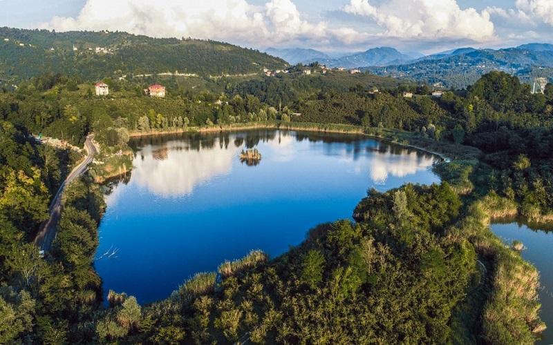
Gaga Gölü (Fatsa Kaymakamlığı)
Gaga Lake has a surface area of approximately 60 decares (about 80,000 m²). Its depth ranges between 10 and 15 meters. The lake consists of two basins: the main basin measures approximately 200 x 250 meters and reaches a depth of 15 meters. The second basin, located in the western part, has a diameter of about 100 meters and a depth of 1 to 2 meters. A small islet is situated in the center of the lake.
Over time, the western part of the lake became marshy due to the effects of surrounding landslides, leading to a decline in water quality. To restore connectivity between the two basins, the local population excavated a threshold between them. During dry periods, the lake may temporarily split into two separate bodies of water.
Gaga Lake and its surroundings are rich in biological diversity. The lake’s perimeter is densely covered with reed beds and aquatic vegetation. Plant species observed along the shoreline include those with leaves floating on the water surface, emergent species growing both above and below the water, and fully submerged species. This vegetation plays a vital role in the lake’s oxygen cycle and biological purification processes.
The lake also provides breeding, shelter, and feeding grounds for numerous waterbird species and holds significance for birdwatching due to its location along migratory routes. Observations have confirmed that certain migratory bird species, including swans, winter at the lake. Among the fish species in the lake, carp is particularly prominent. Four distinct fish species have been identified in the lake. It has also been observed that fish use the adjacent marshland as a wintering habitat.
Gaga Lake and its surroundings have been officially designated as a Class 1 and Class 3 Natural Site and are under legal protection. The lake has also been developed by the Ordu Metropolitan Municipality as a nature park and transformed into a public recreational area. Facilities within the park include walking paths, a snack bar, restrooms, a mosque, a fountain, an observation deck, a parking lot, swings, and photography zones. Additionally, canoeing is permitted.
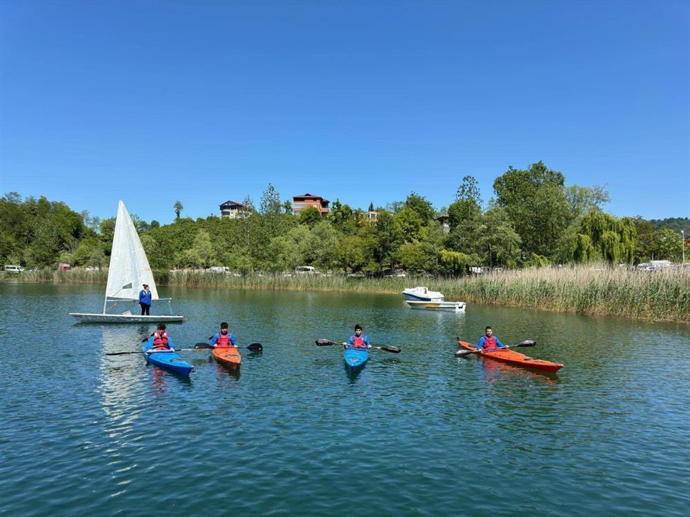
Gaga Gölü (TC.Kültür Ve Turizm Bakanlığı)
Access to Gaga Lake is via an asphalt road. It lies along the highway connecting Fatsa to Aybastı and is approximately 10 kilometers from the district center. The distance from the city of Ordu is about 33 kilometers. In the past, during periods when the lake posed a flood risk, the Fatsa-Aybastı highway was raised by 1.5 to 2 meters.
Akkan, Erdoğan, and Güngen, Gürcan. “Gaga Gölü (Ordu).” Ankara Üniversitesi. Accessed May 15, 2025.https://tucaum.ankara.edu.tr/wp-content/uploads/sites/280/2015/08/tucaum2_11.pdf
Ordu Metropolitan Municipality. “Fatsa’nın Saklı Cenneti: Gaga Gölü.” Ordu Büyükşehir Belediyesi Web Sitesi. Accessed May 15, 2025.https://ordu.bel.tr/haber/fatsa-nin-sakli-cenneti-gaga-golu-47449
T.C. Kültür ve Turizm Bakanlığı. "Gaga Gölü - Fatsa." Türkiye Kültür Portalı. Accessed May 15, 2025.https://www.kulturportali.gov.tr/turkiye/ordu/gezilecekyer/gaga-golu--fatsa
T.C. Ministry of Culture and Tourism. “Gaga Gölü – Fatsa/Ordu.” *Ordu İl Kültür veTurizm Müdürlüğü. Accessed May 15, 2025.https://ordu.ktb.gov.tr/TR-130471/gaga-golu-fatsaordu.html
T.C.Fatsa Kaymakamlığı Governorship. "Gaga Gölü." T.C. Fatsa District Governorship Website. Accessed May 15, 2025.http://www.fatsa.gov.tr/gaga-golu

Gaga Lake
Location | Örencik Village Fatsa District Ordu Province Türkiye | ||||||||
|---|---|---|---|---|---|---|---|---|---|
Lake Type | Landslide-originated freshwater lake | ||||||||
Depth | 10–15 metres | ||||||||
Nutrition Sources | Spring sources, Surface runoff, Precipitation | ||||||||
Biological Characteristics | Aquatic plants: Reed, emergent and submerged species; Animals: Carp, migratory birds (e.g. swan), various waterfowl; Ecological importance: Located on migration route; Suitable area for birdwatching | ||||||||
Conservation Status | Grade 1 and Grade 3 Natural Site Area | ||||||||
Purpose of Use | Viewing terrace Walking paths Picnic area Recreation Canoeing Birdwatching; Tourism potential: Increasing through promotion and landscape initiatives | ||||||||
Geological and Geomorphological Formation
Physical Characteristics
Ecological Structure
Conservation Status and Use
Access