


This article was automatically translated from the original Turkish version.
+1 More
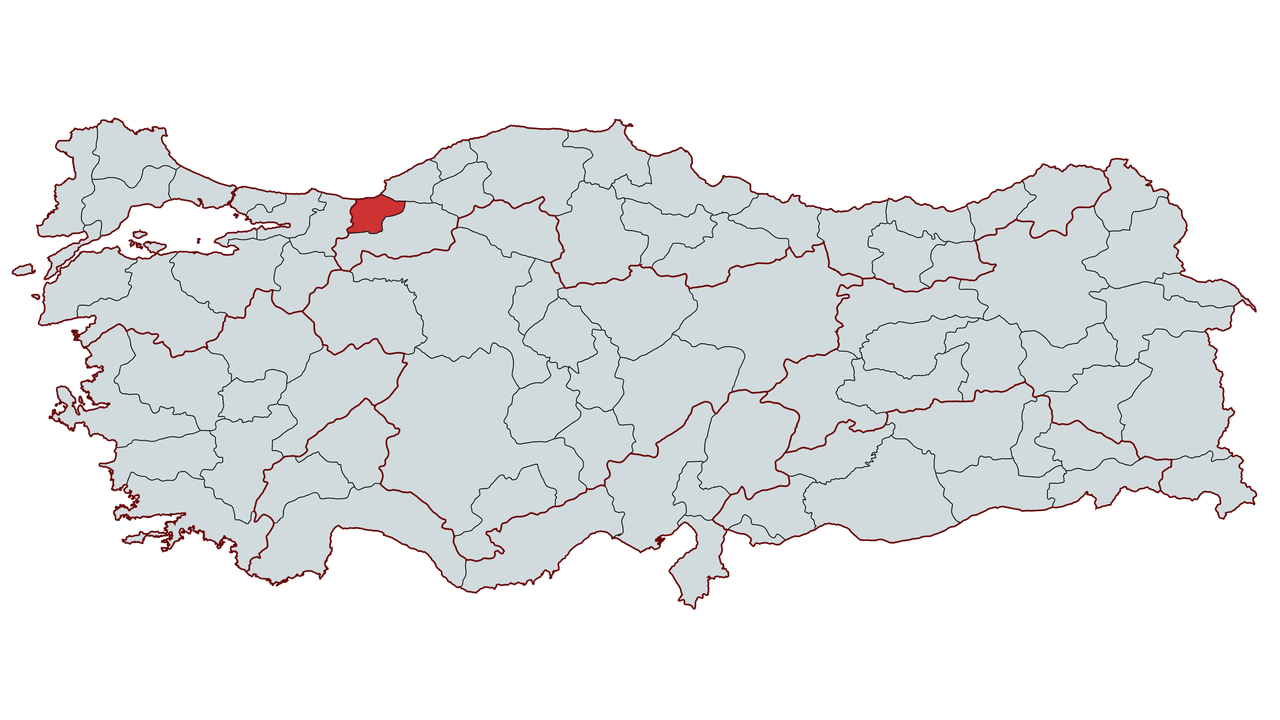
Düzce
Country | Türkiye | ||||||||
|---|---|---|---|---|---|---|---|---|---|
Region | Black Sea Region | ||||||||
Population | 412.344 (2024) | ||||||||
Area | 2.492 km² | ||||||||
Climate | Black Sea Climate | ||||||||
Important Structures and Natural Areas | Güzeldere and Samandere Waterfalls Ceneviz Castle (Akçakoca) Efteni Lake and Wetland Konuralp Museum Konuralp Ancient City (Prusias ad Hypium) Fakıllı Cave | ||||||||
Governor | Selçuk Aslan | ||||||||
Mayor | Dr. Faruk Özlü | ||||||||
Area Code | 380 | ||||||||
License Plate Code | 81 | ||||||||
Düzce is a city located in the Black Sea Region of Türkiye and gained provincial status in 1999. It is the only remaining ancient city in Western Black Sea region. Throughout history the city has been a settlement area for various civilizations and became an important trade center during the Ottoman period. Today it maintains its economic vitality through agriculture industry and trade activities.
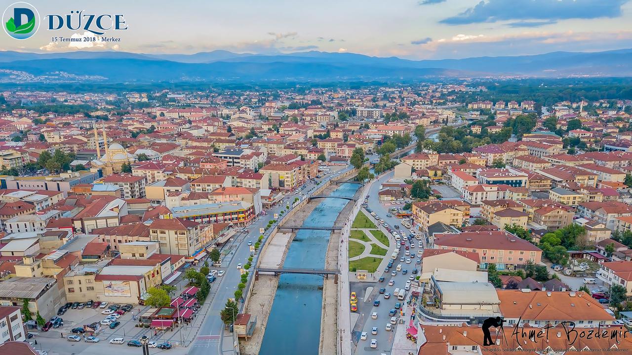
Düzce City Center - Ahmet Bozdemir
The known history of Düzce extends back to around 1390 BC. The region has been subject to invasions by numerous peoples and states throughout history. Remnants of civilizations such as the Phrygians Lydians Persians Romans Byzantines Seljuks and Ottomans can be found in the area. The region came under Ottoman rule following a battle in 1323 between Konuralp Bey one of the commanders of Orhan Gazi and Byzantine lords. This area was named after Konuralp Bey and has retained this name to the present day. The ancient city located in the village of Konuralp attached to Düzce dates back to the 3rd century BC.
During the Bithynian period Düzce was known by the name of Prusias (Üskübü) located in what is now the village of Konuralp. At that time the Düzce Plain was a vast swampy area unsuitable for agriculture.
The region was incorporated into the Roman Empire in 74 BC and during this period the swamps were drained and opened for agriculture. The area began to develop during the Roman era and after the fall of the Roman Empire it came under Byzantine control. During the Byzantine period Düzce experienced significant development especially in its later years.
Düzce was incorporated into Ottoman territory in 1323 by Konuralp Bey one of the commanders of Orhan Gazi. During the Ottoman period the region known as Konsopa gradually increased in commercial and economic importance. From the first quarter of the 14th century the area was referred to as Konuralp district or Konrapa. Until 1869 Düzce was a subdistrict under the Bolu Sanjak of the Kastamonu Vilayet. In 1870 it became a kaza under the Bolu Sanjak. In 1871 the district center was moved from Üskübü (Konuralp) to Düzce.
After the proclamation of the Republic Düzce developed economically and infrastructurally becoming one of Türkiye's important trade centers. The passage of the D-100 highway and the TEM motorway gave the region a strategic position in national and international transportation. The city suffered extensive damage in the earthquakes of 17 August and 12 November 1999 and was subsequently rebuilt with a modern infrastructure. On 9 December 1999 it was declared the 81st province of Türkiye.
Düzce lies between 40°50' and 41°10' north latitudes and 30°50' and 31°50' east longitudes. The province located in Western Black Sea Region is bordered by Bolu to the east Sakarya to the west the Black Sea to the north and Zonguldak to the south. The city situated at an elevation of 160 meters above sea level holds a strategic position along the D-100 highway and the TEM motorway.
Except for the coastal areas Düzce's terrain features a central depression surrounded by mountains. The Akçakoca Mountains lie to the north the Bolu Mountains to the east and the western extensions of the Abant Mountains to the southeast and south. Among Düzce's most prominent elevations are Kaplandede Mountain (1160 m) Elmacık Mountains and Sünnice Mountains. The North Anatolian Fault runs through the southern part of the region. This fault has played a major role in the formation of the Düzce Plain and renders the city seismically vulnerable.
The most important river in Düzce is the Melen River which splits into two branches: the Küçük Melen and the Büyük Melen. The Küçük Melen covers the section up to Efteni Lake while the Büyük Melen flows into the sea at Melenağzı Village. Efteni Lake is one of the province's important wetlands and provides habitat for over 150 bird species. Additionally the Hasanlar Dam located between Düzce and Yığılca is used for irrigation and energy production.
Düzce lies under the influence of the Black Sea climate. The annual average temperature is 13°C and the annual precipitation is 823.7 mm with a relative humidity of approximately 75%. Humidity levels are higher in mountainous areas while the plains exhibit a drier microclimate. Düzce is rich in natural vegetation. Along the coast Mediterranean shrubland and pseudo-mediterranean communities are found while inland areas are dominated by extensive forests of hornbeam beech chestnut oak black pine Scots pine and oriental beech.
The population of Düzce has fluctuated throughout history due to migration economic changes and natural disasters. According to the Turkish Statistical Institute (TÜİK) data for 2024 the total population of Düzce is 412344. The population of the provincial center is recorded as 263220.
Düzce's economy is largely based on agriculture trade and industry.
Düzce is one of Türkiye's major hazelnut production centers. In addition maize wheat rice and fruit cultivation are widespread.
Düzce is an emerging industrial province. The automotive textile furniture forest products and food industries are the leading sectors in the region. Its strategic location between Istanbul and Ankara supports industrial development.
Düzce is a region notable for its historical and natural features. Remains from the Roman Byzantine and Ottoman periods along with various water sources are defining elements of its geographical and cultural structure.
Düzce features diverse rivers and lakes originating from its mountains. Some rivers converge at Efteni Lake before flowing into the Black Sea via the Büyük Melen River. These water sources are of ecological importance and serve as subjects of various studies.
The district of Akçakoca on Düzce's Black Sea coast has held importance for trade and transportation during various historical periods. The region contains various historical and natural formations.
Düzce is a region with cultural and natural diversity that offers potential for research in archaeology history biogeography and geology.
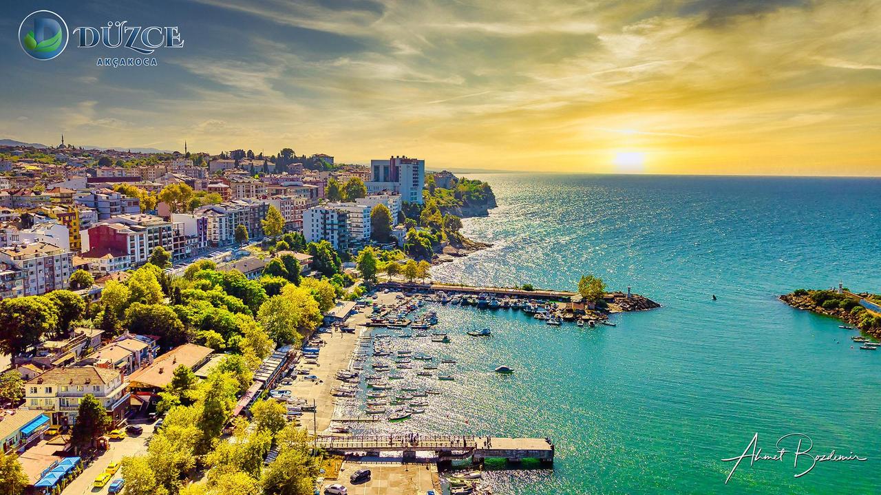
Düzce Akçakoca - Ahmet Bozdemir
Düzce Province consists of 8 districts 2 towns and 278 villages:
Düzce Belediyesi. "Düzce Belediyesi Resmî Web Sitesi." Accessed February 14, 2025.https://duzce.bel.tr/.
Düzce Ekonomik of Commerce and Industry. "Düzce Economic and Commercial Data." Accessed February 14, 2025.https://www.duzcetso.org.tr/detay/948
Düzce Ticaret Borsası. "Düzce Hakkında." Accessed February 14, 2025.https://www.duzcetb.org.tr/icerik/duzce-hakkinda/.
Düzce Valiliği. "Düzce Valiliği Resmî Web Sitesi." Accessed February 14, 2025.http://www.duzce.gov.tr/.
T.C. Ministry of Environment, Urbanization and Climate Change, Düzce Provincial Directorate. “İlimiz Hakkında.” Accessed February 14, 2025.https://duzce.csb.gov.tr/ilimiz-hakkinda-i-1074
Turkish Statistical Institute (TÜİK). "Cumhuriyetin 100. Yılı İstatistik Portalı." Accessed February 14, 2025.https://cip.tuik.gov.tr/

Düzce
Country | Türkiye | ||||||||
|---|---|---|---|---|---|---|---|---|---|
Region | Black Sea Region | ||||||||
Population | 412.344 (2024) | ||||||||
Area | 2.492 km² | ||||||||
Climate | Black Sea Climate | ||||||||
Important Structures and Natural Areas | Güzeldere and Samandere Waterfalls Ceneviz Castle (Akçakoca) Efteni Lake and Wetland Konuralp Museum Konuralp Ancient City (Prusias ad Hypium) Fakıllı Cave | ||||||||
Governor | Selçuk Aslan | ||||||||
Mayor | Dr. Faruk Özlü | ||||||||
Area Code | 380 | ||||||||
License Plate Code | 81 | ||||||||
History
Bithynian Period
Roman and Byzantine Period
Ottoman Period
Republican Period
Geography
Geomorphology
Hydrography
Climate and Vegetation
Population and Demographics
Economy
Agriculture
Industry and Trade
Culture and Tourism
Historical and Cultural Structures
Natural Structures and Water Sources
Black Sea Coastline
Administrative Structure