This article was automatically translated from the original Turkish version.
+2 More
Province | Ardahan | ||||||||
|---|---|---|---|---|---|---|---|---|---|
Population | 8.448 | ||||||||
Area | 752 km² | ||||||||
District Governor | Barış AYTÜRK | ||||||||
Mayor | Kemal Yakup AZİZOĞLU | ||||||||
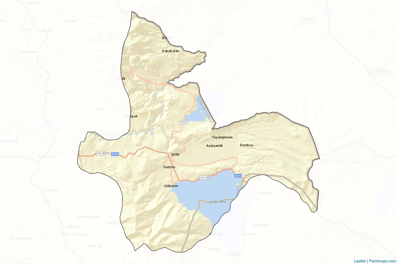
Çıldır, is a district of Ardahan province in northeastern Türkiye. The district is situated on a flat plateau at an average elevation of 1950 meters. With a total area of 752 km², its terrain is partially flat and partially hilly. Çıldır is one of the districts of Türkiye that shares a land border with Georgia, 66 km long, and with Armenia, 13 km long. The Kura and Karasu rivers flow through the district’s boundaries. The main natural elevations within Çıldır’s borders are Keldağ and Gökdağ, both reaching approximately 3000 meters in elevation. According to TÜİK 2024 data, its population is 8,448.
The known history of Çıldır extends back approximately 6000 years. The earliest settlers, the Hurrians, established a state centered at Akçakale; subsequently, the Urartians, Saka Turks, Iranians, and Khazars dominated the region. Conquered in 1064 by Seljuk Sultan Alp Arslan, Çıldır came under the rule of the Kipchaks, Georgians, Khwarazmians, and Mongols during the 12th and 13th centuries. In 1578, during the Ottoman-Safavid conflict, Çıldır was incorporated into Ottoman territory following the Battle of Çıldır. After the Russo-Turkish War of 1877–1878, the region fell under Russian control but was reintegrated into Turkish territory on 25 February 1921 during the National Struggle.
Çıldır district is located in the northeastern part of the Eastern Anatolia Region, built on a broad, flat plateau with an average elevation of 1950 meters. The district’s boundaries encompass a mixed topography of both hilly and flat areas. With a total area of 752 km², the highest elevations within Çıldır are Keldağ and Gökdağ, reaching approximately 3000 meters. The Kura and Karasu rivers flow through the district, forming its primary water sources. The main natural lakes within the district are Çıldır Lake, covering 123 km², and Aktaş Lake, covering 27 km². A portion of Aktaş Lake lies within Georgian territory, and the Türkiye-Georgia border crossing is located along its northern shore. To the east of Çıldır lies Armenia (13 km), and to the northeast lies Georgia (66 km). The district experiences a harsh continental climate, limiting agricultural activity; as a result, pasturelands and animal husbandry are predominant.
Çıldır Lake, located within the boundaries of Ardahan and Kars provinces, is the largest freshwater lake in the Eastern Anatolia Region and the second largest lake in Türkiye, with a surface area of 123 km². At an elevation of 1959 meters, its maximum depth is 42 meters. The lake is a natural formation created by lava and debris dams. It is fed by numerous streams and springs, with its sole outflow being the Telek Creek in the northwest.
The surrounding area is predominantly pastureland and unsuitable for agriculture. Fishing is practiced year-round, and during winter months, when the lake surface freezes, traditional methods of ice fishing are employed. The primary fish species is the mirror carp (Cyprinus carpio). However, drought and unregulated fishing have negatively impacted fish stocks.
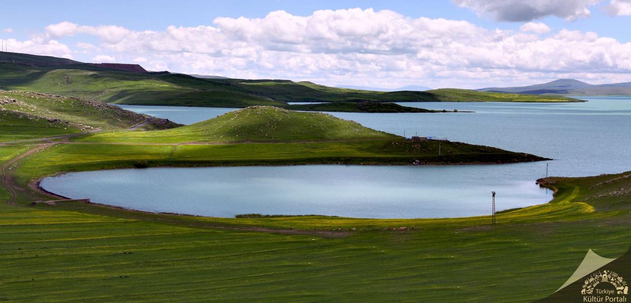
Çıldır Lake (Türkiye Kültür Portalı)
Akçakale Island, the largest island in Çıldır Lake, contains archaeological remains spanning from the Neolithic period to the present. Remnants of stone-dwelling structures approximately 10,000 years old have been observed on the island. Located near Akçakale Village, the island is open to visitors during summer months and attracts local and foreign tourists throughout the year.
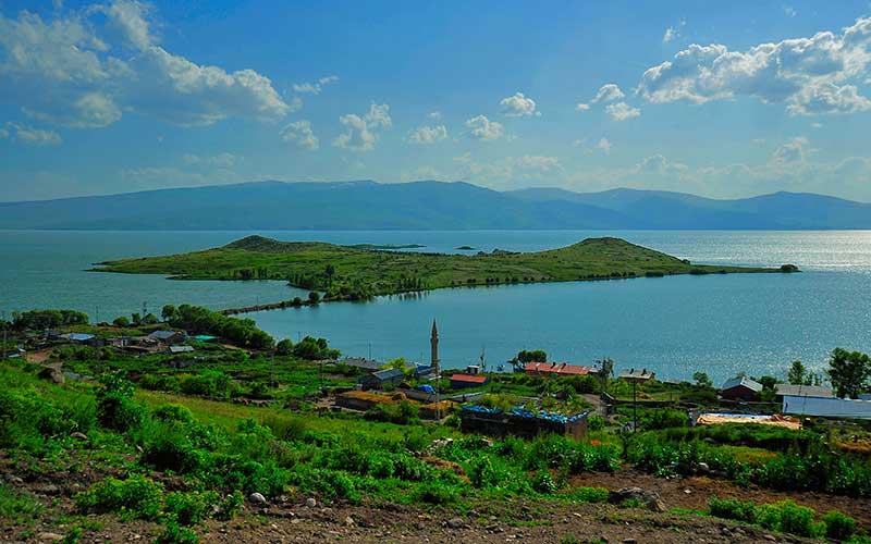
Akçakale Island (Çıldır District Governorship)
Çıldır Lake is an important stopover for migratory birds. Birds that complete their breeding season in the lake’s vicinity prepare for migration. The birdwatching tower, where migratory birds can be observed especially during spring and summer, holds significant value for nature observation.
Aktaş Lake is a tectonic lake located on the border between Ardahan and Georgia. Of its total area of 27 km², 14 km² lies within Turkish territory. It has an elevation of 1798 meters and a maximum depth of 10 meters. The lake has been known by various names, including Hazapin, Kenarbel, Karsak, and Kazapin.
Twelve small islands are located within the lake, all of which lie within Turkish borders. Islands such as Büyük Ada and Başak Ada serve as nesting and sheltering grounds for birds. Species observed around the lake include the Dalmatian pelican, velvet scoter, common pochard, common crane, black grouse, and Van Lake gull. Aktaş Lake is protected under the Regulation on the Conservation of Wetlands. Additionally, due to its location within a military zone, human interference is limited, creating a secure habitat for bird populations.
Şeytan Kalesi is situated on a hill near Yıldırımtepe village (formerly Rabat), at an elevation of 1910 meters. The structure is surrounded on three sides by cliffs and is difficult to access. It is associated with local legends. The castle measures 161 × 93 meters, and one of its three towers has survived intact to the present day. Within the castle ruins, there is a single-nave church dedicated to Saint Stefan, dated to the 14th century, as well as traces of a cistern and stairs leading down to a stream.
Şeytan Kalesi is believed to be an early medieval structure and was also used during the Georgian principality period. According to the Georgian chronicle of Meshuri Matiane, the castle was ceded to the Ottomans in the 16th century and continued to function under Ottoman administration from that time onward.
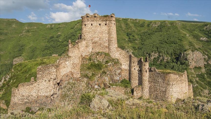
Şeytan Kalesi (Anadolu Ajansı)
Goose meat is among the most well-known local dishes in Çıldır and its surroundings. Geese in the region are raised from spring to autumn, salted during the early winter months, and preserved for consumption. Typically cooked and served with bulgur pilaf, goose meat is a rich and fatty type of meat. It is nutritionally valuable due to its high content of protein, phosphorus, calcium, and vitamins A, B, and E. The broth from cooking goose meat is also used in preparing pilaf or consumed as soup. In Çıldır and the Kars-Ardahan region, goose dish holds a traditional place on winter tables.

Goose Dish (Anadolu Ajansı)
Anadolu Ajansı. “Ardahan'da kanyonun zirvesindeki 'Şeytan Kalesi' tatilde ziyaretçilerini ağırlıyor”. Accessed August 25, 2025.https://www.aa.com.tr/tr/yasam/ardahanda-kanyonun-zirvesindeki-seytan-kalesi-tatilde-ziyaretcilerini-agirliyor/2636009
Anadolu Ajansı. “Kars ve Ardahan'ın ramazan menüsü: Kaz eti.” Anadolu Ajansı. Accessed August 25, 2025.https://www.aa.com.tr/tr/ramazan-2017/kars-ve-ardahanin-ramazan-menusu-kaz-eti/842087
T.C. Ardahan Valiliği. "Çıldır." Ardahan Valiliği Resmî Web Sitesi. Accessed July 6, 2025.http://www.ardahan.gov.tr/cildir.
T.C. Ministry of Culture and Tourism. "Tarihçe." Türkiye Kültür Portalı. Accessed July 6, 2025.https://www.kulturportali.gov.tr/turkiye/ardahan/gezilecekyer/cildir-golu-1
T.C. Çıldır District Governorship. "Çıldır Gölü Kuş Gözlem Kulesi." Çıldır Kaymakamlığı Resmî Web Sitesi. Accessed July 6, 2025.http://cildir.gov.tr/cildir-golu-kus-gozlem-kulesi.
T.C. Çıldır Kaymakamlığı. "Mahalli İdareler." Çıldır Kaymakamlığı Resmî Web Sitesi. Accessed July 6, 2025.http://cildir.gov.tr/mahalli-idareler.
T.C. Çıldır Kaymakamlığı. "Çıldır Gölü." Çıldır Kaymakamlığı Resmî Web Sitesi. Accessed July 6, 2025.http://cildir.gov.tr/cildir-golu123.
T.C. Çıldır Kaymakamlığı. "Şeytan Kalesi." Çıldır Kaymakamlığı Resmî Web Sitesi. Accessed July 6, 2025.http://cildir.gov.tr/seytan-kalesi.
T.C.Çıldır Kaymakamlığı Governorship. "Akçakale Adası." Çıldır Belediyesi Resmî Web Sitesi. Accessed July 6, 2025.http://cildir.gov.tr/akcakaleadasi.
T.C.Çıldır Kaymakamlığı Governorship. "Kaz Yemeği." Çıldır District Governorship Official Website. Accessed August 25, 2025.http://www.cildir.gov.tr/kaz-yemegi
T.C.Çıldır Kaymakamlığı Governorship. "Çıldır Aktas Gölü." Çıldır District Governorship Official Website. Accessed July 6, 2025.http://cildir.gov.tr/cildir-aktas-golu.
Türkiye İstatistik Kurumu. "Adrese Dayalı Nüfus Kayıt Sistemi Sonuçları, 2024." TÜİK. Accessed July 6, 2025.https://data.tuik.gov.tr/Bulten/Index?p=Adrese-Dayali-Nufus-Kayit-Sistemi-Sonuclari-2024-53783
Çıldır Belediyesi. "Tarihçe." Çıldır Belediyesi Resmî Web Sitesi. Accessed July 6, 2025.https://cildir.bel.tr/tarihce.
Province | Ardahan | ||||||||
|---|---|---|---|---|---|---|---|---|---|
Population | 8.448 | ||||||||
Area | 752 km² | ||||||||
District Governor | Barış AYTÜRK | ||||||||
Mayor | Kemal Yakup AZİZOĞLU | ||||||||
History
Geographical Structure
Natural Attractions and Historical Structures
Çıldır Lake
Akçakale Island
Çıldır Lake Birdwatching Tower
Aktaş Lake
Şeytan Kalesi
Local Cuisine
Goose Dish