


This article was automatically translated from the original Turkish version.
+1 More
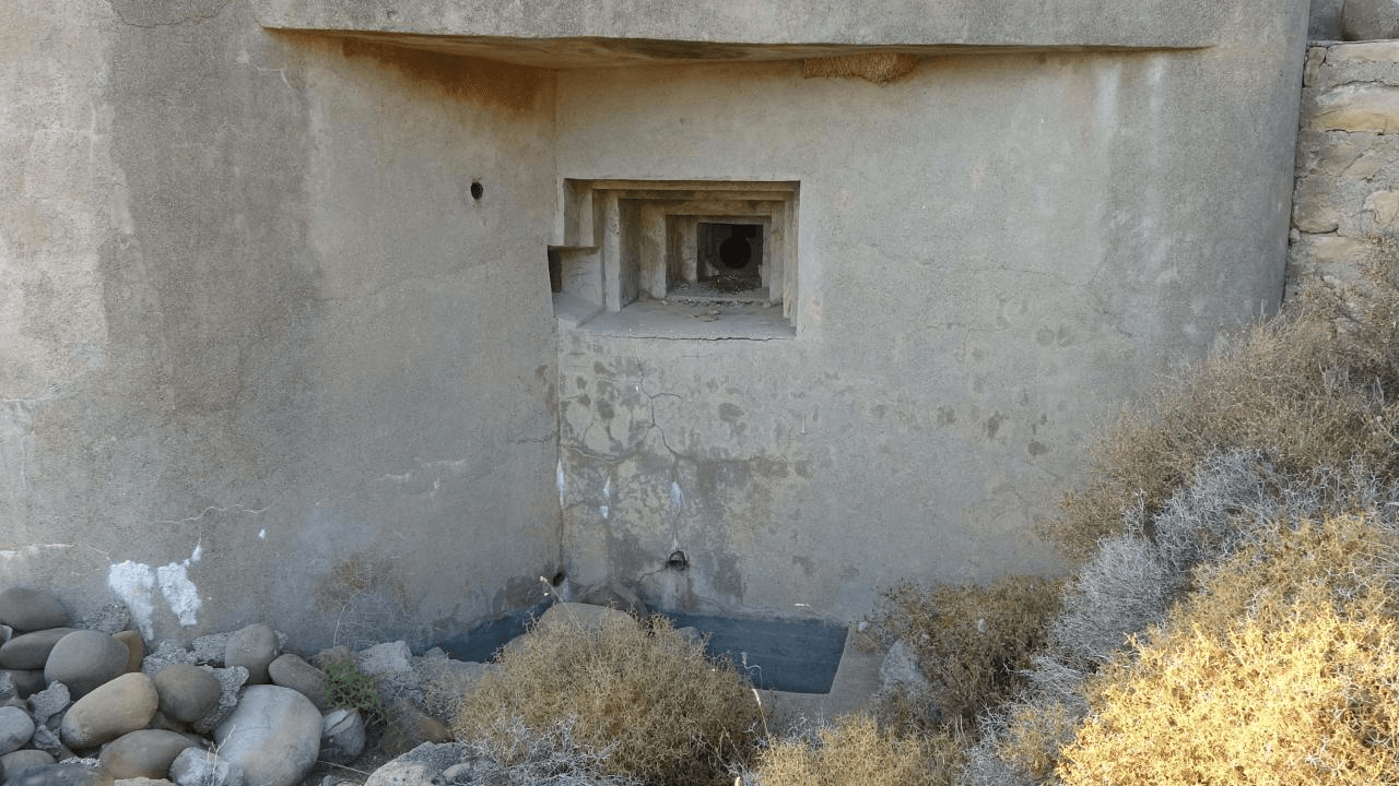
Chakmak Defense Line (Korugan)
Flint Line Areas | Istanbul (Çatalca, Büyükçekmece, Terkos, Black Sea coast), Kırklareli (some remnants), Edirne (some remnants), Çanakkale/Gelibolu (similar structures) | ||||||||
|---|---|---|---|---|---|---|---|---|---|
Historical Structures | Reinforced concrete bunkers (machine gun/artillery positions), Tunnels (connection, supply), Tank barriers ("dragon's teeth"), Underground shelters | ||||||||
Current Situation | Most abandoned or neglected, Some bunkers repurposed for different uses, Surface excavation and preservation efforts exist, Tourism potential is being evaluated | ||||||||
The Çakmak Defense Line was constructed between the late 1930s and early 1940s as a key component of Türkiye's strategic defensive measures against a potential attack during the years when World War II was ravaging Europe. Implemented under the directives of the Chief of the General Staff at the time, Marshal Fevzi Çakmak, this defense line aimed primarily to protect Istanbul and its surrounding areas from a possible enemy occupation.
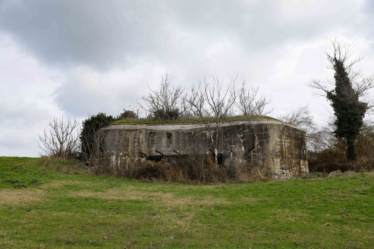
Çakmak Defense Line (Source: Government of Istanbul)
Geographically, the Çakmak Line encompassed a broad defensive zone stretching from the shores of the Sea of Marmara in the south to the Black Sea coast in the north. The primary objective of this strategic positioning was to halt or at least significantly delay any Axis Powers attack—particularly from Nazi Germany—advancing through the Balkans toward Thrace, thereby granting the Turkish Armed Forces valuable time to establish defensive positions. Ensuring the security of the Istanbul Strait and the capital was among the line’s foremost goals.
Istanbul’s Secret Bunkers (Source: YouTube-TrtHaber)
The architecture of the Çakmak Line was designed in accordance with contemporary modern military defense principles. Along the line, strategically placed reinforced concrete bunkers (pillboxes), machine gun and artillery positions, anti-tank obstacles, interconnected tunnel systems, and underground shelters formed the core structural elements. The extensive use of reinforced concrete in construction aimed to enhance resistance against enemy fire. The bunkers were designed to allow small numbers of soldiers to sustain prolonged defense, with logistical needs such as ammunition and supplies also taken into account.
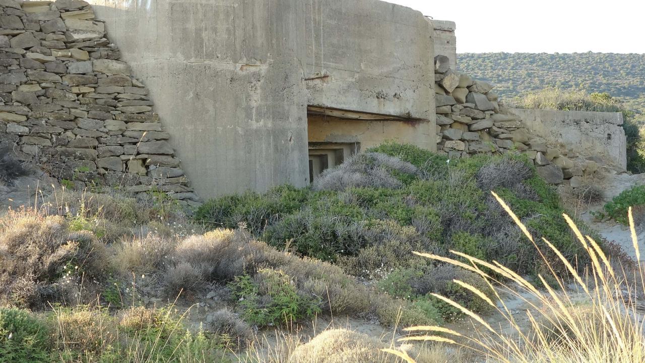
Çakmak Defense Line (Source: TRT News)
The outbreak of World War II and Nazi Germany’s rapid expansion across Europe kept Türkiye on high alert despite its policy of neutrality. The construction of the Çakmak Line was a direct response to these concerns, as Türkiye sought to strengthen its defensive posture against developments in the Balkans and potential German expansionism. However, unexpected developments in the course of the war and the German army’s focus on other fronts prevented the Çakmak Line from being tested in direct combat.
Despite the passage of many decades since its construction, significant remnants of the Çakmak Line still stand today. Particularly in the rural areas west of Istanbul, around Çatalca, reinforced concrete bunkers and tunnel entrances can still be observed. These structures provide tangible evidence of military architecture and defense strategies during World War II. In recent years, local administrations and researchers have undertaken efforts to inventory, preserve, and potentially integrate these historical remains into tourism initiatives. These structures are regarded not merely as relics of a defensive line but as important cultural heritage elements that shed light on Türkiye’s recent history. However, some experts have also argued that the line represented a strategic misallocation of resources and that those resources could have been better directed toward alternative defensive measures.
HMECH Society. "Yakın Tarihimizin Stratejik Hatası: Çakmak Hattı Koruganları." Accessed April 16, 2025. [https://www.hmechsociety.com/post/yakın-tarihimizin-stratejik-hatası-çakmak-hattı-koruganları]
Mimarlık Dergisi. "İstanbul Savunma Hattı." Accessed April 16, 2025. [http://www.mimarlikdergisi.com/index.cfm?sayfa=mimarlik&DergiSayi=439&RecID=5563]
Security Strategies Journal. "II. DÜNYA SAVAŞI’NDA TÜRKİYE’NİN SAVUNMA STRATEJİSİ: ÇAKMAK HATTI." Accessed April 16, 2025. [https://dergipark.org.tr/tr/pub/guvenlikstrtj/issue/56002/768619]
İstanbul Valiliği. "Çatalca'da Çakmak Savunma Hattının Bir Bölümü Daha Yüzeye Çıktı." Accessed April 16, 2025. [http://istanbul.gov.tr/catalcada-cakmak-savunma-hattinin-bir-bolumu-daha-yuzeye-cikti]
Chakmak Defense Line (Korugan)
Flint Line Areas | Istanbul (Çatalca, Büyükçekmece, Terkos, Black Sea coast), Kırklareli (some remnants), Edirne (some remnants), Çanakkale/Gelibolu (similar structures) | ||||||||
|---|---|---|---|---|---|---|---|---|---|
Historical Structures | Reinforced concrete bunkers (machine gun/artillery positions), Tunnels (connection, supply), Tank barriers ("dragon's teeth"), Underground shelters | ||||||||
Current Situation | Most abandoned or neglected, Some bunkers repurposed for different uses, Surface excavation and preservation efforts exist, Tourism potential is being evaluated | ||||||||
No Discussion Added Yet
Start discussion for "Chakmak Defense Line" article
Strategic Positioning and Defensive Purpose
Architecture and Structural Features
Historical and Geopolitical Context
Current Status and Significance