


This article was automatically translated from the original Turkish version.
+2 More
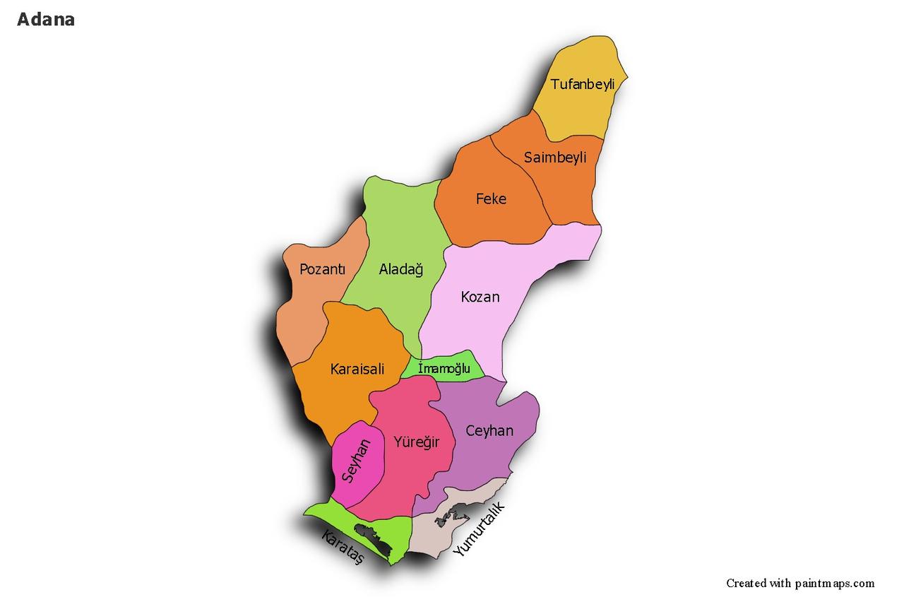
Ceyhan and surrounding districts
Province | Adana | ||||||||
|---|---|---|---|---|---|---|---|---|---|
Region | Mediterranean Region | ||||||||
Climate | Mediterranean climate | ||||||||
Population (Number) | 155000 | ||||||||
Area | 1427 | ||||||||
Important Rivers | Karaçay Ceyhan River Mercin Suyu | ||||||||
Historical Sites | Kastabala Ancient City, Yılankale, Kurtkulağı Caravanserai | ||||||||
Ceyhan is a district of Adana province in southern Türkiye, notable for its historical depth, geographic location, and economic functionality. Located in the Eastern Mediterranean region of the Mediterranean Basin, Ceyhan holds a strategic position in terms of both agricultural production and energy and industry investments. Situated along the Ceyhan River, the district has historically served as a settlement and trade route hub.
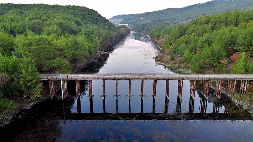
Ceyhan River (Source: Anadolu Ajansı)
The district of Ceyhan has been inhabited since ancient times. During antiquity, the region known as “Kastabala” was ruled by numerous civilizations including the Hittites, Assyrians, Persians, Hellenistic kingdoms, Romans, and Byzantines. During the Ottoman period, with the settlement of Çukurova, the Nogai Turks were first relocated to the area in 1865; subsequently, groups of different ethnic origins such as Crimean Tatars, Circassians, Balkan migrants, and Papaks also settled in the district. Following social unrest in 1909, the region known as “Örfiye” was granted district status under the name “Ceyhan” on 3 May 1929.
Ceyhan is located east of the city center of Adana, on the fertile plains of Çukurova. The district covers an area of 1,427 km². It borders Osmaniye Province and the Erzin district of Hatay to the east, Kozan and Kadirli districts to the north, Yüreğir and İmamoğlu districts to the west, and Yumurtalık district to the south. The most important river flowing through the district is the Ceyhan River. Additional small watercourses such as Mercin Suyu, Karaçay, Handeresi, and Çeperce Deresi also contribute to the district’s hydrological system. The Misis (Nur) Mountains lie in the southwest, and parts of the district feature gently undulating terrain.
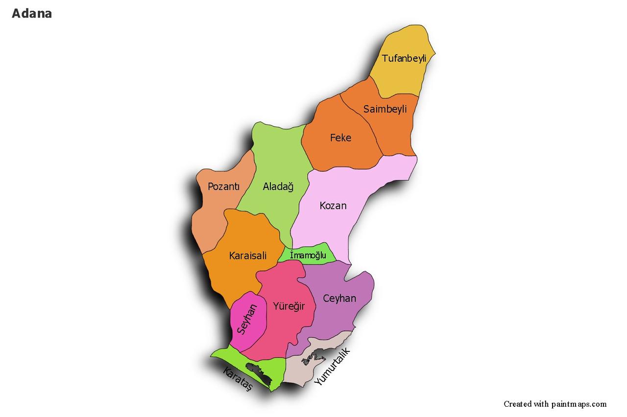
Ceyhan District and Neighboring Districts (Source: Paintmaps)
The dominant climate type in the district is Mediterranean. Summers are hot and dry, while winters are mild and rainy. The annual average temperature is around 18.7 °C. Average annual rainfall in the plains ranges between 600 and 750 mm, rising to over mm in mountainous areas. Precipitation peaks during the winter season. The natural vegetation consists primarily of maquis formations, with occasional pine forests. Reforestation efforts involving eucalyptus and poplar trees are also notable.
Ceyhan district has a multicultural and ethnically diverse population due to historical migrations. Communities such as the Nogai Turks, Circassians of Caucasian origin, Crimean Tatars, Balkan migrants, and Papaks, who were settled in the region from the 19th century onward, form the foundational elements of its demographic structure. According to data from the Turkish Statistical Institute (TÜİK), the total population of Ceyhan was approximately 155,000 as of 2024, with the majority residing in the district center.
Ceyhan’s economy is largely based on agriculture, livestock farming, and industry. Productive Çukurova soils yield crops such as cotton, wheat, maize, peanuts, and citrus fruits. Recent industrial developments, particularly in energy transportation and petrochemical investments, have transformed the district’s economic structure. The Ceyhan Terminal owned by BOTAŞ and the Baku-Tbilisi-Ceyhan and Ceyhan-Kirkuk oil pipelines have established Ceyhan as a key hub in international energy transportation.
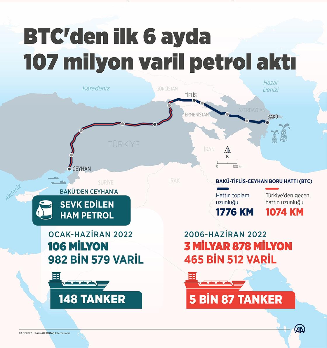
Baku-Tbilisi-Ceyhan Pipeline (Source: Anadolu Ajansı)
Ceyhan possesses significant tourism potential due to its historical heritage. Notable historical sites include the ancient city of Kastabala, Yılan Kale, and Kurtkulağı Caravanserai. Yılan Kale, in particular, is an archaeologically significant defensive structure dating from the Crusades period. The surroundings of the Ceyhan River are also valued for nature tourism due to their natural beauty.
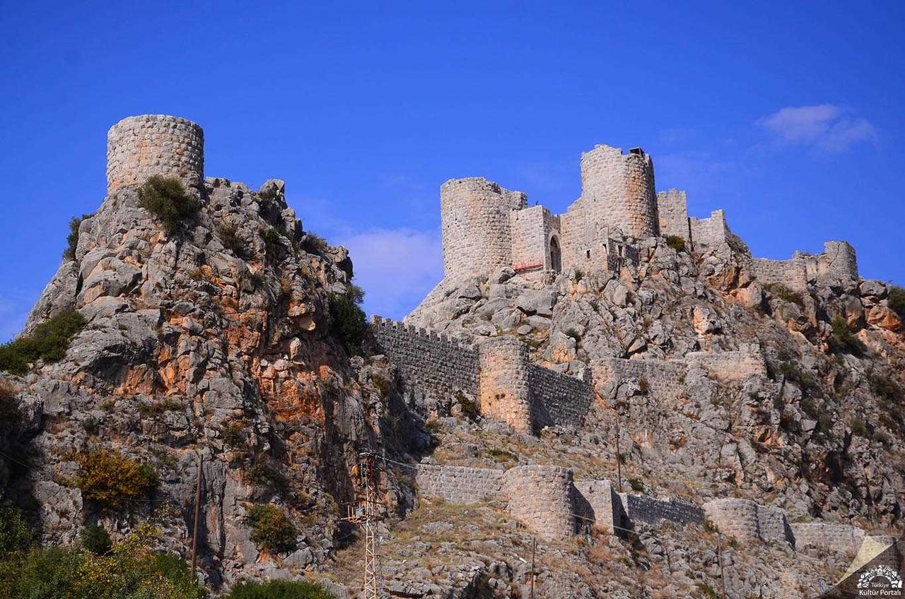
Yılan Kale (Source: Kültür Portalı)
The cultural structure of the district has been shaped by the cumulative contributions of migrant communities settled throughout history. Folk dances, traditional wedding customs, and oral folk literature reflect this diversity. Various festivals and cultural events are organized in the district, supported by local community education centers, culture houses, and libraries.
Ceyhan cuisine reflects the distinctive characteristics of Adana cuisine. Meat dishes such as kebabs, içli köfte, analı-kızlı çorbası, and şalgam are commonly consumed. The diversity of agricultural products is reflected in the variety of vegetables and fruits available in local markets and integrated into the culinary culture.
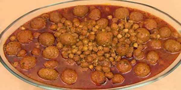
Analı Kızlı Çorbası (Source: Kültür Portalı)
Ceyhan is a vital center in Türkiye’s energy corridor projects. The ports and pipelines located in the district play a critical role in both Türkiye’s energy security and international energy trade. Additionally, the district’s logistical infrastructure supports this strategic position.
BOTAŞ Genel Müdürlüğü. “Ceyhan Terminali Hakkında Bilgi.” BOTAŞ Enerji Kurumu. Accessed April 16, 2025.https://www.botas.gov.tr
Ceyhan Kaymakamlığı. "Ceyhan İlçesi Coğrafi Yapısı." T.C. Adana Valiliği. Accessed April 16, 2025.https://www.ceyhan.gov.tr
Ceyhan Kaymakamlığı. “Ceyhan İlçesi Tarihçesi.” T.C. Adana Valiliği. Accessed April 16, 2025.https://www.ceyhan.gov.tr
Ministry of Culture and Tourism. "Kastabala Antik Kenti ve Yılan Kale." General Directorate of Cultural Heritage and Museums. Accessed April 16, 2025.https://www.ktb.gov.tr
Türkiye İstatistik Kurumu (TÜİK). "Adrese Dayalı Nüfus Kayıt Sistemi Sonuçları 2024." TÜİK Resmî Web Sitesi. Accessed April 16, 2025.https://www.tuik.gov.tr

Ceyhan and surrounding districts
Province | Adana | ||||||||
|---|---|---|---|---|---|---|---|---|---|
Region | Mediterranean Region | ||||||||
Climate | Mediterranean climate | ||||||||
Population (Number) | 155000 | ||||||||
Area | 1427 | ||||||||
Important Rivers | Karaçay Ceyhan River Mercin Suyu | ||||||||
Historical Sites | Kastabala Ancient City, Yılankale, Kurtkulağı Caravanserai | ||||||||
Historical Development and Archaeological Heritage
Geographical Location, Topography, and Natural Resources
Climate Characteristics and Vegetation
Population Structure and Demographic Features
Economic Activities and Sectoral Structure
Tourism Potential and Historical Monuments
Cultural Structure and Artistic Activities
Traditional Culinary Culture and Local Dishes
Strategic Importance and Key Features