


This article was automatically translated from the original Turkish version.
+2 More
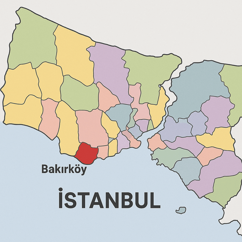
Bakırköy
Settlement Type | District | ||||||||
|---|---|---|---|---|---|---|---|---|---|
City | Istanbul | ||||||||
Mayor | Dr. Ayşegül Ovalıoğlu | ||||||||
District Governor | Recai Karal | ||||||||
Area | 29.22 km² | ||||||||
Population (Count) | 219.893 | ||||||||
Location | European Side | ||||||||
Boundaries | Bahçelievler-Güngören (to the North) Zeytinburnu (to the East) Küçükçekmece (to the West) Sea of Marmara (to the West) | ||||||||
Bakırköy is a district located on the European side of Istanbul, along the coast of the Sea of Marmara. The district’s history extends back to antiquity, and over time it has served various administrative, military, religious and social functions during the Roman, Byzantine, Ottoman and Turkish Republic periods. Bakırköy, which adopted its current name in 1925, was known as Hebdomon during the Byzantine era and held a significant position as a settlement in historical records.
The history of Bakırköy extends back to the Byzantine period. During the Roman Empire, Hebdomon, situated along the Via Egnatia route, was an important settlement housing imperial summer palaces, religious structures and military encampments. Buildings suffered damage during Latin and Arab invasions and were gradually abandoned. In the Ottoman period, following the conquest of Istanbul, this settlement was known as Makriköy and was administered for a time as a village under the Küçükçekmece district.
The transition of the Ottoman Empire to modern administrative structures began in the mid-19th century with the Tanzimat Decree. During this period, Bakırköy was incorporated into the Kaza-yı Erbaa Mutasarrıflığı and eventually attained the status of a kaza. After the proclamation of the Second Constitutional Monarchy in 1908, it operated as the 20th Municipal Department under the Istanbul Municipality. In 1910, following administrative reorganization, the name Bakırköy replaced Küçükçekmece as the official designation of the district.
During the Republican era, Bakırköy officially became a district of Istanbul in 1926. Over time, it acquired its present boundaries following the separation of neighboring districts such as Bahçelievler, Güngören, Bağcılar and Küçükçekmece.
Bakırköy is situated in the Çatalca-Kocaeli section of the Marmara Region and lies in the southwest of Istanbul. To the north it borders Güngören and Bahçelievler, to the east Zeytinburnu, to the west Küçükçekmece, and to the south the Sea of Marmara.
Geologically, the area consists of layers from the Devonian, Eocene, Neogene and alluvial periods. It features diverse geological characteristics including schist, limestone, gravel, terrestrial-marine facies and alluvial deposits.
Bakırköy possesses a rich cultural heritage from the Roman and Byzantine periods. Although the majority of archaeological remains from the Hebdomon settlement have not survived to the present day, the area’s history can be traced through various written sources and limited archaeological findings.
Research has identified traces of palatial structures, religious buildings and military installations along the Via Egnatia route in Hebdomon. Most of these remains were destroyed during modern urbanization without adequate documentation or preservation efforts.
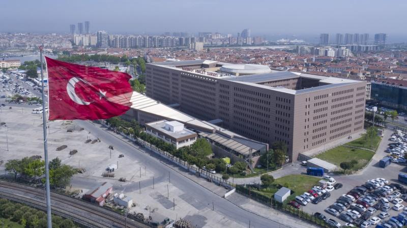
Bakırköy Adalet Sarayı (Adalet Bakanlığı)
Bakırköy currently comprises 15 neighborhoods:
With a population of 219,893, Bakırköy is one of Istanbul’s oldest urbanized areas. Population density is particularly high in the neighborhoods of Ataköy and Osmaniye.
Bakırköy occupies a central position in terms of transportation and is served by metrobus, Marmaray, sea buses and extensive bus networks. It is connected to Istanbul’s main transportation corridors via the coastal road and the E-5 highway.
Throughout history, Bakırköy has been one of Istanbul’s key settlement areas. Shaped by military, religious and political functions since the Roman period, the region maintained its administrative structure through the Ottoman and Republican eras and gradually became one of Istanbul’s central districts.
Bakırköy Belediyesi. “Tarihimiz.” Accessed April 24, 2025.Link
Bakırköy Kaymakamlığı. "Tarihçe." Accessed April 24, 2025.Link
Esenlik, Firdevs. Osmanlı’dan Cumhuriyet’e Bakırköy’ün (Makriköy) İdari Tarihi. Master's thesis, İstanbul Üniversitesi Sosyal Bilimler Enstitüsü, 2023.
Karabacak, Regaip. "Bakırköy (İstanbul) İlçesinin Coğrafi Etüdü." Bilim Armonisi 1, no. 1 (2018): 55–64.
Türkoğlu, İlknur, and Esra Sayın. “Via Egnatia Üzerinde Yer Alan Hebdomon’un (Bakırköy) Kentsel Arkeoloji Perspektifinden Değerlendirilmesi.” Kültürel Miras Araştırmaları Dergisi 3, no. 1 (2022): 1–16.Link

Bakırköy
Settlement Type | District | ||||||||
|---|---|---|---|---|---|---|---|---|---|
City | Istanbul | ||||||||
Mayor | Dr. Ayşegül Ovalıoğlu | ||||||||
District Governor | Recai Karal | ||||||||
Area | 29.22 km² | ||||||||
Population (Count) | 219.893 | ||||||||
Location | European Side | ||||||||
Boundaries | Bahçelievler-Güngören (to the North) Zeytinburnu (to the East) Küçükçekmece (to the West) Sea of Marmara (to the West) | ||||||||
No Discussion Added Yet
Start discussion for "Bakırköy (District)" article
History
Geographical Location and Boundaries
Archaeological and Cultural Heritage
Neighborhoods and Settlement Structure
Demographic Structure
Transportation Infrastructure