This article was automatically translated from the original Turkish version.

Alpu (Yapay Zeka Tarafından Üretilmiştir)
Elevation(s)(Text) | 764 metres | ||||||||
|---|---|---|---|---|---|---|---|---|---|
Population(Text) | 9,966 (2022, TÜİK data) | ||||||||
Number of Neighborhoods | 33 | ||||||||
Economy(ies) | Agriculture (sugar beet) silver craftsmanship 'Savat' limestone extraction animal husbandry | ||||||||
Geography(ies) | Porsuk Creek valley oak and hornbeam forests northern Sündiken Mountains | ||||||||
Area(s)(Text) | 1 028 km² | ||||||||
Location | Inner Anatolia Region Eskişehir Province boundaries | ||||||||
Alpu is a district in the Central Anatolia Region of Türkiye, subordinate to the province of Eskişehir. The district shares land borders with Beylikova to the east, Eskişehir Central to the west, Sarıcakaya to the northwest, Mahmudiye to the south, and the province of Ankara to the north. It has an area of 1,028 km² and an average elevation of 764 meters above sea level.
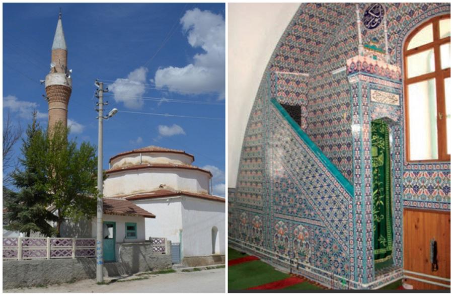
Alpu and its surroundings have been inhabited by civilizations such as the Hittites and Phrygians. After the Battle of Manzikert in 1071, Bozhan, one of the Seljuk Uç Beys, built a caravanserai on the site of the present-day town of Bozan and settled six caravanserais there. This settlement gradually came to be known as Altı, then Altu, and finally Alpu. In 1936, immigrants from Romania and Bulgaria established the Fevzipaşa Neighborhood in the district. A municipal administration was established in Alpu in 1954.
Alpu is located on the valley of the Porsuk River and lies north of the Sündiken Mountains. Within the district boundaries, there are forested areas with dense stands of oak and hornbeam trees.
The population of Alpu district in 2022 was 9,966. The district consists of 33 neighborhoods and is administered by the municipality and the district governorship.
The economy of Alpu district is based on agriculture, forestry, and animal husbandry. The majority of the land in the district is used for sugar beet cultivation. Lületaşı is extracted in the Dereköy locality and sold both in raw and processed forms. Approximately 250 families continue the silvercraft art known as “Savat,” which involves decorating silver with black savat clay paste.
Alpu district is approximately 40 kilometers from the city center of Eskişehir. Road access is available, and rail transport is also present. Alpu Railway Station lies on the route of the İzmir Blue Train.
Alpu Kaymakamlığı. "Tarihçe." Accessed July 11, 2025. https://www.alpu.gov.tr/tarihce.
BEBKA. "Alpu İlçe Raporu." Accessed July 11, 2025. https://bebka.org.tr/admin/datas/sayfas/198/alpu-ilce-raporu_1568787633.pdf.
Eskişehir Diyanet Müdürlüğü. "Alpu Müftülüğü." Accessed July 11, 2025. https://eskisehir.diyanet.gov.tr/alpu/Sayfalar/contentdetail.aspx?MenuCategory=Kurumsal2&ContentId=muftulugumuz.
Eskişehir İl Kültür ve Turizm Müdürlüğü. "Alpu." Accessed July 11, 2025. https://eskisehir.ktb.gov.tr/TR-149980/alpu.html.
Etonet. "Alpu." Accessed July 11, 2025. https://www.etonet.org.tr/Ilceler/alpu.htm.
Alpu (Yapay Zeka Tarafından Üretilmiştir)
Elevation(s)(Text) | 764 metres | ||||||||
|---|---|---|---|---|---|---|---|---|---|
Population(Text) | 9,966 (2022, TÜİK data) | ||||||||
Number of Neighborhoods | 33 | ||||||||
Economy(ies) | Agriculture (sugar beet) silver craftsmanship 'Savat' limestone extraction animal husbandry | ||||||||
Geography(ies) | Porsuk Creek valley oak and hornbeam forests northern Sündiken Mountains | ||||||||
Area(s)(Text) | 1 028 km² | ||||||||
Location | Inner Anatolia Region Eskişehir Province boundaries | ||||||||
History
Geography and Nature
Population and Administrative Structure
Economy
Transportation