


This article was automatically translated from the original Turkish version.
+2 More
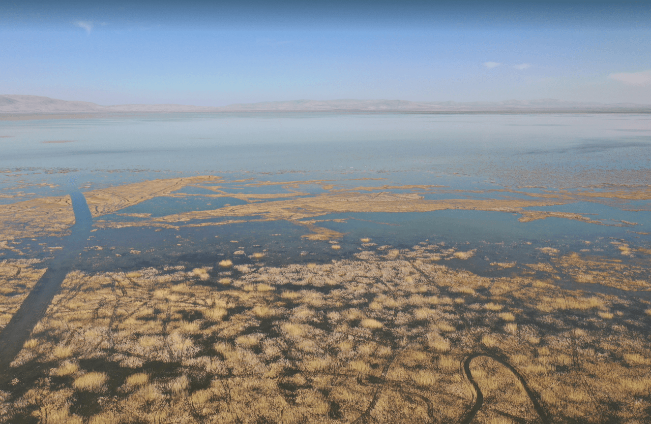
Akşehir Lake
Location | Konya and Afyonkarahisar | ||||||||
|---|---|---|---|---|---|---|---|---|---|
Coordinate | 37°47′N 31°33′E | ||||||||
Type | Tectonic / Closed Basin Lake | ||||||||
Surface Area | 367 km² in 1985 → 36.9 km² in 2020 | ||||||||
Akşehir Gölü is a tectonic, closed-basin lake located between the provinces of Konya and Afyonkarahisar in Türkiye’s Central Anatolia Region, situated between the Sultan Mountains and Emir Mountain. The lake lies in the southeastern part of the Akarçay Closed Basin, within the approximately 2375 km² Akşehir Subbasin. Although its surface area has varied significantly over time, it was historically recorded as Türkiye’s fifth largest lake. During its fullest periods, its surface area reached between 360 and 367 km².
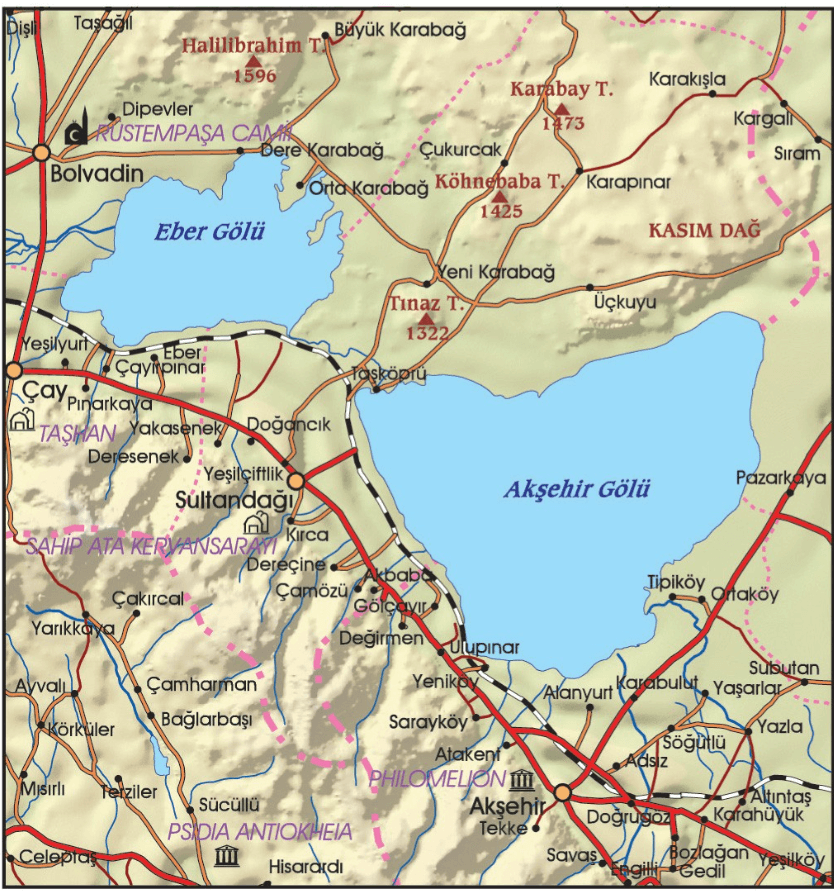
Akşehir Gölü Haritası (Akşehir Kaymakamlığı)
Akşehir Gölü is bordered by the Emirdağlar to the north and the Sultan Mountains to the south. The area where the lake is located forms a graben structure shaped by tectonic activity in the region. The Sultan Mountains Fault is the dominant tectonic element responsible for this structure. The lake’s surroundings are generally composed of Neogene-Quaternary units characterized by alluvial deposits and alluvial cones.
The hydrological budget of Akşehir Gölü is sustained by precipitation, groundwater flow, snowmelt, and tributary streams. These include rivers such as Adıyan Suyu, Engilli Deresi, and Tekke Deresi. As a closed system with no outflow, the lake loses water exclusively through evaporation and abstraction for irrigation. The salinity and localized pollution of the lake waters have rendered them unsuitable for drinking purposes.
Until the 1980s, the lake maintained a sustainable structure under natural balance. Since 1984, it has experienced severe water level declines. This decline has been accelerated by human-induced interventions including climatic drought, increased evaporation, intensive water extraction for agricultural irrigation, unauthorized wells, and the construction of dams and reservoirs. The lake’s surface area, which was 367 km² in 1985, decreased to 113 km² by 2005 and further declined to only 36.9 km² by 2020.
Akşehir Gölü (Youtube)
Akşehir Gölü, together with Eber Gölü, forms an important wetland complex. These two lakes, periodically connected via the Eber Canal (Taşköprü Çayı), provide habitat for numerous endemic and threatened species. Important species observed in the area include the great white pelican (Pelecanus onocrotalus), glossy ibis (Plegadis falcinellus), lesser white-fronted goose (Anser albifrons), and the endemic freshwater fish species Alburnus nasreddini and Leuciscus anatolicus.
The extensive reed beds and seasonal grasslands surrounding the lake are critically important for bird migration routes and breeding grounds. Additionally, rare plant species endemic to this region, such as Thermopsis turcica and Eber sarısı (piyan sarısı), also thrive here. The removal or transplantation of these plants is subject to legal penalties.
Changes in the lake’s surface area have been meticulously monitored using remote sensing techniques. Studies employing spectral indices such as NDWI (Normalized Difference Water Index) and NDVI (Normalized Difference Vegetation Index), along with Landsat satellite imagery, have revealed a dramatic reduction in the lake’s extent. The surface area, which measured 366.6 km² in 1985, had declined to only 36.9 km² by 2020. During this period, significant agricultural use has also emerged on the former lakebed.
Fishing was once a vital source of livelihood for the local economy, but this activity has completely ceased due to the declining water levels of the lake. Traditional harvesting of reeds and rushes continues on a limited scale. The use of lake water for agricultural irrigation is widespread, particularly along the southern shores. In recent years, cherry cultivation and fruit farming have increased around the lake, further elevating water demand.
Akşehir Gölü and its surroundings were declared a Class I Natural Site in 1992. In 2006, under the leadership of the Ministry of Environment and Forestry, the “Akşehir-Eber Lakes Wetland Management Plan” was initiated, developing strategies focused on water balance, biological diversity, water pollution, and alternative livelihoods. At the local level, projects such as wastewater treatment plants and sewerage infrastructure are being implemented.
Akşehir Kaymakamlığı. "Akşehir Gölü." Akşehir Kaymakamlığı Resmî Web Sitesi. Accessed May 31, 2025.http://aksehir.gov.tr/aksehir-golu.
Bahadır, Muhammet. “Akşehir Gölü’nde Alansal Değişimlerin Uzaktan Algılama Teknikleri ile Belirlenmesi.” *Marmara Coğrafya Dergisi*, no. 28 (2013): 246–275. Accessed May 31, 2025.https://dergipark.org.tr/tr/download/article-file/3355
Doğa Derneği. “Akşehir ve Eber Gölleri.” dogadernegi.org. Accessed May 31, 2025.https://dogadernegi.org/aksehir-ve-eber-golleri/
Doğan, Abdullah. “Kuruyan Akşehir Gölü Kıyısındaki 150 Dekarlık Alanda 'Eber Sarısı' Çiçek Açtı.” *Anadolu Ajansı*, May 10, 2025. Updated May 11, 2025.https://www.aa.com.tr/tr/yasam/kuruyan-aksehir-golu-kiyisindaki-150-dekarlik-alanda-eber-sarisi-cicek-acti/3562889
Çatal, Ali, and Orhan Dengiz. “Akşehir Gölünün Akşehir Çölüne Dönüşü Süreci ve Etki Eden Faktörler.” *Toprak Su Dergisi* 4, no. 1 (2015): 18–26. Accessed May 31, 2025.https://www.researchgate.net/publication/307803615
Çağlayan, Elif Büşra, Furkan Erel, Emre Batuhan Samur, Metin Deniz, Mohammad Asef Mobariz, and Gordana Kaplan. “Uzaktan Algılama Teknikler ile Akşehir Gölü’ndeki Alansal Değişiminin İzlenmesi.” *Türkiye Uzaktan Algılama Dergisi* 2, no. 2 (2020): 70–76. Accessed May 31, 2025.https://dergipark.org.tr/en/download/article-file/1182775

Akşehir Lake
Location | Konya and Afyonkarahisar | ||||||||
|---|---|---|---|---|---|---|---|---|---|
Coordinate | 37°47′N 31°33′E | ||||||||
Type | Tectonic / Closed Basin Lake | ||||||||
Surface Area | 367 km² in 1985 → 36.9 km² in 2020 | ||||||||
Geographical and Geological Characteristics
Hydrological Characteristics and Lake Regime
Ecological and Biological Significance
Spatial Changes and Remote Sensing Findings
Socioeconomic Impacts and Usage Patterns
Conservation and Management Initiatives