`artvin` ile İlgili Madde Sonuçları

Karagöl-Sahara National Park
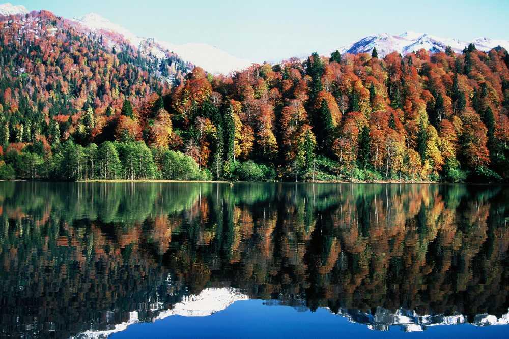
Karagöl–Sahara National Park is a protected natural area located within the boundaries of Artvin province in northeastern Türkiye, specifically in the Şavşat district. It consists of two distinct sections: Karagöl and Sahara plateau.【1】 The area has been designated as a national park due to its forest ecosystems, wetlands, alpine meadows, and rich biological diversity.National park status recognizes it as an area where natural landscapes, geological features, flora and fauna diversity, and recre
EN
Nisanur Karagöl

Yusufeli Dam
The Yusufeli Dam is a hydroelectric dam located on the Çoruh River in the Yusufeli district of Artvin Province, Türkiye. With a height of 275 metres from its base, it is the tallest double-curvature concrete arch dam in Türkiye and the fifth tallest in the world. Construction began in 2013 and impoundment commenced on 22 November 2022. The dam was implemented by Limak İnşaat and represents Türkiye’s strategic shift toward domestic and renewable energy sources in its energy policy.Yusufeli Dam (A
EN
Rümeysa Gökçınar

Artvin (Province)
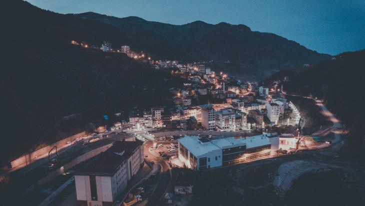
Artvin is a province in the northeastern part of Türkiye, bordering the Black Sea and renowned for its natural beauty. It shares its eastern boundary with Ardahan, its western boundary with Rize, its southern boundary with Erzurum, and its northern boundary with Georgia. Its rugged terrain, rich forests and rivers attract attention. Throughout history, it has been shaped by the influence of many civilizations including the Hurrians, Urartians, Scythians, Seljuks, Byzantines and Ottomans like.Ort
EN
Muhammed Kerem Gümüş

Ardanuç (District)
Ardanuç is a district in northeastern Türkiye, located east of Artvin province. The district center is located at an elevation of 500 meters and covers an area of 989 km², 37 km from the city center via the Artvin–Göle–Ardahan highway. The region exhibits a typical continental climate and consists of 49 villages.HistoryThe district of Ardanuç, located at the intersection of Anatolia and the Caucasus, has witnessed the dominance of numerous civilizations throughout history and is a significant
EN
Emre Zengin
Borçka (District)
Borçka is a district of Artvin Province in northeastern Türkiye. The district center is located in the Çoruh River valley, on the Artvin–Hopa highway; its administrative borders cover an area of 762 km² and its average elevation is 125 m. It is 30 km from the city center and 36 km from Hopa; it consists of 36 villages and a central settlement.Borçka Karagöl ( Turkiye Culture Portal )" image-alternate="" image-element-format="right">HistoryThe earliest traces of the settled history of Borçka
ENEmre Zengin

Hopa (District)
Hopa is a coastal district northeast of Artvin province, on the Black Sea coast , and is notable for its proximity to the Georgian border . Covering 289 km², the district is bordered by Sarp to the east, Borçka to the south, Arhavi to the west, and the Black Sea to the north. Its landforms consist of the steep slopes of the Karçal, Sultanselim, and Balıklı Mountains, along with a narrow coastal strip.Yavuz Sultan Selim Hill, at 1,513 meters , is the district's highest point. Hopa, which had a p
ENEmre Zengin
Murgul (District)
Murgul is a district of Artvin Province in northeastern Türkiye. The district center is located 48 km away on the Artvin-Yusufeli highway, in the foothills of the Çoruh Valley . The province borders Artvin to the east, Arhavi to the west, Borçka to the north, and Yusufeli to the south. Its 406 km² area consists of 50% forest , 45% pasture and rocky land, and 5% agricultural land. It consists of two municipalities , and Damar town , and 10 villages.Murgul (Source: Murgul Municipality )" image-al
ENEmre Zengin

Puçuko
Puçuko is a traditional dish specific to Artvin cuisine, made from dried fresh beans. The dried beans, known as “puçuko,” are produced by sun-drying fresh beans harvested during summer, and they appear on tables during winter as an economical, nutritious, and culturally significant meal.Geographical Indication RegistrationPuçuko, applied for on 7 September 2017, was registered as a geographical indication by the Turkish Patent and Trademark Office on 26 December 2017. This registration was carri
EN
Rüya Dumlu

Rize Kavurması
Rize Kavurması is a geographical indication meat product produced from beef and unique to the province of Rize. Registered under the “Mahreç” designation type, this product was officially registered with the Turkish Patent and Trademark Office by the Rize Chamber of Commerce on 15 October 2019 (Registration No: 462). The application was submitted on 27 December 2017 under application number C2017/242. The geographical boundary of the product is limited to the province of Rize, and production may
EN
Sabiha Meyra Şahinler

Artvin
About the CityArtvin is a mountainous and forested city located in the northeast of Türkiye, between the Black Sea and the Caucasus. It shares a border with Georgia, giving it strategic importance as the eastern gateway of the Eastern Black Sea region.The city is situated around the Eastern Black Sea Mountains and the Çoruh River. Its rugged topography makes it notable for its natural beauty and rich vegetation. The highland pastoral culture is an integral part of daily life in Artvin, with comm
EN
Zozan Demirci