`ugurludag` Related Article Results
Uğurludağ (District)
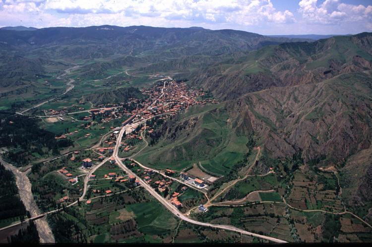
Uğurludağ district is located in the Central Anatolia Region, northeast of Çorum. Its surface area is 596 km², its average elevation is 775 meters, and it is 66 km from the central district. Its population in 2024 was 6,282; the district center is comprised of five neighborhoods and 20 surrounding villages.HistoryThe Uğurludağ district has been home to various settlements throughout history. Archaeological finds in the Resuloğlu area, located within the district's borders, indicate that the area
EN
Emre Zengin

Uğurludağ (İlçe)
Uğurludağ ilçesi, Çorum’un kuzeydoğusunda, İç Anadolu Bölgesi’nde yer alır. Yüz ölçümü 596 km², ortalama rakımı 775 metre olup merkez ilçeye uzaklığı 66 km’dir. 2024 yılı nüfusu 6.282 kişidir; ilçe merkezi 5 mahalle, çevresinde ise 20 köy bulunmaktadır.TarihUğurludağ ilçesi, tarih boyunca çeşitli yerleşimlere sahne olmuş bir bölgedir. İlçe sınırları içinde yer alan Resuloğlu mevkiindeki arkeolojik buluntular, bölgenin Eski Tunç Çağı’ndan (yaklaşık M.Ö. 2500) itibaren iskân gördüğünü göstermekted
TREmre Zengin