

`camardi` Related Article Results
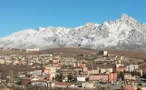
Çamardı (District)
Çamardı is located in the southeastern part of Niğde Province, at the foothills of the Taurus Mountains. It is bordered by Niğde Central to the north, Bor to the west, Ulukışla to the northwest, and Adana Province to the south. Area and Elevation The district covers an area of approximately 1,204 km² and has an average elevation of 1,600 meters. The district center is situated at an altitude of 1,250 meters. Topography Geographically rugged, about two-thirds of the district’s terrain is mountain
EN
Meltem Saraç
Çamardı (İlçe)
Çamardı, Niğde ilinin güneydoğusunda, Toros Dağları eteklerinde yer almaktadır. Kuzeyde Niğde Merkez, batıda Bor, kuzeybatıda Ulukışla ilçeleri, güneyde ise Adana ili ile çevrilidir. Yüzölçümü ve Rakım İlçenin yüzölçümü yaklaşık 1204 km² olup, ortalama rakımı 1600 metredir. İlçe merkezi ise 1250 metre yüksekliktedir. Yüzey Şekilleri Coğrafi açıdan engebeli olan ilçenin arazisinin yaklaşık üçte ikisi dağlık, üçte biri ise yayla niteliğindedir. Yaylalar özellikle yaz aylarında otlak ve tarım için
TRMeltem Saraç