

`byzantine-period` Related Article Results
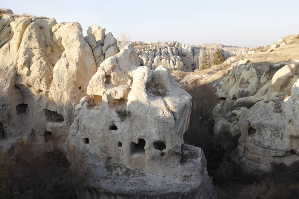
Gomeda Valley
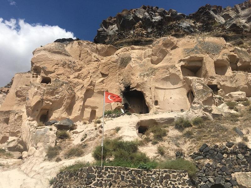
Gomeda Valley is located approximately 2 kilometers southwest of the Mustafapaşa neighborhood in the Ürgüp district of Nevşehir Province, Türkiye. Geographically situated west of Mustafapaşa and north of Ayvalı Village, the valley is one of the most notable geomorphological features within the Cappadocia region. Historically known by the Greeks as “Kanavuria,” the valley has been identified as one of the fissures of Elevres. Gomeda Valley (Ürgüp Municipality) " image-alternate="" image-element-f
EN
Melike Saraç
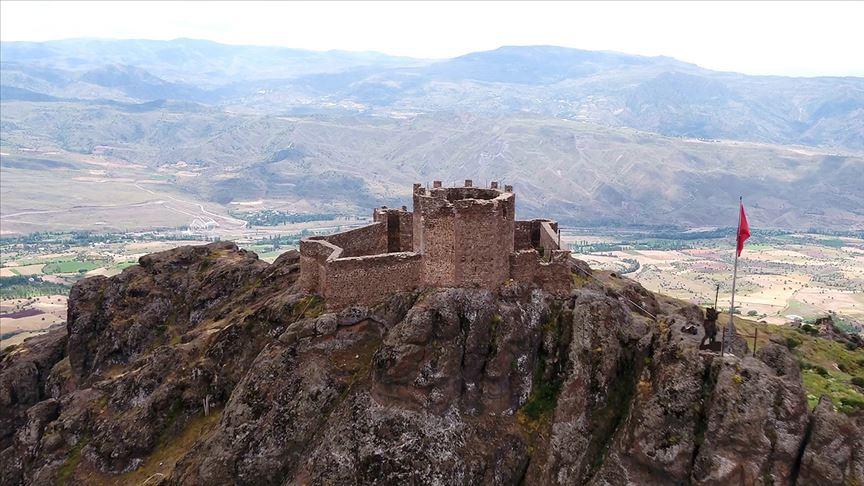
Şebinkarahisar Castle
Şebinkarahisar Castle is located approximately 90 km east of the city center of Giresun, at the northwestern edge of the Kelkit Basin. The castle was built on a rocky hill at an elevation of about 1,200 meters, a position chosen to control the surrounding valleys and passes. The region lies within the interior of the Eastern Black Sea and is connected via valleys to the Black Sea coast and the Kelkit Basin extending as far as Samsun. Şebinkarahisar Kalesi (Anadolu Agency) " image-alternate="" im
EN
Nursena Güller
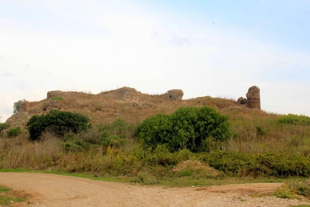
Tophisar Castle
The Tophisar Castle, located near the village of Tophisar in the Karacabey district of Bursa, is one of the rare examples reflecting the strategic and architectural heritage of the Middle Ages. Situated on a dominant hill approximately 3 km southeast of the village, the castle stands at the center of a multi-layered settlement spanning from the Byzantine period to the early Ottoman era. Along with surrounding structures that served both military and religious functions, the castle was not merely
EN
Ahmet Burak Taner
 Ma
MaMazı Underground City
Mazı Underground City is located within the boundaries of Mazı Village in the Ürgüp district of Nevşehir Province, Türkiye. Known in ancient times as “Mataza,” this settlement is situated approximately 18 kilometers south of Ürgüp and 10 kilometers east of Kaymaklı Underground City. As one of the underground cities exhibiting the characteristic features of the Cappadocia region, Mazı functioned as a multi-purpose subterranean settlement used for defense, shelter, and worship. History The primary
EN
Meltem Saraç
AlAlabanda Ancient City
Alabanda is an ancient settlement located in the ancient region of Caria, within the borders of Çine district in Aydın Province, modern-day Türkiye. The ancient city is situated within the boundaries of Doğanyurt village, which belongs to Çine, specifically on Araphisar, a neighborhood of this village. The city spans the slopes of two hills that are extensions of Karadağ, spreading towards the Çine Plain. Known for its archaeological remains and historical records, Alabanda was an important sett
ENMeltem Saraç
Ortahisar Castle
Ortahisar Castle is a natural rock mass located in the Ortahisar town of Ürgüp district, Nevşehir province, Türkiye, which has a unique place among the geological formations of the Cappadocia region. This structure, reaching us from ancient times, has been used as both a defense and living area due to its historical and architectural features. Physical Features and Structural System Ortahisar Castle is approximately 86 meters high and consists of soft volcanic rocks called tufa. This geological
EN
Sinem Bostan
DuDulkadirli Underground City
The Dulkadirli Underground City is located approximately 50 kilometers north of Kırşehir city center, along the Kırşehir–Akçakent highway. It lies within a plateau-like topography shaped by the tributaries of the Delice Stream, a branch of the Kızılırmak River. More specifically, it is situated on the left edge of a valley at the source region of the Manahözü Stream, within the Kılıçözü basin. The landscape was formed by Pleistocene-age rivers that cut through Pliocene erosion and fill surfaces.
EN
Melike Saraç
The Underground City of Tatlar
Tatlarin Underground City is located within the boundaries of the Tatlarin township, approximately 10 kilometers north of Acıgöl district in Nevşehir Province, in Türkiye’s Central Anatolia Region. The underground city is situated on a hill known locally as “Kale.” The township of Tatlarin lies within Nevşehir Province, one of the cultural and historical centers of Cappadocia, and exhibits similarities with other underground settlements in the region. The underground city was constructed over a
ENMelike Saraç
NeNevşehir Castle
Nevşehir Castle is located on a dominant hill at an elevation of 1,285 meters in the center of Nevşehir province. The castle attracts attention due to its proximity to the city center and the surrounding rock settlement remains from the Byzantine and Ottoman periods. The asymmetrical structure extends parallel to the orientation of the hill on which it stands and features two gates: one to the east and one to the west. The western gate has a rounded arch, measuring 2.10 meters in width and 2.45
ENMelike Saraç
MaManisa Castle
Manisa Castle is located on the northern slopes of Spil (Sipil) Mountain, south of the city center of Manisa, and consists of two main sections: the “Inner Castle” (Sandıkkale) and the “Outer Castle”. The castle’s design harmonizes with the region’s historical and topographical structure, both in terms of its natural setting and construction techniques. Historical Background The exact date of the castle’s construction is unknown, but it is known that during the Hellenistic period an acropolis ex
ENMelike Saraç